Asgard pass and larches

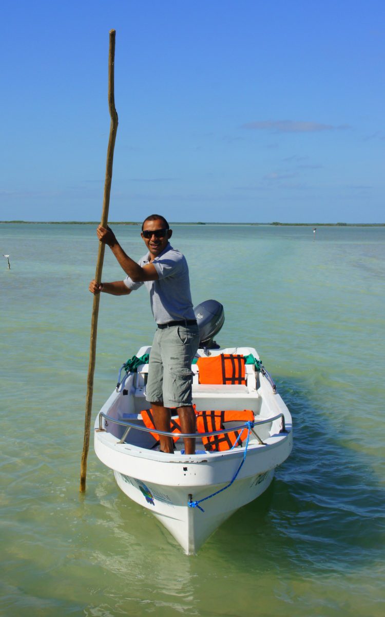
Running the Enchantment Lakes Traverse

Asgard pass and larches

“Go to the Enchantments!” said half the people I know. Words like “circle of mountains” and “endless alpine lakes” reinforced their exhortations. I didn’t need much convincing.

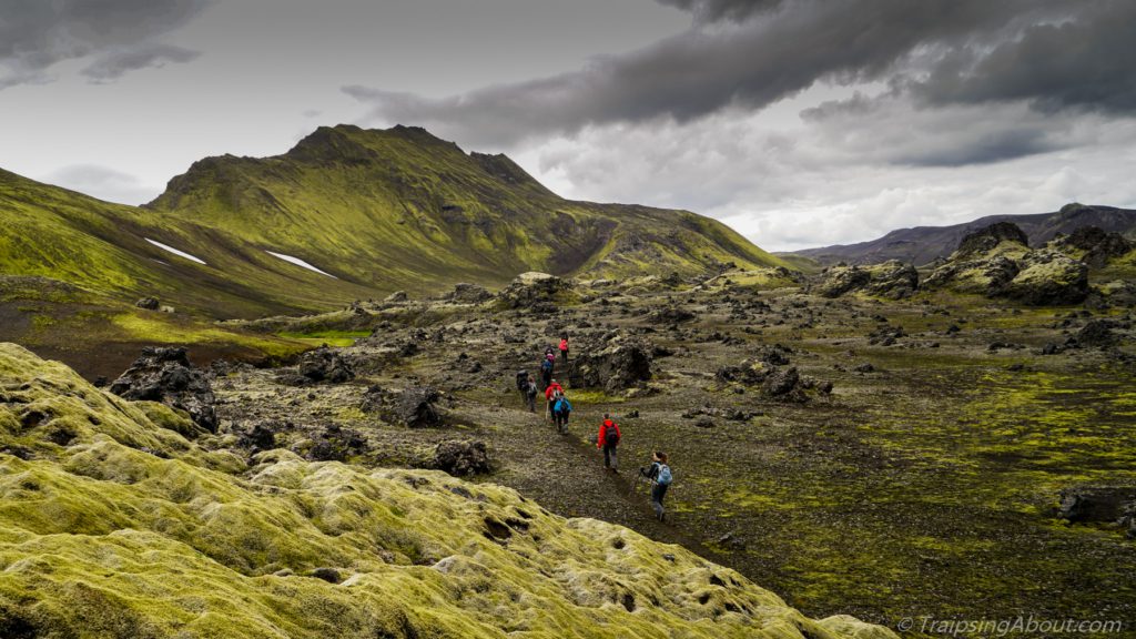
Where is this magical outdoor palace? A few miles outside Leavenworth, WA, nestled in the peaks of the North Cascades. The Enchantment Lakes traverse is a 19-mile trail, usually completed as a multi-day backpack. To do that requires scheduling ahead to get a permit (pffft, planning?).

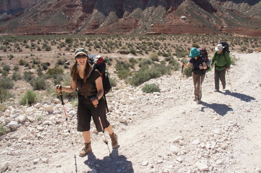
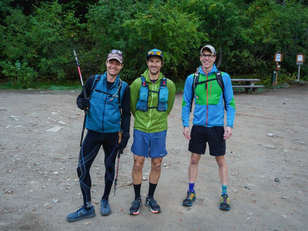
That left us one alternative: run it in a day. So, as part of a fall finale roadtrip, my friends Paul, Ben and I did just that.

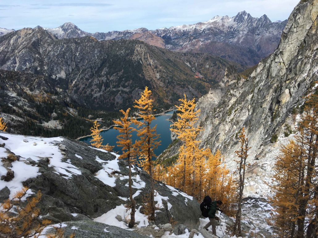
Larches, me, and a whole lotta beauty. Photo: Ben Groenhout

The trail is a point-to-point requiring either a shuttle or 11 miles running back to the car cursing people who don’t pick up hitchhikers. Luckily, some van life buddies hauled us up a bumpy, windy dirt road to the Stuart Lake trailhead on a frosty October morning.

Miles to go: 19. Elevation to ascend: 5,500′. Temperature: 31 degrees. Stoke level: 10.

The Run

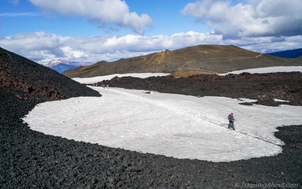
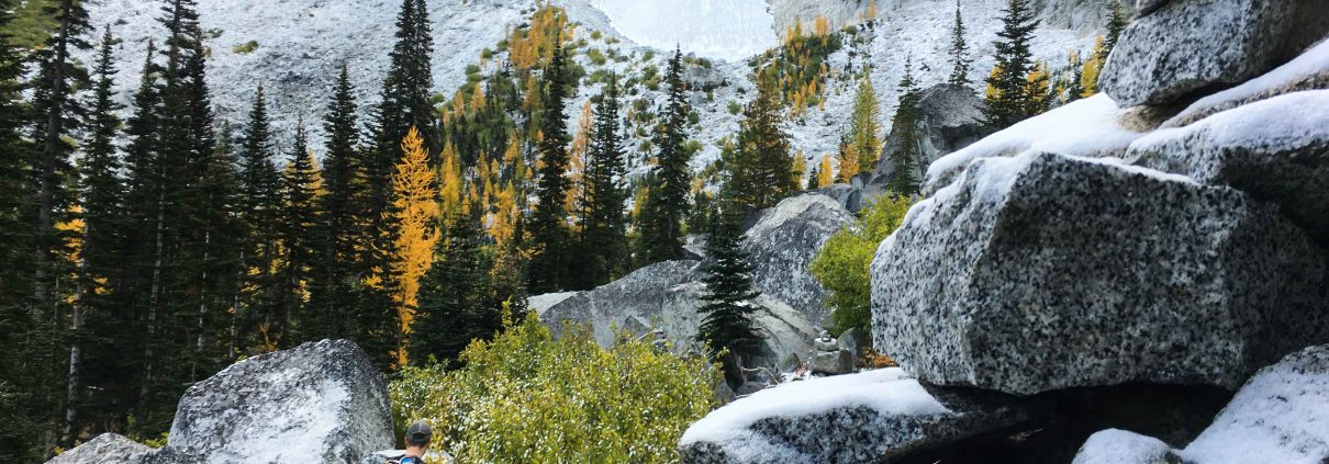
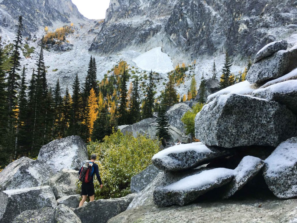
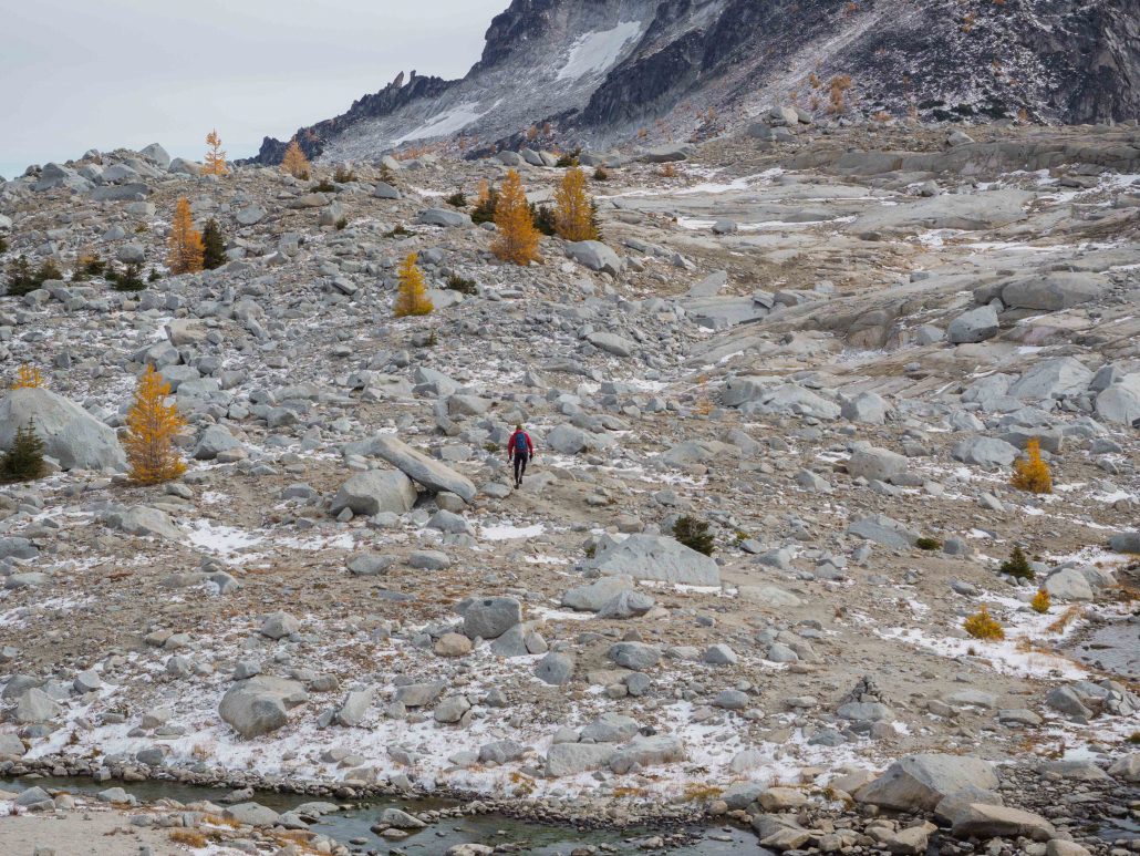
The trail follows a creek up up up, gently at first, then so steep that “running” switches to speed hiking. The freezing temps keep us cool; steam sizzles off our backs. A few views peep through the trees, but we keep our heads down and motor toward Colchuck Lake, four miles in.

A frosty morning on the way up to Colchuck Lake!

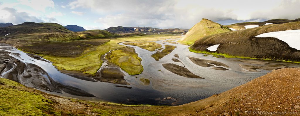
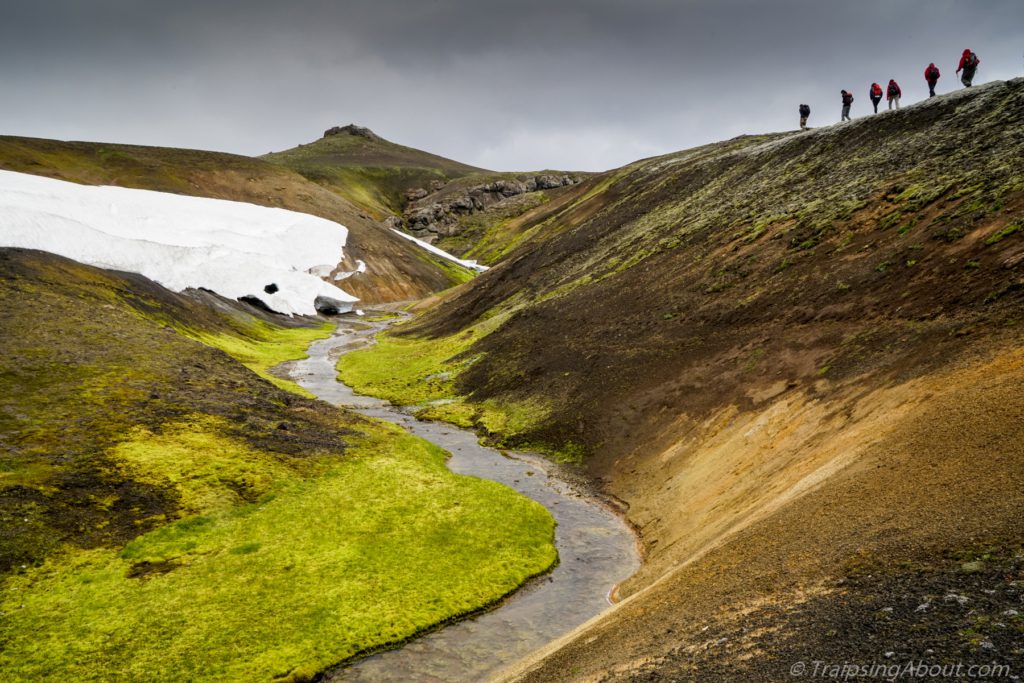
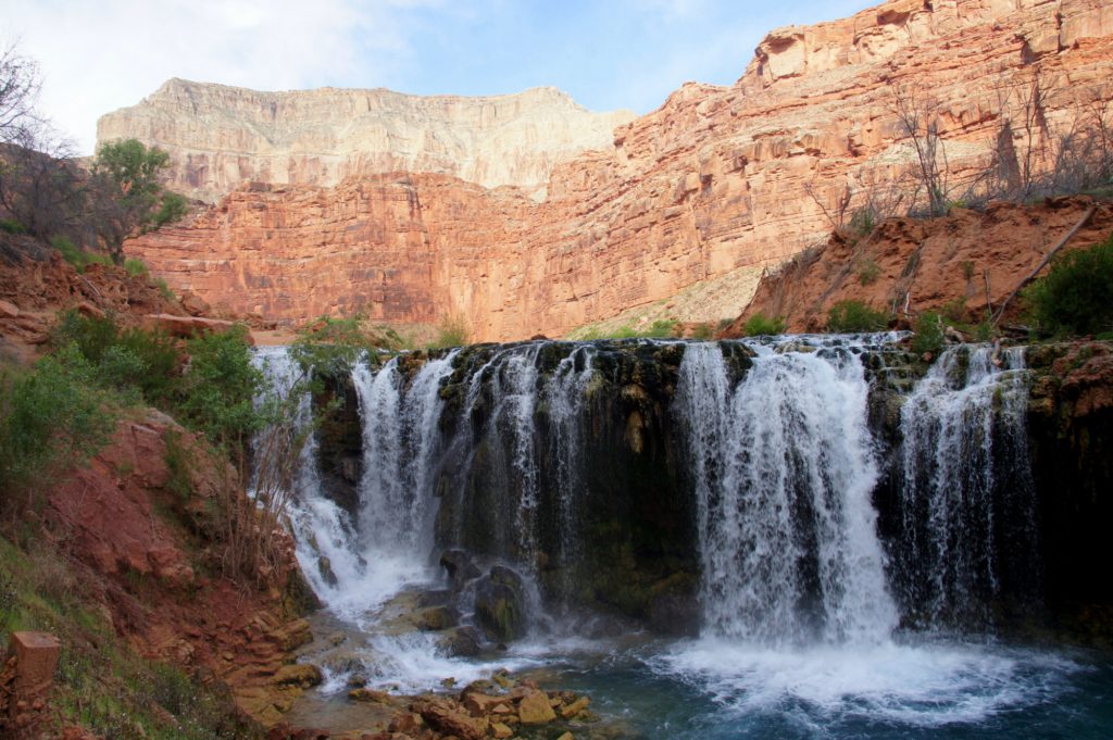
Most day hikers turn around at Colchuck Lake, a jewel of water dropped at the base of imposing Asgard Pass and Instagrammed far too much. We pause at the lake to gobble some food and eye the pass.

My friend Jono’s Asgard summary: “I’d rather go up it twice than down it once.” Picture gaining 2,000’ in a mile on loose, chunky rock. For our ascent, a dusting of snow and ice adds the fun of slick stone and frozen creeks (aka dangerous slip’n’slides into boulder fields). Avoiding becoming a human pinball pinging off rocks keeps us focused, to say the least.

By the way, dig these kinds of posts? Sign up for my free Traipsing About newsletter for outdoor adventure talk and other shenanigans.

A backpacker heading down Asgard Pass the wrong way, knees aching for SURE.

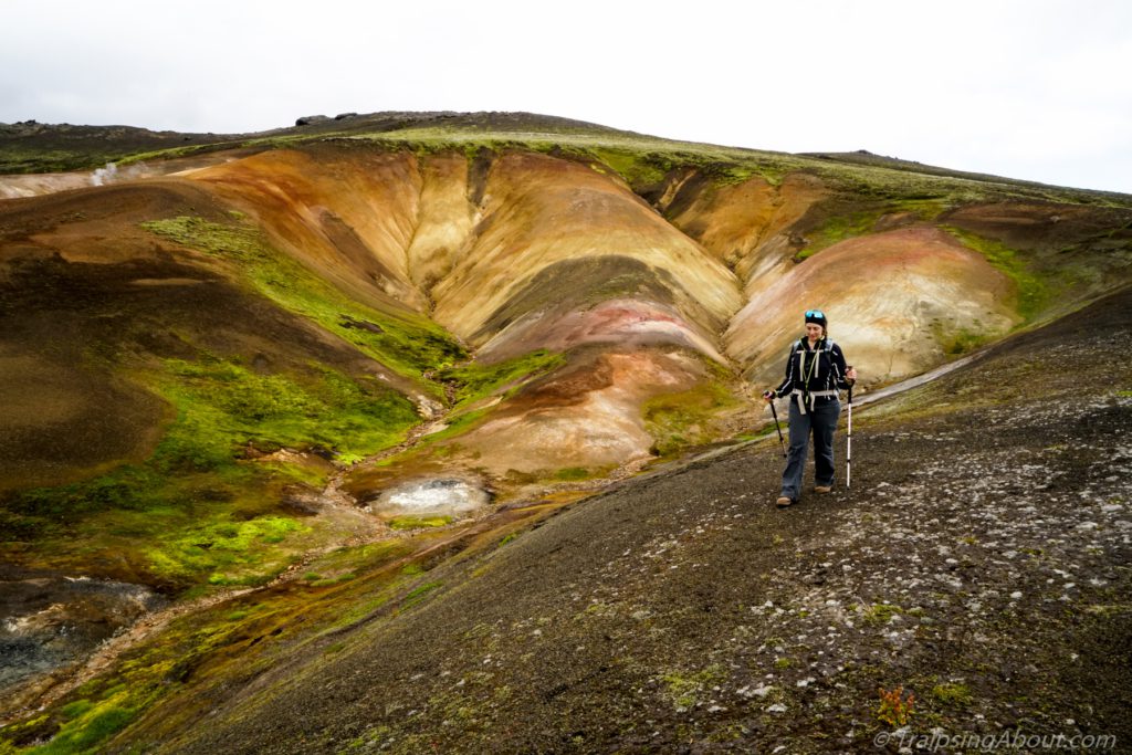
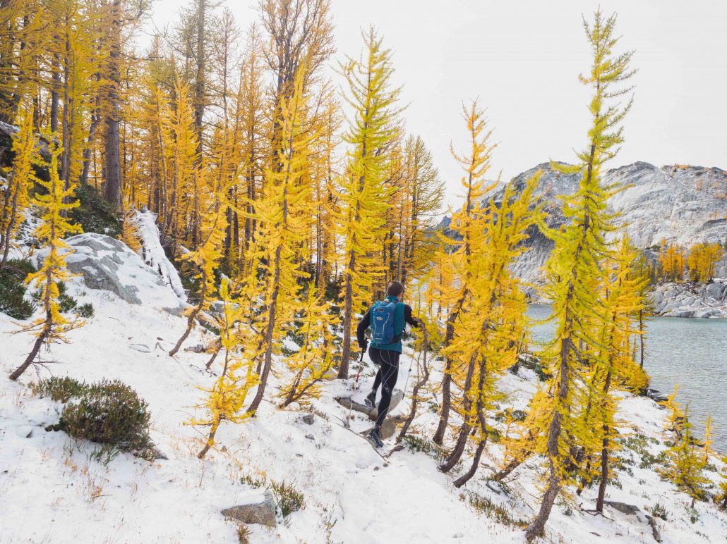
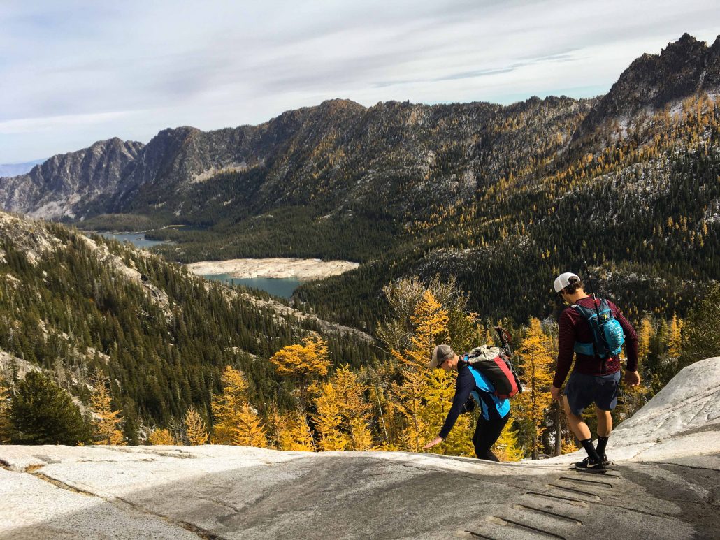
Huffing and puffing, we hit the top of the pass. BOOM. Hellllo mountain views! Peaks, lakes, and boulders surround us. Bright yellow larches fire in their fall glory. Ah, this is why people all say “go to the Enchantments” like mindless zombies! (I am immediately infected with Enchantment’s Fever.)

Paul, master of food munitions, busts out leftover vegan pizza. “It’s a four-slice day,” he grins. The wind whips across the lakes and we shelter against a large boulder, refueling. Only 14 miles to go.

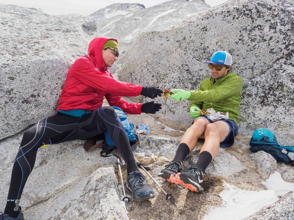
Only true friends share their pizza at the top of a pass! Photo: Ben Groenhout

Me running through the boulders at the top of Asgard Pass. Photo: Ben Groenhout

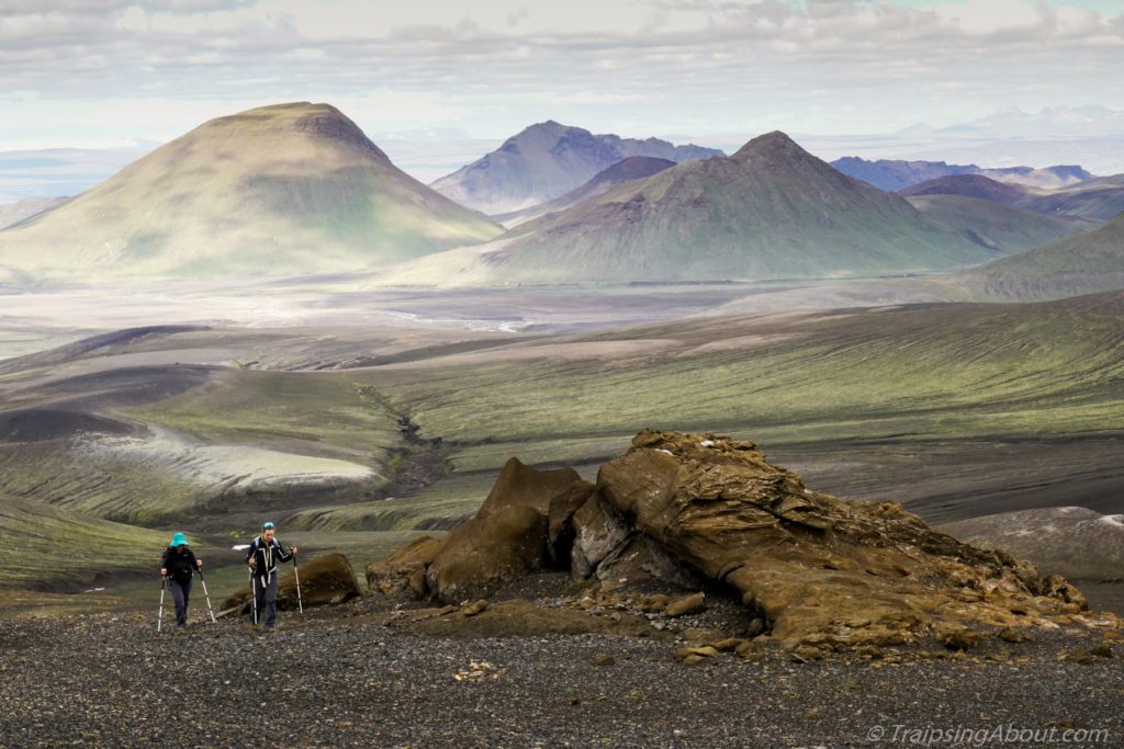
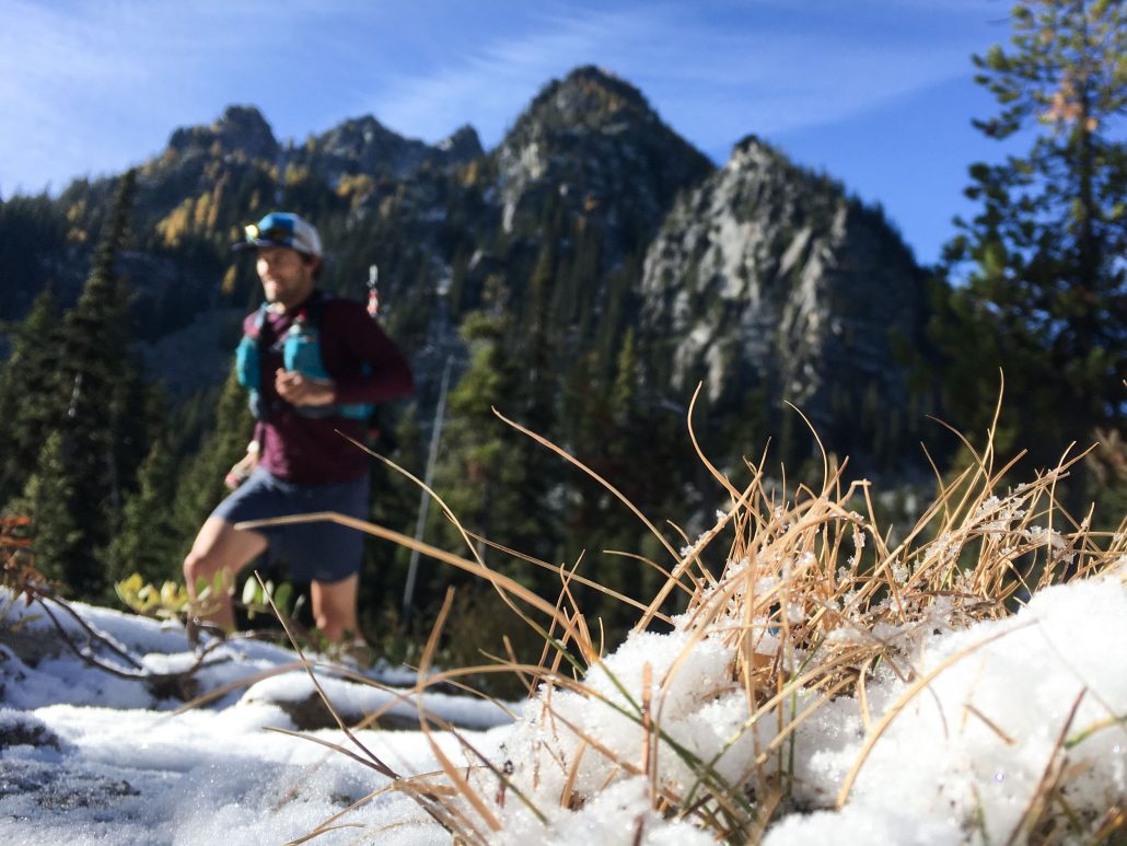
If you look at the elevation chart for the Enchantments run, it trends downhill for the last 2/3 of the trail. Asgard marks the start of the gradual descent toward Snowy Lakes trailhead. Time to run.

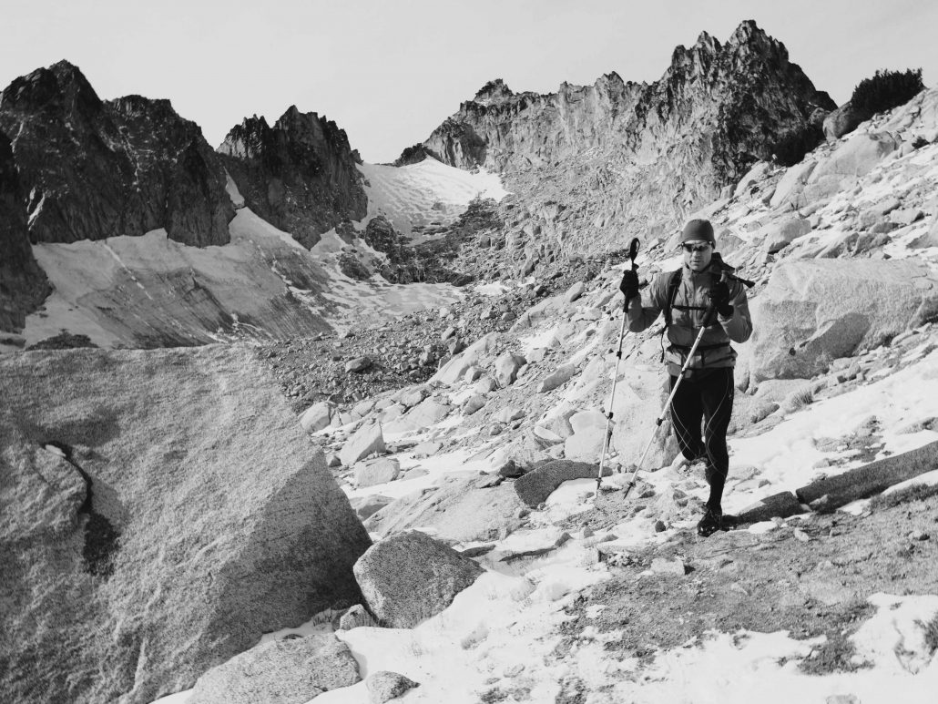
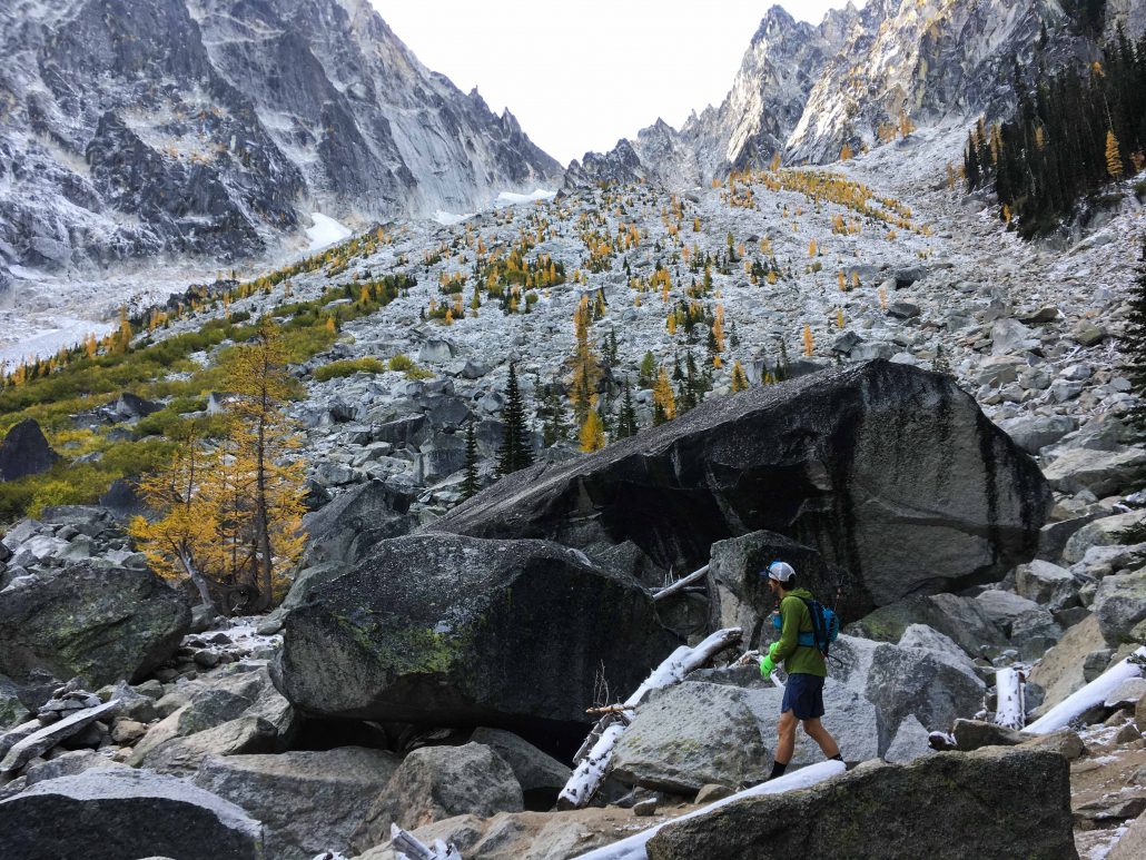
This isn’t buff, flowing singletrack. The running is rocky and technical, with route finding via cairns and sections of granite slabs with no trail. My GPS watch thinks I’m a stumbling drunk as I careen left and right, stop to take pictures, filter drinking water, and retrace my steps looking for the trail. (Here’s my meandering route on Strava.)

Down a steep granite section on the trail. Photo: Ben Groenhout

Enchantments boulder field

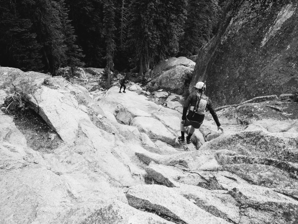
Me picking my way through a boulder field. Photo: Ben Groenhout

Even though hundreds of people a year enter the Enchantments, it’s still a remote, physically tough zone to reach. For me, perspiration to move through a landscape deepens my appreciation, be it bike touring or this run. I’m lucky to have the privilege to enter such a serene, untrammeled zone that most will only see in pictures, far away from cell signals and the tumult of modern life. The U.S. has its problems, but the sheer amount of wild, protected public land is simply fantastic.

What Goes Up, Gets to Run Down!

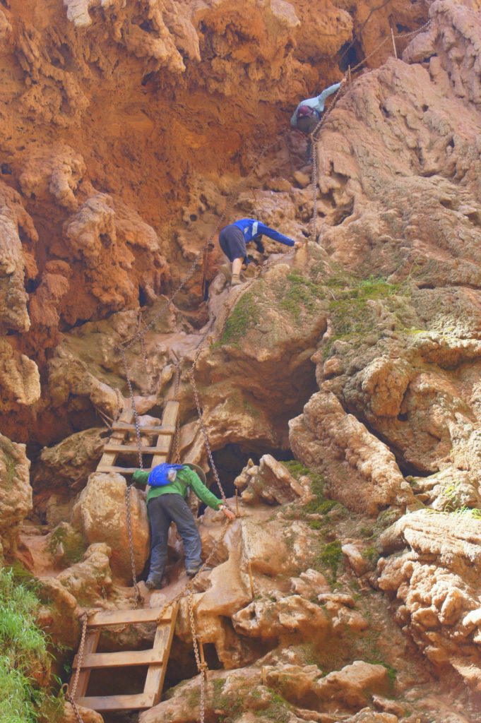
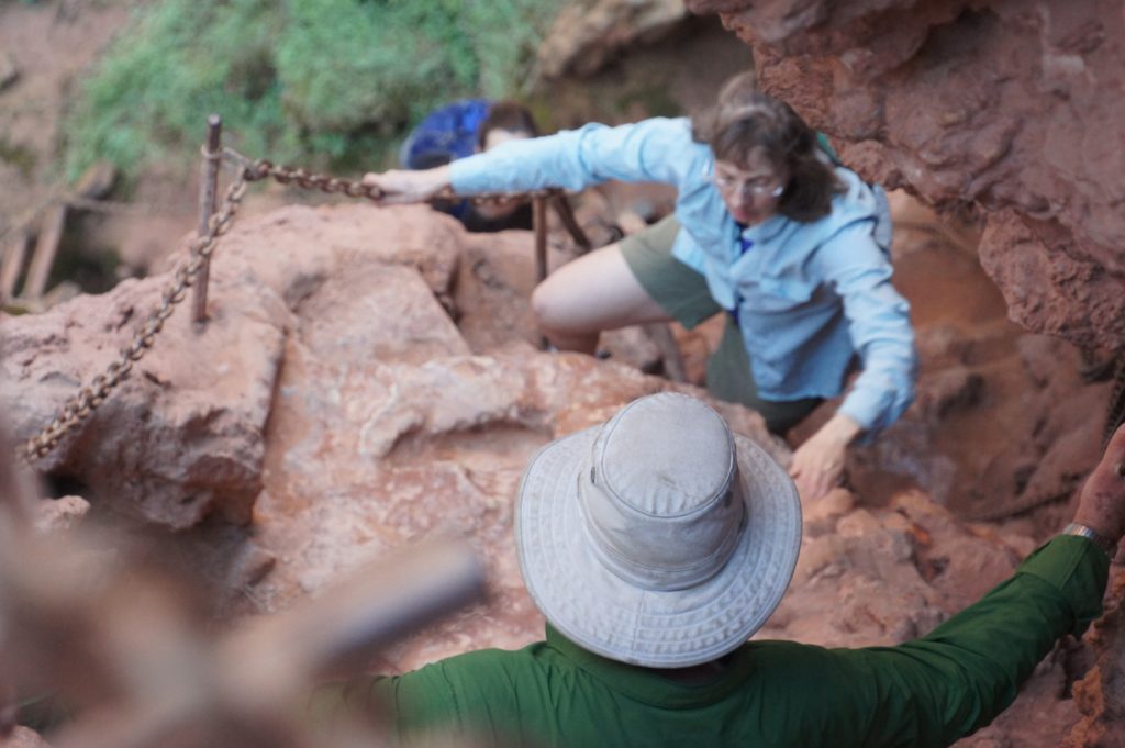
We spend the next few hours engaged in quintessential technical trail running. It’s slow and entertaining, with roots, rocks, steep slabs, scrambling. The best! We drop down an exposed “ladder” section with rebar sunk into the granite, waltzing by a backpacker who is freaking out at the potential fall on snowy rock.

Ben and Paul heading down the steep rebar staircase, Snowy Lake in the distance.

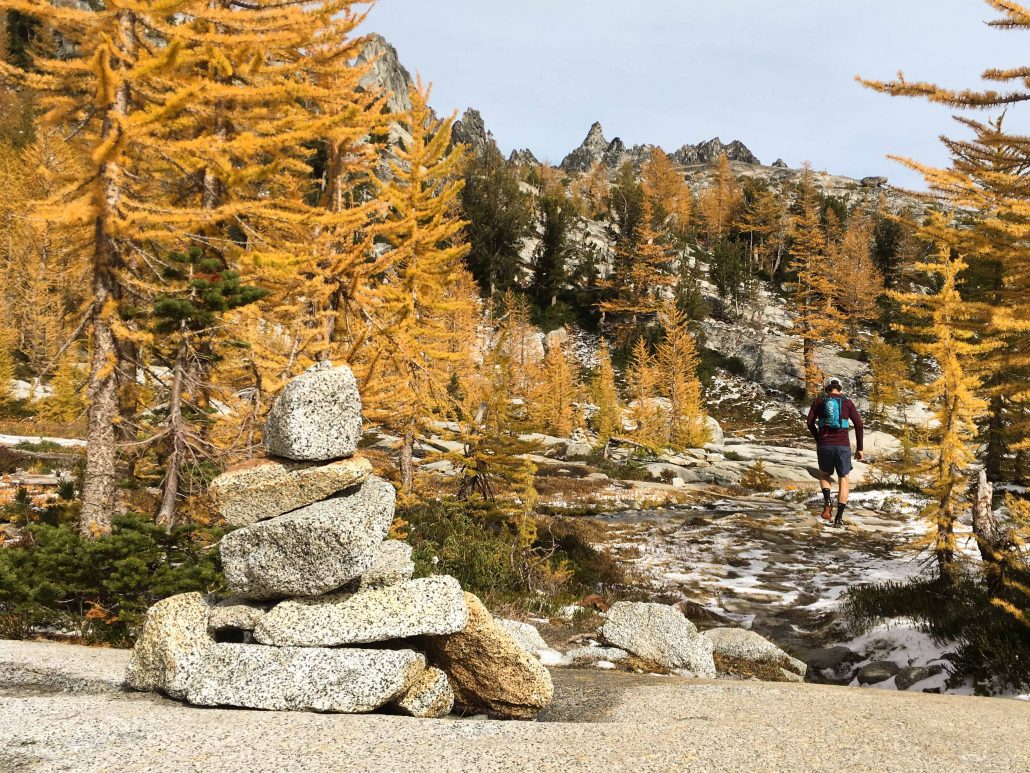
Paul heads past a cairn into the spectacular larches.

At Snowy Lake, 15 miles in, my energy levels are low. I haven’t run much in the past few months and my legs are talking to me. Annie’s Gummy Bears boost my spirits and we hit a consistent pace along the lake on smooth forest singletrack. All there is to focus on is the clicking of trekking poles and foot placements. Trail running as a meditation, switchback after switchback.

A mountain goat interrupts my flow. Grizzled, inquisitive, staring at me. He can run straight up this mountain side, trail be damned, but this is his home and he’s lounging on his rock armchair. Only crazy humans drive hours and invest in outdoor gear to spend fleeting hours in the mountains before returning to their safe, comfortable shelter. We’re a strange species. I bid him adieu and move on.

The end of the trail. Dozens of cars, a group of backpackers with stoke levels cresting. They’re heading in for a couple nights in the wild.

As a newly minted Enchantment’s Parrot, there’s only one thing to do. I squawk, “You’re going to love it!” Zombies run in packs, after all.

Heading to Colchuck Lake.

Til next time…

Basic Logistics

First off: for more of Ben’s excellent shots, go here!

Trail Run Project’s writeup has all the details you’ll need to make this run happen.

When to Go: I love fall and that is my vote for fall colors, no crowds, and the best temps. The mountains won’t be clear of snow until summer, so the window is small! To dodge 12 million day hikers, definitely hit the trail on a weekday if possible.

Gear We Carried: trekking/running poles, Katadyn BeFree water filter (my new favorite possession), medkit, vest, rain jacket, beanie. Nada mas except pizza!

Clearly I missed the memo on green and blue.

Moonscape Trekking in the Icelandic Highlands

Trekking Iceland highlands canyon

In 2010, Iceland’s impossible-to-pronounce Eyjafjallajökull volcano erupted. The resulting plume of ash shut down air traffic in Europe, and all eyes were suddenly on Iceland. “Hey, what IS that place?” asked people around the world. “I thought Iceland was just a big, boring glacier?”

Nope! Turns out Iceland is green (and Greenland icy) and features spectacular scenery. Especially in the middle of the country, where hut-to-hut treks weave through a surreal landscape of volcanoes, glaciers, and hissing sulfurous vents.

We crossed dozens of streams and hissing steam vents along our route.

After 2.5 great weeks in our camper van, we laced up our hiking shoes and headed out for five days and 55 miles of hut-to-hut trekking in the highlands. It was hands-down one of the coolest hiking experiences I’ve had.

For the first three days, there were no trails. Our destination was a GPS point over distant mountains and we simply hiked over whatever lay between us and shelter. Switchbacks? Pfffft. Just get to the top any possible way. My kinda hike! (We did have a guide to show us the way.)

Trekking Iceland highlands

Chelsea and I travel a lot, but we rarely plan ahead. This creates issues when there are, say, limited sleeping berths in huts. Luckily, her mom is a genius planner and we joined her parents for the trek. Hey, at least we aren’t living at home with them! As usual, C’s folks were tough as hell and hiked 10-15 miles a day on uneven, tricky terrain. (Linda, thanks for handling everything.)

We tromped up volcanic slopes and waded glacial-melt rivers. At lunch we’d sit in thick green moss with views of expansive valleys. Smoking fumaroles belched sulfur and steam, waterfalls poured off cliffs, and we even rambled through short, gnarled birch forests. Our final day was a stunning climb up to the location of the 2010 eruption, a pass between Eyjafjallajökull and the sleeping giant Katla.

Ground zero for the 2010 eruption at Fimmvörduháls.

Ground zero for the 2010 eruption at Fimmvörduháls.

Sleeping in Style

Iceland’s highlands are sprinkled with sleeping huts, remnants of the sheep herding days of yore. Instead of drunk shepherds, these huts now frequently house trekkers exploring the middle of the country.

We stayed in four different huts, each with a different feel. All featured a kitchen with (cold) running water, a propane stove, and flush toilets. A giant pot of water was kept hot on the stove to fuel hikers with tea and coffee.

10 steps from our hut on day 1, this is a panorama view of a river valley we hiked through, fording through coooold water a few times...

10 steps from our hut on day 1, this is a panorama view of a river valley we hiked through, fording through coooold water a few times…

The one similarity: nightly snoring contests a chainsaw festival would envy. To fight the rippling snorts of tired hikers, bring good ear plugs or your life will suck! I’m a light sleeper, but with ear plugs was able to zonk out every night. (Chelsea’s pro tip: not all earplugs are the same. Look at the rating on the package before you buy and test them out before the trip to make sure they fit your ears and get the job done. She obviously didn’t sleep as well as I did.)

Trekking Iceland highlands colorful hills

How’s The Weather, Wally?

We hiked in early August, but the Arctic Circle ain’t famous for sunny, warm weather. Most days we donned rain jackets to ward off a stinging-cold shower for at least part of the day. Expect to hike at least part of the time in gusting wind and rain. At least the clouds add to the moody mystique and keep noses from getting sunburned.

Still, inclement weather simply added extra zest, and thanks to many warnings, we were prepared. Remember, it’s not bad weather if you have the right gear. (Or have lived in the rainy Pacific NW.)

Moody, gray skies and a striking landscape.

Moody, gray skies and a striking landscape.

Bright green moss along a stream fed by a snow field.

Bright green moss along a stream fed by a snow field.

Choosing a Route

There are tons of potential highland trekking routes. However, Nat Geo’s “Ultimate Adventure” article about the Laugavegurinn (also called Laugavegur) trail means that just about everyone starts at Landmannalaugar and ends at Skógar.

Thanks to Linda’s travel planning genius, we spent the first three days on a different, less-traveled route to the west that dovetailed with the main trek. We literally didn’t see a single other hiker those days, just open vistas.

Chelsea and Linda contemplating this mountain's lack of switchbacks.

Chelsea and Linda contemplating this mountain’s lack of switchbacks. No, the background is not CGI…

After hiking with just our group through empty landscapes, it was a shock on the 3rd night to arrive at a hut jam-packed with people and drying rain gear and see 75 tents pitched outside on any flat surface. It felt like a mountain favela, or perhaps like Everest base camp in busy season.

To avoid that, I highly recommend getting off the main trek. Any guide company (we used Fjallback) can set you up with a quieter, less-trafficked path. If you’re going with a group of friends, it will be even easier to select a remote trip. Even if you’re self-supported, the extra effort is totally worth it to reap the benefits of solitude in nature. Here’s a list and map of all the huts.

A moonscape of moss and lava.

A moonscape of moss and lava.

Add It To the Bucket List

To see the remote, beautiful landscapes of Iceland, for my money there’s no better way than a trek in the highlands. The peaceful, lengthy communion with nature that I felt hiking for long hours left me tired, happy, and dreaming of visiting again. Don’t let the snoring in the huts or the inclement weather dissuade you – exploring the center of Iceland on foot is not to be missed.

Trekking Iceland highlands ridge

Escaping to Half Moon Caye in Belize

Sunrise on Half Moon Caye

Foreigners can stack up like pancakes in tiny Belize, which is less than 70 miles wide. Some hot spots felt like a factory designed to funnel sunburned tourists into attractions; others were remote, serene, and wonderful. We squeezed through caves in water up to our necks (one with full skeleton in it), canoed on rivers with orange iguanas eyeing us, ziplined (as tourists love to do), and generally jumped headfirst into eco-tourism land. It was great fun.

But for me, exploring nature is best done away from crowds, and that’s where Half Moon Caye shines. A tiny speck of an island, it lies 60 miles off the coast of Belize. Leaving the reggae jams of the coast behind (Caribbean influence is strong in Belize), a 2.5 hour boat ride ended with waving palm trees beckoning us to the sandy beach in the reef system of Lighthouse Atoll.

Hammock in the wind on Half Moon Caye

You can kick off the shore directly into a swirl of tropical fish, nurse sharks, barracuda, octopus, and turtles. From the hammock in front of our tent, the clear green Caribbean stretched out into the distance, waves rumbling in. Frigate birds soared overhead, stenciled into the sky. The serenade of a conch shell announced meals three times a day. Yep, I’m talking about a real, off-the-grid island adventure.

And the best part? No crowds. Thanks to oversight by the local Audubon Society, only 20 people at a time visit Half Moon Caye. It’s a remote paradise at the intersection of land and sky, Belize and the Caribbean. Red-footed boobies and the frigate birds nest together by the dozens, turtles lay their eggs on the beach, and hundreds of hermit crabs etch paths into the sand. As a German guy on the trip said, “I’ve never felt this close to nature.”

This frigate bird barfed up food for its juvenile kiddo, then flapped off to search for more grub.

This frigate bird regurgitated food for its juvenile kiddo, then flapped off to search for more grub.

Coordinated by fantastic guides, days began with sunrise yoga on the beach and then morphed into snorkeling, bird watching and kayaking the reef, plus a night snorkel where I saw my first sparks of bio-luminescence. Giant buffet meals were gobbled up and the travelers gelled into a group of friends. Under a full moon, we chatted nightly until the power went out, then started adventures anew in the morning for four luxurious days.

Full moon on Half Moon Caye

If there was any disappointment with the trip, it was the stark reality that you can’t escape the effects of civilization. Even hours off the coast, snorkeling around in a World Heritage Site called the Blue Hole (a collapsed cavern 1000 ft wide and 450 deep), plastic trash occasionally floated by. A bottle cap here, a wrapper there. It was easy to mistake remnants of plastic for a jellyfish, and I understood how a turtle might snap it up and choke on trash. A poignant reminder all of us leave a footprint that affects the entire world.

The famous Blue Hole. (Photo from Wikipedia.)

The famous Blue Hole. (Photo from Wikipedia.)

On the shores of the island, we launched a beach cleanup near the nesting area for the bird colony. Picking up toothbrushes, plastic utensils and straws, we hoovered up remnants of a society too comfortable with single-use disposables and packaging. Miles from industry or any big cities, the ocean delivered garbage from afar. Seeing this steeled our resolve to continue eliminating that kind of plastic from our lives. The simple stuff can make a difference – even while traveling, we carry reusable water bottles, refuse straws at restaurants, and bring our own take-home container to restaurants (Styrofoam is the worst!). It’s a drop of effort in a huge ocean of trash, but big movements start small.

A red-footed booby keeps her egg warm. (Photo credit Chelsea.)

A red-footed booby keeps her egg warm. (Photo credit Chelsea.)

Gents, don't try this at home! The frigate birds inflate a big air sac in their neck to attract the ladies. It can take up to 20 minutes to puff up to full size. (Photo credit Chelsea.)

Gents, don’t try this at home! The frigate birds inflate a big air sac in their neck to attract the ladies. It can take up to 20 minutes to puff up to full size. (Photo credit Chelsea.)

Our final morning, we headed back. Eyelids heavy from the drone of the boat engines, most of us dozed. Then someone shouted, “DOLPHINS!” At first, it was actually just a few short-finned pilot whales, blunt noses poking out of the water. Then came the dolphins, dozens of them, whisking through the waves. At least 50 stuck with the boat for a half hour, jumping high, zooming under the boat and shooting into the air on the other side. Some did full flips, others triple barrel rolls. No footage entirely captures the moment as they surrounded the boat, but I briefly tried (click here for YouTube video) before simply enjoying the display of nature’s awesomeness. A stunning experience and a fireworks finale to our trip.

Escaping to the remote magic of Half Moon Caye was hands-down one of the finest travel adventures I’ve had. Such a perfect place to enjoy nature – I can’t recommend this experience highly enough. Skip the craziness of Caye Caulker and San Pedro and head to the island for a trip you’ll never forget.

Here’s to your next adventure! More photos below too.

Dakota

P.S. A great organization that we support is 5 Gyres. They conduct research and communicate about the global impact of plastic pollution. Check out their work, they kick butt!

P.P.S. You may have noticed a lack of underwater photos. Chalk that one up to me dropping a camera for the first time ever. Unfortunately, it wasn’t even mine – sorry, bro-in-law’s roommate. RIP, GoPro…I hope someone finds you on the bottom of the river in that cave. I’m still glad I swam through it.

Beached coral on the island.

Beached coral on the island.

A hermit crab traces a path through the sand.

A hermit crab traces a path through the sand.

The ever-vigilant frigate birds holding position at sunrise.

The ever-vigilant frigate birds holding position at sunrise.

Our fellow travelers and a couple of guides.

Our fellow travelers and a couple of guides.

Bottle caps show up in the stomachs of birds that skim the surface of the water to feed.

Bottle caps show up in the stomachs of birds that skim the surface of the water to feed.

Me, Chelsea, and her parents scouring the beach for trash. Not pictured is the fantastic Leilah from Toronto, who also helped out.

Me, Chelsea, and her parents scouring the beach for trash. Not pictured is the fantastic Leilah from Toronto, who also helped out.

Happy New Year!

Belize snorkeling

Plans can be even better when you break them. A year ago, we were in Santa Cruz, California, planning to head home in February after a simple four month jaunt. Now it’s the last day of 2014, and the picture above is certainly not from our front porch in Portland.

First off, thanks to all of you. Thanks for the words of encouragement and for cheering us on. It’s never easy to find the time to share words and photos (I’m finishing this at the breakfast table, for instance), but your cheery feedback motivates me to keep it up. I’m also grateful for a splendid year of exploring, plus writing without any boundaries. I hope you’ve enjoyed the virtual ride!

To friends back in Portland, thanks for supporting our wandering spirits and staying in touch. We miss you, big time. To new amigos all over whom we’ve met in person or virtually through the blog, thanks for reaching out to say hi, not to mention inviting total strangers into your lives for bike rides, dinners, and a place to stay. We feel at home in more cities now than when we started this jaunt and are lucky to finish 2014 with additional awesome people to call friends. Y’all are fantastic.

May 2015 be filled with adventure, laughter, and energizing challenges for your body and mind. Here’s to visiting beautiful places where you can breathe deep and feel at peace. Without a doubt I can say that carving out space to explore during this past year is one of the best gifts I’ve ever given myself. I can’t recommend a free-form adventure highly enough for catalyzing a change, testing your boundaries and figuring out what makes you tick.

We’ll ring in this New Year in the jungle of Belize with Chelsea’s family. The two of us aren’t sure what lays ahead in 2015, but we’re no stranger to following our guts or listening to adventure’s beacon pinging the way. I suspect it will be good.

Happy New Year! We’ll see you out there.

Dakota

One of my favorite shots (from a couple years ago). Me on two mountain bikes at once, some exuberance from Chelsea, and wide open space in southern Arizona. If 2015 is this much fun, sign me up.

One of my favorite shots from a couple years ago around New Year’s. Me on two cheap rental mountain bikes at once, some exuberance from Chelsea, and wide open space in southern Arizona. If 2015 is this much fun, sign us up.

Snapshots from Three Weeks in Tulum

The quintessential beach shot. Tulum does it right! Whether during the day or at night, there's always a quiet area to hang out and listen to the water lapping on the beach.

I spent last night shivering with a fever in a Mexican border town and can’t really think right now, so pictures will tell the stories from Tulum. I spent my days there learning Spanish, swimming in natural groundwater reservoirs called cenotes, hanging with new buddies, lounging on the beach, snorkeling, biking and running, eating fajitas and chile/pineapple popsicles, and generally just loving life, Mexico-style.

A half dozen people told me Tulum is their favorite place in the world. I’ll cast another vote for it as a special destination. If you get a chance to visit, make it happen!

Cheerio,

Dakota

Heading out on a boat ride in the lagoons near Tulum.

Heading out on a boat ride in the lagoons near Tulum.

A river dumps into the Caribbean.

A river dumps into the Caribbean.

Pink spoonbills and a pelican.

Pink spoonbills and a pelican.

The canals of Sian Kaan are lined with mangroves. Best part was a float (sans boat) for a kilometer through a tight canal with a ceiling of woven mangroves. Dead silence save for chirping birds.

The canals of Sian Kaan are lined with mangroves. Best part was a float (sans boat) for a kilometer through a tight canal with a ceiling of woven mangroves. Dead silence save for chirping birds.

A boat in the mangroves.

A boat in the mangroves.

Chelsea packing her brain with Spanish lessons.

Chelsea packing her brain with Spanish lessons. She joined up a couple weeks into my stay here.

When in Rome... Chelsea protects a Santa pinata enroute to a party. Not every day you see Santa wearing a Marmot rainjacket.

When in Rome… Chelsea protects a Santa pinata enroute to a party. Not every day you see Santa wearing a Marmot rainjacket. We got some laughs from locals who wondered what the crazy gringos were up to.

Buddies from the Spanish class.

Buddies (students and teachers) from our Spanish class at the Chac-Mool Institute.

Did you know a crocodile can jump almost 10 feet out of the water?

Did you know a crocodile can jump almost 10 feet out of the water?

An old ruin near Tulum.

A ruin near Tulum at Coba.

An empty beach halfway between Playa del Carmen and Tulum.

An empty beach halfway between Playa del Carmen and Tulum.

We explored a giant abandoned hotel complex. There were easily 20 buildings. Totally eerie.

We explored a giant abandoned resort complex. There were easily 20 buildings with hundreds of rooms. Totally eerie.

Another shot of the hotel. The world without us...

Another shot of the hotel. The world without us…

A cenote near Tulum. Limestone erodes away and leaves caves you can swim around in. So fun.

A cenote near Tulum. Limestone erodes away and leaves caves you can swim around in. So fun. My favorite was a completely underground cenote over 100′ across that was accessed by a long spiral staircase down into the cavern.

Acting tough in front of the main ruin in Coba. 150 feet tall!

Acting tough in front of the main ruin in Coba. (My compatriots missed the memo on a “blue steel” look.) The ruin behind us is 150 feet tall!

NYC’s Pulse and Beat – A Time Lapse Video

A still photo misses the pulse of New York City. It singles out a tender moment or shows the scale of skyscrapers, but the heartbeat and energy flow too fast for a static shot.

Nine million people live in NYC, and sometimes it feels as if all of them are in one subway car or crosswalk with you. Time lapse photograph takes scenes and encapsulates them nicely into a few seconds. Packaged together, those brief moments are a quick glimpse into what makes the city so fun, intimidating and full of life.

This video is a compilation of scenes from our five weeks exploring the city. Central Park, Times Square and other iconic areas appear, along with random moments from our wandering about. I’d never played around with time lapses before – it’s quite fun! I parked my SLR camera the entire visit and shot everything (photos and time lapses) on my iPhone 5.

Without further ado, enjoy! Here’s the link to the short video on YouTube, or just click play below in the embedded version.

On to the next adventure,

Dakota

Gearing Down on the Maine Hut Trails

Flagstaff Lake backpacking

Two weeks, no touring bikes. My metabolism, inspired by three months of biking, rages on like a hungry teenager. It’s as if my stomach frequently yells, “Hey, we’re starving down here!” I’m striking a balance between eating everything in sight and knowing that I’ll turn into Dakota the Puffy Balloon Kid if I do, which means sometimes I have to put my adolescent stomach in detention and let it grumble at me.

Not that we’ve been sitting around eating bon bons and drinking chai all day. Quite the contrary. Since we unclipped our cycling shoes on October 6th, I’ve had a grand total of two days lounging. As my friend Eric said recently, “Good God! Will the two of you just sit down and watch some television?”

No way. Instead, the day after finishing our bike tour found us gearing up for a four-day backpacking trip in Maine. Chelsea’s fabulous mother planned the expedition for us and her parents flew out to celebrate the bike tour’s end the best way I know: tromping through the woods beneath eye-popping fall foliage.

Perfect fall colors on the MHT amid the poplars.

Perfect fall colors on the MHT amid the poplars.

The huts are three hours north of Portland in a tiny town called Carrabassett Valley. Sugarloaf, a ski resort, sits high above the valley. The Appalachian Trail cuts through during its final legs less than five miles away. And over the last six years, a 35 year dream of a local finally happened. It’s called the Maine Hut Trails (MHT) and you need to check it out if you’re ever in this area!

In total, it’s a network of 12 planned huts, 4 currently built and operating, that will connect 180 miles of gorgeous trails. Planned as a cross-country ski destination, it also is great for backpacking and exploring fall colors, which is what brought us there. Picture gleaming log lodges about 10 miles apart with big windows looking out at trees, lakes or over a valley. Throw in three meals a day cooked for us (they easily accommodate special diets too) and the experience was one I highly recommend. All day outside in the trees plus a warm meal at the end of the day is our version of kicking back on a beach.

Our favorite hut during the hike, Stratton Brook. Huge windows overlooking the valley and a nice seating area by the fire.

Our favorite hut during the hike, Stratton Brook. Huge windows overlooking the valley and a nice seating area by the fire.

Fallen leaves in a poplar grove during the hike.

Fallen leaves in a poplar grove during the hike.

I perform some of my clearest thinking when I’m in the woods. (I suspect I’m not alone in that.) Just me and one foot in front of the other. Striding through fall leaves with a pack on my back felt steady and good, even as my feet and shoulder muscles discussed the fact that bike touring didn’t prep them for this activity. And without needing to worry about logistics and where we were going to stay that night, I could reflect on our bike trip. No cell phone, no computer, just nature on full power for four days of unplugged tromping about.

I am letting the full experience of touring marinate before writing a reflections post (if I do one at all). While I’m relaxed post-tour and enjoyed our time in Maine, an unsettled feeling occasionally pops into my consciousness now that we’re without bikes. Time for a new project or goal to engage my compass. I’ve felt this before after achieving significant milestones in my life and I think we all run into it at junctures in our personal journey. (It’s that moment when you submit a big report or watch empty Dixie cups kick around in the wind after a race.) I suspect it would mean I’m not challenging myself enough if I didn’t have moments like this, so I’m just going with it.

An evening canoe on Flagstaff Lake, the first hut we stayed in.

An evening canoe on Flagstaff Lake, the first hut we stayed in.

It’s not a let down or disappointment to be transitioning off the bikes, which we shipped home in a zero-fanfare moment. (I didn’t even tear up, though Chelsea curbed the urge to run back and hug her bike.) It’s just a different phase to which I need to adjust. The hard part will be not bringing it up in every conversation for awhile. Maybe I’ll wear my cycling shorts and jersey a couple days a week and pretend we’re still touring.

Engaging my body while my mind whirs away always works for me. So while I mulled over various ideas the last few weeks, we backpacked on the MHT, hiked granite outcroppings on the coast of Maine near Acadia, and soaked up the final gasps of New England’s leaf show. If nothing else, it was a splendid ramp down for the gnawing beast that is my metabolism as we transition into the winter and not biking every day. From here, feeding my insatiable desire to learn, grow and be challenged will take the place of cycling for awhile. Even if I already miss my bike, I’m looking forward to it.

Headed to Boston today! Ciao for now.

Dakota

A break on the trail.

A break on the trail.

Chelsea near the end of the MHT trail.

Chelsea near the end of the MHT trail.

The Narrow Gauge Rail Trail finish line near where we parked the car. Note for mountain bikers: there are NICE gravity trails in the area built by MTBers for MTBers. Worth a visit!

The Narrow Gauge Rail Trail finish line near where we parked the car. Note for mountain bikers: there are NICE gravity trails in the area built by MTBers for MTBers. Worth a visit!

This young lad was the host of the final MHT hut. His name ?Dakota James...Just. Like. Mine. Whaaaaat are the chances?!

This young lad was the host of the final MHT hut. His name? Dakota James…Just. Like. Mine. Whaaaaat are the chances?!

Dozens of planks spanned creeks during our hike.

Dozens of planks spanned creeks during our hike.


C and parents on the MHT.

C and parents on the MHT.

Backpacking to the Grand Canyon’s Havasupai Falls

Trek along family!

The colors strike you first. There is nothing like the red rock of the southwest contrasted against clear blue skies. Majestic, sweeping views of the Grand Canyon don’t just take your breath away, they cram air into your lungs like a turbo fan. There is a reason people from around the world flock to this giant rift in the Earth’s surface. In a word, it’s stunning.

We were in Arizona spreading ashes at her grandma’s favorite spots. Along with Chelsea’s parents, we did a two-night backpack (about 12 miles each way) into the canyon from the Hualapai trailhead in the west canyon. (Oh, stop the shocked expression – I don’t JUST bike everywhere.) Rather than describe it, here are some reasons in photos you should visit this area! And a few shots from a glorious week of mountain biking in Sedona following the backpacking trip. That alone deserves a post, but just go there and ride until your legs fall off!

I’m writing this from a lovely coffee shop in Lander, Wyoming, a cool Old-West town where I can picture gunfights at noon and stagecoaches rolling through town in tandem with the Pony Express. Soon, we’ll be somewhere in Grand Teton or Yellowstone National Park…

Onward!

Dakota


If you enjoyed this post and want to follow along with our journey, check out the free newsletter!


Ready to head into the canyon!

Ready to head into the canyon!

Starting down the trail.

Starting down the trail.

A mule train wends its way out of the canyon.

A mule train wends its way out of the canyon.

Hundreds of little rocks left in a pitted boulder. For good luck, I like to think.

Hundreds of little rocks left in a pitted boulder. For good luck, I like to think.

You can also opt to have your gear hauled in via mule. Pfffft.

You can also opt to have your gear hauled in via mule. Pfffft.

An early morning dip at the bottom of Mooney Falls. We camped at the top of this 15 feet from the edge!

An early morning dip for a camper at the bottom of 200-foot Mooney Falls. We camped at the top of this 15 feet from the edge!

A 200 foot descent on fun (aka sketchy) chains and rebar from Mooney Falls. Chelsea's parents are champs.

A 200 foot descent on fun (aka sketchy) chains and rebar from Mooney Falls. Chelsea’s parents are champs.

Climbing out of the bottom of Mooney Falls.

Climbing out of the bottom of Mooney Falls.

These clear, blue cascading pools reminded me of Plitvice Falls in Croatia.

These clear, blue cascading pools reminded me of Plitvice Falls in Croatia.

There were hundreds of these in the canyon.

There were hundreds of these in the canyon.

A day hike into the canyon below Mooney Falls.

A day hike into the canyon below Mooney Falls.

Under a waterfall in the canyon.

Under a waterfall in the canyon.

A falls along the way to our campsite.

A falls along the way to our campsite.

Heating up water for dinner.

Heating up water for dinner.

The steep switchbacks begin on the long climb out of the canyon. In 100+ degree heat - woooohoooo.

The steep switchbacks begin on the long climb out of the canyon. In 100+ degree heat – woooohoooo.

Rocking my favorite backpacking gear - nerdy hat (found in the canyon) and flipflops.

Rocking my favorite backpacking gear – nerdy hat (found in the canyon) and flipflops.

Throwing rocks with some buddies on the trail. See you guys in Chicago!

Throwing rocks with some buddies on the trail. See you guys in Chicago!

Sedona shot! Jesse cruising the red rock mesas above town.

Sedona shot! Chelsea’s brother Jesse cruising the red rock mesas above town.

Sedona shot! Jesse dropping into a steep slickrock descent on Hi-Line, a FUN trail.

Sedona shot! Jesse dropping into a steep slickrock descent on Hi-Line, a FUN trail.

Sedona shot! Chelsea cruising some red rock trails west of town.

Sedona shot! Chelsea cruising some red rock trails west of town.

Other AZ shot! Out on a great bike ride in the desert near Kingman in the NW corner of the state.

Other AZ shot! Out on a great bike ride in the desert near Kingman in the NW corner of the state.