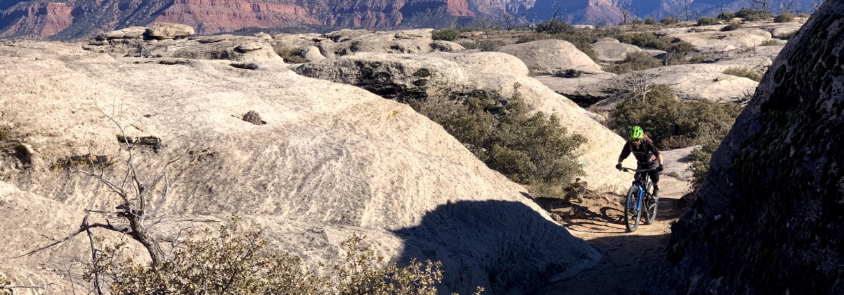
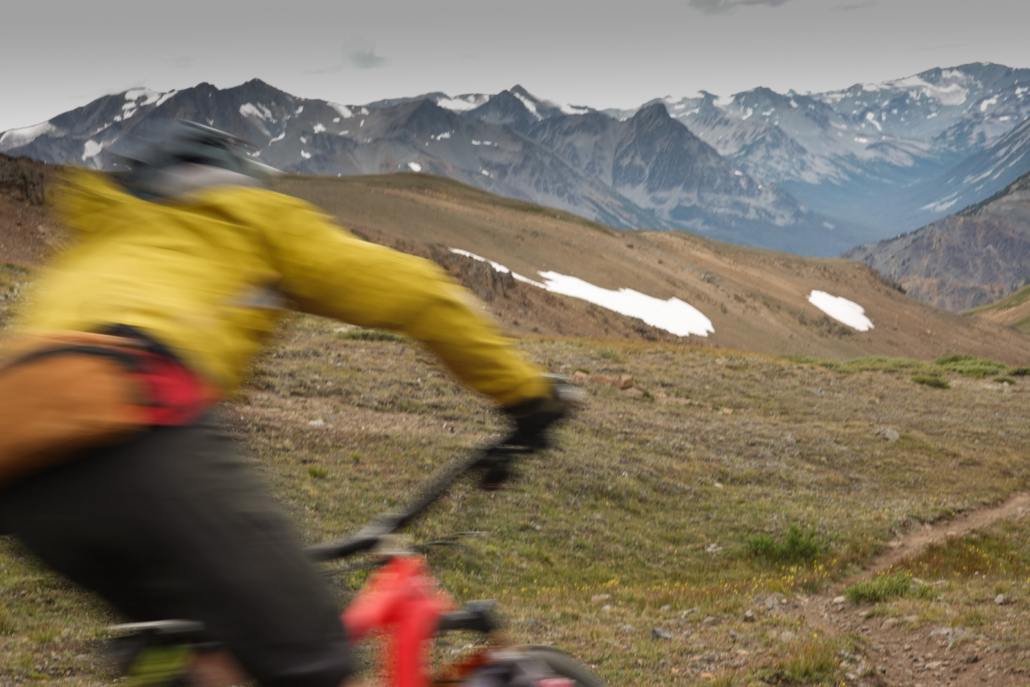
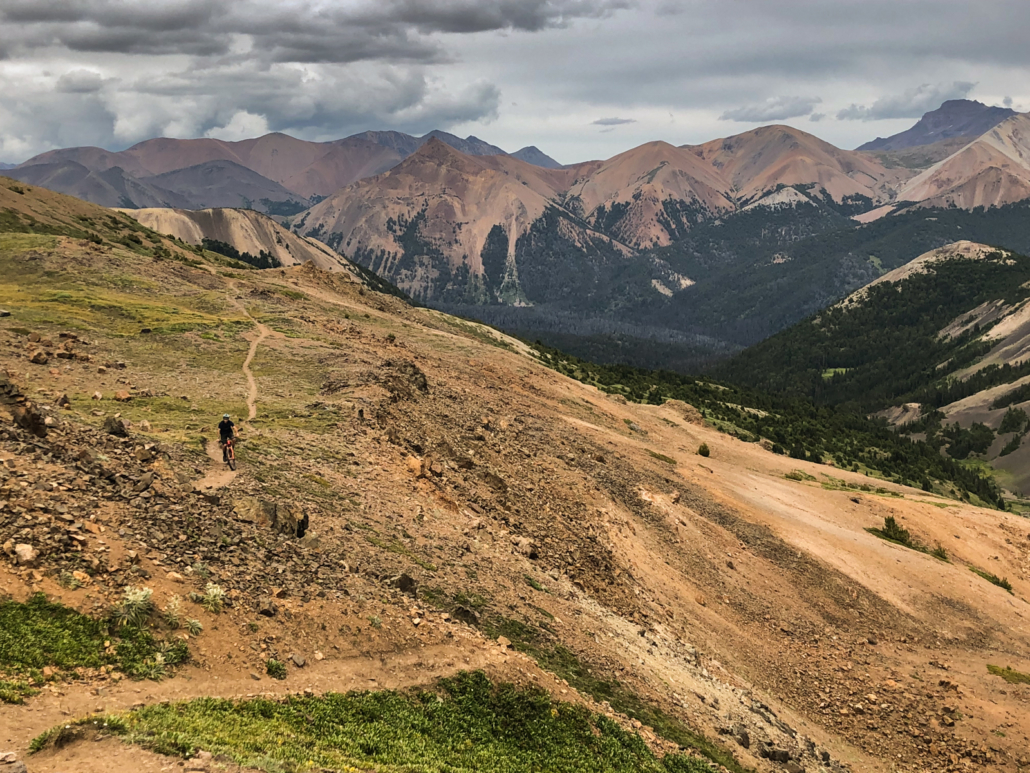
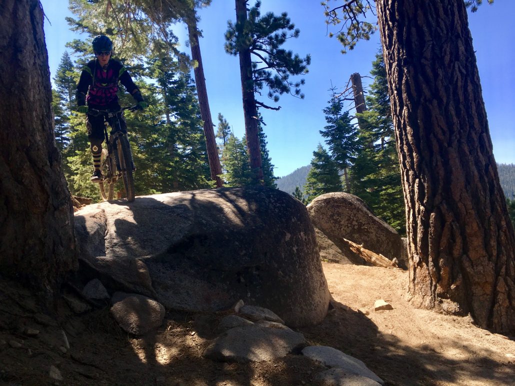
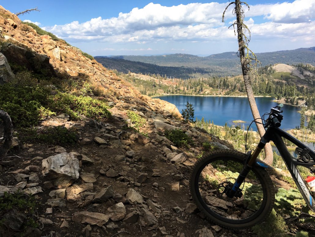
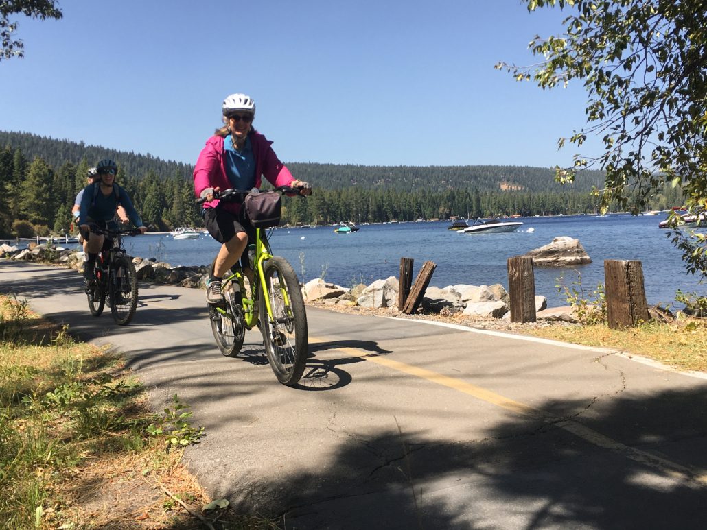
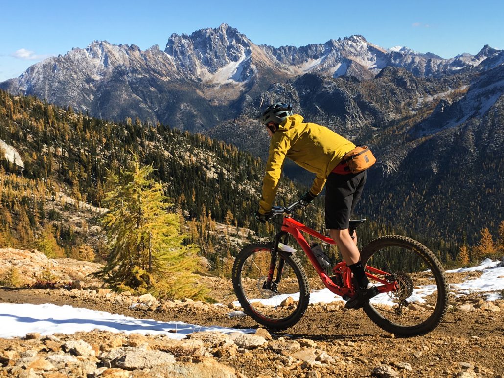
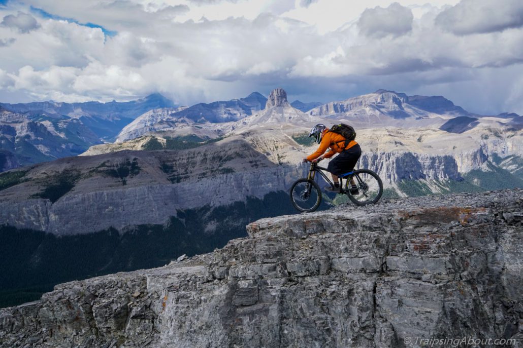
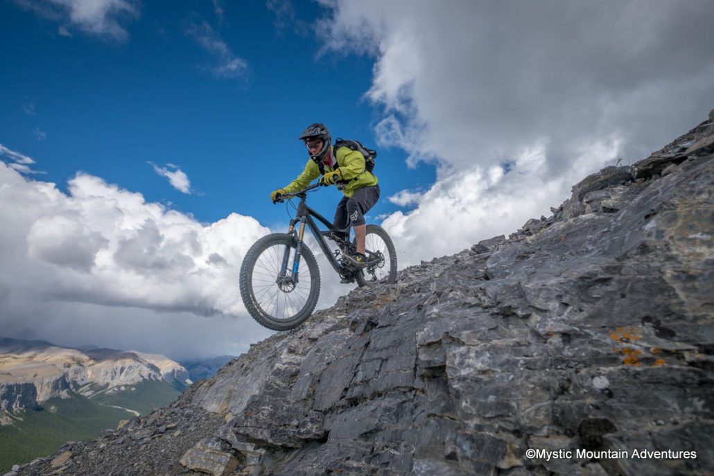
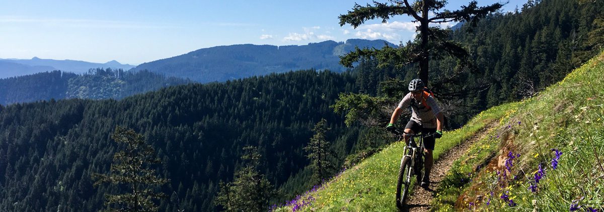
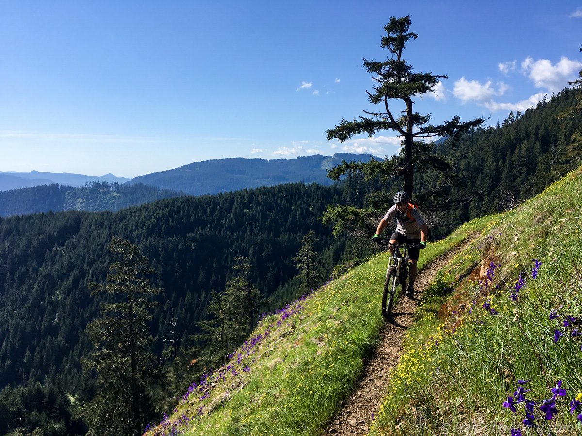
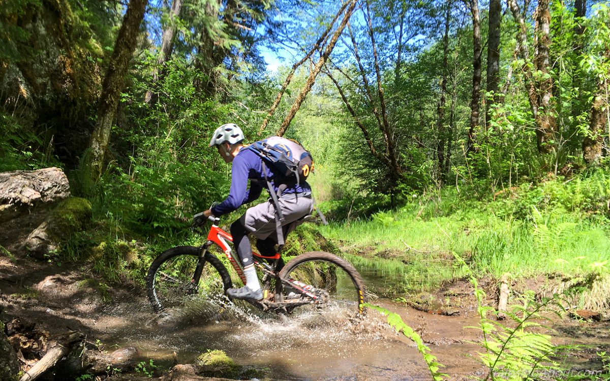
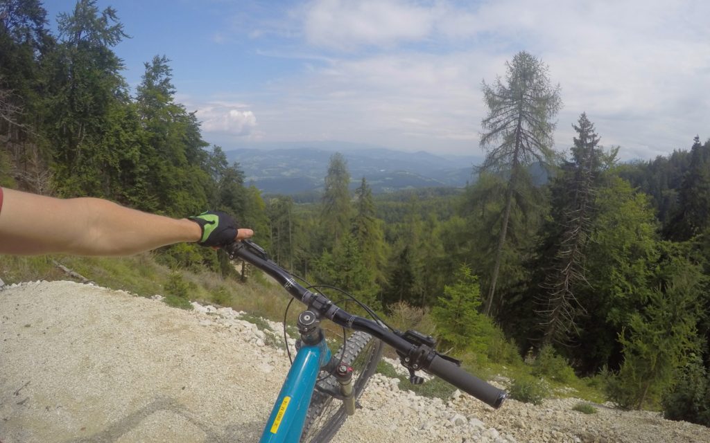
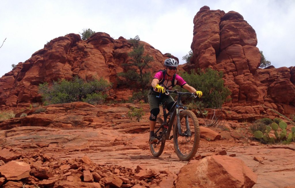
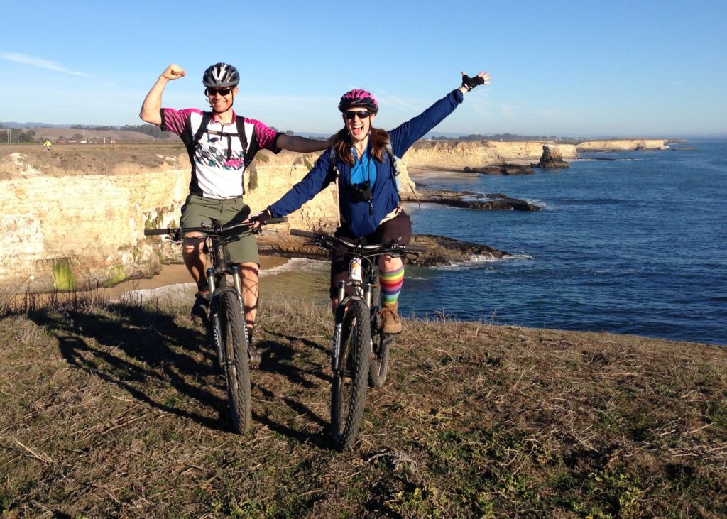
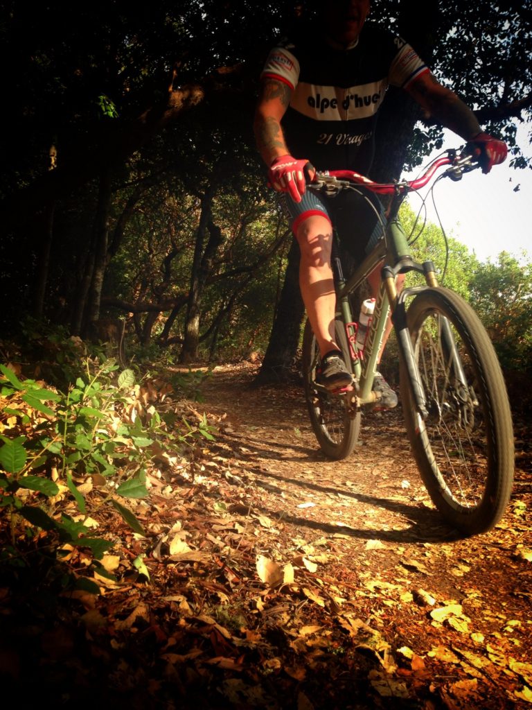
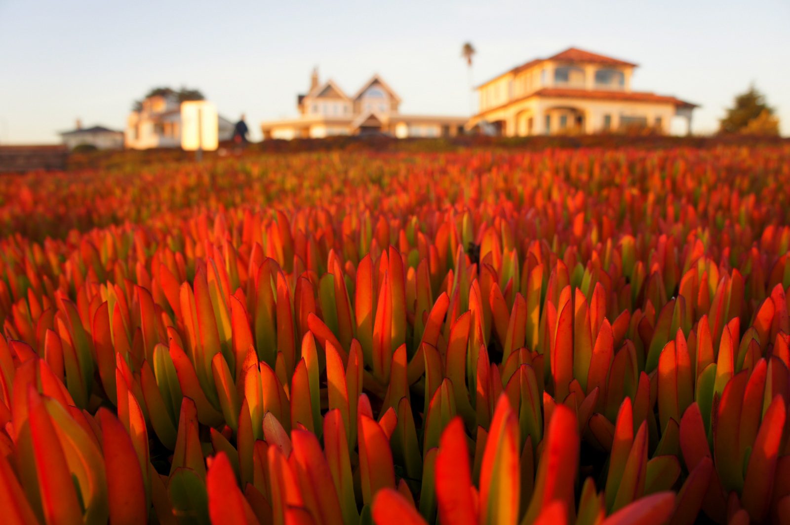
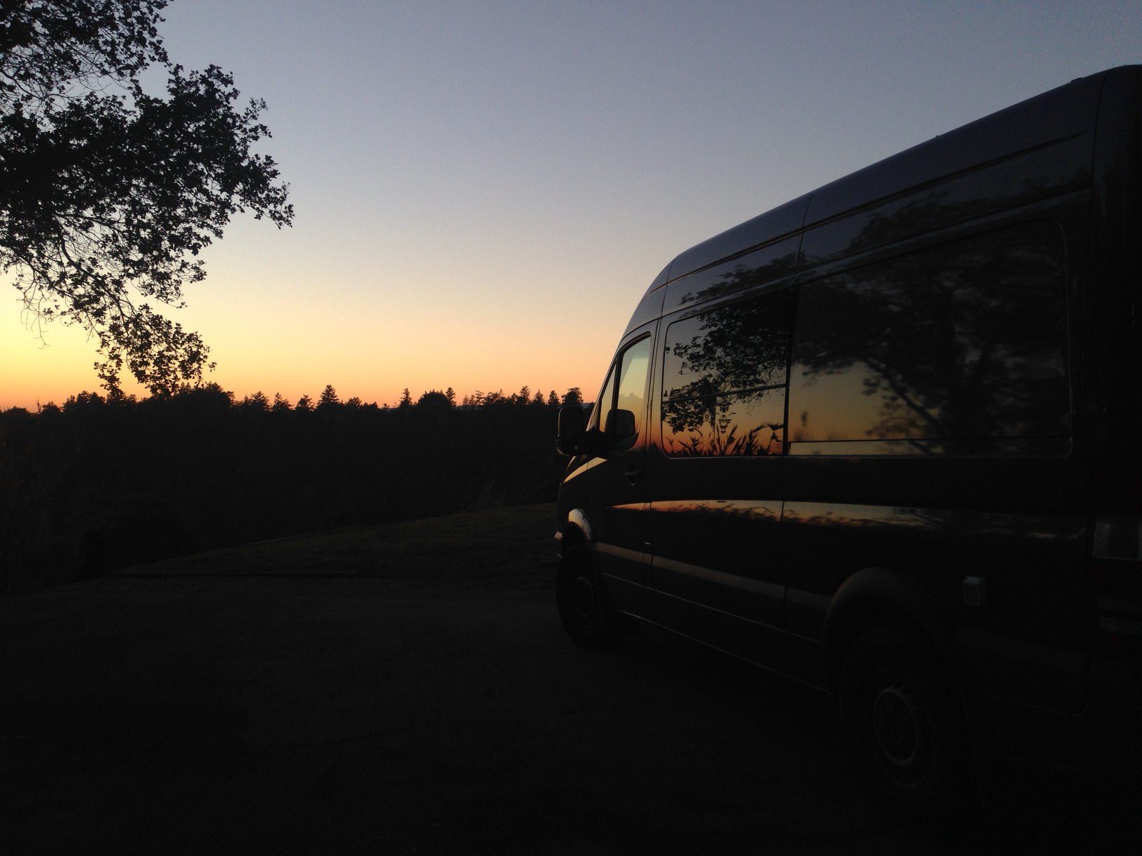
I clearly remember the first time I rode Tyler’s, a popular local bike trail. I walked some rocky uphill ramps, awkwardly landed jumps, and generally hacked my way down it like a noob.
I still had a hell of a fine time.
These days, I’ve ridden Tyler’s dozens of times and know every major feature. I fly down that sucker.
But is Tyler’s more fun/exciting/fulfilling now, or the first time?
In general, is there a way to develop appreciation and deeper comprehension rather than boredom for a repeated experience?
Travel to the same places. Hobbies we’ve done for years. Meals we’ve made for a decade.
Or piano pieces I play.
(YES. Brought it back to piano!)
Navigating the creative gamut
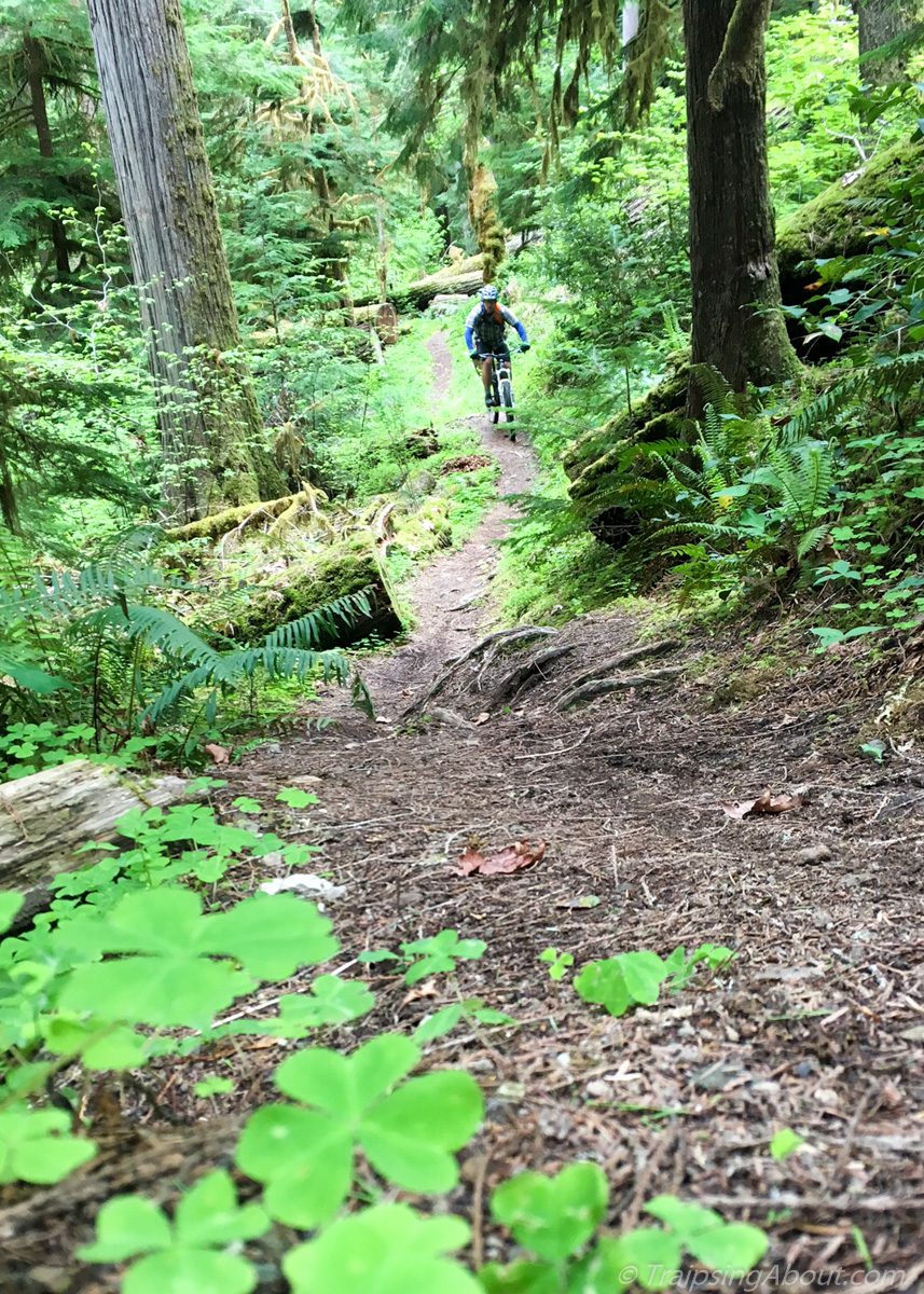
Like a new bike trail, the first time I play a piano piece my brain scrabbles to survive, assembling information to jam the notes into my brain. I’m walking rocky sections and taking in turns, one measure and phrase at a time.
Take Schubert’s Serenade, a song I’ve always loved that I started learning in December.In my initial efforts, I pushed through the technical challenges of the piece and could “play” it. Then I tabled it for month, letting the music sink into my synapses. Cue round two, with more nuance and expression…and yet I’m barely getting started.
Bridging that gap between what I can DO and what I WANT to do is the hardest part. I listen to professional recordings and think, “yup, do that, fingers!” Then I sit down and create some monotone pabulum akin to playing bongo drums with wet laundry. *sigh*
I’m exaggerating, but the gap between my expectations and my abilities does feel frustrating sometimes. Like some truculent kid, I want to play it that PRO way, now now now!
After I turn my pre-frontal cortex back on, I can (usually) reframe things. Because truly, I find this so motivating: I’m going to grow not just with new pieces, but enjoy a deep satisfaction revisiting piano works for the rest of my life. Something fresh to discover, to experience.
And dang it, I AM making progress. Even if I’m roughly 9,000 hours shy of mastery, there’s magic in the journey and daily satisfaction in the learning. I don’t need to be pro to have fun.
Plus, pushing myself on challenging songs pushes me to greater heights on those I already play. It’s the same thing that happens when I ride rocky trails on my bike. I may not slip effortlessly through the toughest moves, but that difficulty makes technical trails feel even more cruiser in comparison.
Unlike during piano pieces, sometimes I pause mid-climb on a bike to eat…
As piano, as life
I love how this mindset so easily translates to other endeavors or pastimes. We’re a different person when we revisit a city or national park, reread a book, build a piece of furniture, or play an old song. Depth, additional context, a slower pace…it all modifies the experience and likely results in a deeper appreciation.
With this in mind, I’m continuing to actively push myself to share not-perfect work like my beginner drawings and music recordings. It’s tough because I want the work to be better, to make insane progress overnight. Sometimes I shake my head at how hard it is to take what’s in my brain and put it on paper or piano.
Whatever. There’s a reason every book on creativity decries perfectionism. I’ll probably always find blemishes and wish-it-were-different aspects of ANYthing I create.
The good news? It creates constant motivation to keep improving, growing, seeking.
That’s a beautiful thing.
As for Schubert’s Serenade? Maybe it’s not perfect, but I recorded it (Youtube link) and hope it resonates deep in your core the same way it does mine. I’m looking forward to a lifetime of it evolving beneath my fingers.
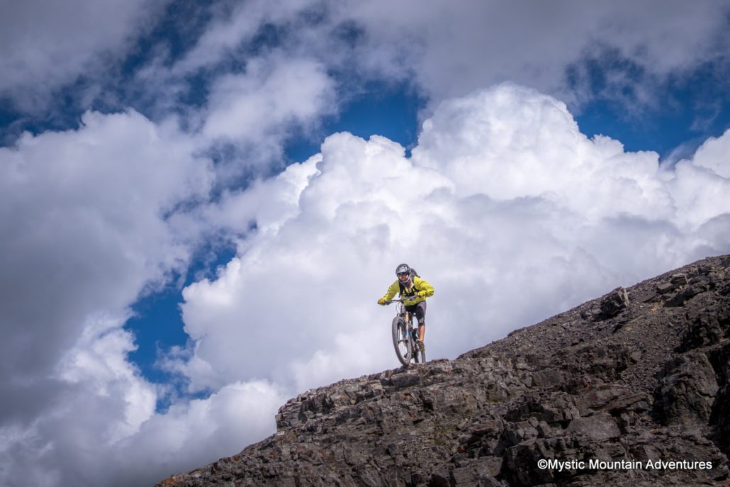
And if I get frustrated, I can always go rip down Tyler’s on my mountain bike.
Dig this post and want more like it? Check out my free 2x/month newsletter.
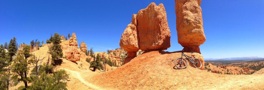
https://www.traipsingabout.com/wp-content/uploads/2023/01/Tylers-1-scaled.jpg7681024Dakotahttps://www.traipsingabout.com/wp-content/uploads/2018/03/Traipsing-About-logo-white-background-450x156.pngDakota2023-01-29 11:58:312023-05-06 14:46:39Revisiting the same-but-not-boring
The Colorado Trail is the big leagues of bikepacking. Get ready for leg-thumping elevation gain, lung-emptying altitude, afternoon thunderstorms tossing lightning and rain at the passes, and remote, rocky terrain with significant consequences.
Oh, AND prepare yourself for a fabulous adventure you’ll never forget.
We experienced no days I can label easy, but for determined bikepackers, it’s not unreasonably difficult. (Well, maybe a couple hours of it…) At our pace of 12 days for the trip, the town resupplies slotted nicely into the program, downed trees weren’t a thing, and perfect trail conditions from rain kept the dust down.
Sure, obstacles appeared. Forest fires from the west tainted the air for the first week. The elevation gain and hike-a-bike are no joke. We fled thunderstoms. My bicycle showed up 2.5 days late with a bonus of a broken dropper post…
But hey— no mosquitoes swarmed us, beautiful vistas assailed our eyeballs, fantastic descents delighted us, dozens of CT backpackers chatted it up, and we had the opportunity to ride through the Colorado mountains on a famous trail. What more can a bikepacker ask for?
Another day on the CT. (Near Kokomo Pass, between Frisco and Leadville.)
Shortcuts for Colorado Trail details
Here’s my experience bikepacking the Colorado Trail. I wrote this as a resource for folks looking to bikepack this route, so free to skip to any specific sections below.
Traveling between Denver and Durango, the Colorado Trail’s originated as a hiking route. Perhaps that’s why so many backpackers stared at us like we’d escaped the loony bin…
Featuring 70,000+ feet of steep climbing in ~550 miles, the bikepacking route bypasses a few wilderness sections on fire roads and pavement. Mostly, it follows singletrack up and down over 10-13k passes. Check out the main Colorado Trail page on Bikepacking.com for a complete write up.
Down down down…sometimes.
The Best-Laid Plans
My plan was simple: fly into Denver and out of Durango with 15 days to complete the trail. About 40 miles each day with space for half-days if thunderstorms whupped our butts or we needed a rest day. No problem.
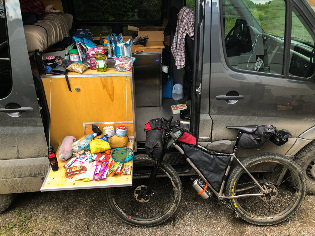
I live in Oregon, so flying lopped dozens of hours of driving time off the trip. Since airlines love to charge $200 to bring a bike only to dropkick them down ramps, I mailed mine with Bikeflights instead.
Sadly, UPS blew it and my bike arrived 2 days late. Instead of bikepacking, my trip companion Mason and I explored Denver. We broke tested traffic laws on Lyft scooters, toured the Denver Art Museum, bought final trip items, and generally made the best of it. Lesson learned: ship bikes with a bigger time buffer.
My bike finally arrived at 5 p.m on Monday. We reassembled it in a chandeliered banquet hall, caught mass transit to Littleton, and pedaled 10 miles to the CT start at Waterton Canyon. We arrived riiiight at sunset—spirits high, visibility low. Trips ideally start at 8 p.m., right?
No matter. Mason and I enjoyed an easy cruise up the canyon and camped near the start of the singletrack, poised to leap into the adventure the next morning.
Here’s the tl;dr for our Colorado Trail trip: up at 6-7 am, on trail after a cold-soak breakfast of oatmeal with nuts and berries. Go uphill (pedaling or hike-a-bike). Go downhill (mountain bike amnesia! Hard climb forgotten!).
Stop pedaling around sunset. Aim for days to end at the bottom of a descent to reset spirits and cleanse the mind. Better for morale.
Repeat.
In between, eat as much as possible, listen to audiobooks when the hike-a-bike gets soul-crushing, stop and talk with as many thru-hikers as possible, and keep eating (always).
Want the real details? Read on.
By the way, dig these kinds of posts? Sign up for the free 2x/month Traipsing About newsletter for more tales from the mountains and creative challenges like drawing and piano when I’m off the bike.
(Real) Day 1: Waterton
Unless you’re already a mountain goat or already live at elevation, your lungs will hurt out of the gate on the Colorado Trail.
Our first two days climb from Denver at 5k’ to 12.5k’ above Frisco. We enjoy occasional downhill moments and plateaus, but generally, we work. I’m immediately glad I swapped my front chain ring out to 26T—unless you have thunder cannons for quads, do it! Loaded bikes are heavy, treat your knees nicely.
My first Colorado Trail surprise is the sheer number of thru-hikers. We pass SO many. The Colorado Trail Foundation estimates 600 hikers will complete it in 2021, 4x the usual.
Chatting with people, we learn the backpackers span all ages and distance traveled per day. Everyone on their own journey, with different experiences and fitness and goals. The majority of hikers are college-age or retired, taking 30-45 days. Compared to bikepacking, it’s another world, a solid chunk of summer spent on trail with rest days and trail families. If it weren’t for so much walking, I might be into it.
My second surprise is my recently-serviced seat dropper post. It worked fine before I put it in the box in Oregon, but refuses to pop back up on trail. *sigh* I finagle a solution to keep it fixed in place.
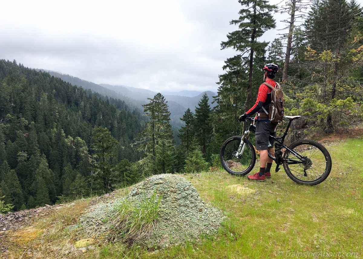
First descent! End of segment 1 heading down to the S. Platte River.
Our inaugural thunderstorm booms overhead when we meet Jay, a Colorado Trail racer. He’s looking rough thanks to a wreck, blood seeping through bandages. Sounds like the CTR racers got their butts kicked with three days straight of pounding rain out of Durango. We trade beta and commiserate, three guys in the woods looking for adventure. We’ve got it, in some form at least.
At our first bypass around wilderness, we chat with another CTR racer who sounds ready to sell his bike and embrace playing Fortnite instead. “Seven major thunderstorms, I counted.”
The Lost Creek detour proves to be an undulating, soft fire road. Rain spits from the gray sky, but the Bikepacking Gods keep the intensity dial below pouring.
To celebrate our first day on the Colorado Trail, Mason loses his phone at the end of a lonnnng descent. Dark:30 is incoming, plus we’re tired and low on water. I convince him to pedal back up and he miraculously finds the phone.
It’s almost dark and I’m shivering, body heat gone. We descend a mile and YES there’s a random stream with a perfect camping spot. I don all my clothing, pitch the tent, chug water, gobble down a freeze-dried meal, and get in my sleeping bag RIGHT before the skies open up. We drift off to raindrops smacking the tent.
Traversing a plateau on day 1 west of the S. Platte River.
Day 2, Tarryall detour to Kenosha Pass
We rise to soaked gear, but at least the rain has stopped. It’s a fresh day and more bicycling awaits!
Turns out the Tarryall traverse is steep climbs and descents, repeated forever. A couple miles in, we pass a father-son duo about to kick off day 3. They’ve under-estimated the trail and are bailing. “We’re playing golf in Breckenridge tomorrow. This trail is HARD.”
At Goose Creek campground, we chat with the friendly camp hosts as their giant tom cat plays in the brush. Our lunch wrap is vegan Violife cheese, Primal jerky, hot sauce and spinach. We’re living the good life out here!
The wide open views of the Tarryall Road detour.
And yet (small) wheels are threatening to come off: while drying my wet socks, I lose one on a descent. NOOOO. Rookie mistake. Second issue: my water filter is already slowing down to a trickle. WTF, it worked at home.
We hit pavement and push on into a headwind. Hours later, Mason’s enthusiasm jumps back to 10/10 when we reach the Stagecoach Saloon, which features a solid selection of snacks. We restock on super healthy options junk food. Stagecoach is our only food stop for the 150 miles between Denver and Frisco.
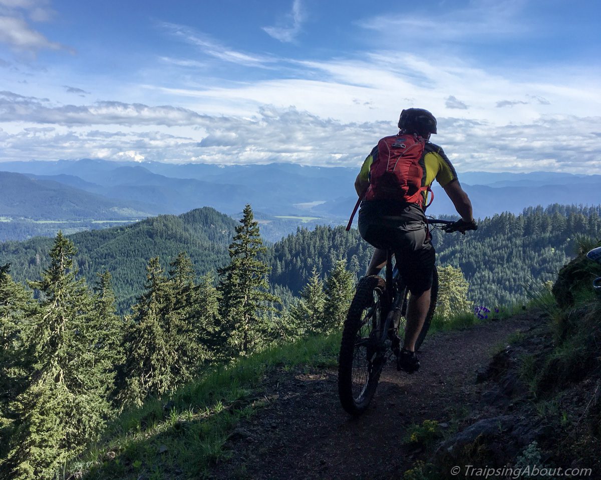
Another hour of fire road climbing and we’re back on the Colorado Trail. Always-Strong Mason pushes up the final climb as sunset sparks to the west. Over the top, mountain bike amnesia strikes as I descend through waving aspen.
We crash out at Kenosha Pass campground. Two Ibuprofen and ear plugs = blissful sleep.
Wrapping up day 2 at sunset, just before the descent to Kenosha Pass.
Day 3, Kenosha Pass to Frisco
We kick things off with a smoky morning climb through sun-dappled aspens. We’d considered bailing on the trip, but an AQI of 175 is only a couple hundred cigarettes per day.
All’s going well, minus the giant hand squeezing my lungs on the long approach to Georgia Pass. Altitude is real and I can’t take deep breaths! We’ve climbed from 5k to 11.8k in 30 hours, so it makes sense.
The descent off the pass is initially fantastic, then devolves into rocky madness near the bottom. I’m a fan of rocky terrain, but this tests me and my loaded bike, especially with a broken dropper post..
Break-your-bike rocky on the Georgia Pass descent.
Halfway down, we catch a hiker who plods along with headphones in. They must be noise-cancelling because we yell like psychos for two minutes until he hits a switchback and yelps in surprise. Hikers and bikers: one earbud while recreating, please.
Mason and I soak our shirts in a cold creek and chat with a backpacker from Florida. He torched his knees out of the gate with big days and may need to bail on his trip. The CT’s elevation gain is hard on a bike, but I can’t fathom hiking all that downhill. Brutal.
Up and over another steep pass with about 12 seconds of pedaling. Podcast and hike a bike, go! Especially at elevation as our lungs adjust, hiking feels far better than gasping.
MOUNTAIN BIKE AMNESIA. The descent is fast, smooth, all the funzies.
However, we hit Breckenridge and realize it’s NINE miles out of the way to Frisco. All paved bike path, but I quickly decide retracing our route the next day will damage my psyche.
In Frisco, we swing by the post office for a restock that Mason mailed ahead. I pull my favorite trick: not eating enough on days finishing in towns. My energy flat-lines and I barely can drag myself around Whole Foods.
WE FOUND FOOD.
We pass the evening in repose in a hotel, cooking ravioli in the room, eating grapes and cherries, and laughing until we cry at the Coffin Floppers comedy sketch.
The only bad (?) news: Mason’s phone is torched from when he dropped it. He’ll spend the rest of the trip without one, probably the longest period of his life sans-phone.
Day 4, Frisco to past Leadville
We kick things off by fulfilling my goal to not be a purist. Gold Hill segment? Nah. We skip it and pedal the sweet bike path from Frisco to Copper Mountain. Between losing two days to my bike delay and the ominous weather forecast, it makes sense. I’d probably do it anyway.
I’m loaded down with a large bag of cherries, which I donate to the first backpackers I see. It totally makes the day of a fruitarian named Jay.
Jay and his cherries! I don’t see any tears of joy in his eyes, but I’m sure they were there.
The usual pass protocol: pedal interspersed with hike-a-bike. I’m huffing my way uphill when another fun moment occurs: “Hey, are you Dakota? I follow your newsletter!” It’s a woman and her husband out for a hike. Small world!
The weather forecast remains true and threatening clouds amass to the west. They aren’t THAT bad though… We push on while keeping an eye on bail-out options in the trees down the slope. Then we’re over the false summit and above the treeline. Keep moving! We move fast and don’t eat enough, but manage to avoid getting zapped.
Halfway down the screamer descent, rain hits. We take advantage and pause to eat trail burritos and animal crackers.
High above Frisco near Kokomo Pass.
It’s a solid push to Leadville, but we arrive in time to mow down giant burrito combo platters. Then we push on, another 10 miles of fire road before crashing for the night by a lovely stream.
Day 5, Twin Lakes to Buena Vista
We rise and immediately ride past a sign proclaiming “no camping within 100’ of water.” Whoops. We were good tenants, don’t worry.
The smoke hangs heavy, toeing 200 AQI. Playing piano is less taxing on the system, methinks. Mason’s bike rebels against the terrible air by jettisoning its chainring. No big deal, it’s only required to pedal. Somehow, he MacGyvers a genius combination of tools to get it tight enough to get to Buena Vista.
Through the aspen…
Hours later, we trade beta with three stoked bikepackers from California northbound on the CT. The exuberant sharing of trail details and what’s to come is a fabulous aspect of any travel, but especially outdoor adventures. They also give us Oreos, so maybe I’m biased.
It’s one of our easiest days, helped by utterly fabulous tailwinds on the pavement into Buena Vista. On a slight downhill slope, we rip along for 20 glorious miles with barely a pedal stroke except to change leg position.
My smirk sums up how I felt not pedaling for 20 miles into Buena Vista. Best tail wind of my life.
Buena (be-oona) Vista is a little town with a chill vibe. The post office is closed, but we planned ahead and scoop up a box we mailed ahead to someone on Warmshowers.
Once again, I make the cardinal error of not eating immediately when getting to a town. Instead, I buy a new, unclogged water filter and get my dropper post fixed at Boneshaker Cycles, a top-notch bike shop. Eventually, I Zombie-stagger my way across the street to get food.
We follow a pro tip on a camp spot and head out of town 10 miles. The smoke hangs heavy in the air and the headwind sucks. Thank god for sleep or bikepacking might feel impossible sometimes. How the ultra-endurance racers push on and on and on is beyond me.
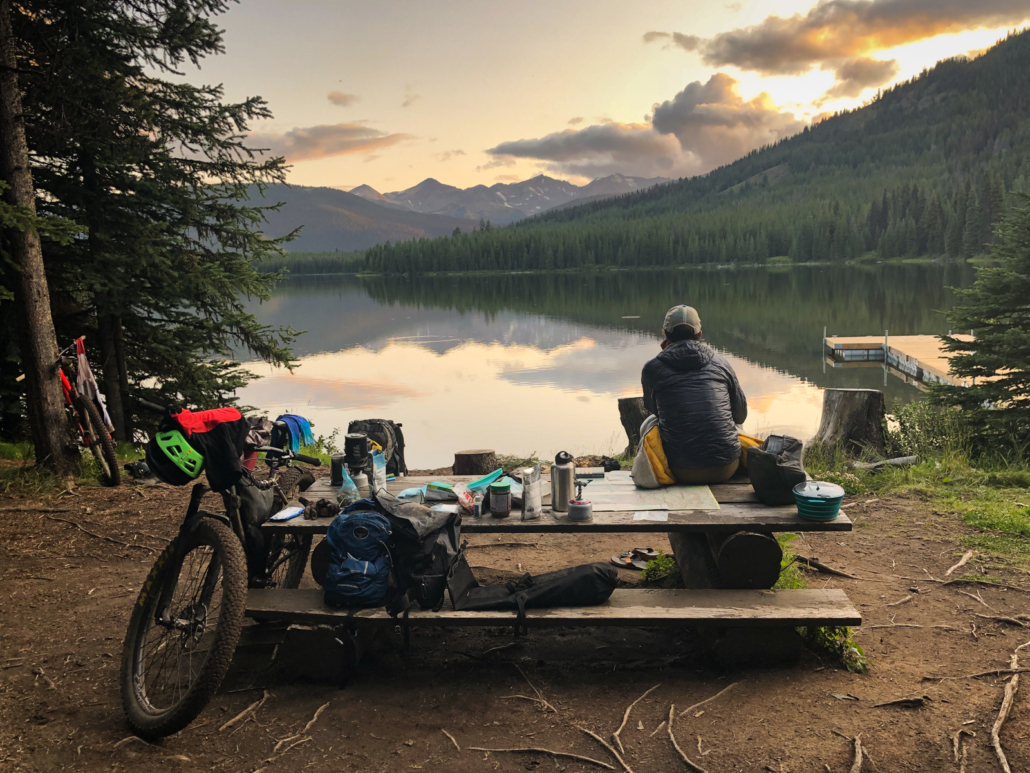
We rinse off in an ice cold creek and crash. Halfway done with the Colorado Trail!
Careful where you step.
Day 6 – Buena Vista to Monarch
A hard day. My memories are mostly steep, unrideable uphills—like, why-is-my-bike-over-my-head steep. Our one big downhill is on pavement into Princeton Hot Springs. Sigh. Can’t win them all.
Mason hates it enough to cut off his shirt sleeves at a lunch stop. He’s officially a punk bikepacker. We channel the anguish and push on.
Getting my heart rate under 250 after the ridiculous hike-a-bike up Chalk Creek. Ouch.
A couple of bikepackers in their late 60’s tell us how they figured out their lackadaisical trip pace. “I don’t have anywhere to be until ski season,” one quips. The retired life!
Sunset approaches and we’re pedaling up the Highway 50 bypass to Monarch Crest. Sunday night traffic suuucks. I’m d-o-n-e. We have no idea where we’re camping and 1.5 more hours of climbing with trucks whipping by sounds suboptimal. Anyone want to buy a cheap bike?
Suddenly, a beacon of hope appears. What is The Butterfly House?! Why, a donation-based respite for weary travelers! The proprietor is out of town—how cool is this place—so we make ourselves at home per the sign on the door. We score showers and do laundry, chat with the handful of backpackers staying there, and feel like humans again.
The quote of the day is from a backpacker named Alex, who asks us, “So, how many times a day do you wreck, 1-2?” HAAAA. If I wreck 1-2 times a year, I’m doing something very wrong. Thru hikers officially think we’re insane.
The Butterfly House! Take the detour up Highway 50 and stay here. Thank me later.
Day 7, Butterfly to Sargants Mesa
We barely peel ourselves away from Butterfly Hostel. A rest day doesn’t sound bad… My legs immediately agree once we resume pedaling up toward Monarch Crest. All good—it’s a beautiful morning, traffic is light, and we’re heading into a fabulous section of the CT.
The Monarch Crest general store revives my spirits with mind-blowing junk food options and cheery employees. Still, when Fritos improve one’s mood, the loony bin isn’t far away.
Monarch Crest trail delivers. Even the uphill pedaling is fun, with views unfolding until the smoky air diffuses them. Pro tip: skip the Ten Mile hike-a-bike and pedal the road. Thank me later.
We descend, climb, the usual. It’s subtly difficult rocky terrain and the elevation is real.
However, we’ve arrived at the most-maligned section of the Colorado Trail, the dreaded Sargent’s Mesa. Descriptions of this zone are either very short or laced with expletives.
Yup, it’s rocky. Unrideable uphills and annoying bumpy flat sections aren’t fun, thought not as bad as expected. The downhills are rowdy as hell, but rideable and fun for us. (Glad I got my dropper post fixed.)
Still, somehow I screw up fueling and my energy feels like dog poo. Too much sugar after the bonanza at Monarch Crest, methinks. I flop on my back on the tent footprint and try to revive my appetite. Each day on the trail is so similar and yet so different, elation easily switching places with, shall we say, less positive emotions.
The result of eating too many Mike and Ike’s and not enough real food.
We push on into sunset, striving for Razor Creek. My energy levels and enthusiasm scrape the depths. Tomorrow, I shall eat less sugar. A descent in the dark, headlamps blazing, brings us to the trickle of water. We pitch the tent in an (almost) flat field and slip downhill into the foot of the tent 25 times an hour that night. It’s not restful.
Day 8, Sargents to Cathedral Cabins
A cold morning wrapped in all our gear, rain pants included. The air is clear and crisp, the nagging smoke moving north for a bit.
Traill magic! Two cheery ladies are cooking pancakes out of their Airstream. “We had 17 people camp in that field last night,” they proudly announce. We roll on with a heads-up that a guy named Eric needs grub—with a restock coming up for us, we give him two freeze-dried meals and pistachios. The backpackers have 10 days between restocks in this section, ouch.
A professional trail angel, Apple, is up next. He leaves broiling Cincinnati every summer to come stay in Gunnison, where he drives out to the CT and sets up a trail angel station from 8-5 every day, chatting away the hours with travelers.
Full-on trail angels! Trail angel, take 2! Apple travels from Ohio to help out hungry hikers all summer.
The fire road bypass around wilderness at mile 361 is long and hot. Maybe I’m just mad because a freeze-dried meal with turmeric spilled in my frame bag and some of my possessions now feature yellow splotches?
We grind out the fire road, up a beautiful valley toward the pass. Sun. More sun. Audiobook territory.
But whatever! A looong descent on the other side erases the hard work from our memory banks and drops us right at our destination for the evening: CATHEDRAL CABINS.
I capitalize CATHEDRAL CABINS because it’s a trip highlight. Cute cabins nestled back in a side valley, moose stomping by in the meadow, a box of food we mailed ahead, and tons of tasty snacks available for purchase. Bikepackers: if you don’t stop here, you’ve made a grave mistake!
We spend a fabulous evening joking around with three other bikepackers and the cheery, friendly owners.
The splendid Cathedral Cabins. For sure stop here even if you don’t stay the night! Food resupply and cool folks in the middle of nowhere.
Day 9, Cathedral past CT high point
Since all nice things must end, we uproot from Cathedral and push on. Low-grade climbing allll morning on a gravel road, friendly ranchers cruising past in their trucks.
Pavement riding isn’t my thing, but Slumgullion Pass is a fantastic name. We aim for the sound barrier on the descent and almost crack 50 mph.
The kindness of strangers on the CT amazes me. We’re eating lunch by the side of the highway when a lady driving a truck slows down to ask if we need anything. She’s got four grungy backpackers in the back. Later we learn that she runs a volunteer shuttle from Lake City all the way up to the trail and back every day to help backpackers with resupplies.
Sadly, there’s no shuttle for the next section, a steep, rocky climb off Spring Creek Pass. We play hopscotch with backpackers, pushing our bikes and even occasionally pedaling. At least the views are stunning—the Colorado Trail’s beauty amplifies as it unfolds from Denver.
Beautiful…and hard work.
At a water stop, we meet a family of four backpacking the CT for three months. The kids are just 8 and 10! What a summer.
Rather than stopping at 5 p.m., we decide to push on (literally) over the CT’s high point. It’s another three hours of hike-a-bike as we ascend to 13,200’. At one point, I’m wrestling my bike up a ridiculous switchback as the sky drips warning rain…and then it clears.
Instead, we’re served a delicious evening dessert of sunset views. The smoke merely deepens the reddish hues. The descent ain’t bad either.
We dry camp at 12k’ overlooking a pretty valley. Another splendid day on the CT, even if we’re face-plant exhausted.
This riiiight here is why we bikepack. (Colorado Trail high point)Best campsite ever, even if we were exhausted afterward from sleeping at 12k!
Day 10, to Silverton
Did I say exhausted? NOW we’re exhausted. We both feel slammed this morning; are we dragging chunks of steel behind our bikes?
Chalk it up to elevation. I haven’t spent much time at 10k+ and spending the night at 12k hurt us.
Thanks to that, we grind. All. Day. Long. Survival mode, a group of hikers with a tour company passing us again and again. Hooray for splendid views because otherwise…dark thoughts.
Tired as can be, but COME ON. How is it so beautiful out here?
Luckily, there are marmots squeaking and skittering about. Their enthusiasm is contagious. Life is good.
We go over three 13k passes, up/down/up/up/up. Yegads the views are good, but clearly I am not cut out to be a high-altitude Sherpa.
The huge descent off Stony Pass is less than smooth, but gravity still works. Somehow, a half dozen masochists are driving up the insane road in beaten vehicles—were they new at the bottom?
SILVERTON. A hotel awaits us, but first we mow vegan pizza, tacos and tofu wraps. Food, life’s panacea. I grab a wrap for the road, Mason fixes a nagging flat tire at the excellent little bike shop.
The final push to Durango is all that remains!
These photos sum up our enthusiasm levels at the end of day 10 in Silverton. High altitude efforts are hard!
Day 11, Silverton to Hotel Draw Road
Two major wins to start the morning: our energy levels are revamped from sleeping at (only) 9k AND our bikes didn’t get stolen from the hotel’s backyard.
We notice immediately that today is different than yesterday…we’re actually pedaling our bikes instead of pushing them. There’s a lovely road climb to Molas Pass, then MORE pedaling on trail. Enthusiasm is high, even if we do spend a few hours pushing our bikes later in the day. (You don’t gain 6800’ in 34 miles just pedaling…)
Good news! You can actually pedal up some of the climbs between Silverton and Durango.
Also, my tofu wrap from yesterday is the best. Always buy extra to-go food in cities!
It’s a fabulous day. Maybe the best one of the trip? We can’t remember more than a day prior at this point—bike, eat, hike, sleep blends together a bit—so who the hell knows.
Two people highlights from the day: at Blackhawk, we joke around with a Boston couple and Mason donates an extra Food for the Sole freeze-dried meal to their cause. Hey, they’re vegan too! There’s almost a spontaneous group hug before COVID awareness stomps the fun.
Another group of backpackers arrives while we’re at the top and compliments us on our passing etiquette. Apparently most bikepackers scare the hell out of hikers? (I’ve done it too.) A reminder to dial it back and be an ambassador out here.
We descend off the pass and stop riding at 6:30 (early for this trip) and lounge about. It’s cool to push to dark, and also rewarding to hang out in a nice campsite and enjoy a little free time.
Top of Blackhawk Pass!
Day 12, Hotel Draw Road to Durango
No rush today, so we sleep in and roll at 8. Just up the trail, some volunteers for a mtb race that day tell us “coming up you’ve got the best 11-12 miles of trail.”
LIARS. It’s mostly uphill and traversing. WTF. Expectation setting sucks! I prefer to be surprised—good or bad—with what’s ahead.
At a water source, we catch a young rider—he looks like a DH racer— from the Midwest who is 32 days in on the CT. He clearly hates bikepacking, but is sticking with it. If I felt as depressed as he looks, I’d sell my bike for scrap and bail immediately.
Wildflowers show off as we climb to Indian Ridge. No passes can faze us at this point, I think…and then hustle like mad to get off the ridge as weather threatens. We learn later that a bunch of the bike racers got stuck in a massive hail storm and bailed.
Our 6,000 descent into Durango is only briefly punctuated by an overgrown hike-a-bike. Otherwise, it’s downhill for days. My arms and wrists are exhausted from the huge quantities climbing and descending in the past 12 days, but hot food and a hotel await us in Durango.
End of the Colorado Trail!
Parting Thoughts
The Colorado Trail is magnificent. Many times during the trip, I’d take in the scenery and think, “Wow, I get to be here.” It’s truly a bikepacking trip of a lifetime.
That said, this is not a trip I’d recommend for a brand-new bikepacker or new mountain biker. The CT is a tough mofo! We met a number of groups who were bailing because they under-estimated the difficulty. A seasoned local we met guessed that only 30% of bikepackers who set out actually complete the entire trail. The altitude is real, the elevation gain is serious, and inclement weather means taking one’s time sometimes isn’t an option given the risks of Bikepacker Flambe on a pass.
I well-know bikepacking contains obstacles and suffering pushing through things are part of it. There were STILL times I questioned what the helllll I was doing with a bicycle on the CT, usually when my bike was above my head on an insane hike-a-bike.
Bikepacking.com says 90% of the trail—time wise—is rideable. I’d peg that closer to 70-80%…and I like technical riding and my bike has a 26T front chainring. TO SUM UP: YOU WILL HIKE YOUR BIKE A LOT. Thank the Bicycle Gods for mtb amnesia, aka forgetting heinous climbs during a fun descent.
Hard work in them hills! (Kokomo Pass)
As any bikepacker knows, it’s not all fun and games. Day rides from my house or camper van aren’t even 100% fun; bikepacking is far from it. It’s all about the spirit of adventure, traversing beautiful landscapes, independence and ingenuity, camaraderie, eating Oreos on a mountain ridge, starry skies and sunrise vistas, and delirious laughter at the end of a hard day. And, sure, going downhill…
My deep thought from bikepacking the CT is this: weather creates half the adventure in outdoor pursuits. Heat, rain, smoke, snow, and wind can conspire to smote a trip upside the head and create insane conditions. Or they might step aside and make for a peaceful outing.
Such is the case with the Colorado Trail. An afternoon of lightning and rain on day one set my mind racing on the dread treadmill. “Will this happen every day?!” My soaked feet and gloves said oh hellll no.
Be prepared to get owned by thunderstorms. Everyone talks about them. We (mostly) got lucky and avoided the Devil’s Dance on alpine ridges, but many trip summaries and friends of mine mentioned fearing for their life at some point. One couple we met dealt with long thunderstorms every.single.day and started riding only at night. (He also got poison ivy so badly that his trip required THREE hospital visits. #cancelmytrip)
That said, the Colorado Trail deserves a slot on every bikepacker’s bucket list. It’s a spectacular chunk of Colorado and will inscribe itself in your memory. Start planning your trip now! Just bring rain gear and an adaptable mindset. Oh, and did I mention hike-a-bike? Pack light.
The Colorado Trail, folks. It’s magic out there.
Photo Gallery
Click on any photo to enlarge and flip through them slideshow style.To get a sense of the trail’s progression, they’re in chronological order.
Mason shreds like a boss on Lyft scooters.
An excellent place to put a big together. Thanks, Holiday Inn Express Denver!
Here we goooooooooo. Look how fresh-faced and innocent we look. We haven't even hiked our bikes yet.
Heading up Waterton Canyon to kick things off.
First descent! End of segment 1 heading down to the S. Platte River.
Traversing a plateau on day 1 west of the S. Platte River.
Mason cooking up some grub during a rain break on day 1 at Wellington Reservoir.
Campsite, day 1. 10 minutes later, it started pouring...so glad we had a tent!
The wide open views of the Tarryall Road detour.
Through the aspens at the end of the Tarryall detour.
Wrapping up day 2 at sunset, just before the descent to Kenosha Pass.
Heading up from Kenosha Pass toward Frisco.
Does red mean it's good to eat?
Break-your-bike rocky on the Georgia Pass descent.
Yup, I love coconut water. Best electrolytes ever.
Heading down toward Frisco.
The grin of someone who just rode 2,000 fun feet downhill.
WE FOUND FOOD.
Pedaling the Frisco to Copper Mountain bike path on a perfect morning.
Jay and his cherries! I don’t see any tears of joy in his eyes, but I’m sure they were there.
High above Frisco near Kokomo Pass.
Hard work in them hills! (Kokomo Pass)
Another day on the CT. (Near Kokomo Pass, between Frisco and Leadville.)
He might look crazy, but Mason makes a meaaaan vegan trail burrito. Spinach, Violife cheese, jerky, and hot sauce...with animal crackers for dessert.
Trail burrito, veg style. I should eat these at home...
Whaaat the...? Oh, just a WWII POW camp for Italian and German prisoners in the middle.of.nowhere near Leadville. Spooky.
Eating a massive quantity of food at Casa Sanchez in Leadville. Yes, I ate more two hours later.
A nice evening listening to the burbling creek...and 12,000 cars from Denver driving by to get an early start on Mt. Elbert. Ear plugs rule!
Hot chocolate to round out a long day.
Through the aspen...
Side view of my Why Cycles Wayward CT setup.
Front view of my Why Cycles Wayward CT setup.
Top view of my Why Cycles Wayward CT setup.
Mason shows off his field repair skills: Leatherman + chain tool to tighten a Cinch chainring!
Errrr, getting a bit hazy, folks... (North of Buena Vista.)
That smirk sums up how I felt not pedaling for 20 miles into Buena Vista. Best tail wind of my life.
Bikepacking grub. Freeze-dried is good, but I always buy additional food in towns when I can.
Careful where you step.
Getting my heart rate under 250 after the ridiculous hike-a-bike up Chalk Creek. Ouch.
The Butterfly House! Take the detour up Highway 50 and stay here. Thank me later.
Restocking at the Monarch Crest general store. All the necessities: Mike and Ike's, pickles, Fritos, and Nutter Butters.
Heading up Monarch Crest trail.
Monarch Crest views. Smoke barely at 175 aqi.
Curious cows on Sargent's Mesa.
The result of eating too many Mike and Ike's and not enough real food.
Late finish on Sargent's Mesa. GPS says elapsed time is 12.5 hrs, 7,100' of climbing, and too many Nutter Butters consumed.
Sunrise on Sargent's Mesa. We use the bikes to stake out the tent fly.
Full-on trail angels! They had 17 people camp by them the night before just to get the morning pancakes.
This trail angel, Apple, comes out from Ohio for the entire summer to help out hungry hikers.
Heading down toward Cathedral Cabins on the detour.
The splendid Cathedral Cabins. For sure stop here even if you don't stay the night! Food resupply and cool folks in the middle of nowhere.
Um, is this a trail? Walking the flat section above Spring Creek Pass. Pro tip: stay on the fire road and skip this BS.
Mason demonstrates an exhausted 1,000 yard stare.
Food for the Sole! I'm not sponsored or anything, but recommend this for anyone who wants real, delicious food in the backcountry.
Food break before the push over the CT high point.
Literally a final push over the CT high point at 13,000+ feet.
The Colorado Trail, folks. It's beautiful.
Over the high point of the CT at sunset.
This riiiight here is why we bikepack. (Colorado Trail high point)
Heading off the CT high point.
Down down down...
Best campsite ever, even if we were exhausted after sleeping at 12k!
Best campsite ever, angle #2. This is west of the CT high point before the next big climb.
This about sums up the climbs for the 35 miles before Silverton.
Above treeline, living the hike-a-bike dream!
The prettiest flat tire repair station I've ever seen.
COME ON. How is it so beautiful out here?
Push uphill, ride downhill! Hard work forgotten. Kinda.
More splendid views east of Silverton.
The terrain up high on the CT showing off yet again.
Oooooh, we get to ride down all of that?!
A perfect day in the San Juans, heading toward Durango.
Good news! You can actually pedal up some of the climbs between Silverton and Durango.
These photos sum up our enthusiasm levels at the end of day 10 in Silverton. Food soon (mostly) revived us. High altitude efforts are hard!
Another day, another pass. (Somewhere north of Durango.)
The San Juan Mountains, folks.
Hiding from an afternoon thunderstorm.
Top of Blackhawk Pass on our 2nd to last day.
A perfect campsite near Hotel Draw Road. Final night on the CT!
More views in the San Juan Mountains near Durango.
The final push to Indian Ridge.
Feeling VERY glad we're 30 minutes ahead of that cloud system on Indian Ridge.
End of the CT!
Logistics for bikepacking the Colorado Trail
Tips and suggestions for the route
Getting to/from start/finish
If you aren’t driving to the start, logistics to get to the trailhead are a little extra. From downtown Denver, catch mass transit to Littleton and then pedal the 10 miles to Waterton Canyon. It’s a nice warm up. Pro tip: your fare out of town is TWO zones, or $6 at the time of this writing.
Time of year
There’s no perfect time to ride the Colorado Trail, merely options. Go in June and risk snow on the passes. Go in July and risk daily monsoon-driven thunderstorms. Go in August and risk heat and/or thunderstorms. Go in September or later and you might get snowed on.
We opted for early August to ideally a) avoid snow b) get ahead of forest fires (sigh) and c) dodge the monsoon season.
We avoided snow and (mostly) dodged monsoon deluges. Forest fires served up shitty air quality for the first week (150+ aqi), but we pushed through it. What’s the equivalent of 200 packs of cigarettes going to do to my lungs anyway?
It was 99F in Denver at the start, but thanks to the high elevation, temps ranged from 45-75F from day 2 onward. Perfection.
May your trip avoid snow, smoke/fires and rain. Or at least two out of three.
Navigation
Navigation was straight-forward—the Colorado Trail is well-marked. I downloaded the route GPX from bikepacking.com and used Ride with GPS a bit, but wound up mostly using the Guthook app because it has more marked water sources. Highly recommend getting it.
My preferred method to save battery is to keep my phone on airplane mode with the volume turned up loud enough to hear the DING when a turn is approaching. There’s also another tone when you miss a turn, which quickly corrects any missteps.
Food
As usual, I rolled on a plant-based diet for this trip. My companion Mason is also vegan, which made things easy.
With the exception of restaurant meals in Frisco, Leadville, Buena, and Silverton, I ate mega-delicious Food for the Sole freeze-dried meals. Lunches were a mix of freeze-dried options and various snacks from restocks along the way. Mason got sick of freeze-dried meals toward the end, but I enjoyed them the entire trip.
Overall, I aim for 400 calories an hour without counting calories. I prefer to have an extra meal and bonus snacks in case of a mechanical…or just raging hunger! It’s never perfect and sometimes I screw up and underfuel, but it usually works for me.
Food for the Sole! I’d recommend this for anyone who wants real, delicious food in the backcountry.
The section from Buena Vista to Silverton is LONG without a restock. Check out the Monarch Crest store and do not miss Cathedral Cabins before Lake City. You can mail a box to them, but they have tons of freeze-dried meal options and piles of delicious snacks for reasonable prices.
Riding on a vegan diet and curious what you can find in convenience stores? Traipsing About reader, badass cyclist and fitness coach Lauren Costantini put together a list of foods for all you plant-based folks.
Water
Tons of water on this route except for the Tarryall bypass and Sargent’s Mesa. You’ll (likely) never need to carry more than 2-3 liters at a time unless you for some reason are dry camping.
We both used Katadyn BeFree filters until mine got so clogged that I bought a Platypus flter in Buena Vista. The frustration of doing the boa constrictor squeeze on a filter every time you want water is not to be underestimated! Bring a new filter or clean yours thoroughly before the trip.
Sleeping
We stayed in hotels for four nights (Frisco, Monarch Crest Butterfly House, Cathedral Cabins, and Silverton). Otherwise, we slept outside.
We brought my Big Agnes Fly Creek UL2 bikepacking tent and split carrying duties between poles and fabric. Given temps, overnight moisture (dew and rain), I was glad to sleep in a tent every night. You’ll have no problem finding places to sleep along the route.
Best campsite ever. This is west of the CT high point before the next big climb.
Cell signal
With Verizon, I had at least a weak signal up high most of the time. To save battery, I mostly kept my phone on airplane mode.
Gear
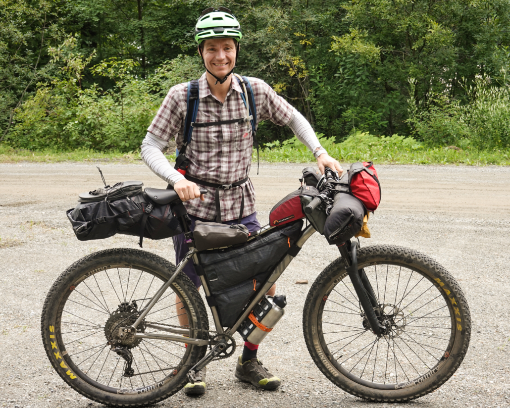
My Why Cycles Wayward setup for the Colorado Trail.
I rode my 2019 Why Cycles Wayward V.1 set up with a Terrene McFly 2.6” rear and 2.8” front tires. I run a 140mm front fork, which seems to handle most anything I’d want to ride a loaded bike down.
This year I added a 26T chainring on my Wayward to complement the 11-46 Shimano XT setup I’ve got. It was AWESOME. Spinning is the name of the game while bikepacking! You’ll never miss your taller gears as much as you’ll dream of more climbing range, trust me.
Rounding out my gear was a Revelate front roll bag for sleeping gear, a custom Rockgeist frame bag, and a Bedrock Black Dragon dropper bag.
https://www.traipsingabout.com/wp-content/uploads/2021/09/Colorado-Trail-bikepacking-August-2021-66-scaled.jpg19202560Dakotahttps://www.traipsingabout.com/wp-content/uploads/2018/03/Traipsing-About-logo-white-background-450x156.pngDakota2021-09-16 06:00:002023-05-06 15:04:26Bikepacking Magic on the Colorado Trail
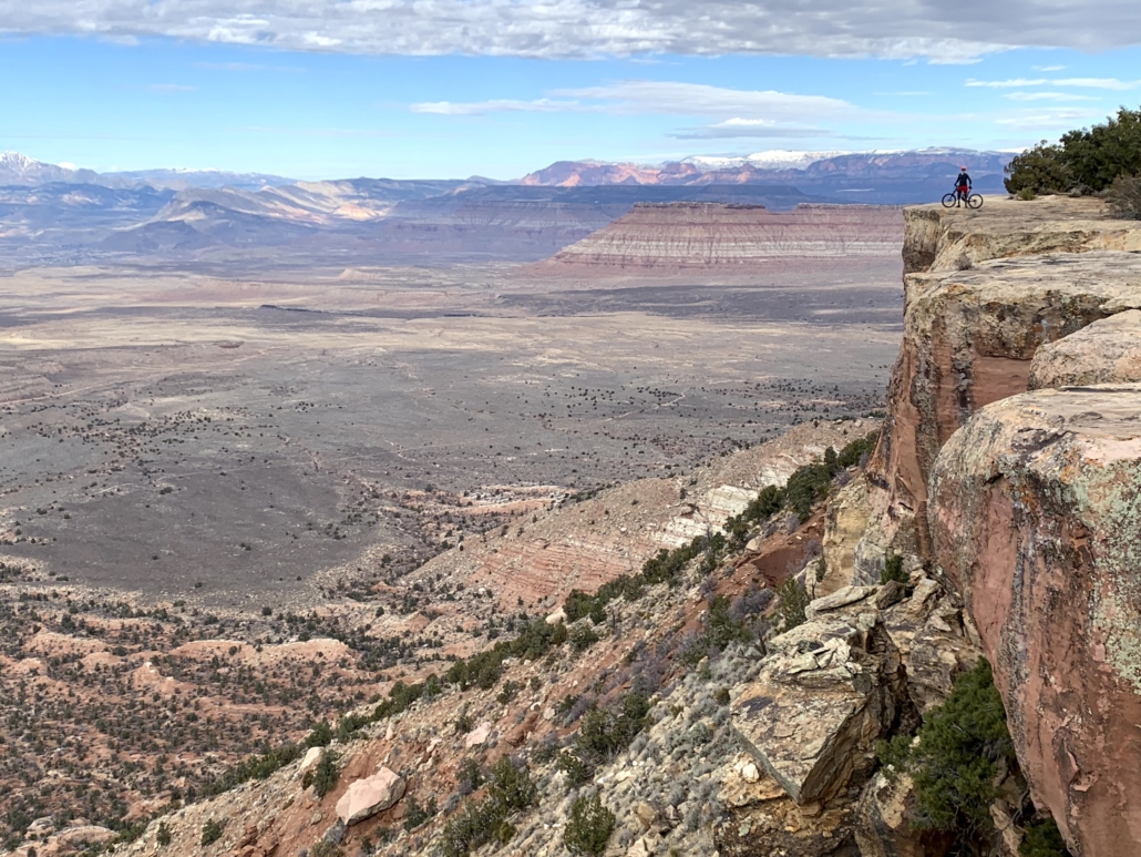
The area around Hurricane, Utah is a tumultuous riot of steep, rolling rock, an outdoor playground. The expansive views and fine winter weather create a dream destination for desert lovers, including mountain bikers sick of snowy home trails.
In January 2020 P.C. (pre-COVID), I’d journeyed to the desert with my friends Paul and Eric in search of sunshine and temps over 35 degrees. I’d quickly figured out how to pronounce Hurricane – Hurr-UH-CUN – and so far the only trip negative was Paul’s penchant for hiding in surprising places and scaring the bejeebus out of me, an immaturity battle I quickly escalated. (Eric wisely steered clear of our asinine antics.)
However, I generally prefer my heart-palpitating moments on a mountain bike. (Earmuffs, mom.) To that end, we beat my bike rack to death on the rutted dirt road to Gooseberry Mesa, a fabulous piece of terrain overlooking the surrounding valleys. Astride our bikes, we pedaled the undulating terrain, a natural skatepark for bikes.
At the bottom of a particularly steep rock, three guys – clearly experienced, with all the cool gear – were “sessioning” or repeating (and failing) the same move. As I rode up, a break in the action presented itself, so I gave it some gas and clawed up it.
I stopped at the top and one of the trio yelled, “Hey, have you ridden this before?”
“Nope. I’m from Oregon.”
Long pause.
“What kind of tires you got?” “Minion DHFs.”
“OHHHHH…”
Commence excuses. Justifications. Posturing. Typical tough guy BS reinforced starting in childhood. Anything to help these three guys feel ok that I, a root and dirt rider from the PNW, might waltz onto their terrain and ride something they couldn’t.
Picture a rock move like this, but about 2x steeper, with a turn. So awesome.
Paul and I exchanged glances as the guys spouted excuses – one had tired legs, another was on a new bike, and of course one owned the wrong tires. It was like I’d grabbed their ego voodoo dolls as I pedaled by, then smashed them in my Magic DHF Tread.
Never mind that Minion DHFs are best known for loose, wet terrain, NOT for rocks. If I’d sported Teflon tires, these guys would have said I could slide my way up the rock.
We left their empty excuses behind us and vamoosed to the viewpoint. Enjoying lunch with a spectacular vista, we forgot the guys…until they rolled up again. Sigh.
Endless vistas… (Little Creek Mountain’s Big Loop trail.)
One of them immediately blurted, “I rode it.” It wasn’t genuine pride: it was an ego looking for affirmation. I pictured a kid seeking a gold star.
In the inimitable fashion of posturing males (takes one to know one), the guys blathered on about their trip. Paul, who suffers no fools, pointedly walked away to enjoy the view and his PBJ in silence. I briefly hoped he’d turn around and scare the crap out of the guys, but social decorum prevailed.
Luckily, they left soon enough, echoes of excuses and pathetic tire tread marks the only proof of the brief interlude. Well, that and our laughter at their ridiculous comments. We adopted “If only I had a DHF” for any mistake for the rest of the trip, on the bike or off.
Even with the sour aftertaste, I love experiences like this for an opportunity to learn. Those three riders remind me to steer clear of a) excuses, especially to random strangers, and b) posturing versus letting performance speak for itself.
All a work in progress for me depending on the day. I’m not perfect and will slip up, so perhaps I need a frequent reminder of this 15-minute episode in the desert.
I’m hoping that tattooing ‘DHF’ on my forearm will suffice.
Gooseberry Mesa viewpoint! Hope my parachute works…Eric playing around on Guacamole Mesa while Paul looks for the levitate button on his bike.More Guacamole Mesa magic. Ahhh, the desert.Paul searches for the paraglide button on his bike on Little Creek Mountain.
https://www.traipsingabout.com/wp-content/uploads/2020/11/Guacamole-Mesa-views-mountain-biking-scaled.jpg19202560Dakotahttps://www.traipsingabout.com/wp-content/uploads/2018/03/Traipsing-About-logo-white-background-450x156.pngDakota2020-11-18 19:54:292020-11-19 11:32:14Posturing Ain't Pretty (and Other Desert Teachings)
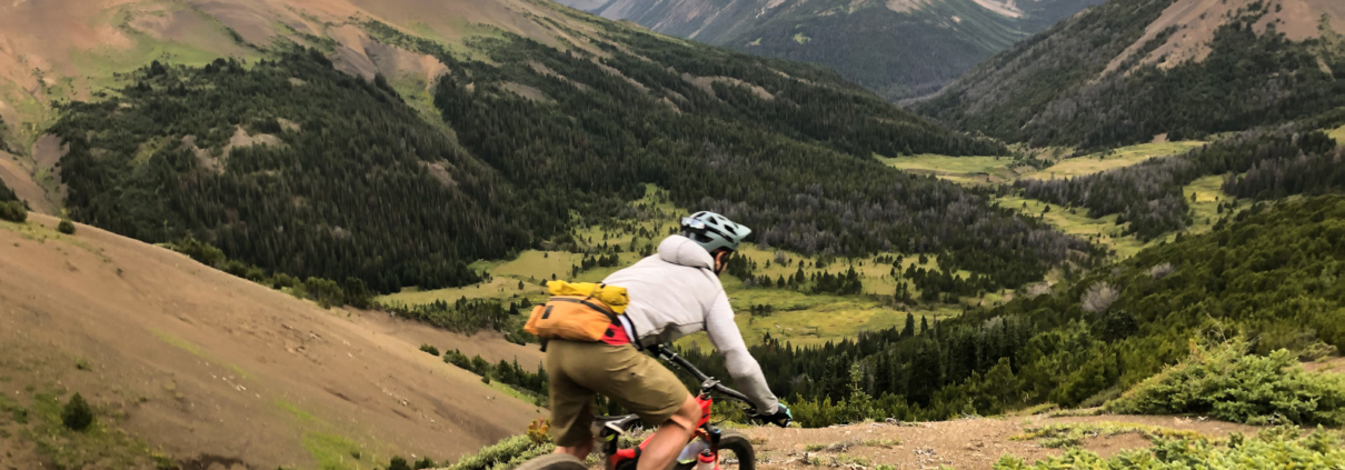
Call it mountain bike amnesia, but I’m already forgetting the hard work necessary to bikepack in the Chilcotin Mountains. Sweaty hike-a-bikes up mountain passes drift away, replaced by stunning vistas and brake-melting descents, a goofy grin plastered across my face.
Our simple trip goals: pedal bikes laden with six days of food into the backcountry of British Columbia. Keep the plan flexible. Make decisions knowing that help won’t arrive for a looong time if we mess up.
And, lastly, the most difficult and important goal: Don’t eat all the good snacks on day one.
Loaded with six days of food and not out of snacks (yet!).
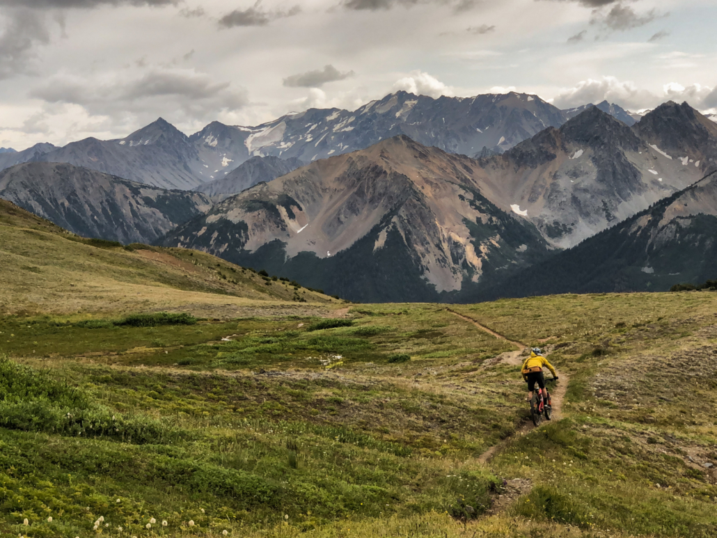
The verdict: WHOA. The Chilcotins are as beautiful and physically challenging as we’d heard. The terrain looks like a love child of Iceland and the Pacific NW, ranging from tree-lined lakes to icy creek crossings to alpine passes to scree traverses
This remote zone contains all the ingredients for a delightful backcountry adventure. All you need is food, maps, pedal power, and ear plugs to ignore the large bears chipmunks stomping around all night.
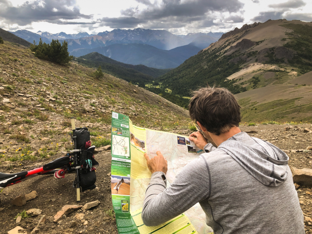
Map check on top of Windy Pass.
Wait, I’ve Never Heard of the Chilcotins!
To reach the South Chilcotin Mountains, drive north of Whistler, B.C. WAY north. There are two options: the tire-eating beast of a fire road called The Hurley, or via Lillooet, town motto Guaranteed Rugged.
Either way, it’s over two hours heading north off the grid while wondering if you’ll end up in Alaska.
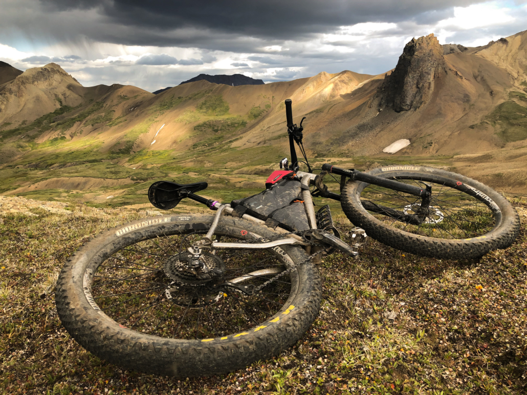
A moody evening in the Chilcotins with my trusty Why Cycles steed in the foreground.
Most people who visit the Chilcotins use a float plane from Tyax Adventures that ferries people and/or gear in and out. While enticing, parting with hundreds of dollars to avoid a little sweat seemed unnecessary at best…and irresponsible at worst. We hauled all our stuff, including bear spray for encounters with the REAL locals, grizzly bears, then set up two different base camps for unloaded riding.
I wasn’t expecting an all-fun trip. (Excellent adventures never are, right?) Hard work sharpens enjoyment’s edge, which is why chocolate tastes so damn good on top of a mountain pass.
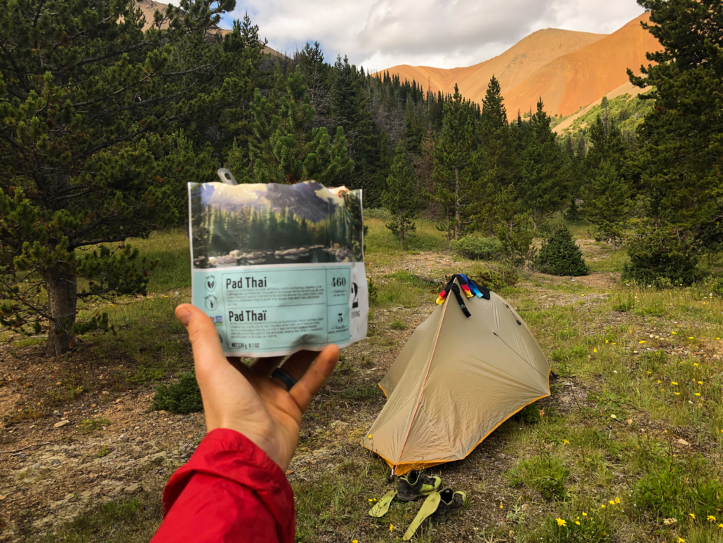
Honestly, the trip wasn’t too bad. Even with my bags stuffed with 11 freeze-dried meals and a jar of peanut butter, sweeping views were my appetizers and staring at mountains while eating pad thai was a double-whammy dinner.
By the way, dig these kinds of posts? Sign up for the free 2x/month Traipsing About newsletter for more tales from the mountains and creative challenges like drawing and piano when I’m off the bike.
It ain’t a fancy restaurant, but I’ll take this view any day!
The Experience
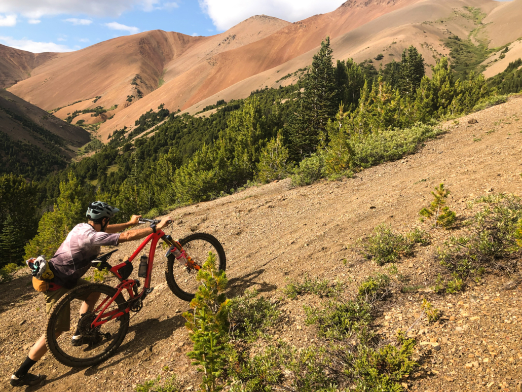
Friends warned us about the push required to get into the Chilcotins. Horse hooves created the backbone for these mountain trails, so they are A) steep as hell, and B) rugged. Many times pedaling simply didn’t make sense and we’d hike-a-bike, leaning into the bars. Some sections are so steep that pushing a loaded bike isn’t possible. The routine was step, push up with the bike, lock brakes, move feet, push up, repeat. Isn’t bikepacking FUN?
Manson Col means “gawwwd my calves hurt” in British Columbian.
The upside to pushing: unlike with a headwind, there’s always fun to be had on the other side of a hard effort uphill. The reward is solitude on mountain passes and the adrenaline fairy dishing out large helpings of excitement on the downhills.
Another thing we quickly learned was the “Chilcotins Pace”. By that, I mean SLOW: In an eight-hour day, we could cover about 20 miles. Creek crossings abounded, as did swampy/muddy sections, mountain passes, and rooty/rocky riding.
Every time we’d get cocky, we’d get smacked upside the head by reality. This was an experience, not simply a mountain bike ride.
Mid Tyaughton trail wasn’t silky smooth singletrack…The reward for mud and hike-a-bikes!
It’s All Worth It
Yeah, it’s hard work in dem mountains. Whatever. That’s the price to entry for bikepacking the Chilcotins.
But that’s not the reason to go there. It’s possible to melt brakes riding downhill ALL day with zero work at Whistler Bike Park, after all.
Heading out on High Trail on our final day.
Beyond all the amazing riding, our time included camping by a quiet, beautiful lake. Sunsets over mountains. A burbling creek by our second camp. Solitude in the alpine listening to marmots whistle. Starry skies to make our eyes sing. A sense of adventure tough to find on manicured, purpose-built trails.
Perhaps best of all, we didn’t have to use any bear spray.
Paul in sunset reverie on Spruce Lake.
Photo Gallery!
Logistics and Details for Bikepacking the Chilcotins
Looking to skip the float plane from Tyax Adventures and pedal in yourself? Here are a few logistical tips:
Buy a hardcopy map of the area or at least the Gaia one. Navigation via just Trailforks is possible, but hardcopy in case things go wrong is a good idea.
Go in the summer. Our mid-August trip featured perfect temps, few mosquitoes, and minimal rain.
Water is plentiful. This ain’t the desert: you’ll only need to carry one full water bottle except maybe over the passes.
Respect the Chilcotins Pace. We found that planning to go 20 miles in an 8 hour day out was a good estimate. (On a typical ride in most places, I move 3-4x faster.)
Flip flops were great for the many creek crossings (~20 total during our trip).
This is bear country. Bring bear spray! Spruce Lake and Lorna Lake have bear boxes to stash food in. You’ll need to hang food in trees if you camp elsewhere, so bring some rope for that.
There are two primary ways to pedal in: a relatively easy route up Gun Creek Trail or a burly climb over Windy Pass. If you’re looking for alpine terrain like we were, take Windy Pass.
Basecamping treated us well as a way to explore on an unloaded bike for a few days. Our camps: two nights at Spruce Lake and two below Manson Col.
Layer up! The weather is fickle and moves in fast on mountain passes.
Surf’s up! Drifting scree up high.
Ride Stats
Here are each day’s details as recorded on Strava. I suspect moving times should be higher, but my GPS thought I wasn’t moving on some of the steeper uphill hike-a-bikes… Apparently “glacial pace” isn’t a Garmin option?
Day 1: Tyax Lodge to Spruce Lake via Windy Pass on Tyaughton Creek Trail. Relatively fast going and mostly rideable except Windy Pass. Stats: 20 miles, 4.5 hrs moving time, 5300′ climbing.
Day 2: Deer Pass loop (CCW) from Spruce Lake via Mid Tyaughton Creek Trail with return Upper Gun Creek Trail. Slow going on Mid-Ty Creek, almost 100% hike-a-bike over the pass, and rideable from there. Stats: 25 miles, 5.25 hrs moving, 5000′ climbing (unloaded)
Overgrown adventure riding on Little Paradise trail.
Day 3: Moving base camp to sub-alpine camp on Manson Creek, then unloaded riding/pushing up to Manson Col. *This is a lesser known, RAD zone. Stats: 17 miles, 4.5 hrs moving, 4300′ climbing
Day 4: A big CCW up Manson Col, Little Paradise, Little Graveyard, Big Creek, and Lorna Pass. Fair warning that Little Graveyard and Big Creek are muddy, frustratingly slow trails if it rained recently. Stats: 22 miles, 5.25 hrs moving, 4400′ climbing (unloaded)
Day 5: Up, over and out! Down Manson and Mid Tyaughton Creeks, up Windy Pass (get ready for barely doable hike a bike) and then back to Tyax Lodge via High Trail and Molly Dog and Pepper Dog trails. Stats: 30 miles, 5.75 hrs moving, 5000′ climbing
Me contemplating 2,000′ of face-punch uphill hike-a-bike on the way out over Windy Pass. Paul’s comment when he got to the top: 45 minute break, NOW!
Favorite Trails
The downhill ones, DUH. Specifically Lorna Pass ridden south, Deer Pass ridden west, Windy Pass ridden either way, and Manson Col/Creek ridden with gravity on your side! You can’t go wrong. The traverse trails in the valley were muddy for us, but were still entertaining in their own right. (Except for the bogs of Little Graveyard, that is.)
Paul at Mach Fun down Deer Pass!
The Gear
Packing all the food and gear the night before. Except the van – that doesn’t fit in my bike bags.
Max gear weight (bike, bags, food for entire trip, 64 oz of water, gear I wore): ~80 lbs. No wonder those passes were hard, that’s almost half my body weight!
Bike weight + unloaded bags: 37 lbs
Gear (sleeping, cooking, clothing, tech): 20 lbs
Max food weight: 14 lbs
Allow to me geek out… Weight matters, but adding a few pounds doesn’t change much. My reasoning: if my bike plus me weighs 250 lbs, even adding 5 lbs of weight is only 2% more overall. I could have doubled my food for only 5% extra weight. I doubt it would have slowed me down much
My takeaway: Unless you’re racing, that extra chocolate bar and warm layer is TOTALLY worth it!
Big country! Paul pushing his fully loaded bike up the long Windy Pass on the way in.
Trip Food
If you’re aiming to do a bikepacking trip like this, you probably know what your body needs. If it helps, here’s what I brought:
~20,000 calories, or about ~3,500/day. (This will obviously vary depending on the person.) Enough to keep the fire hot without towing a trailer! Dense calories is the name of the game, with a few luxuries.
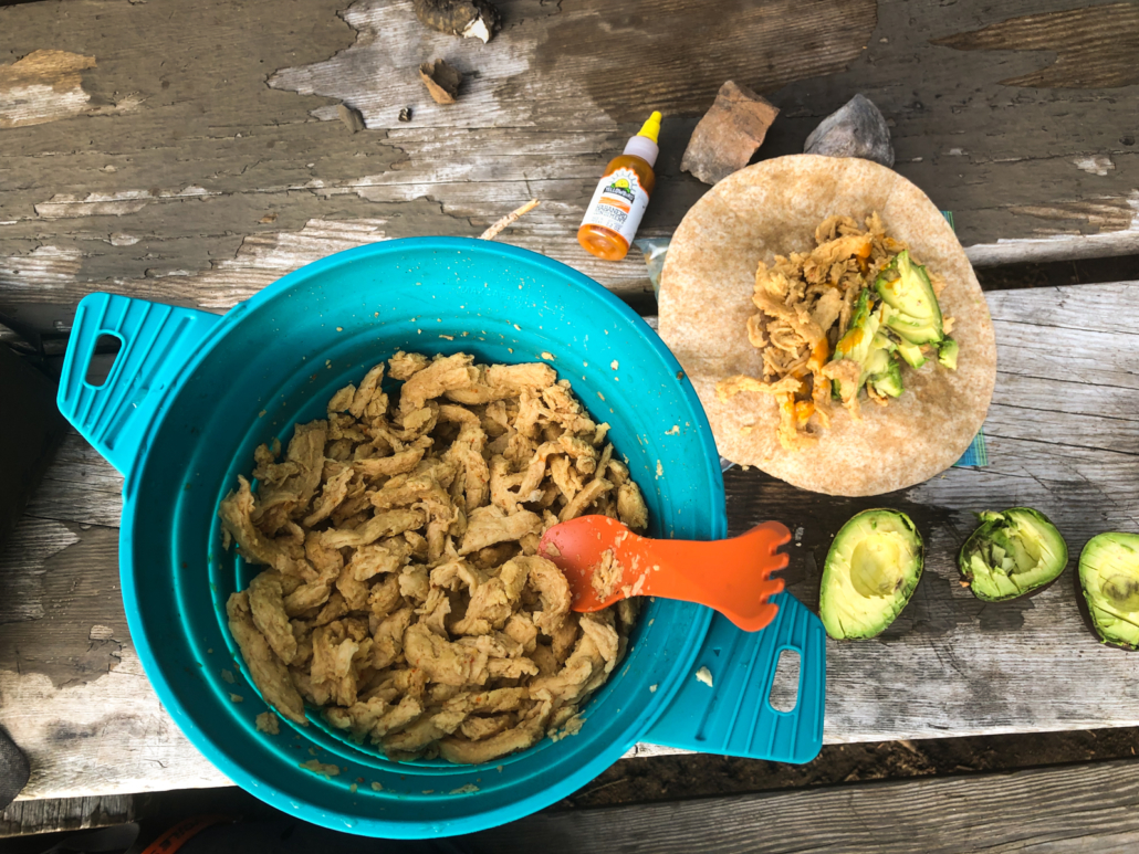
Dinner, night one! Soy curls with homemade fajita mix plus a luxury avocado. Remember your hot sauce!
All the Grub (I’m vegan, so it’s all plant-based)
11 freeze-dried meals. Backpacker’s Pantry pad thai is my favorite, with Kathmandu curry and other vegan options. One for dinner and another that I’d make in the morning and eat by noon each day…or 10 am, heh.
A (plastic) jar of peanut butter and jam that I pre-mixed for trail burritos or for adding to oatmeal
2 bars per day. Picky Bars are my favorite. Pro Bars are a calorie-dense option as well.
Trail mix to eat/add to oatmeal and trail burritos
Pickles (carried sans juice in a plastic bag). Zero calories, heavy, and a divine gift from the gods at the top of a mountain pass. Totally worth it.
Olives (transferred to a plastic baggie). All part of my attempt to not ONLY have sweet treats. Great for adding to freeze-dried meals or eaten alone.
Gummies (Annie’s)
Dried fruit (pineapple, mango, dates)
2 chocolate bars
That’s all I’ve got, folks. Drop a line in the comments or via email if you’re heading out to bikepack the Chilcotins and need more information. Happy pedaling…err pushing!
Thanks Chilcotins! Some of the coolest, most remote terrain I’ve ever had the pleasure of exploring on a bicycle!
https://www.traipsingabout.com/wp-content/uploads/2019/10/Manson-Col-descent-Chilcotin-Mountains-bikepacking.jpg12001600Dakotahttps://www.traipsingabout.com/wp-content/uploads/2018/03/Traipsing-About-logo-white-background-450x156.pngDakota2019-10-10 21:12:192023-05-06 15:13:06A Rugged Adventure Bikepacking in the Chilcotin Mountains
TAHOOOOOE! The word is fun to yell and the mountain biking there is even better.
When a blog reader asked for recommendations of California mtb trails, I pointed him at a past blog post about coastal rides. However, I didn’t have anything written about Tahoe trip Chelsea and I did last summer. Now I do!
I’ve ridden all these, with the list drawing from various websites and local friends who recommended their favorite trails. I’m an advanced rider (stop chortling, mtb friends) and these trails are blue or black difficulty. I linked to many of the trails on Trailforks to make it easy.
I love multi-hour rides that cover lots of distance, plus enduro-style descending. If you’re looking for tame, flat (cough boring cough) trails, this isn’t your list!
Without further ado, my favorite Lake Tahoe mtb rides:
Rolling down the TRT above Spooner Lake.
Tahoe Rim Trail (TRT) from Mt. Rose to Spooner to Van Sickle: Starting at Mt. Rose, pedal the Tahoe Rim Trail up and down to the top of Van Sickle, then descend into the tourist loony bin that is the S. Lake Tahoe. Fantastic lake views, playful and engaging riding (ahhh, granite is so fun), remote riding, and a healthy dose of effort make this a must-do. The full shebang is 45 miles and took me about 5 hours, so plan for a full day of riding and bring a water filter.
Getting up there at High Meadows near Star Lake.
TRT from Kingsbury S to Star Lake, Freel Peak/Meadows, down Mr. Toads: A close second place for favorite ride around Tahoe! Starting from the Heavenly Resort (we stayed at Chelsea’s parent’s timeshare there), pedal south on the TRT Heavenly and High Meadows to a refreshing (cold!) dip at Star Lake and eat some lunch.
Keep pedaling on Freel Peak trail as views across Lake Tahoe open up, then one last push on Freel Meadows. Finish with a rollicking shred down Mr. Toad’s Wild Ride (a fantastic ride by itself). There’s a huge day ride called Rose to Toad’s that combines these first two rides.
Monument Pass and Cold Creek – you’ve got to get up there somehow (I pedaled in from Kingsbury South trailhead on the TRT Heavenly), but once you’re there, it’s all fun downhill. Monument Pass is smoother terrain with lots of switchbacks up high; Cold Creek sports rocky sections with large boulders that are a) fun and b) dangerous when your front wheel disappears into a deep pit. #wreckingsucks
My sister-in-law on Sidewinder.
Corral/Sidewinder – I linked Monument and Cold Creek (above) with this ride, but most people do them on their own. FUN trails! Sidewinder is a natural granite playground into Corral’s flowy jump trail. Gotta ride it if you’re in the area. The climbing is on pavement so you can crank out laps if you want.
California Hangtown, baby! The climb to the top of Sidewinder.
Christmas Valley – a local Tahoe rider recommended this. Moderate-grade climbing that results in a low-flow descent with way more pedaling than I expected. Entertaining and the end makes it a worthwhile ride, but if you are only doing a couple rides in the area, I vote for skipping this one.
Chelsea’s bro enjoying the fruits of Tahoe.
Armstrong Pass – I linked this with Christmas Valley and it worked well. Similar riding to the rest of the Tahoe Rim Trail and it dumps you out right at the top of Corral/Sidewinder for more fun. A good way to get up to Star Lake if you want to ride Monument Pass and Cold Creek.
Hole in the Ground and Donner Lake Rim – Everyone loves Hole in the Ground…and I confess that I don’t know why! There’s a big climb up, lots of techy traversing (ok, that part is fun), and then it dumps you onto a FIRE ROAD for almost the entire 2,000’ descent.
I don’t know about you, but I don’t ride UP singletrack and DOWN fire roads without a lot of sadness… An out-and-back on Donner Lake Rim Trail was interesting purely for the tech-nasty bike handling required, but it’s mostly flat.
Sneaked a gratuitous van shot in after all!
Bonus Rides:
Flume Trail – Ok, so I didn’t ride ALL of these. Everyone rides Flume Trail near Tahoe, but I opted for the Tahoe Rim Trail from Mt. Rose right above it. However, 12.7mm tourists and Instagram posts can’t be wrong…right? If you want a green trail with views of the lake, I hear it’s great.
Downhill to Downieville!Downieville fun on Gold Valley Rim.
Downieville – my mountain bike friends speak of Downieville like it’s hallowed ground, a shrine of trails not to be missed. I needed to go there, so on the way back from Tahoe we detoured a bit to explore.
You can pay to shuttle from Downieville to avoid the ~3k’ climb up from the highway. NAH. Just pedal it! The fire road is steep, but the views are great. I added a bit to my day and did the climb from Sierra City, then rode Gold Valley Rim, Pauley Creek, Butcher, 2nd, 1st divide, which is (mostly) the route that the Downieville Classic follows.
Note: I considered riding up the highway, but it’s narrow and people are going fast. Hitchhike or catch a shuttle if your awesome wife isn’t available to meet you at the end of the ride.
The less fun, but good-for-ya route to the top at Downieville. Shuttles are overrated.Getting up high on Mt. Elwell near Graegle!
Graegle – Say it like “Gray Eagle” and fly like… anyway.
This little town is COOL and geared toward mountain biking like Oakridge, Oregon. I did a double-whammy day of Mills Peak and Mt. Elwell, which is either a big ride or my legs were tired from all the Tahoe riding! Mills is the easier of the two, with climbing on the highway/fire road to the trailhead. From there, shred back toward town on well-built, varied trails.
As for Mt. Elwell… Pedal back up from town (or ride this on the second day if you’re wiser than me) and then huff and puff up the too-steep-to-ride trail to the top of Elwell. I knew it was steep when a guy on an electric bike couldn’t pedal it!
Why ride uphill when you can carry your bike?
From the top, buckle your shoes and don the pads cuz it’s game time. Rocks! More rocks! ROCKS. Be prepared for black diamond riding. Nothing is crazy and there aren’t any big gaps, but the riding is in your face and challenging. Disclaimer aside, it’s also suparad! At the bottom, jump in the reservoir and enjoy the laidback vibe in town.
Chelsea’s mom laying down a patch of rubber on the trail from Tahoe City.
Family Fun: we did two rides with C’s family on the paved trails along the lake. One starts west of S. Lake Tahoe and the other we started in Tahoe City on the north shore. Both were fun and bike rental shops abound.
The first is shorter (maybe 10 miles available), whereas the second one has ~30 miles out and back, which Chelsea’s parents crushed on their rental cruisers. Someday I’ll be that tough!
Fabulous lake views from the top of Ellis Peak.
Hike Ellis Peak – need a rest day (well, from biking)? This six mile hike ends with a full-on amazing view of Lake Tahoe. Highly recommended!
In a funny small-world moment, we picked up two PCT hitchhikers on the drive back from Ellis Peak’s trailhead. Turns out one follows me on Instagram and is the personal trainer for Portland friends. Her girlfriend Carrot is a well-known thru-hiker whose excellent book we’d read. I love that kind of random stuff!
Small world!
That’s all I’ve got. If you have trails to recommend, fire away below in the comments. Happy pedaling!
Onward!
https://www.traipsingabout.com/wp-content/uploads/2019/02/Tahoe-Rim-Trail-mtb-Mt-Rose.jpg7681024Dakotahttps://www.traipsingabout.com/wp-content/uploads/2018/03/Traipsing-About-logo-white-background-450x156.pngDakota2019-02-06 06:06:372019-02-05 23:12:37My Favorite Lake Tahoe Mountain Biking Trails
One million feet: 35 trips from sea level to the top of Everest. Fighting gravity to climb that many feet uphill in a year without any motorized assistance is incredible and badass.
Well, my friend Paul did it. Props, kudos, congrats, and a standing ovation, you beast!
Annnd done! Paul at max grin capacity on Dec 31 after hitting 1 million near Bend.
On December 31, 2018, Paul wrapped up his year-long goal to log 1,000,000 vertical feet of human-powered ascending. To count, it had to be sweat, commitment and burrito-driven, all performed outdoors. No trainers or treadmills, no ski lifts, no shuttling, just old-fashioned oomph.
Paul’s words: “The goal was based on a few principles…
We are capable of so much more than we think.
Spend time in the mountains with good people.
We all have life goals in work and life, often imposed by others with no understanding of the individual. This was 100% my goal. Something I knew I could do based on many years of testing the body and mind.
It sounded fun!
Experience the mountains through a variety of outdoor human-powered adventures while learning how to ski, evolve the mountain biking, rock climb more, and trail run some bigger routes.”
Coffee first, then conversation. Then cold creek dip.
How Tough is 1 Million Feet?
For perspective, 1 million feet of vertical gain equals 3,140’/day (260 flights of stairs!) and 4+ hours with one rest day per week. You know those days when you wake up after a run or bike ride and take a rest day because your legs are tired? Nope. Get up, put on gear, and get out the door. My biggest year is 450,000′ of vertical, a piddly fart of an effort compared to 1,000,000′.
Factor in Paul’s job, injuries, sickness, our climbing trip to Red Rocks (bad for vert because climbing is slow) and what he was staring in the eye was one helluva challenge. I bet you’ve never thought this deeply about the nuances of vert accumulation. I hadn’t!
A “rest day” in Leavenworth with only 1,000′ of steep hiking to get to the climb.
Since he’s a lunatic and wanted to make it harder, Paul focused on “interesting” vert. He wasn’t just logging big miles on a road bike, Everesting up and down the same climb. Gnarly mountain biking, big trail runs like the Enchantments Traverse, and backcountry skiing ( (hiking up a mountain on your skis before descending) in all kinds of conditions made the challenge even tougher.
His stats: 53% mountain biking, 23% backcountry skiing, 15% road biking, 7% trail running, and 2% rock climbing. Lots of classic cold and wet Pacific NW days riding muddy trails, skiing in stormy conditions at the crack of dawn (often when I slept in) and pushing to make a big goal happen.
Vert earns you views like this one on Cutthroat Pass in WA.
Hanging with the Vert-Seeker
I logged many days and 80,000’ uphill with Paul during the challenge and witnessed his willpower and stoke levels fluctuate. The immensity of the goal was sometimes a yoke around his neck and also propelled him to complete tough objectives like running the 40-mile Timberline Trail.
That fire burns for adventure, but Paul can also go deep. Around a campfire in the North Cascades, we talked about creating our personal ideal lives. The next day, we pedaled and pushed through snow on a remote, beautiful ride. As a finale to eight days of outdoor adventure, we dunked in a snow-melt creek, Paul’s favorite post-activity refresher no matter HOW cold temps are.
Digging deep bouldering in Leavenworth.
I saw him depressed and angry about a tweaked knee from a climbing fall in Red Rocks, talked about relationships and the housing market for endless hours (yessss, sell that house and be free, man!) and coached him through (mostly) plant-powered efforts as he strove for the lowest possible inflammation levels during his challenge.
Emotions whipsawed. Hooting and hollering on trail descents, worrying about incoming storms on multi-pitch rock climbs, staring from the tops of mountains at distant vistas, assessing avalanches in the backcountry…
We humans experience a lot in the outdoors: raw emotion from weather, exposure, fear, exhaustion, beauty, friendship. There’s power in pushing physical limits and magic in the simplicity of man vs. gravity in a natural setting.
What a guy! Hauls vegan pizza up an icy pass and shares it with me. Photo: Ben Groenhout
How the Challenge Affected Me
In the past few years, I haven’t undertaken challenges where finishing was in question. Even the Oregon Timber Trail, the hardest physical journey I’ve done, always felt achievable. Sure, I get tired, bonk, or feel bored and ready to be done, but even at my MOST tired (often with Paul!), I know a granola bar and one last hard push reaches the finish line.
Paul’s awesome effort reminds me that aiming for a goal where victory isn’t guaranteed is a primo way to feel alive. That and freezing lake dips!
Looking back, I suspect Paul will remember his 40th year on this planet more than others. Life isn’t just about fun, after all. From Nobel laureate Danny Kahneman: “Happiness is a momentary experience that arises spontaneously and is fleeting. Meanwhile, satisfaction is a long-term feeling, built over time and based on achieving goals and building the kind of life you admire.”
Snow, freezing temps, steep hike-a-bike…Paul’s kinda day out!
To a satisfaction-building, admirable accomplishment, I say CHEERS. Well done, my friend.
Oh, and in case you’re wondering, did Paul sleep in on January 1st and read a book all day on the couch? NAH. After 10 straight days skiing to finish off the challenge, he got up early on New Year’s day and headed out for some more backcountry turns in the snow.
Endless stoke!
Follow Paul on Instagram. I always enjoy his varied, creative, rambling stream-of-consciousness posts. Plus he’s always in beautiful areas sharing photos to make you dream! Here’s his summary post regarding the vert challenge.
Here’s to the next adventure together, my friend!
P.S. Dig this? Want to get the Traipsing About newsletter with blog posts and my curated list of media, books, gear, favorite places to explore and random rad stuff I encounter or love? Enter your email below!
https://www.traipsingabout.com/wp-content/uploads/2019/01/Flyboys-rock-climb-Methow-Valley.jpg7681024Dakotahttps://www.traipsingabout.com/wp-content/uploads/2018/03/Traipsing-About-logo-white-background-450x156.pngDakota2019-01-08 05:30:162019-01-07 18:45:15Fighting Gravity for 1 Million Feet
The dust has settled and the High Cascades 100 race is fading into the rear view mirror. Don’t worry, 100 miles and 9+ hours of pedaling didn’t beat the love of mountain biking out of me – I’ve already ridden again!
I’ve got a blog post brewing with details of the race (spoiler: it was awesome), which I’ll post soon. For now, here’s a 1-min video cut showcasing pre-race preparation. I hope you dig it.
Onward!
https://www.traipsingabout.com/wp-content/uploads/2017/07/High-Cascades-100-Video-e1500429264329.jpg327581Dakotahttps://www.traipsingabout.com/wp-content/uploads/2018/03/Traipsing-About-logo-white-background-450x156.pngDakota2017-07-18 19:04:492017-07-18 19:04:49Fun at the High Cascades 100 (Video)
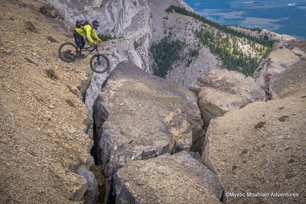
The text message read, “You interested in an alpine adventure?” Having no idea what that meant, I (of course) said yes.
My guide was Jake, a local from Canmore I met through Instagram who offered to show me around. Our destination was Black Rock Mountain, a peak in the Canadian Rockies near Canmore, Alberta.
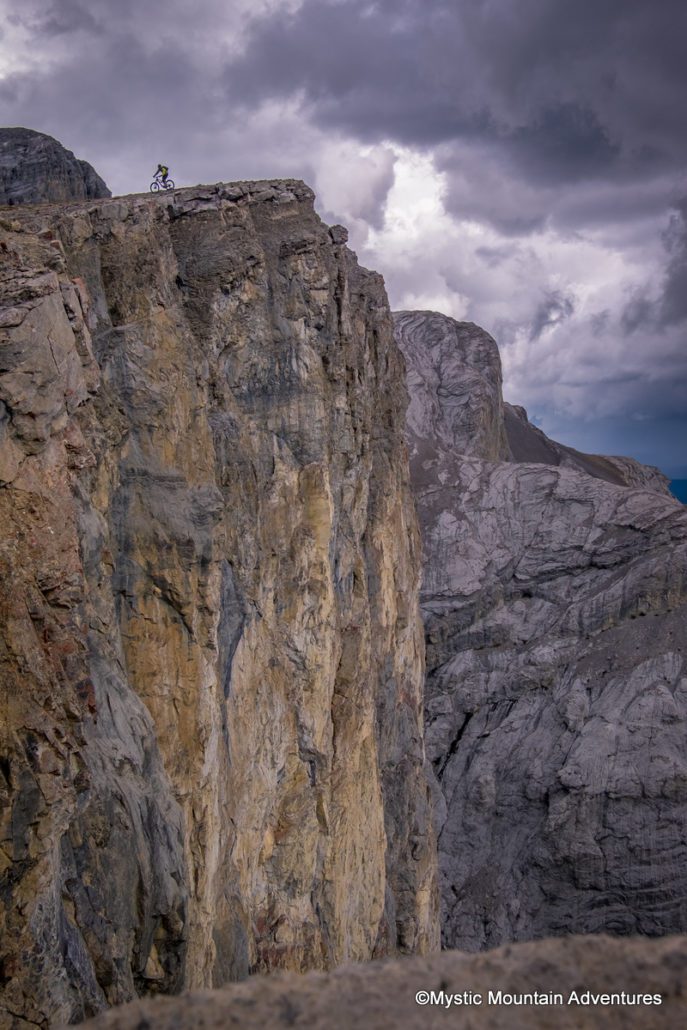
A bit of exposure on the way down…
Biiiig cliff, tiny little biker.
Jake’s truck easily bombed through gnarly 4×4 roads and river crossings to the bottom of the mountain. We were ready to rumble.
Well, almost: For the first time in my life, I forgot my cycling shoes, making a great impression on my new friend. Nothing like downhill mountain biking on SPD pedals while wearing thin, flexible barefoot shoes. Sigh. I’m sure he wondered whether this total noob was going to survive the day.
We pushed and carried our bikes 3,000 feet up steep rock chutes, scree slopes, and other “holy crap, this is unrideable terrain” and finally arrived at a fire lookout. Peering down the 45 degree slope, I admit to having a questioning moment. However, I sure as hell wasn’t going to carry my bike back DOWN the mountain.
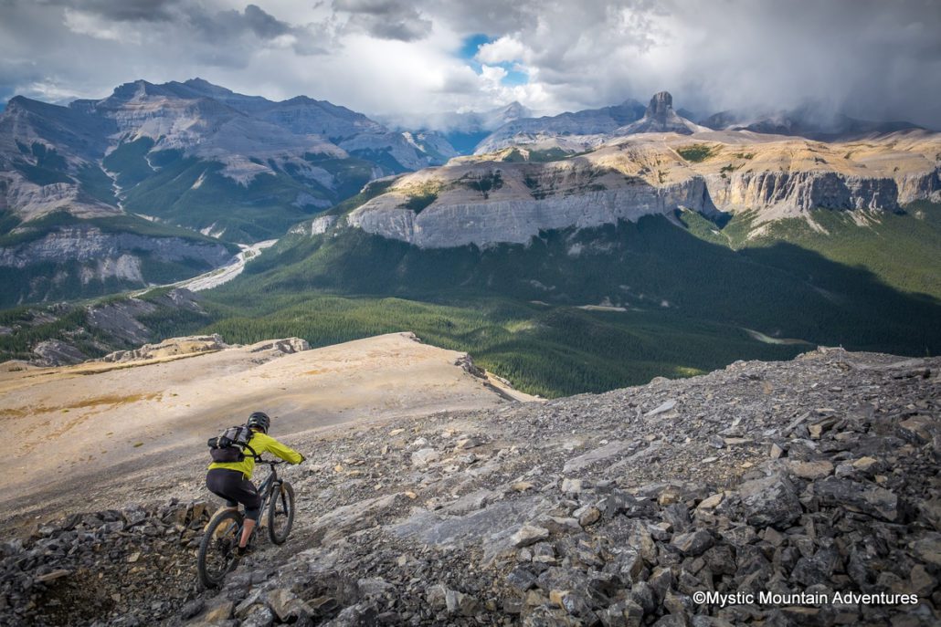
Nothing but downhill and views!
Jake leads the way down a narrow ridge line.
Up next was one of the gnarliest, scenic, fast, and exhilarating mountain bike rides of my life. Words don’t do it justice, so check out the video I made and Jake’s incredible pics of our descent (see below).
For reference, he’s in the orange jacket, I’m in yellow. Follow him on Instagram for more amazing alpine shots. Unlike me, he does this all the time!
Enjoy.
P.S. Don’t worry, mom, this isn’t my typical kind of ride! There were no wrecks and I only used up one of my nine lives (and one carbon rim).
Me dropping through a steep rocky chute.
River crossing on the way in, Black Rock Mtn in the background.
Top of Black Rock at the decommissioned fire lookout.
Dropping down a narrow ridge near the top of Black Rock Mtn
Running from the thunder clouds.
https://www.traipsingabout.com/wp-content/uploads/2016/09/Black-Rock-mountain-biking-steep-descent.jpg8001200Dakotahttps://www.traipsingabout.com/wp-content/uploads/2018/03/Traipsing-About-logo-white-background-450x156.pngDakota2016-09-11 19:12:372016-09-11 19:12:37An Alpine Adventure in the Canadian Rockies
I recently spent four days mountain biking in the outdoor playground of Oakridge, Oregon. All I can say is: Visit. This. Place.
Riders out there, bring your mountain bike. If you or your family are into other sports, there’s fun to be had in a kayak, with a bird spotting scope, and by lacing up hiking shoes. It’s time to play outside.
Oakridge is a small town on the west side of the Cascade Mountains. Founded as a rough and tumble logging town with more taverns than churches, it wasn’t always a place that attracted adrenaline-loving yuppies like me.
Old habits meet new activities on a connector fire road.
These days, it’s different. You’re as likely to see a cycling jersey as a plaid work shirt.
With a vision many rural communities in the west can learn from, Oakridge is leveraging its natural assets via tourism. It now hosts big events like Mountain Bike Oregon, races like Trans-Cascadia, or great fun for groups of friends coming in to ride. It’s not a one-stop solution, but the town is definitely attracting cash to revitalize the local economy.
The climb to Heckletooth Mountain might just pop an artery, but what a place for lunch.
Access is a key component – Oakridge lies at the center of five major trailheads with enticing ridges rising in all directions. The International Mountain Biking Association (IMBA) just labeled it a Gold-Level mountain biking destination, just one of six in the country. The town is the hub in a spoke system radiating outward with hundreds of miles of trails.
These trails saunter along alpine ridges speckled with wildflowers, slip through old-growth forest and wind along green, moss-lined green river trails. Pedal from a cheap rental in town or camp at the dozens of great National Forest Service campgrounds; either way, life is good. Five friends and I rode until we dropped and barely dinged the shiny surface of this pedaling paradise.
Gabe enjoying wildflowers (and fast downhill) on Alpine Trail.
The badass trails are the major draw. What also impressed me is the vision and creativity the people of Oakridge are employing to make it a destination, not just a place Oregonians ride. They aren’t just order takers like a cotton candy vendor at a busy fair. It’s a place where you can tell they appreciate having you around.
Take the Mercantile, for instance. This cool bike shop rents and sells fancy downhill bikes, but also stocks plaid workshirts. There’s a huge trail map on the wall and the employees happily pointed out which trails were clear of snow and which had tons of downed trees.
You know there’s some fun about to happen when the rigs are loaded and lined up like this!
Then there’s the We Speak pins that people around town wear, touting their local-only knowledge. “I Speak Camping,” says Heather’s pin, and another guy knows wildflowers. Instead of grouchy order takers, the town seems to exude hey, we’re glad you’re here!
Oakridge isn’t a secret. We met multiple parties from out of town, including one down from British Columbia (a destination itself). Still, with so many trails dedicated to non-motorized vehicles, there’s lots of room to play!
If you’re planning a summer or fall mountain biking trip, put Oakridge on your list. Forget the crowds in Moab and the lifts of Whistler and head to this Oregon gem. I’m definitely going back soon.
Greg takes a moment to enjoy the views over Larison Creek.
In our four days in town, we explored five different trail systems. The only thing more tired than my legs was my jaw from all the grinning!
Based on my experience and beta from friends who know the area well, I can recommend the following trails for anyone heading to Oakridge. Ride Oregon Ride has good info too.
Updated fall 2017: After additional time in Oakridge, I added other favorite rides. The town only continues to grow the riding in the area, so it’s even better now!
Alpine – the famous (for good reason) shredfest. Get ready for alpine wildflowers with views of the valley followed by fast single track snaking through forest.
Evan topping out on a big climb to the stellar views on Alpine Trail.
ATCA (Alpine-Tire Mountain-Cloverpatch-Alpine) – even shuttling this, you’ll pedal 5,000′ of elevation in less than 30 miles. IT’S WORTH IT! The huge trees on Tire and fine, fine descending on Tire will make that climb out of Cloverpatch totally worth it.
Larison Rock – fast fast fasssst rip right into Oakridge. Watch out on the marble-slick corners on this one – it’s easy to overcook those and launch off your bike.
Little Bunchgrass into Heckletooth Mountain – you’ll weave through huge trees high on a ridge, test your skills on some steep rocky sections, and then climb (and climb some more) to the top of Heckletooth. The descent is a steep, furious ripper on switchbacks that’ll test your skills. Enough said – this is my favorite ride of the trip. (I might have said that after every ride…)
Dead Mountain – great views of the valley plus machine-built jumping and radness up top into a fast single track. Easy to pedal right back into town too, which is always nice.
Jason from Bermstyle.com takes in the valley view from Dead Mountain.
Eula or Hardesty – accessed via the same fire road, these two are SO good. Eula is so-steep-there’s-no-stopping in places and you’ll drop 3k’ in a few grin-inducing miles. Hardesty is a favorite of mine and is zippy, twisty fun through cut logs and over roots. Don’t miss it!
Lawler – an Oakridge classic that was rebuilt recently. Classic Oakridge singletrack up top followed by the new part down low – machine-built, ripping fun.
Middle Fork Willamette River – this one has echoes of the McKenzie River Trail, a famous destination in Oregon for biking. I’d ride the West Fork any day for the remoteness and lack of hikers gaping at the oncoming bikes. Beautiful riding.
Jim splashes through a creek on the Middle Fork trail.
Larison Creek – a 10 mile fire road climb followed by some of the most beautiful, mossy, technical creekside riding I’ve done.
Gabe zips through the emerald palace of Larison Creek.
Salmon Creek Falls Trail – accessed right from town, it’s a smooth beginner trail on the north side, classic technical river trail on the south. The climb out of the south will test any rider’s fitness!
Local 180 Brew Pub – a top nanobrewery and watering hole for mountain bikers. Live music and friendly staff.
Oregon Adventures – don’t feel like pedaling to the top or need a local guide? We didn’t need their services, but multiple friends have recommended this company for those looking to shuttle Oakridge or not get lost in the wilderness arguing with your map about which direction is west. They arrange a 17k in a Day shuttle with close to 20,000’ of descending on the best trails in Oakridge.
Local Mountain Biking Events and Races
Mountain Bike Oregon – this event put Oakridge on the map. Join hundreds of mountain bikers for food, riding, and tales of valor after three days shredding the best trails in Oakridge.
Trans-Cascadia – friends of mine created this enduro race series. Test your mettle against some amazing riders.
Ricky wisely chooses to walk, not ride, mossy logs on Larison Creek.
Two months ago, my friend Michael told me about the Petzen downhill mountain bike area in SE Austria. Since it is hunkered in the Carpathian Mountains near Slovenia and 1,500 miles from where we were in England, I figured that would never happen. Nevertheless, I added it to Evernote just in case.
Sometimes, these things work out. As we pedaled through Slovenia, I mapped out a route to Petzen. As luck would have it, we found a vegan hotel/restaurant on Lake Klopein, the perfect location for a few days off after our tour through Hungary. Petzen happened to be just a few pedal strokes (ok, 15 miles) away. A perfect day trip.
The warm-up ride to the park was worth it: the stellar downhill and views of the valley make Petzen was the best flow trail I’ve ever ridden. It was so flowy that my first six-mile run through the berms actually made me slightly motion sick! The trail, which won IMBA’s 2014 Flow Trail of the Year award, is fantastic.
Enough said. Other than visiting it, the best way to experience Petzen is through a video. Here it is.
https://www.traipsingabout.com/wp-content/uploads/2015/08/1-GOPR1223.jpg6401024Dakotahttps://www.traipsingabout.com/wp-content/uploads/2018/03/Traipsing-About-logo-white-background-450x156.pngDakota2015-08-25 09:30:222015-09-02 13:06:40I Like Big Tires and I Cannot Lie (An MTB Video)
The spring pilgrimage to Utah is a common trek for avid mountain bikers. They flock to the southern part of the state in search of dry trails and to avoid nasty east coast weather or the rainy Northwest. Moab is the well-known Mecca of Fat Tired Fun, but there are two-wheeled adventures splashed from there all the way to Las Vegas.
In April, I was lucky enough to spend a few weeks romping around on the splendid singletrack in southern Utah. Under blue skies, my tires crunched and whirred over miles of red rock until my legs burned from climbing and my neck creaked from rocky descents. Some days I rode solo, hours in the middle of nowhere where I could stop on a bluff and enjoy a solitary lunch. I also met up with friends from Oregon, Colorado, and California to form biker gangs bandying about enough acronyms to make a newbie rider’s brain bulge.
We rode singletrack, not fire roads… This is a connector section on the Mag 7 trail.
Here are the trails I’ll ride again when I return to Utah…which I certainly plan on doing! Even if you’re on a family trip or are cruising with a partner who doesn’t ride, I suggest that any mountain biker driving through the five national parks of Utah should bring a (full-suspension) bike with them to fully enjoy the fun.
Porcupine Rim (Moab, UT) – first up, any mountain biker visiting Moab needs to shred down Porcupine. It’s one of the most famous trails in the U.S. (world?), and for good reason. The trail is miles of downhill fun that, depending on snow levels, starts as high as 11,000’ elevation and finishes at 4,000’ at the Colorado River. Along the way, the action heats up from silky singletrack into rockier terrain, finishing with riding to test the best riders. All the while, you’ll be craning your neck to catch views of the red rock valleys that make Utah famous.A tip: don’t be a Roadie Punk – pay $25 for a shuttle from one of the bros in town (Porcupine Shuttle is great, as is Coyote Shuttle) and let them drive your lazy butt to the bottom of the snowline. You’re going to have 20+ miles of downhill; save the vertical gain for your commute and weekly ride back home! You came to Moab to shred the GNAR, bro.
JEM/Goulds Loop (Hurricane, UT) – sick of rocky drops and full-face helmets, and simply want to grin your face off? If JEM were a song, it would be a Green Day jam cranked to full volume. Pedal as hard as you can on this IMBA Epic and live it up! The trailhead is right outside Zion National Park, an easy hop free of tourist throngs in the park. Add Goulds/Hurricane Rim to the mix if you want a big (and very fun) day on the bike.
Thunder Mountain (Bryce Canyon NP) – hoodoo rock spires, backcountry riding, and solitude are the name of the game on Thunder Mountain. Just a few minutes from the entrance to Bryce Canyon, this ride is a remote ride to a lunch spot overlooking the valley. If you see another person on the trail, I’d be surprised.
Hoodoos!
Gooseberry Mesa (Hurricane, UT) – bikers rave about Slickrock Trail in Moab, but I’d rather ride the mesas around Zion National Park any day of the week. Why? Gooseberry is the same style of riding (up and down on grippy, rolling rock), but is more technical and fun, especially the South Rim trail. The mesa is accessed via a rough road that results in empty trails and solitude any hermit worth his bushy beard would enjoy, plus free camping. Did I mention sweeping views of the valley outside of Zion National Park? Gooseberry is the well-known mesa, but there are others, such as Guacamole Mesa, that are good fun as well.
Magnificent 7 to Portal Trail (Moab, UT) – there’s a sign near a cliff edge on the Portal Trail that intones, “Walk your bike. People have died here. People like you. GET OFF YOUR BIKE.” Signs leading to Portal encourage turning around while you still can, shrilly proclaiming that you are approaching trails best ridden by <25 year old males with GoPros strapped to their heads. Don’t listen to them – Mag 7 through Portal is one of the most fun, physical and view-laced trails you’ll ever ride. Use your brain and walk the cliffs marked by warning signs, bring plenty of grub and water, and make this a must-do if you’re an advanced rider looking for an adventure around Moab. Shuttling to the top of Mag 7 (as they call it) and riding all the way out is a 20+ mile, all-day adventure through the rocky terrain around Moab that you won’t forget.
Durango, CO trail systems. I enjoyed a week of exploring this high-altitude mountain biking destination while local riders I met showed my lungs who was boss. All the trails are accessed right from downtown; this is another IMBA Epic that anyone who enjoys biking will dig. Phil’s World, right across from Mesa Verde National Park (about 40 miles west of Durango), is another stellar area developed by local trail builders.
For trail guides, I recommend picking up maps at any of the bike shops in Moab. For the other rides, the Singletracks.com or Maplets app are great resources. Even without a map, you’ll figure it out…and if you don’t, then you’ll get to do a longer (if unplanned) ride! Bonus miles are the best. Take a picture of the trail head map and head out.
Here’s to two-wheeled fun in the wilds of Utah. Snag a spring break from the cold and wet; head to the red rock! Ride on, amigos.
My buddy John riding a ridge on Amasa Back in Moab.
A post-ride session of Cards Against Humanity. John, you know I deserved the win on this round!
https://www.traipsingabout.com/wp-content/uploads/2015/05/1-DSC053531.jpg6391024Dakotahttps://www.traipsingabout.com/wp-content/uploads/2018/03/Traipsing-About-logo-white-background-450x156.pngDakota2015-05-20 10:26:592018-03-08 08:59:47Five Rad Mountain Bike Rides in Southern Utah
There’s a moment of truth in rock climbing and mountain biking where forward progress is the only option. Letting go of a solid climbing hold to make a move, fear swells in your throat until you reach a safer zone and breathe easier. Launching into a treacherous descent on the bike, you grip the handlebars in anticipation, then relax and go with the flow.
For me, these are two distinct types of fear, static and dynamic. Rock climbing is the former, an evaluative fear of leaving a position you know in a slow, calculated manner. Slow is good when you’re perched high above the ground on tiny footholds, fingers gripping a ledge, forearms filled with blood and thoughts of falling racing through your mind. Overgripping expends more energy and makes you fail faster.
On the other end, mountain biking is a dynamic fear where you rip around a corner, suspension jackhammering over rocks. Decision: weave left, right or try to jump the whole damn thing? One split second to decide how to navigate obstacles and then they’re behind you. Both these sports are certainly adrenalin-filled and intense, yet so different.
Climbing was my primary sport for 10 years, the thrill of conquering new routes crack in my veins. Chelsea grew to know terms like “redpoint” and “5.12b” like she was a climber herself. I dreamed about routes I’d climbed, retracing each move in my mind before I’d go back and repeat them in person, pushing myself. I loved it, and just writing this makes me smile thinking of climbing High Plains Drifter with my buddy Zack, views of the Columbia Gorge stretching out for miles behind me.
High above Banks Lake in NE Washington on a climb called “Fire Crotch.” Because if you slip and fall, it’s not good for things…
Fear of falling off a route is always present, even as merely a grain of doubt. There are a couple ways to go about it – believing you can’t make a move and giving up, or knowing the consequences and going for it, attempting to latch onto the next hold. Either way, if you fail there is brief moment where you’re in flight before the rope, bolts, quick draws and your climbing partner all work together to stop your fall. They are usually clean and smooth, yet falls are something that can be intimidating. Failure and its byproducts usually are!
For a long time, falling was something I would literally practice. Climb above my last protective bolt, let go and take a fall. Repeat. The idea was to disconnect the anticipation of falling and fear rather than dreading slipping off a move. Non-climbers will think I’m crazy, but every single book about mental training for climbing that I’ve ever read recommended this. And it works! You can literally train your mind not to fear the fall, and I was able to push my skills to new levels. The sinking feeling in the pit of my stomach at the start of every fall was never eliminated, but my nerves steeled against it.
When Fear Takes Over
In early 2012, a switch flipped inside me. I suddenly loathed the idea of falling. Even writing about falling, my palms are sweaty as if I’m approaching a tough section of a climb where I know falling is likely. I stopped dreaming about a successful ascent and dreaded the failure. It was no longer fun, yet I kept going to the gym or heading out to climb outside as part of my programming. “I’m pretty good at this, so I’ll continue.” I still enjoyed the social aspect of the gym and the puzzle-deciphering of climbing, but something was missing.
I frankly don’t know why my desire to climb disappeared so quickly. Initially, I thought I was just bored after doing it for a decade. I suspect it was deeper than that though. I think it was continuously pushing boundaries with my business at the time, every decision a difficult one that my success hinged upon. There’s a fear management reservoir in my body and mine was tapped out.
There are studies about our ability as humans to only make a certain amount of choices per day, even easy ones, and I think that applies to managing fear as well. Even free-solo climber Alex Honnold, whose abilities to curb fear are famous, ran out of his elixir halfway up free-soloing 2,000’ Half Dome in Yosemite. Watching the (recreated) moment on film, he freezes (2:20 in the film) with his back to the wall, a quarter mile of potential free fall below him, and then summons the courage to continue.
Since shelving my climbing rope, I’ve picked up mountain biking as my primary activity. Oddly enough, I’d abstained in past years because I considered it more dangerous than climbing. Something about ripping down a trail into the unknown made it seem more treacherous. Tougher to control my surroundings in a free-flowing trail ride than a static, move-by-move climb. (After wrecking numerous times following skilled friends down rocky trails, I know there is more risk of death with climbing, but more frequent injury with biking.) The learning curve is as steep as the slopes I rode, and bouncing off rocks happened a few times in the first year of riding.
Climbing trip to Lake Louise (Canada). Climber is Dan Suppnick.
Ever since I was a little kid, I’ve over-gripped and tried to control my surroundings. Something in me craved routine and order, neither of which were prevalent in my family. (Something I’m grateful for now!) Playing Monopoly with me involved rolling the dice…and that’s all. I’d move the pieces, hand out money and cards and control it all. A small example of a reality resulting in not being vulnerable and truly trusting others to do their part. Self-sufficient and in control, always. Running the show solo has absolutely helped me with whatever successes I’ve achieved, yet the expression “your best is also your worse” is certainly accurate. My control freak side is both one of my greatest strengths and also my Achille’s Heal, depending on the situation.
Letting Go
What I find interesting is that my transition from the static fear of rock climbing to managing dynamic fear mountain biking coincided with breaking loose blockages in my work and physical life. In June 2012, I was square in the middle of business building and settling down in our lovely home, nesting away. Yet deep in my core was a strange unsettled feeling. I think it stemmed from a calcification of a reality I didn’t truly desire, the same way fear was beginning to freeze me on a climbing route. I was going through the motions in a framework I didn’t truly embrace. A good life, to be sure, yet one in which I felt stuck and unfulfilled.
While climbing, you can have all four appendages on the wall yet be totally out of balance. Picture your feet and hands off to the right, with your body leaning left. You’re straining to hold yourself in place, gripping holds with calloused fingertips. But what if you realigned things, moved a foot and hand left, and suddenly are able to rest easy, with 20% of the previous effort and a relaxed smile on your face.
At various points in my life, I’ve been the pumped out, a tired climber laboring to maintain my status quo, and it was more difficult that just letting go – except for the mental part. Even an incredibly uncomfortable position can seem safe sometimes. Think of a job you want to leave, yet the transition to a new career or working for yourself is scarier than being unhappy every day. I’ve been there, and the dislocation wasn’t easy. Yet my life is so much better for the fracturing, and I’m stronger knowing I can change paths again and will survive it.
Grinning during a steep descent on Hi-Line trail in Sedona.
Control and letting others take the reins and lead is something with which I continue to struggle. However, right around when I stopped climbing and started mountain biking, it was as if a valve opened up inside me. This shift happened rather quickly. I certainly can’t give the credit to a switch from climbing to careening down trails, yet the parallel is interesting. In fall 2012, we took a six-week road trip through Colorado and northern California, testing the limits of my work. It forced me to hire another person, which I had been avoiding. Must…control…everything. That hire has changed the course of my business and led to others while allowing greater freedom, giving me the confidence to continue testing boundaries further.
I’m still scared of obstacles. This trail called life is full of rocks, drops, and sandy corners that leave me shaking my head after a wipeout. Yet I’m finding that moving past obstacles is considerably easier when I’m in motion, not stuck in a static position (be it physical, emotional, or intellectual). When I’m still, I over-analyze and “control” the future until it passes me by with a hot spray of dust in the face. The more I flex my dynamic fear muscle, the stronger it gets, and I think it helps me handle static fear as well (such as when I’m on an airplane on a bumpy takeoff) . I’m feeling more comfortable letting go of my status quo of the moment, knowing that I’ll be able to handle whatever comes my way. And though I’m not climbing now, I suspect that I’ll strap on climbing shoes again in this life and get back out there to test my limits.
Here’s to acknowledging your fears, whatever they are, and not letting them control you.
Dakota
If you enjoyed this post and want to follow along with our journey, check out the free newsletter!
Rappelling off a long climb at sunset in the City of Rocks.
https://www.traipsingabout.com/wp-content/uploads/2014/05/IMG_9721.jpg7681024Dakotahttps://www.traipsingabout.com/wp-content/uploads/2018/03/Traipsing-About-logo-white-background-450x156.pngDakota2014-05-02 08:38:552017-01-07 21:11:13Control Freaks Never Prosper
When our dear friends Jamie and Evan told us they were moving to Santa Cruz from Portland, not only were we super sad, we didn’t quite get it. How could anyone leave Portland, an amazing city with so many fantastic people, forward-thinking projects, great food, not to mention bike jousting or guys riding unicycles wearing kilts and playing bagpipes…random Portlandia scenes, ya know.
Santa Cruz cliffs.
Now, we get it. Santa Cruz is a perfect blend of city, ocean, forest, and fun, all smashed into a sunny pocket of Central California that just served up a seriously awesome holiday break for us. Here’s the story of three excellent weeks in a few sentences and lots of pictures!
Looking back during a beach walk.
-Riding the Ohlone Bluff trail on with Chelsea and her family. It’s a rutted dirt road framed on the west by cliffs that slip down into the water of the Pacific, brussel sprout farms to the east, and red tailed hawks soaring in the wind above us. Chelsea’s parents, who will forever be tougher than us, rode 18 miles on town comfort bikes with no suspension (or padded shorts) on the rough, bouncy road. I don’t know how they do it!
Hamming it up somewhere along the Ohlone Bluff trail (C photo credit)
This trip is all about teamwork and a cheery outlook!
-Hours of Settlers of Catan with the family eating food, trading laughs and commodities, and trying not to team up on Chelsea’s brother Jesse too much.
Settlers of Catan. Game time with the family!
-Mountain biking. I adore Santa Cruz trails! Right out our door, I could ride a mile to single track trails that led up through grasslands into scrub oak and then into redwood trails twisting around gnarled limbs and stumps. Unreal fun – I can’t get enough of it! Eleven rides in three weeks.
Sunset ride at Wilder Ranch north of Santa Cruz.
Exploring the Demonstration Forest in Nisene Marks State Park with Evan.
Cruising trails with new friend Craig in Nisene Marks State Park.
-Watching Monarch butterflies start their winter migration. They start at Natural Bridges State Park clumped in frozen masses waiting for the morning sun to hit their wings. Then they power up like little batteries, their wings acting as solar panels. Soon they are flittering about in the light, heading northeast eventually as the weather warms up.
A bundle of monarchs in the morning sun.
-Walking West Cliff Drive, a long ocean-side path looking south across Monterey Bay. We watched seals, dolphins, sea lions, pelicans, and cormorants mingle and play on the water. Along with what seemed like hundreds of surfers out on Steamers Lane by the lighthouse, bobbing up and down.
Chelsea and her family watch seals on the cliffs of Santa Cruz.
A pair of seagulls hanging out.
Ice plants and Santa Cruz homes.
Sunset on the cliffs.
Sunset on the cliffs of Santa Cruz.
Coastal view north of Santa Cruz on a family walk.
A cool arrangement of keys in a local Santa Cruz shop.
-Days and evenings spent hanging with Jamie and Evan. Laughing our heads off at random things and helping them move into their new home after packing them up in Portland. Hanging on their deck watching deer in the field below or listening to owls hooting in the trees. Great friends are hard to find and we are lucky to have these guys in our lives and can’t wait to see them again.
Hanging with Jamie, Evan and their two fun doggies.
And with that, Santa Cruz is behind us. Adios for now good friends and great times. We shall certainly return!
We are currently exploring the wonders of Big Sur and absolutely loving it. What a place. I’ll leave you with a teaser picture…high up on Highway 1 from our van this morning. Room with a view!
View from our window on Highway 1 this morning.
https://www.traipsingabout.com/wp-content/uploads/2014/01/DSC08773.jpg10651600Dakotahttps://www.traipsingabout.com/wp-content/uploads/2018/03/Traipsing-About-logo-white-background-450x156.pngDakota2014-01-09 18:11:142014-06-27 08:35:22Three Weeks in Santa Cruz
Now that we’re on the road, I don’t want to just talk about the good stuff. After all, the best travel stories are tales of misadventure and discomfort. I can draw a dozen arrows of pain from my memory quiver that still stick in my mind: 14 hours into a packed night train ride in China, Chelsea and I get puked on by a cute little Chinese girl; feverishly ill in a hostel in Burma with MalariaTyphoidDeathFever, which I then give to my friend Eric, who shivers so badly on the plane ride out that he puts a plastic bag on his head to try to stay warm; getting frisked by overzealous Russian policeman knowing that my visa invitation is not legit, and that I’m couchsurfing illegally. You know what I’m talking about. Lost passports, unraveling plans, adversity. The “good” stuff!
All that said: Just so that my mom and dad don’t think traveling is all about suffering, let’s talk about today. It has not been one of those days where we wake up with a Chinese kid’s vomit in our ramen. Today is the wow-how-am-I-so-lucky day.
We woke up to a knock on the van door. Jamie and Evan, our amazing Santa Cruzian™ friends, had a breakfast spread of granola and fruit, buttery English muffins and hot cider ready to munch on looking out over the Pacific Ocean. Yes please, I will have some cinnamon roll too. Then Chelsea and Jamie head out to kayak, and I launch out the door on my mountain bike ride to explore Nisene Marks State Park, right at the bottom of their driveway.
Sunset reflected in the Sprinter. Parked for a few days!
Chelsea is aware that I’m typically an hour to three hours late returning from mountain biking. I’m a punctual guy, yet there is something about biking in the woods that extends timelines and washes away caring about time. Not this time, dang it. I give her a timeline – back at 12:30 – and head out. First phase is a solid eight miles uphill through gorgeous redwoods, and then a quick food break. While I’m there, I chat with three local guys out for a jaunt. “Hey, want us to show you around?” they ask. Yes please.
People who know me (hopefully) consider me a pretty fit guy. Does. Not. Matter. Turns out that Austin, Jeremy and Pete have bikes with rocket boosters on them. Or ate Velociraptor for breakfast and are ready to tear some legs off. We do a climb Jamie said would take me 40 minutes, but in 20. (Wait, I thought this was a good day?) I cease talking about five minutes into the climb and try to keep my tongue out of my spokes and my lungs from pushing my eyes out of my head. Repeat, about a dozen times in the next three hours. Biking is fun.
Mid-ride in Nisene Marks. You can barely tell I’m exhausted. Yes, it’s a blurry snapshot…
However! In between the hamstring-shredding uphills, which I secretly enjoy anyway, we snake through redwood groves on twisty single track that splits my face with a gigantic grin again and again. They tour me through hidden trails cut in way back in the forest where Ewoks chatter from the trees and deer scatter up narrow ravines. It is sunny and 65 and I haven’t a care in the world other than not losing my guides and spending two weeks lost in the wild.
Cut past the end of the ride. Late getting home yet again, only by two hours (sigh). I’m draining four glasses of a tasty berry smoothie while sitting in the warm sun with my shirt off watching birds hop around the yard. Our friend’s dog Cooper repeatedly brings me a ball, which I chuck over and over (who is the trained one here anyway?). I lie down on my back and close my eyes, soaking in the rays on my tired body. This moment right here is why we are on this trip. I know there will be periods of logistical headaches and unforeseen complications that stress us out. Yet as the red glow of a sunset darkens the sky as I write this, I know these snippets of awesome are the reason we are out here.
Now please excuse me while I go stretch my aching hamstrings.
Looking out over the Pacific Ocean.
Sunset composition.
https://www.traipsingabout.com/wp-content/uploads/2013/12/image-1.jpeg12241632Dakotahttps://www.traipsingabout.com/wp-content/uploads/2018/03/Traipsing-About-logo-white-background-450x156.pngDakota2013-12-14 20:29:502015-07-28 08:04:57Why We're Out Here - A Snapshot
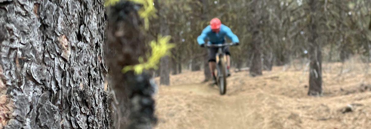
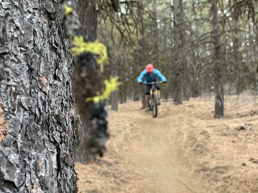
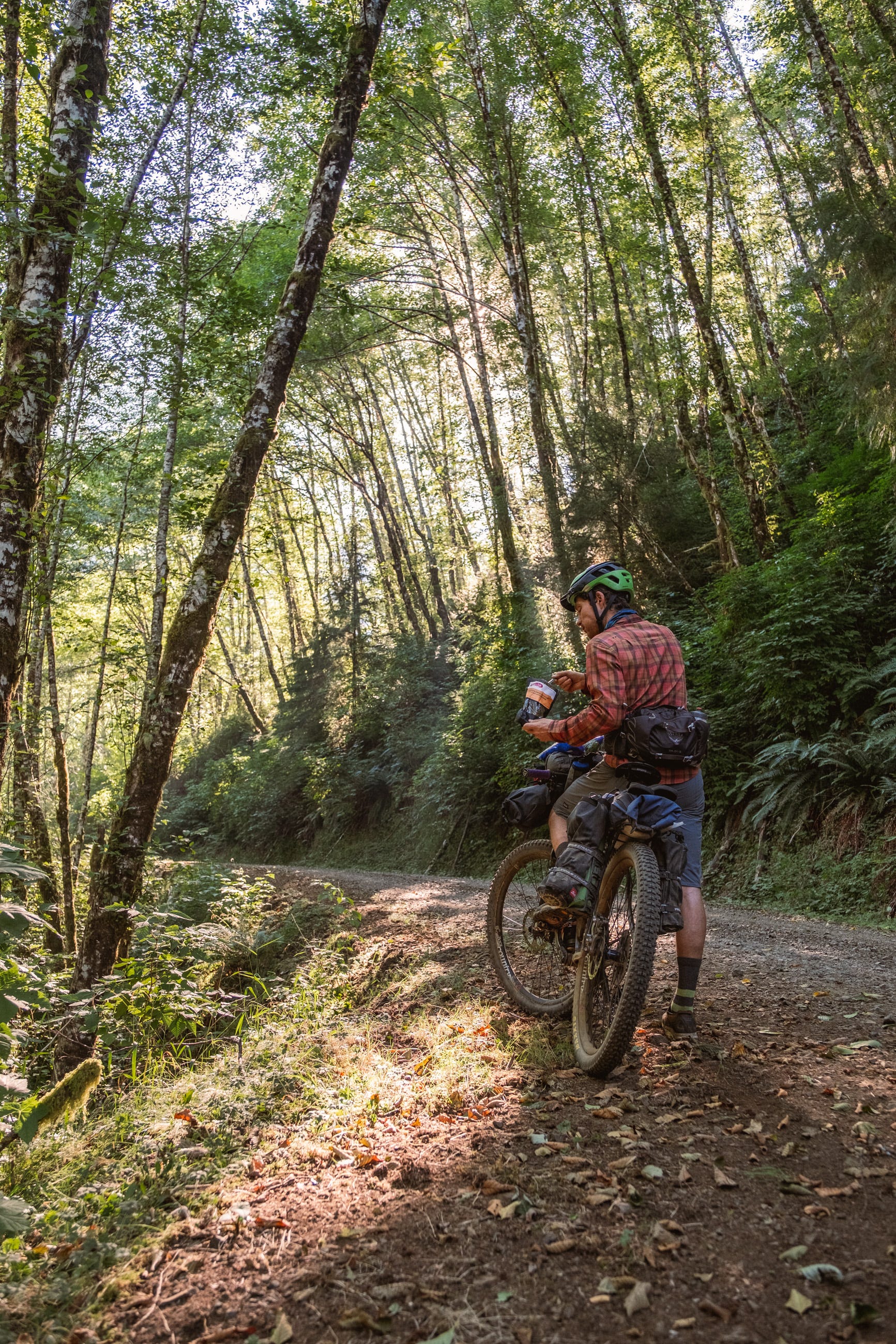
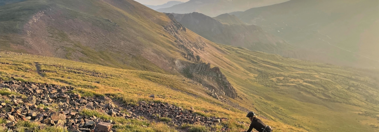
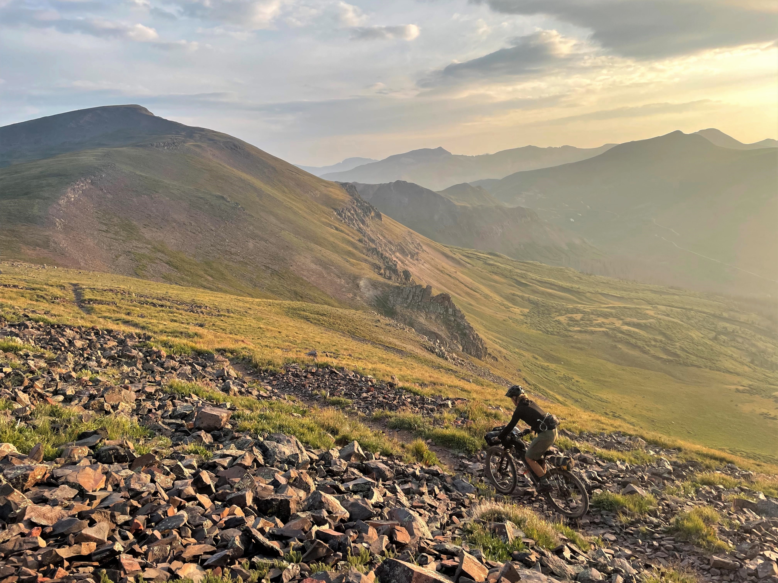
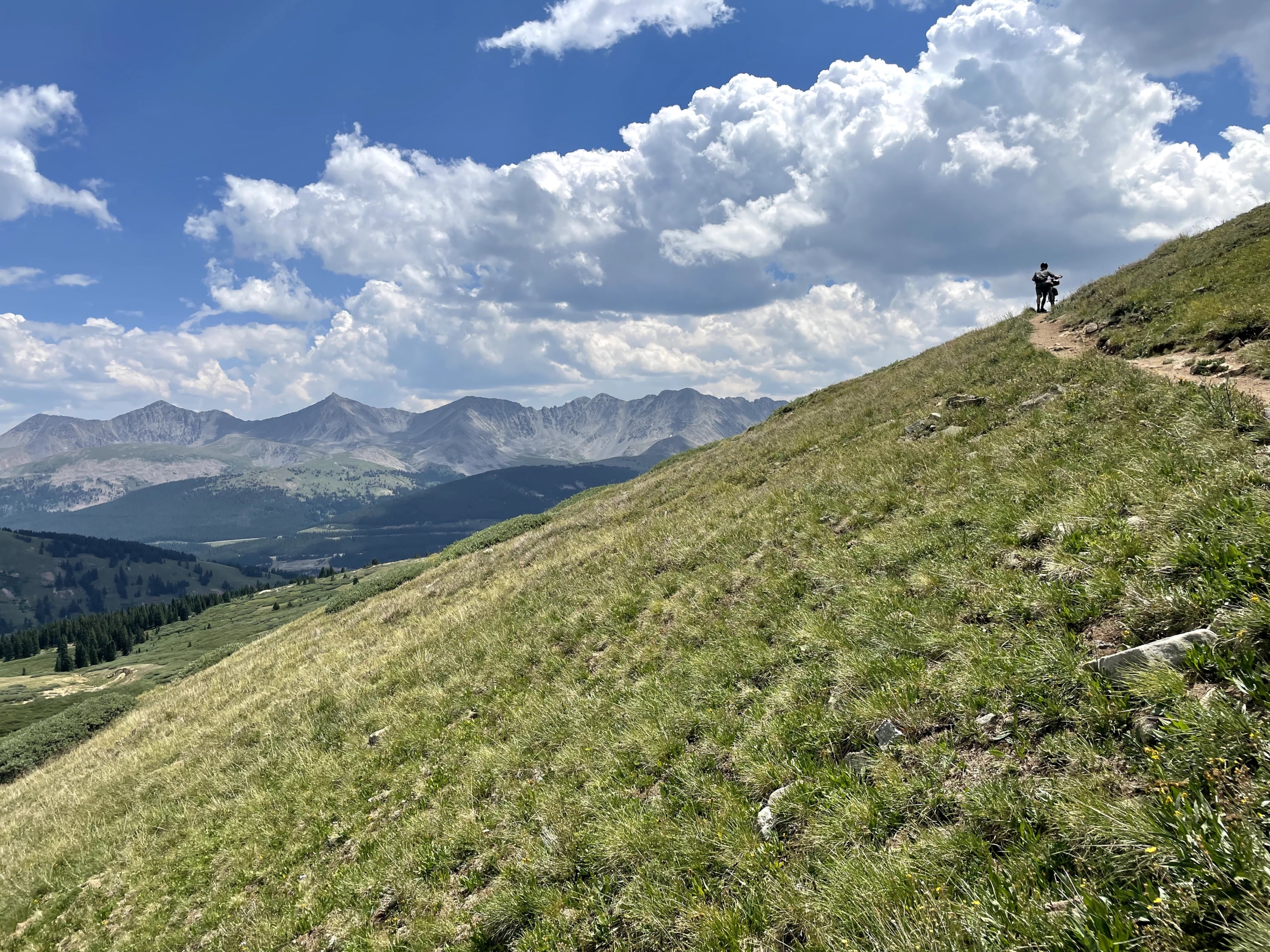
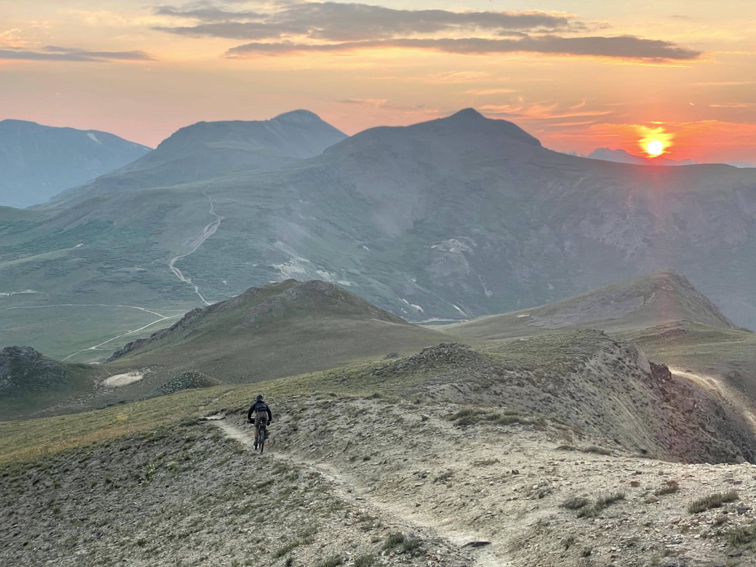
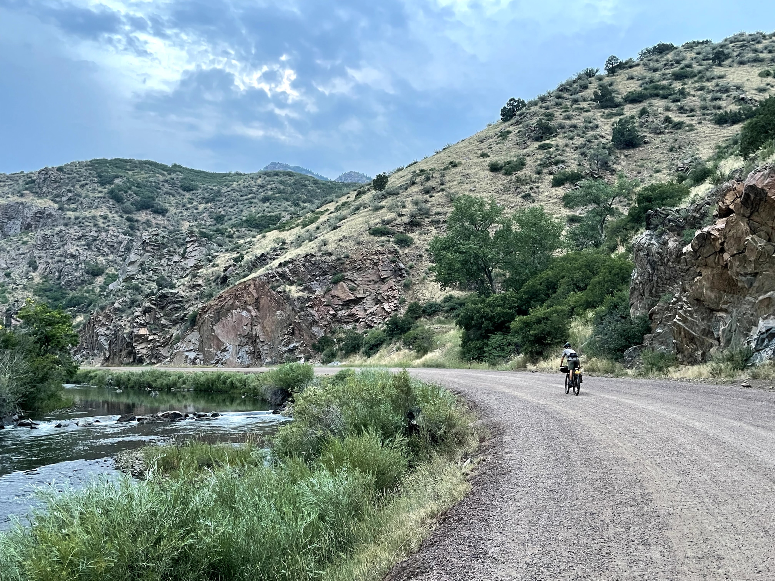

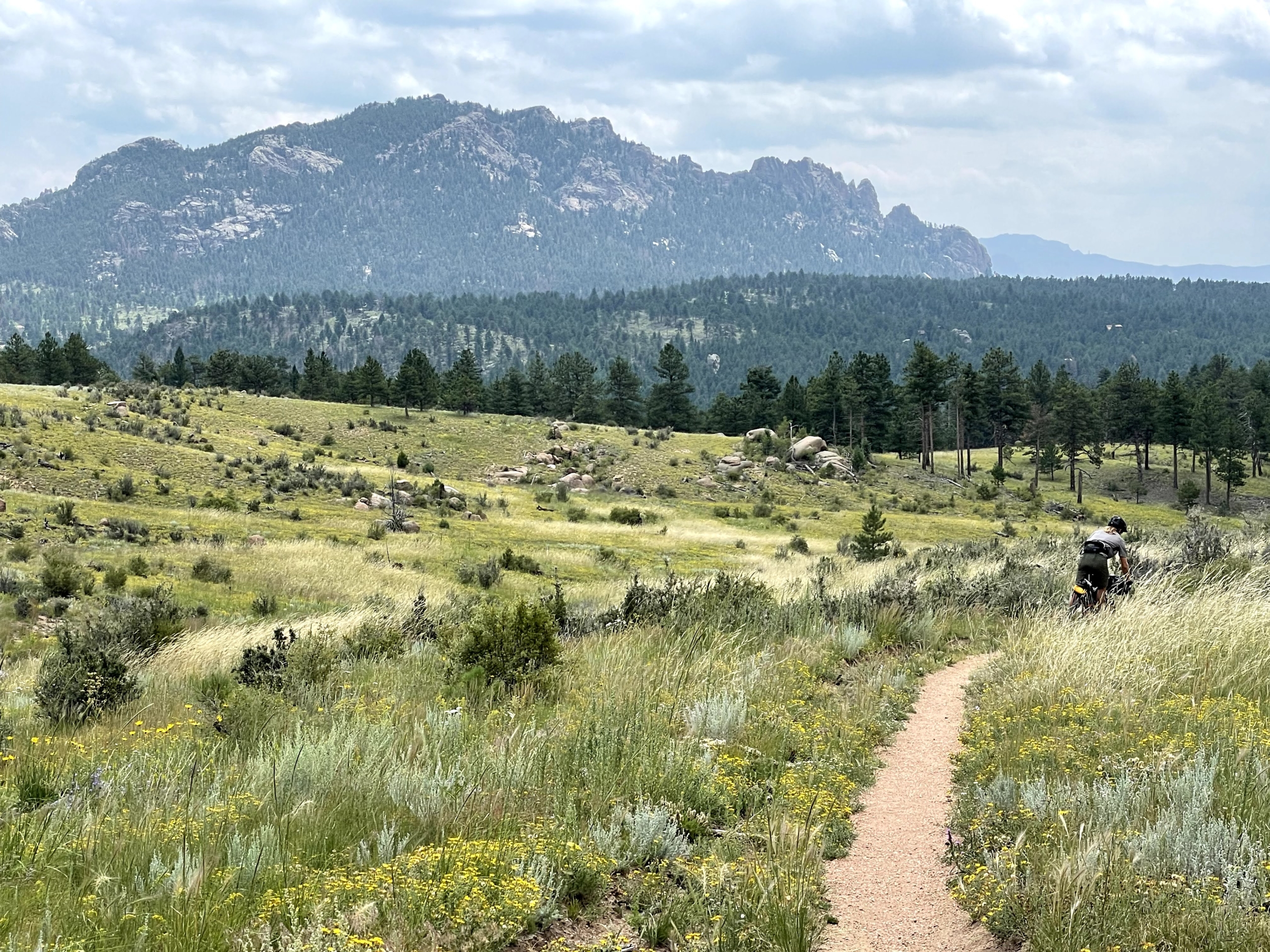
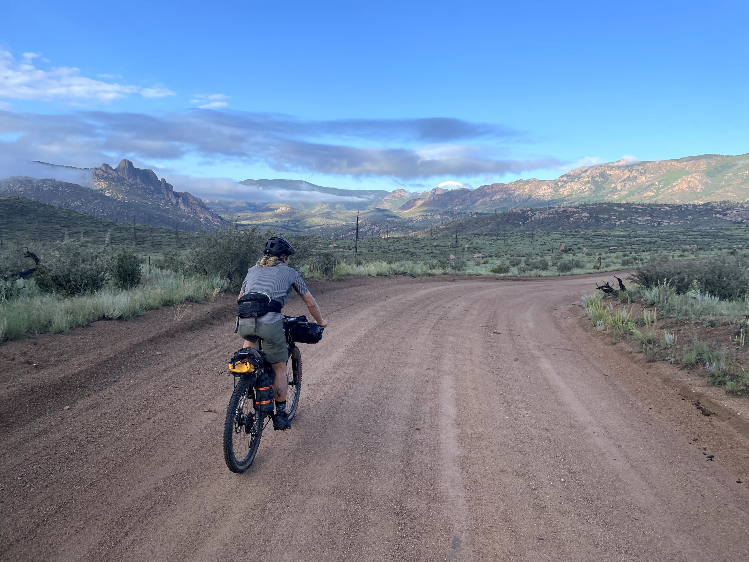

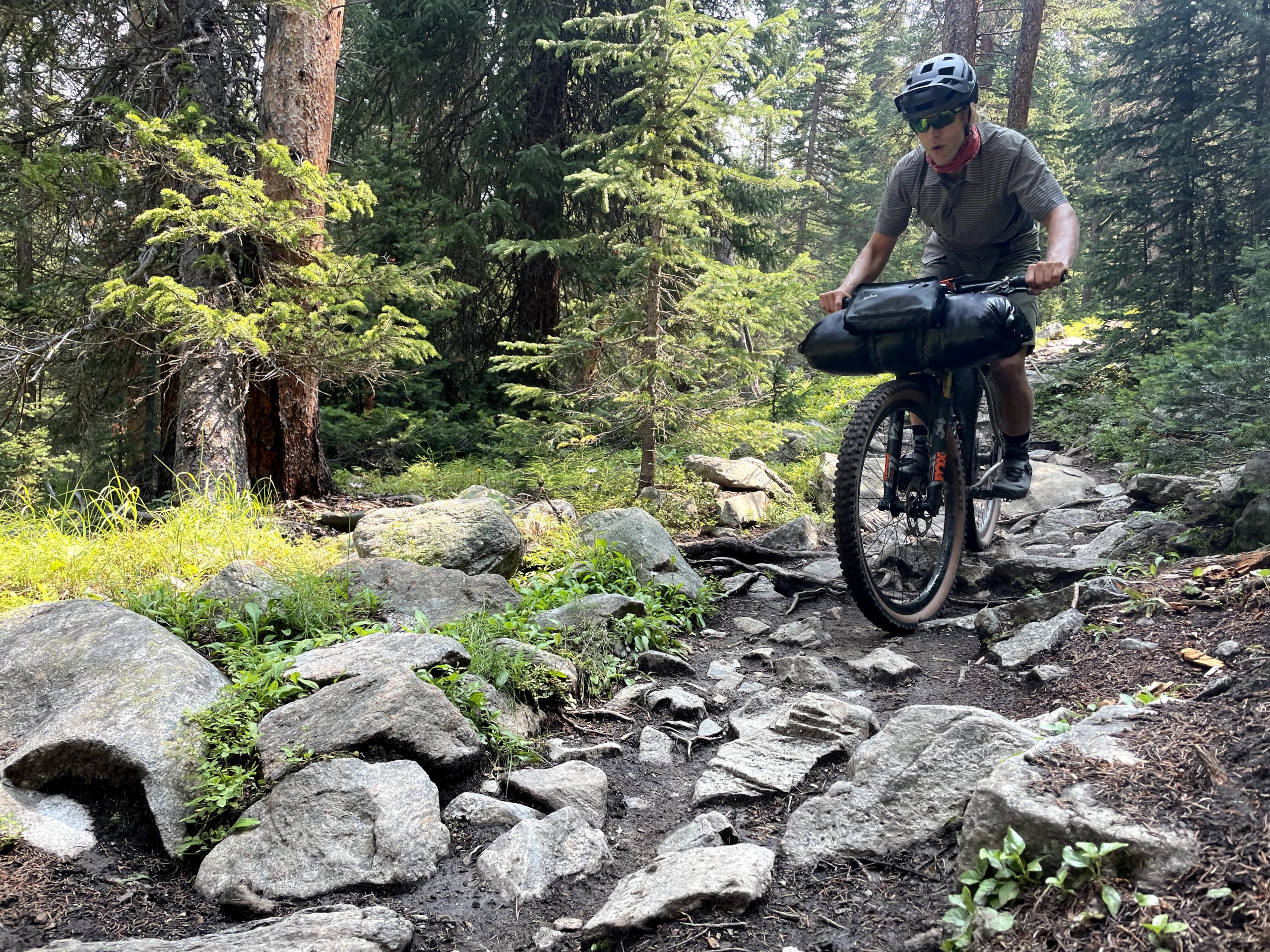
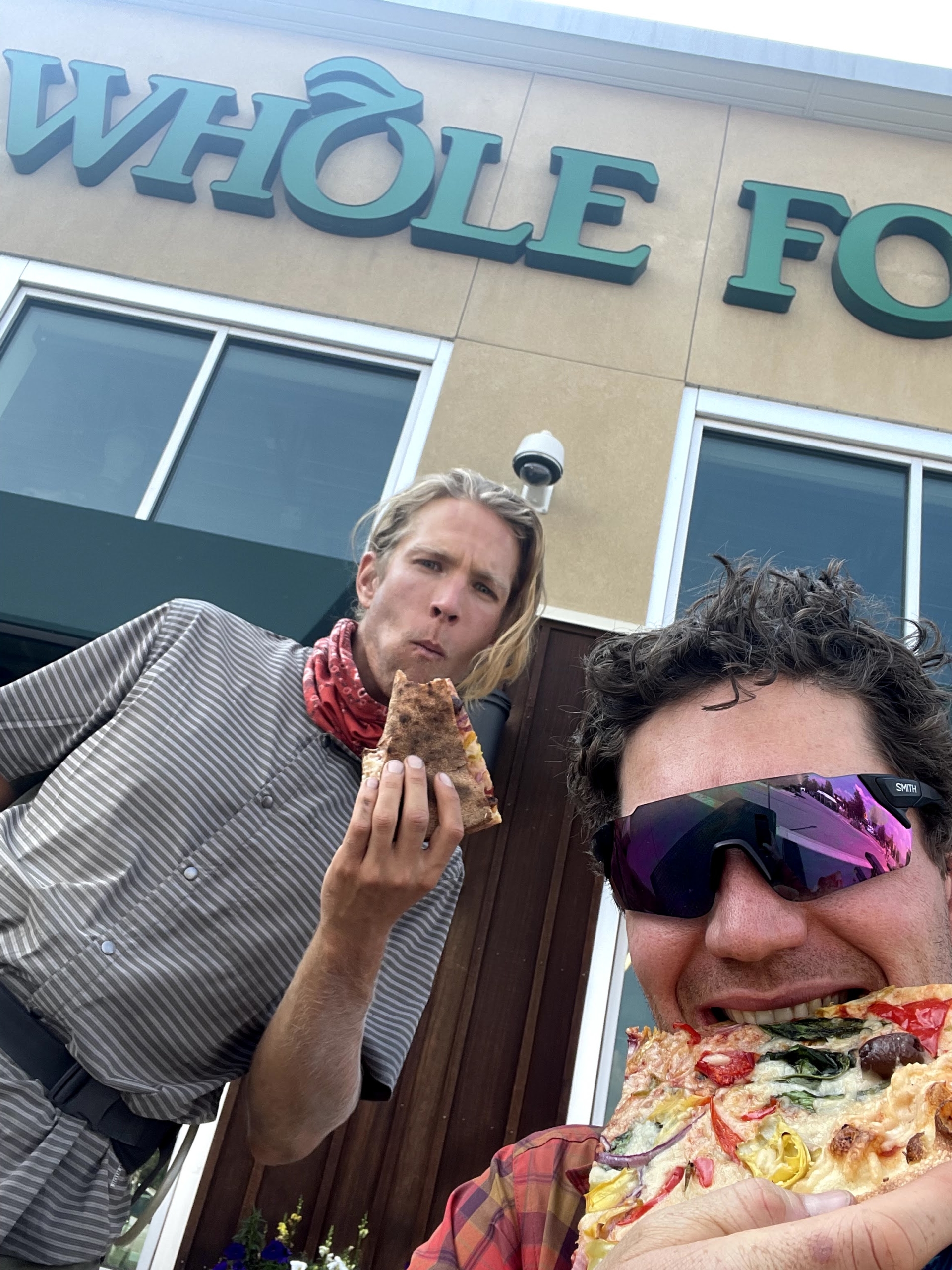

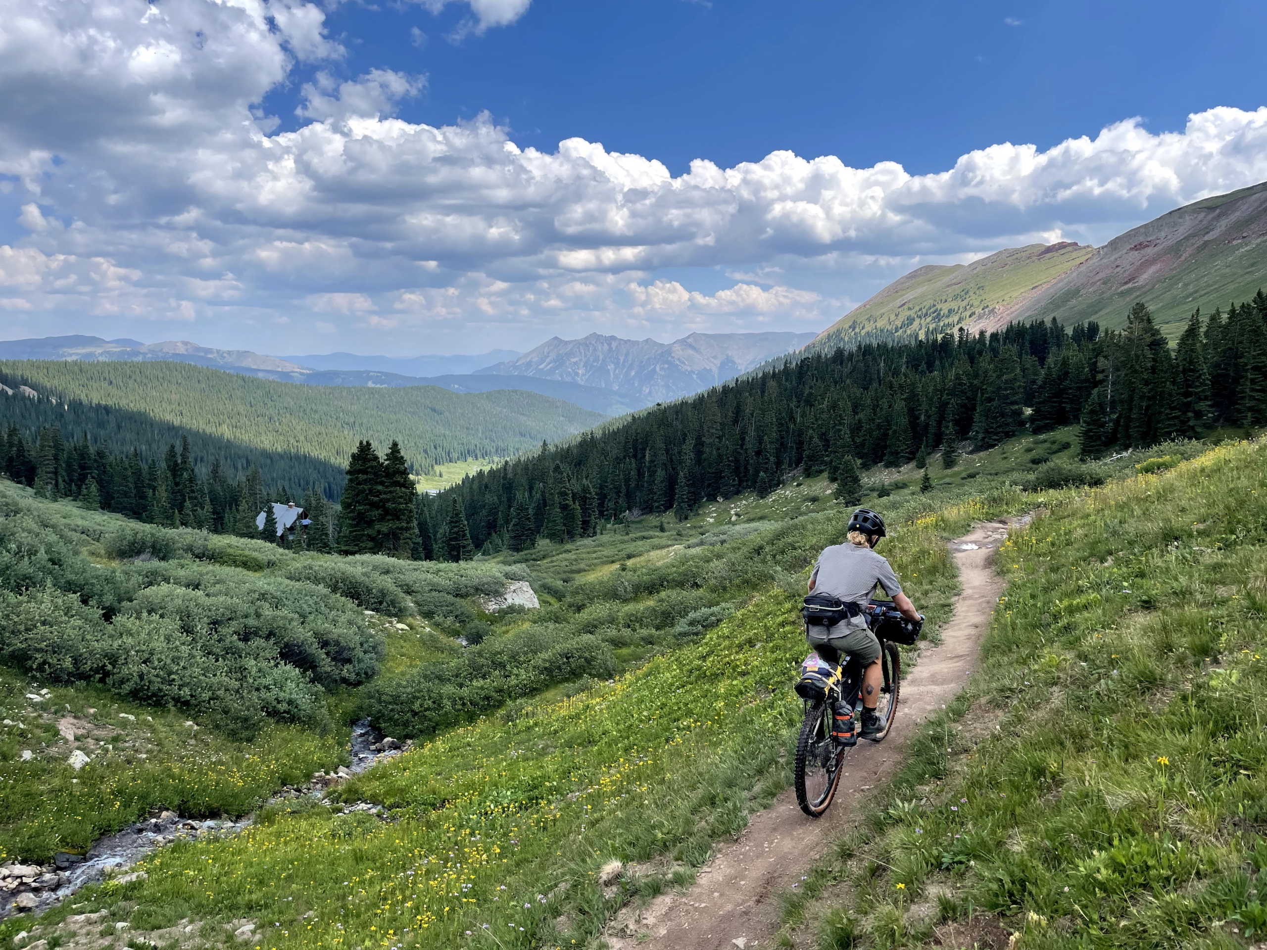
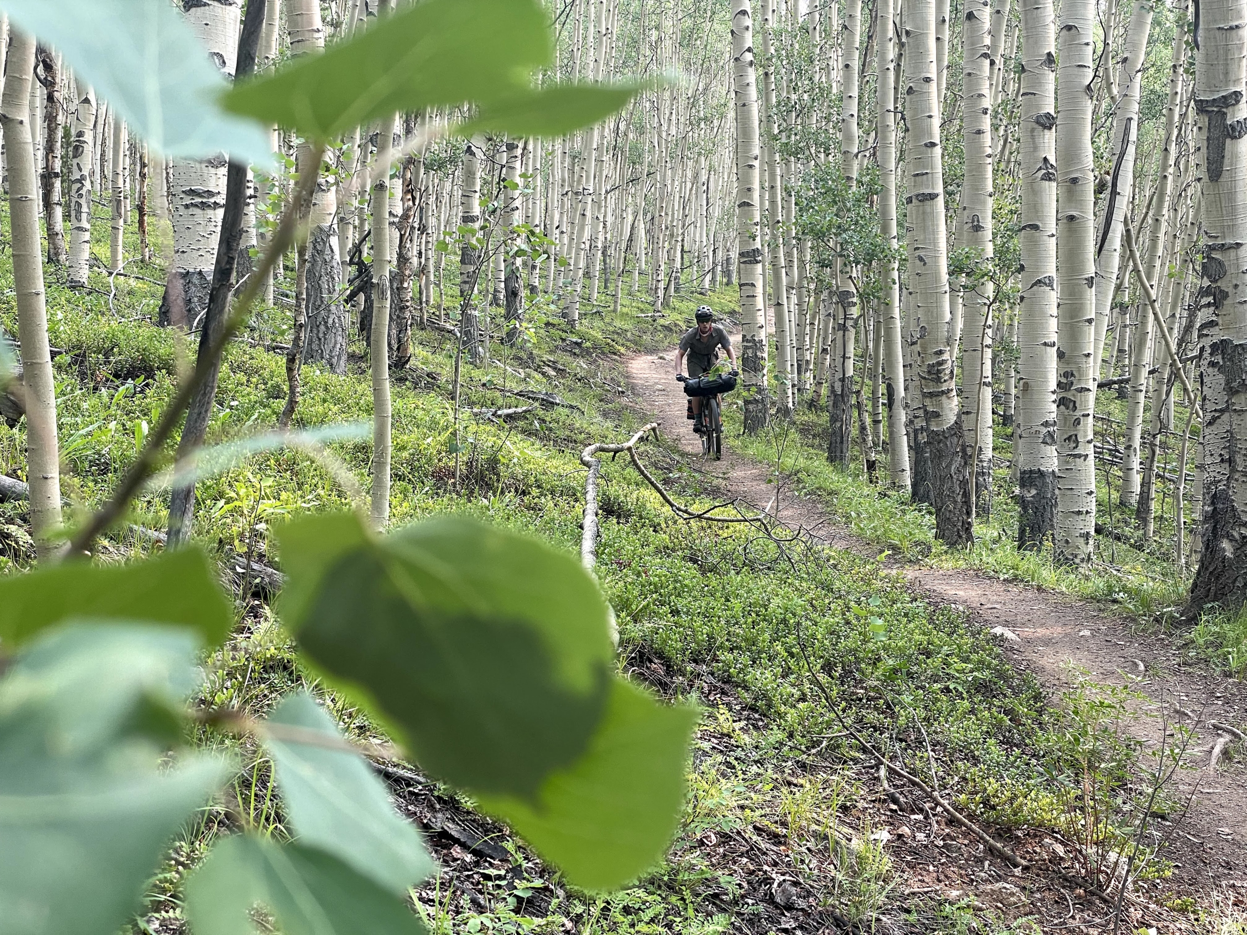
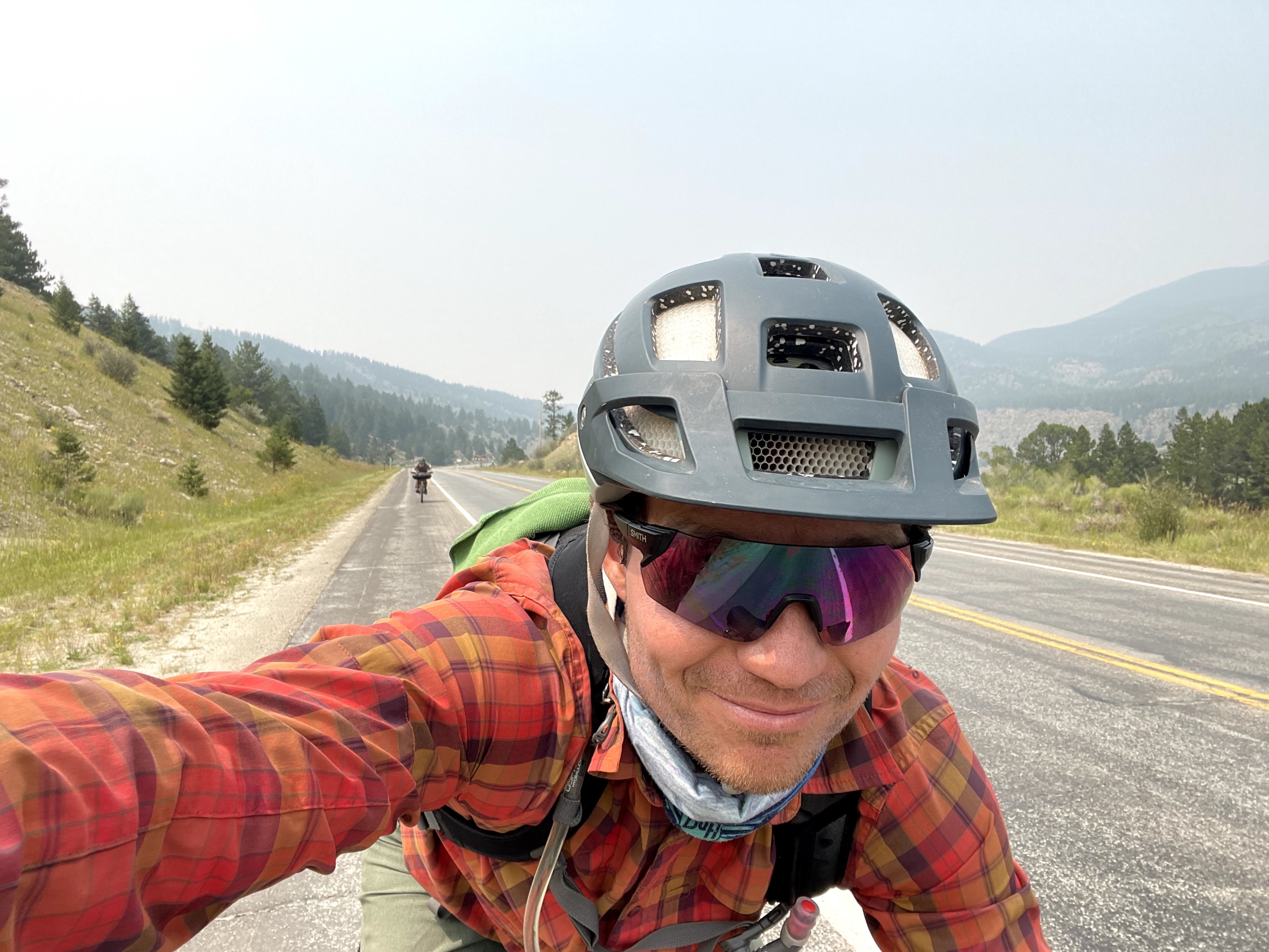
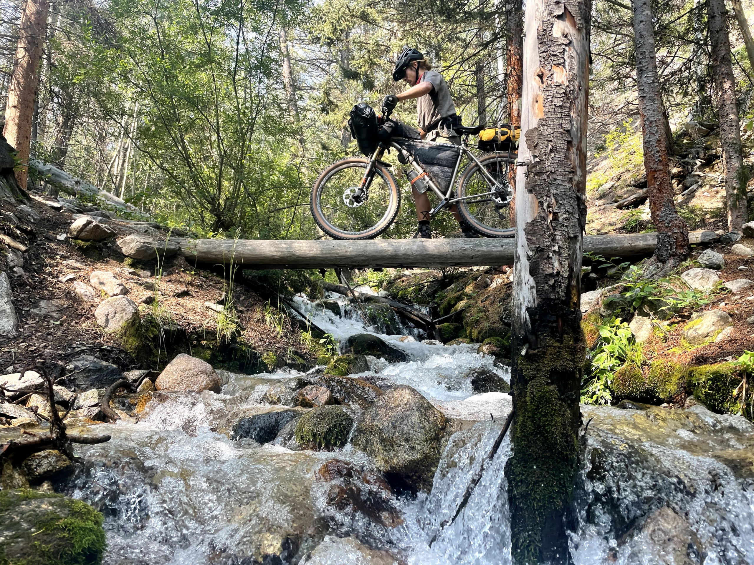
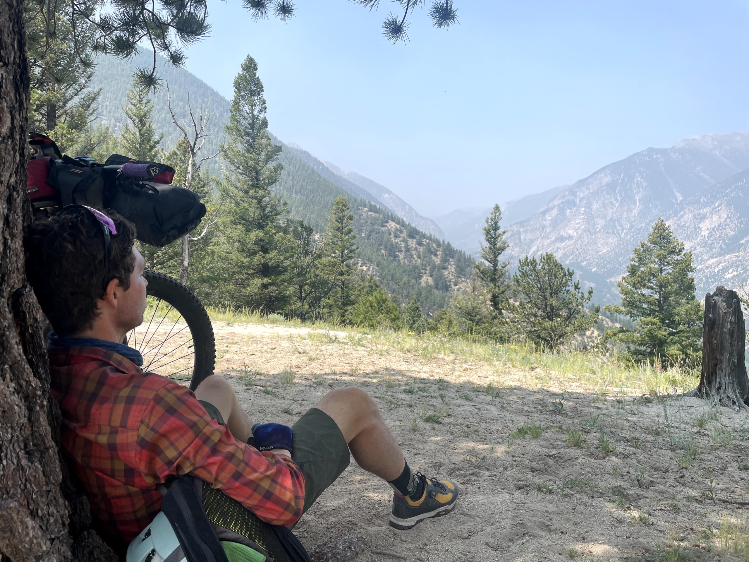

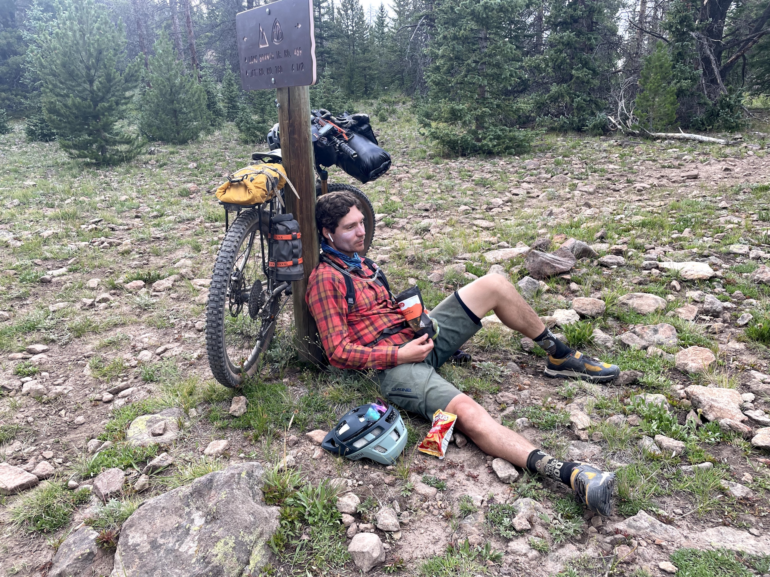
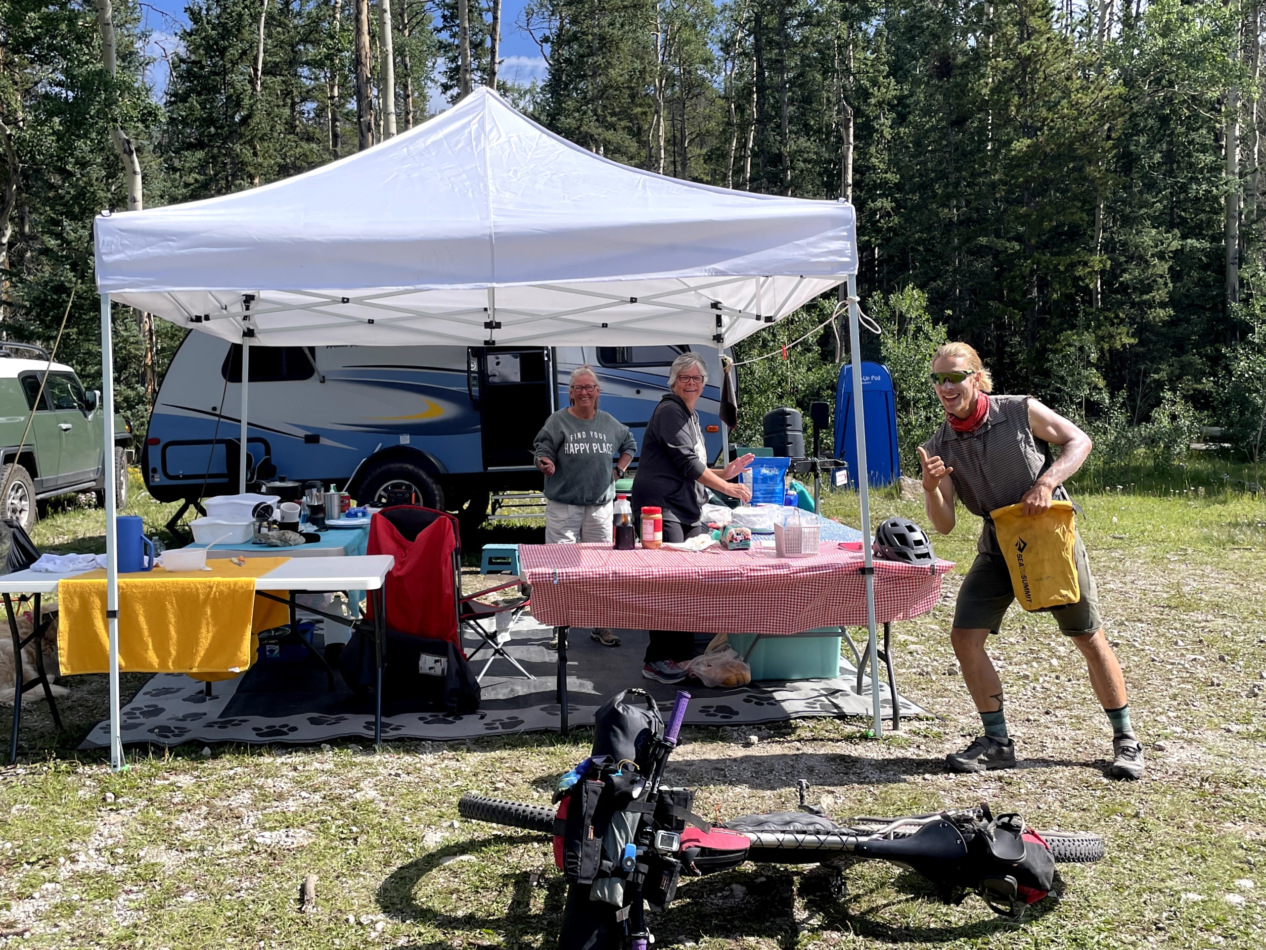

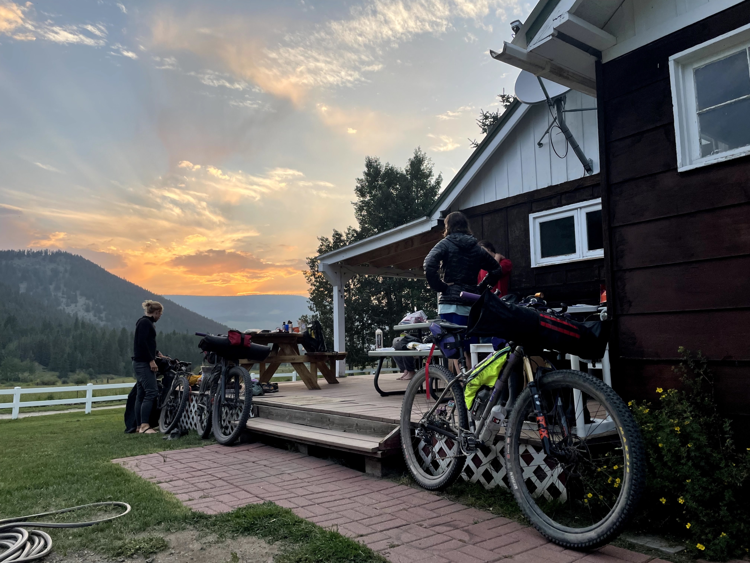
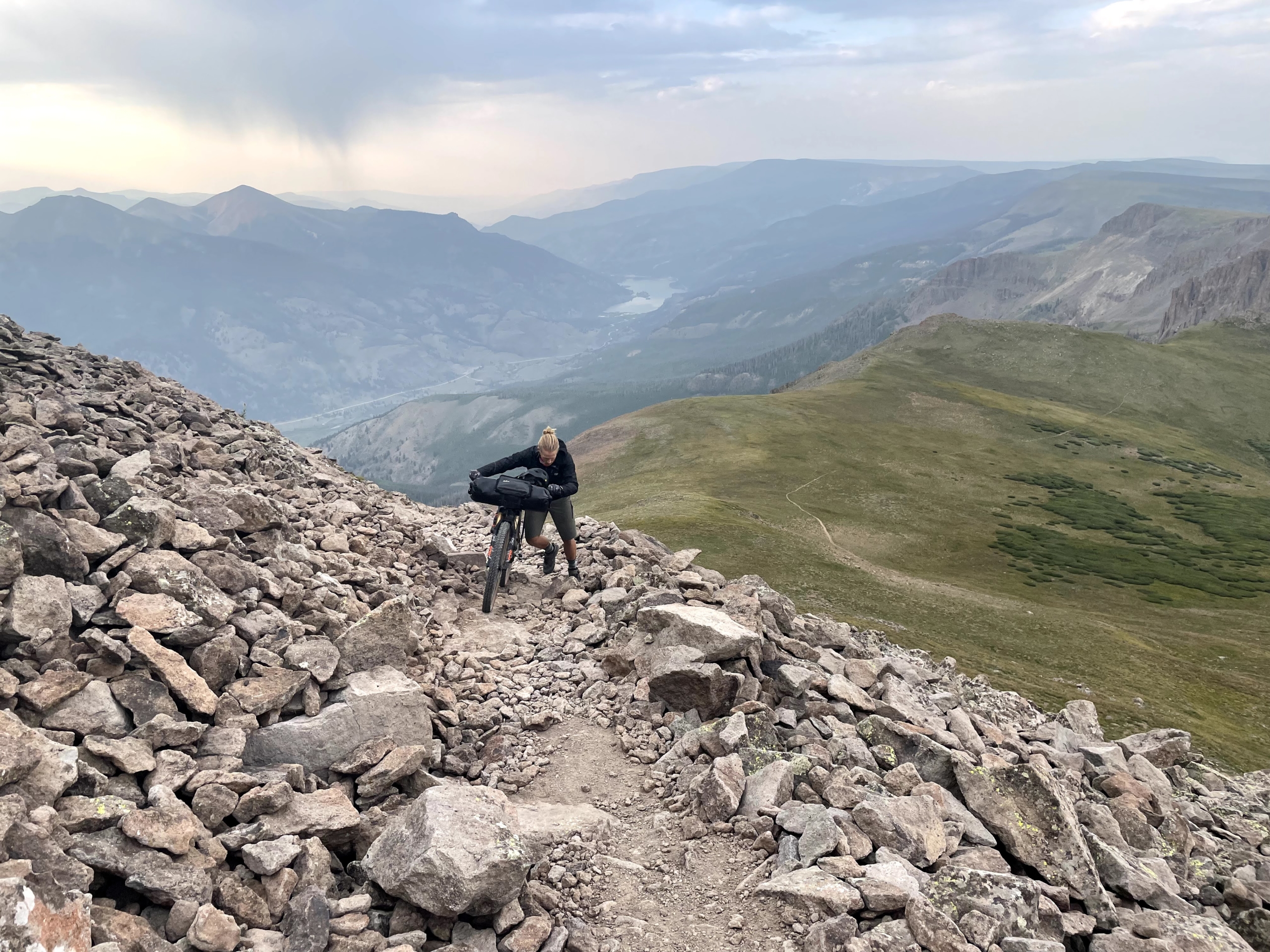
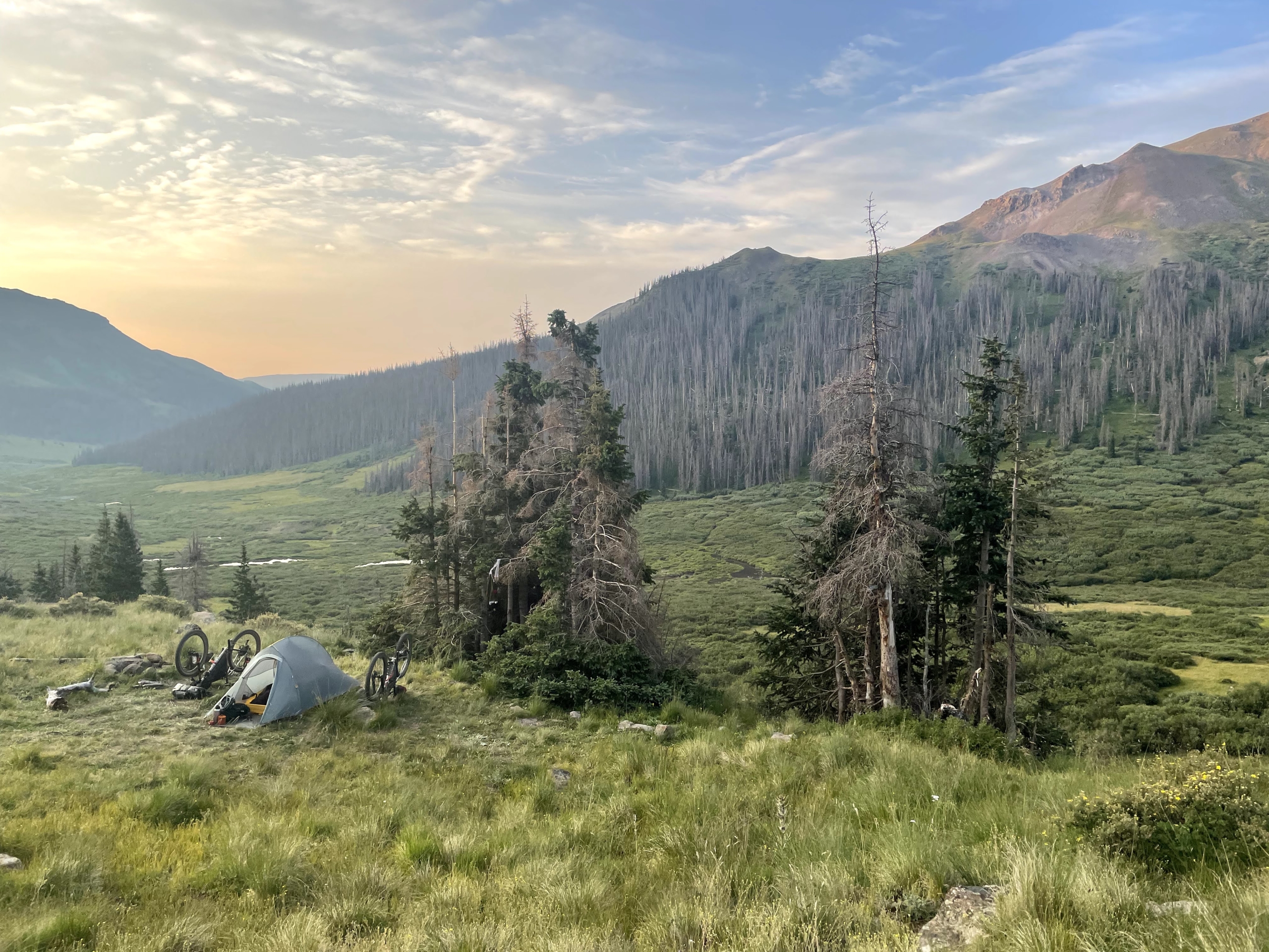
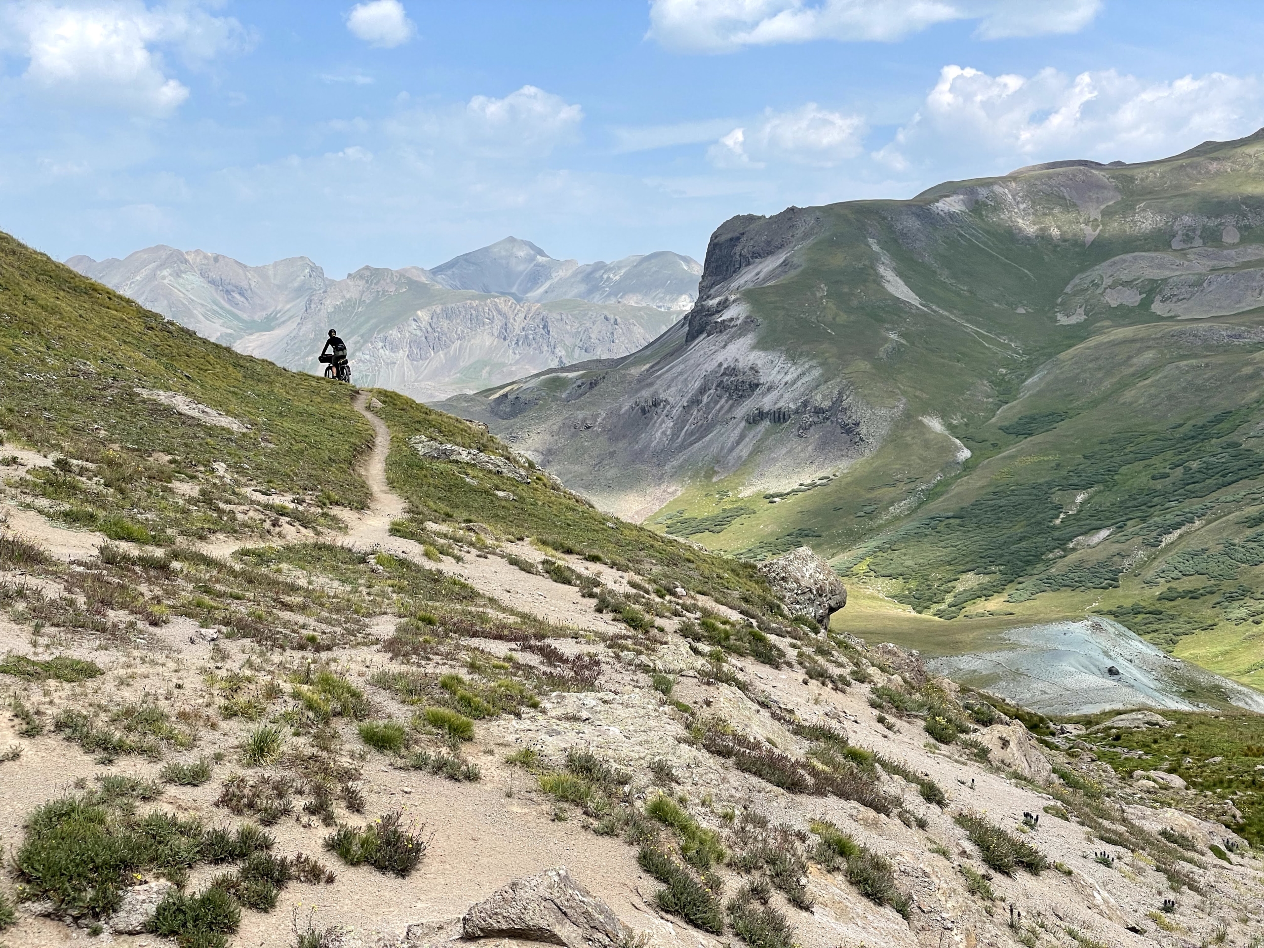
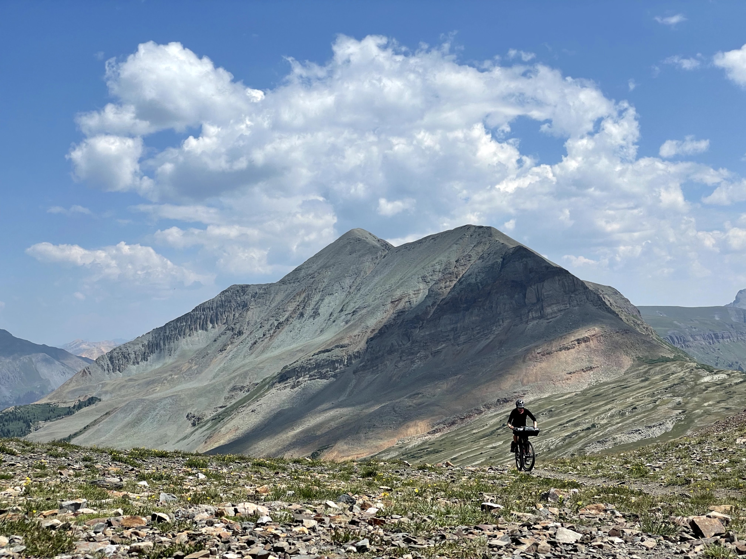
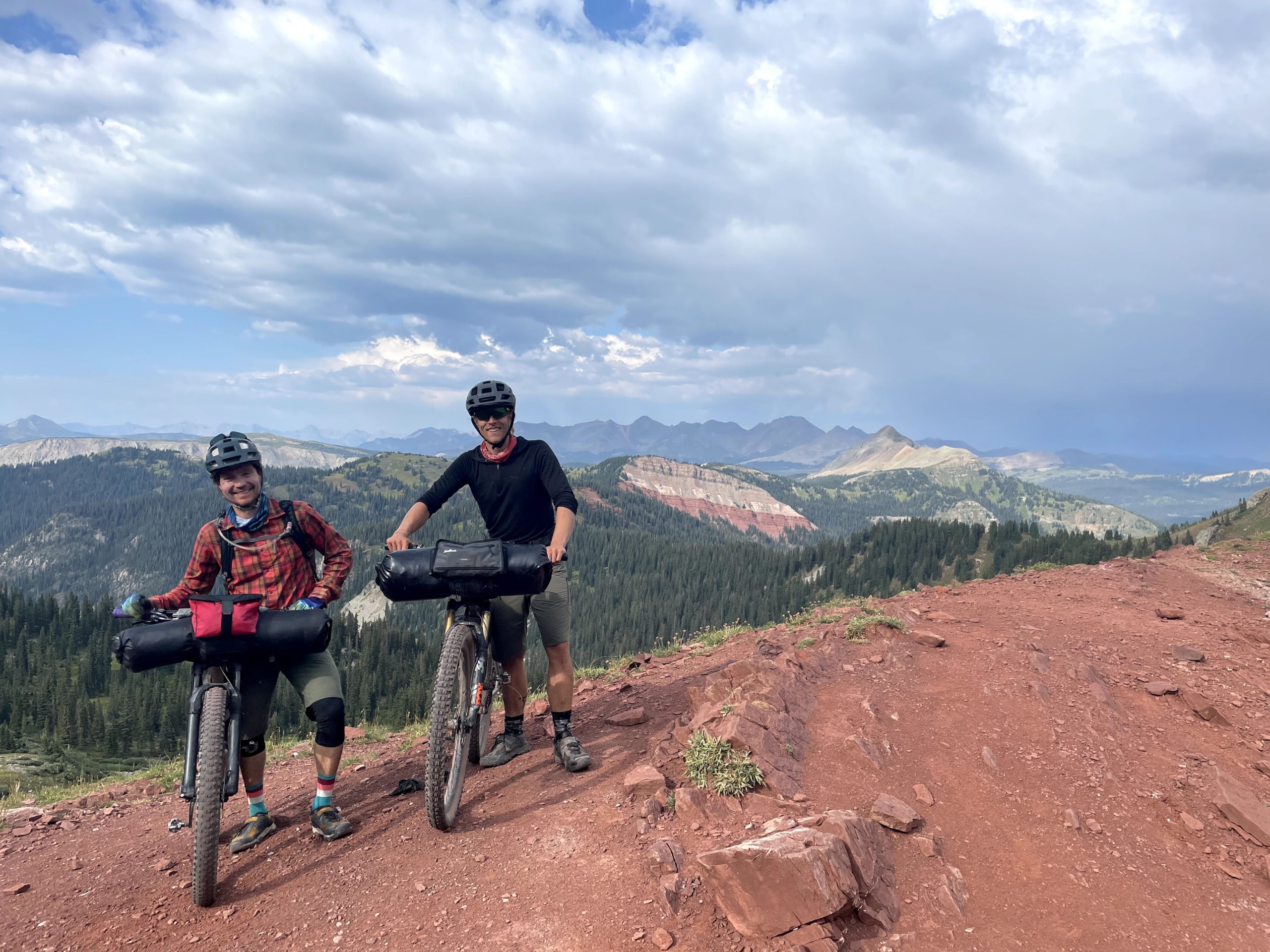
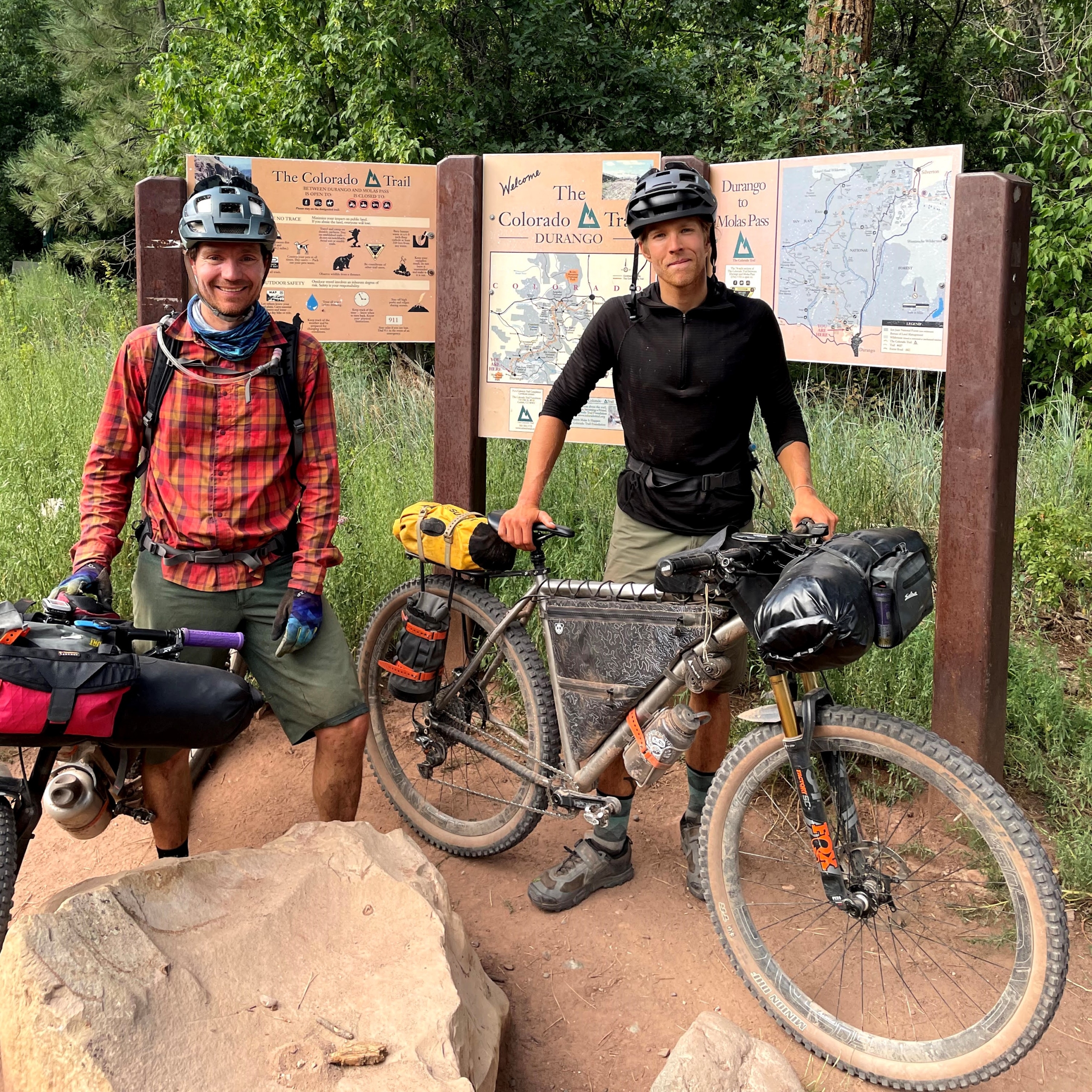

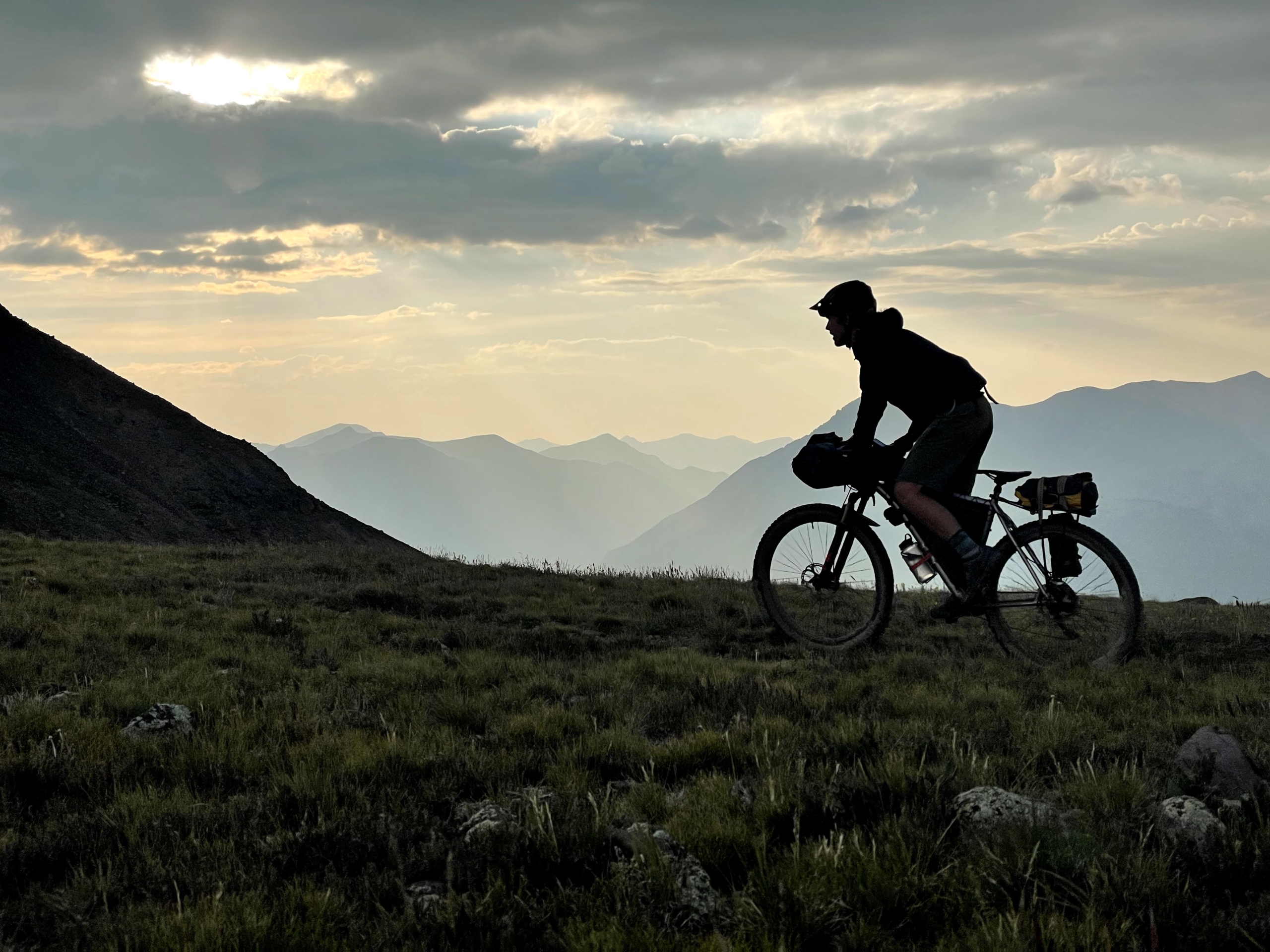


")


")