


A Rock Climbing Van Trip to Hells Canyon

Sometimes I visit a new destination carrying expectations. For rock climbing in Hells Canyon? Nope!
I van tripped there on a passable rumor from a guy (who knew a guy) claiming the existence of hundreds of bolted climbing routes. The interwebs proved less helpful: “There is no guidebook - hike up and climb stuff.”
FINE.
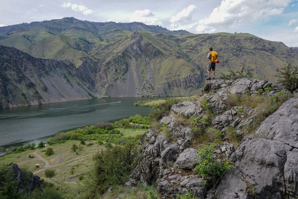
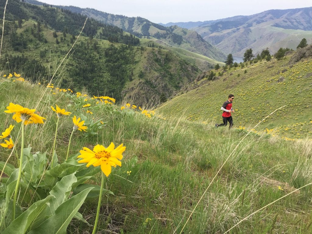
SURELY there is a route somewhere around here. (Photo: Sean Jacklin)
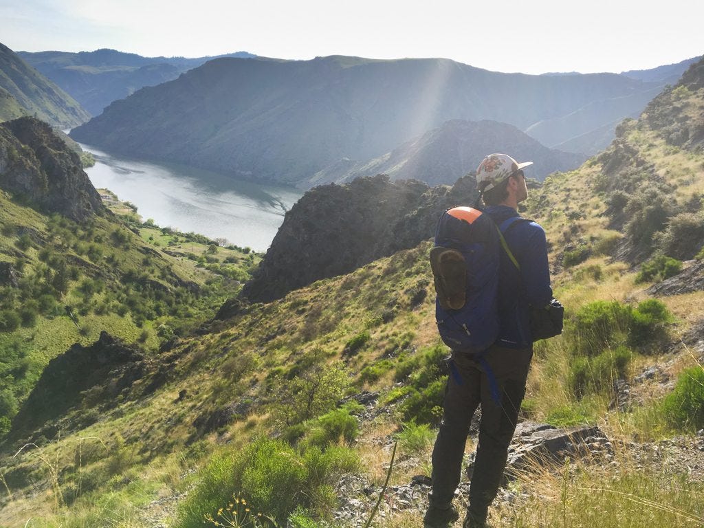
Heading Into the Canyon
For the uninitiated, Hells Canyon forms the border between NE Oregon and Idaho. The Snake River separates the two states and cuts the deepest canyon in the states. Steep trails head uphill from the many pullouts along the road.
The road from Baker City heads east, cell signal weakening. Around Oxbow, a tiny town on the border, no signal is the name of the game. Put that phone on airplane mode and enjoy the serenity.
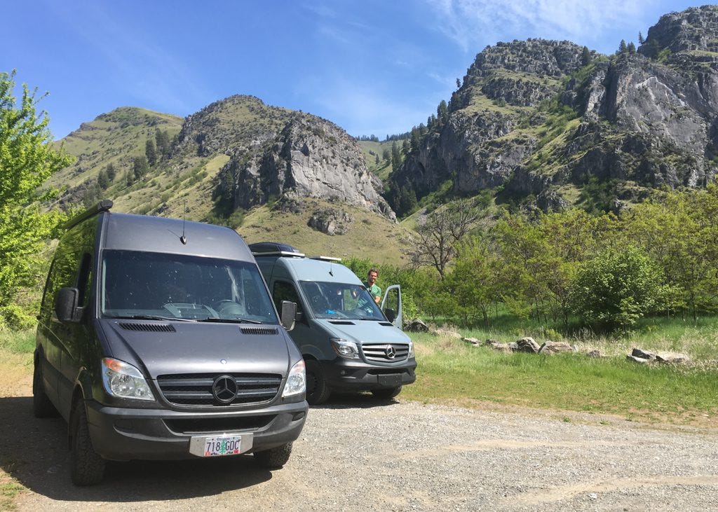
Pulling into the campground with my compadre Sean, right across from the routes!

Do campgrounds get any better than this? Right on the river, quiet, with a magic tree. (Photo: Sean Jacklin)
Miles back on the east side of the Snake River is the Alison Creek pullout. From the parking lot, a half dozen hulking limestone formations loom just a short (steep) hike away, most stacked with bolted sport routes.
Every climbing area has its own ethics. In Hells Canyon, the local route developers keep new projects under wraps and suppress any guidebook or online route guide development. Having climbed frequently at the zoo that is Smith Rock, I appreciate their perspective! Hey, they’re nice enough to bolt the routes, so I’m not going to complain.
Sean scoping out routes at the base of the Flatiron.
The canyon lies in national forest with prime free camping next to the river. We chose a perfect spot shaded by arching cottonwoods that framed views of the water and our climbing destination. Not gonna lie, the pull to hang in a camp chair and read a book was stronnng.
All Alone in Hells Canyon
Somehow, we rallied. Hiking in to climb on day one, we met a couple from my hometown (shout out to Moscow, ID!). They told us two things: 1) an irritated rattlesnake lay poised just upstream and 2) “The route on the left side of that wall is an 11c; the ones to the right are harder.” No dummy, I sent Sean ahead in his long pants and hung back yelling "HEY SNAKEY SNAKEY," a variation of my ultra-effective bear repellent song (heyyy bear!).
Those vague tips were the only beta we received in three days. In fact, those were the only other people we saw the entire time. Hells Canyon is a remote, untrammeled area of the world, and I bet it stays that way. With few amenities, no guidebook, and GASP no possibility of posting Instagram Stories while there, it won't turn it into a Yosemite Falls gridlock, don't worry.
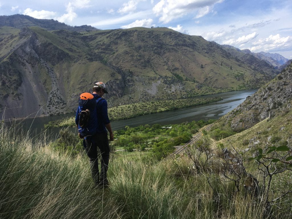
Heading down to the vans for a well-earned dinner!

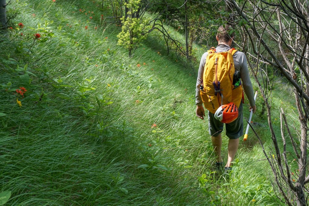
Some steep, entertaining approaches to routes in the canyon.
This isn’t a climbing blog, so I won’t bore you with tales of glory and the excellent fun. (A small victory, I did onsight the aforementioned 5.11c.) Beyond the climbing, my favorite aspect of Hells Canyon was the remoteness and discovery aspect. Every route offered panoramic views of the canyon.
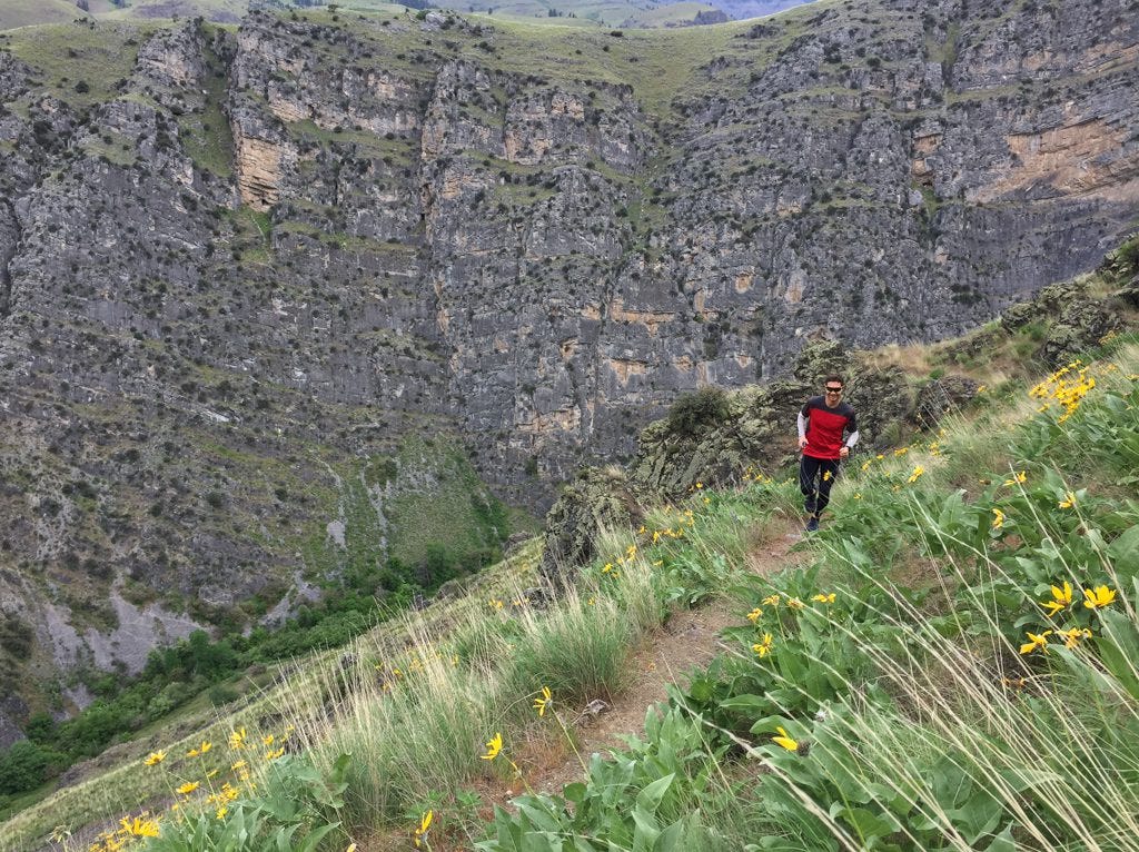
After two days of shredding our fingertips on sharp limestone, we opted for a rest day trail run. Sweaty uphill work brought us to a ridge traverse through wildflowers, a rollicking jaunt with sweeping views of the canyon. The route finding and downed trees stayed right in line with the rowdy spirit of the canyon.
We cleaned up with a dip in the brace-yourself cold river, then ate lunch sitting by the side of the river. (Mega burritos for the win). The serenity, lack of cell service, and excellent options for adventure made it hard to peel away so fast, but it was time to point the vans south to meet some buddies. Onward to the City of Rocks!
Cruising along a ridge traverse 3000' above the river (after some hard work getting up there!) (Photo: Sean Jacklin)
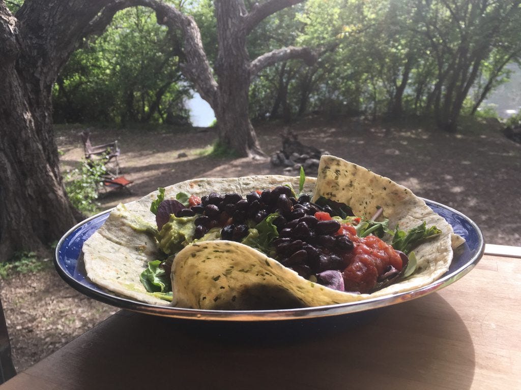
Nomnomnom. Final lunch in the perfect campsite before hitting the road.
[av_promobox button='no' label='Click me' link='manually,http://' link_target='' color='theme-color' custom_bg='#444444' custom_font='#ffffff' size='large' label_display='' icon_select='no' icon='ue800' font='entypo-fontello' box_color='custom' box_custom_font='#0a0a0a' box_custom_bg='#aaaaaa' box_custom_border='#333333' av_uid='av-3jqrhn' admin_preview_bg='']
All the Logistics:
Hells Canyon is hot (as hell) in the summer. Spring and fall is the best time to go, with fall better because the wet limestone can seep water in the spring, especially on the steeper routes.
Pack plenty of water and food for your trip because the campsites are no-frills-just-an-outhouse style. Last stop for food is the town of Oxbow at the bridge crossing from Oregon into Idaho. Copperfield Campground is a big, well-appointed one (we opted for free, remote camping up-canyon).
There’s an RV water fill a few miles up canyon from Oxbow. (Lowest water pressure ever, but it’s free!)
There is zero cell service in the canyon. You’ll lose it before Oxbow. Enjoy the silence!
To find the climbing, use the Mountain Projects app and find Hells Canyon, then use the “get directions” feature. It’ll take you right to the trailhead. (Or just go to this Google pin.) Any of the pullouts from there bring you to fantastic river camping spots.
If you want amenities close to the climbing, Hells Canyon campground is about 5 miles south of Alison Creek and has water, electric hookups and freshly mowed grass to roll on.
For the 10-mile trail run up Alison Creek, here's my route on Strava.
[/av_promobox]
SO much undeveloped rock in the canyon. (Photo: Sean Jacklin)
[av_promobox button='no' label='Click me' link='manually,http://' link_target='' color='theme-color' custom_bg='#444444' custom_font='#ffffff' size='large' label_display='' icon_select='no' icon='ue800' font='entypo-fontello' box_color='custom' box_custom_font='#0a0a0a' box_custom_bg='#aaaaaa' box_custom_border='#333333' av_uid='av-1xk2jf' admin_preview_bg='']
The Climbing:
The rock is featured limestone and the routes we climbed were vertical to overhanging. Not a ton of steep caves, but routes are steep enough that you are working - this isn't slab climbing.
Onsighting is tough because there aren't any tick marks on the holds. Search and destroy!
The orange rock is loose/sketchy; the best rock is blue in color with pockets and water runnels.
Rumor has it there are multi-pitch climbs up the 400-600' walls, but as newbies to the area, we didn't attempt to find any.
There are reportedly hundreds of routes to climb. We did maybe a dozen of them. If you can find someone who has climbed there before, listen to them!
Since routes aren’t marked and there is no guidebook, you never know what you’re getting into. Bolts are close together and you can basically aid the routes, but I recommend feeling solid leading 5.11s outside if you’re making the long drive out here. At the very least, bring a bail biner with you.
The routes are long! Bring a 70m rope and lots of quickdraws; many of the routes are 17 draws. That said, the bolting is closely-spaced (WOOT) and you can skip a bolt or two or downclimb to grab one a draw on many of the routes if you are running low.
My favorite routes were on the crag high on the left drainage (30 min steep hike uphill from Alison Creek TH). Apparently it's called the Flatiron. Otherwise, we just jumped on interesting-looking routes all over the canyon.
[/av_promobox]

Til next time...


