Bikepacking Magic on the Colorado Trail
The Colorado Trail is the big leagues of bikepacking. Get ready for leg-thumping elevation gain, lung-emptying altitude, afternoon thunderstorms tossing lightning and rain at the passes, and remote, rocky terrain with significant consequences.
Oh, AND prepare yourself for a fabulous adventure you’ll never forget.
We experienced no days I can label easy, but for determined bikepackers, it’s not unreasonably difficult. (Well, maybe a couple hours of it…) At our pace of 12 days for the trip, the town resupplies slotted nicely into the program, downed trees weren’t a thing, and perfect trail conditions from rain kept the dust down.
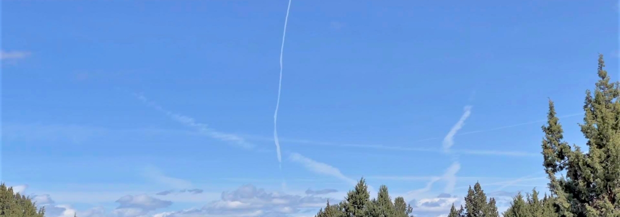
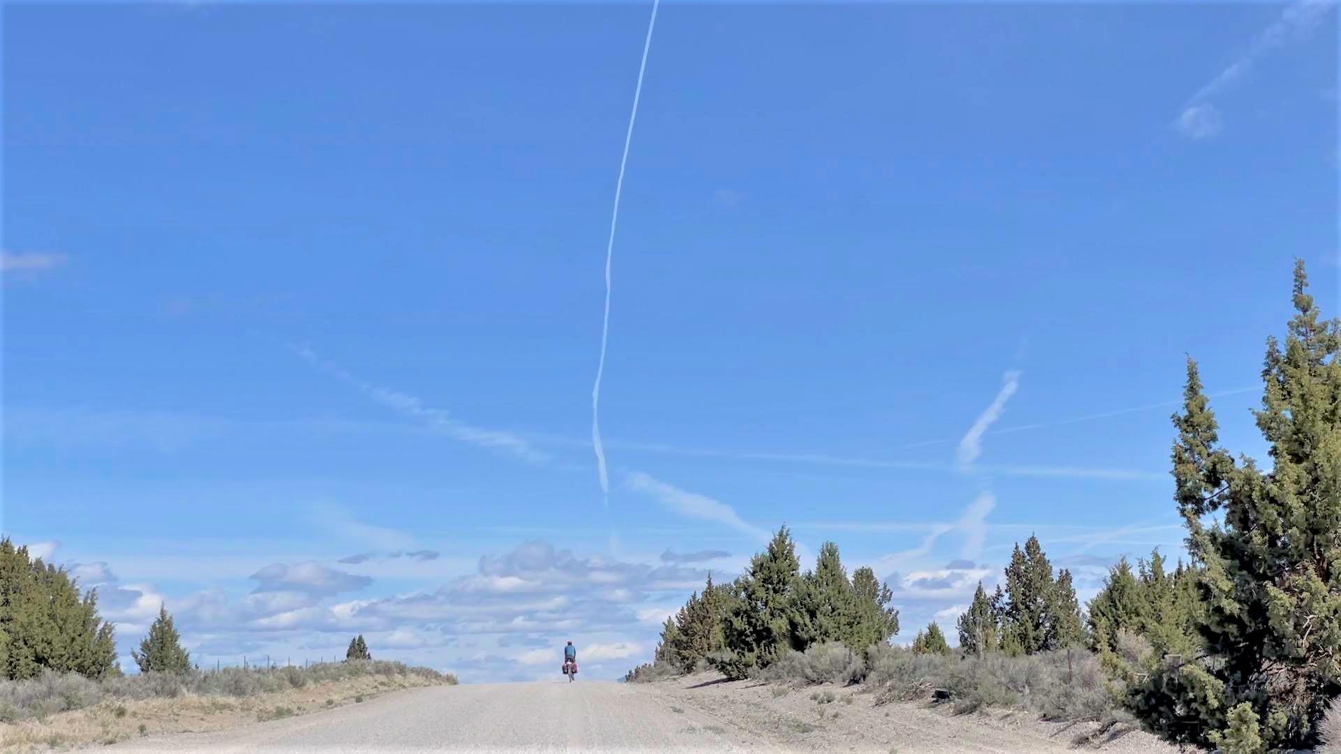
Sure, obstacles appeared. Forest fires from the west tainted the air for the first week. The elevation gain and hike-a-bike are no joke. We fled thunderstoms. My bicycle showed up 2.5 days late with a bonus of a broken dropper post…
But hey— no mosquitoes swarmed us, beautiful vistas assailed our eyeballs, fantastic descents delighted us, dozens of CT backpackers chatted it up, and we had the opportunity to ride through the Colorado mountains on a famous trail. What more can a bikepacker ask for?
Shortcuts for Colorado Trail details
Here’s my experience bikepacking the Colorado Trail. I wrote this as a resource for folks looking to bikepack this route, so free to skip to any specific sections below.
- Route description and overview
- Our trip plan for the Colorado Trail
- My experience bikepacking the Colorado Trail – day to day summary
- Parting thoughts – what to expect
- Photo gallery
- Trip logistics: food, water, camping, navigation, etc
Colorado Trail Route Description and Overview
Traveling between Denver and Durango, the Colorado Trail’s originated as a hiking route. Perhaps that’s why so many backpackers stared at us like we’d escaped the loony bin…
Featuring 70,000+ feet of steep climbing in ~550 miles, the bikepacking route bypasses a few wilderness sections on fire roads and pavement. Mostly, it follows singletrack up and down over 10-13k passes. Check out the main Colorado Trail page on Bikepacking.com for a complete write up.
The Best-Laid Plans
My plan was simple: fly into Denver and out of Durango with 15 days to complete the trail. About 40 miles each day with space for half-days if thunderstorms whupped our butts or we needed a rest day. No problem.
I live in Oregon, so flying lopped dozens of hours of driving time off the trip. Since airlines love to charge $200 to bring a bike only to dropkick them down ramps, I mailed mine with Bikeflights instead.
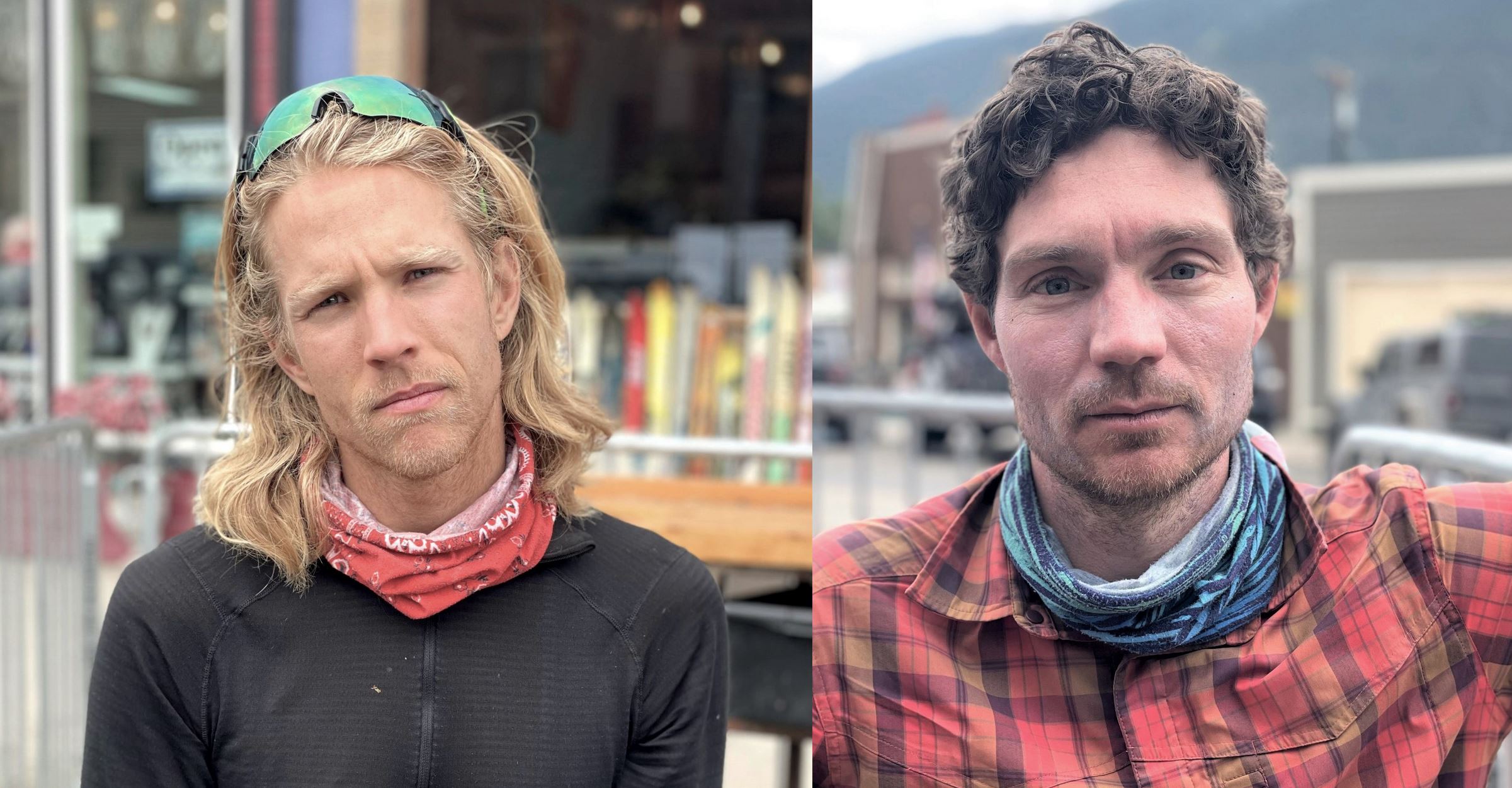
Sadly, UPS blew it and my bike arrived 2 days late. Instead of bikepacking, my trip companion Mason and I explored Denver. We broke tested traffic laws on Lyft scooters, toured the Denver Art Museum, bought final trip items, and generally made the best of it. Lesson learned: ship bikes with a bigger time buffer.
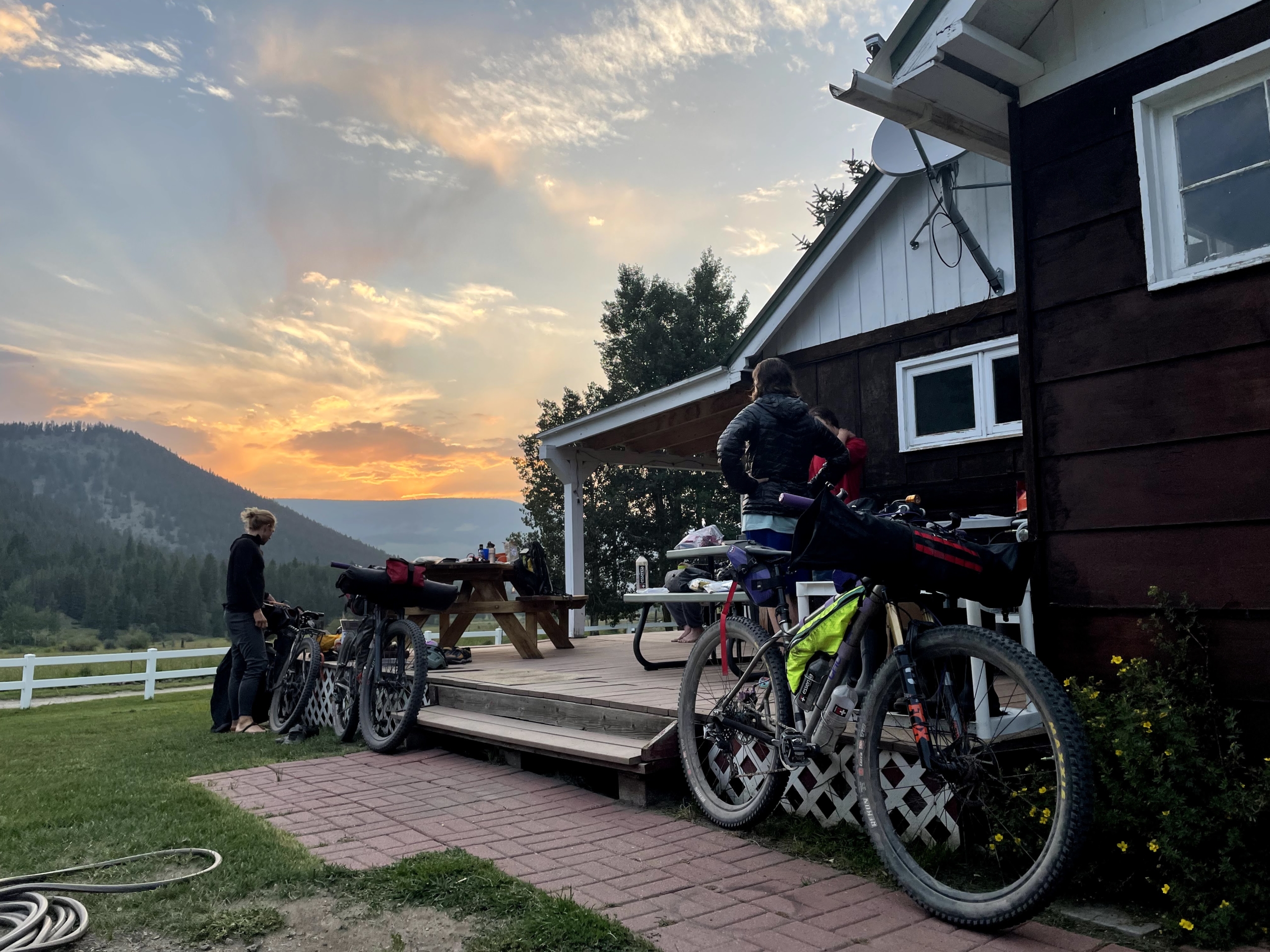
My bike finally arrived at 5 p.m on Monday. We reassembled it in a chandeliered banquet hall, caught mass transit to Littleton, and pedaled 10 miles to the CT start at Waterton Canyon. We arrived riiiight at sunset—spirits high, visibility low. Trips ideally start at 8 p.m., right?
No matter. Mason and I enjoyed an easy cruise up the canyon and camped near the start of the singletrack, poised to leap into the adventure the next morning.
Memories of the Colorado Trail
Those looking for the full adventure, read on below. Otherwise, skip to trip takeaways and logistics!
Here’s the tl;dr for our Colorado Trail trip: up at 6-7 am, on trail after a cold-soak breakfast of oatmeal with nuts and berries. Go uphill (pedaling or hike-a-bike). Go downhill (mountain bike amnesia! Hard climb forgotten!).
Stop pedaling around sunset. Aim for days to end at the bottom of a descent to reset spirits and cleanse the mind. Better for morale.
Repeat.
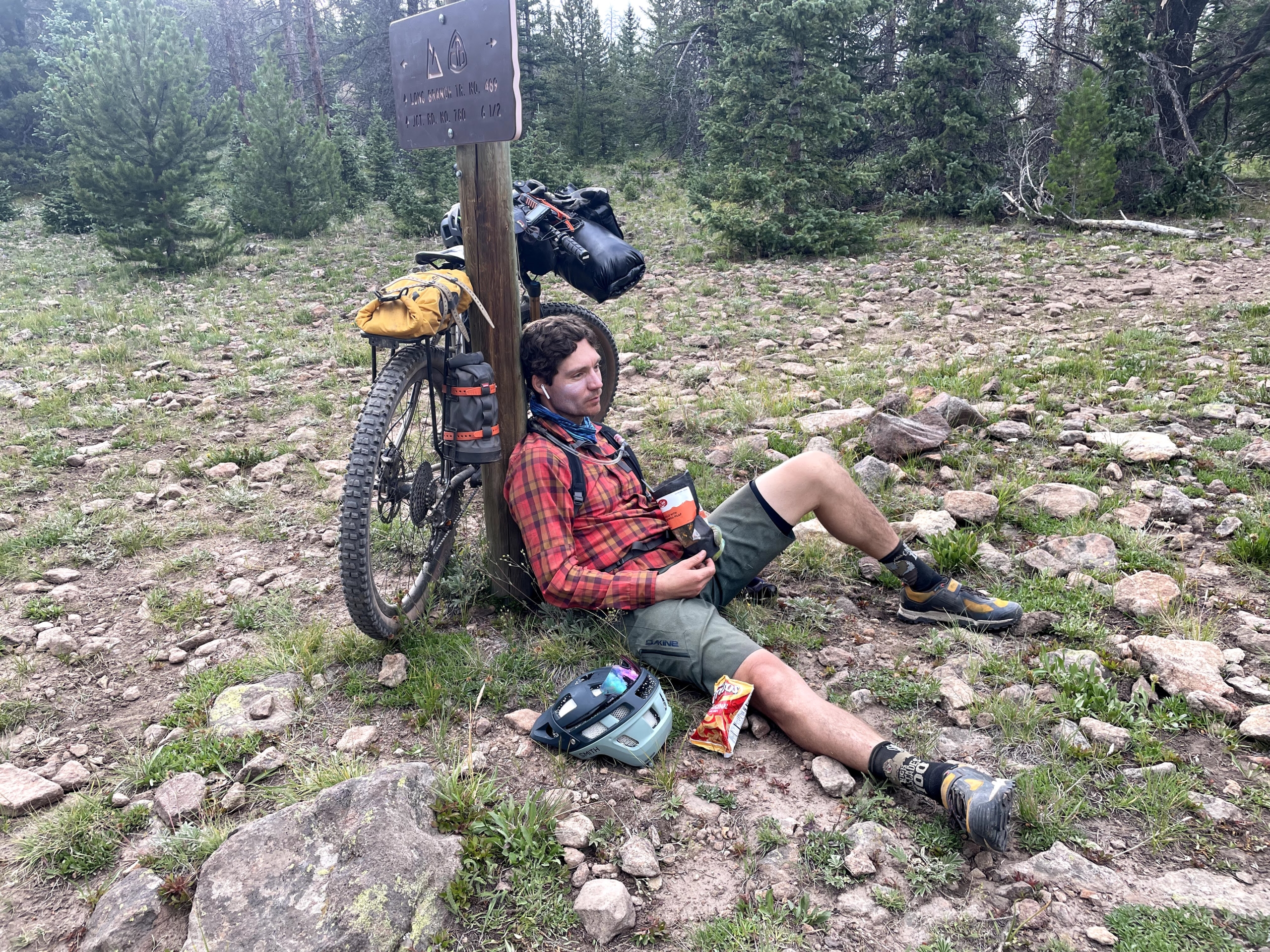
In between, eat as much as possible, listen to audiobooks when the hike-a-bike gets soul-crushing, stop and talk with as many thru-hikers as possible, and keep eating (always).
Want the real details? Read on.
By the way, dig these kinds of posts? Sign up for the free 2x/month Traipsing About newsletter for more tales from the mountains and creative challenges like drawing and piano when I’m off the bike.
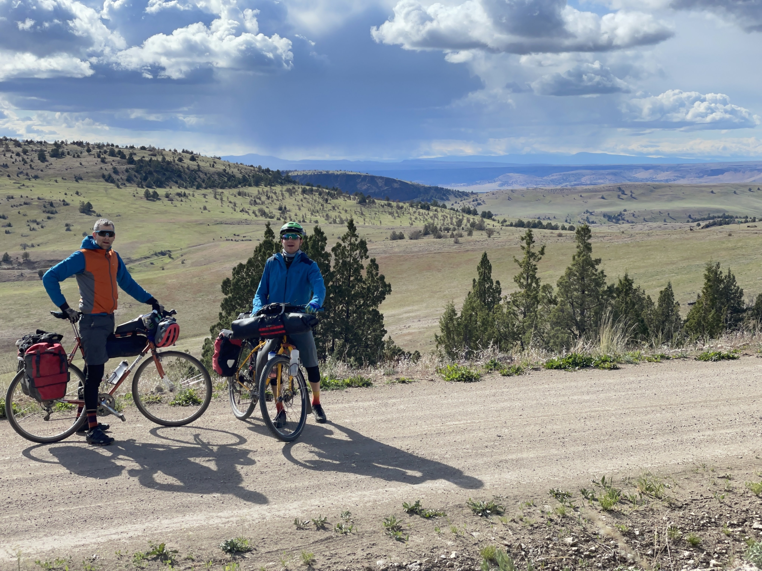
(Real) Day 1: Waterton
Unless you’re already a mountain goat or already live at elevation, your lungs will hurt out of the gate on the Colorado Trail.
Our first two days climb from Denver at 5k’ to 12.5k’ above Frisco. We enjoy occasional downhill moments and plateaus, but generally, we work. I’m immediately glad I swapped my front chain ring out to 26T—unless you have thunder cannons for quads, do it! Loaded bikes are heavy, treat your knees nicely.
My first Colorado Trail surprise is the sheer number of thru-hikers. We pass SO many. The Colorado Trail Foundation estimates 600 hikers will complete it in 2021, 4x the usual.
Chatting with people, we learn the backpackers span all ages and distance traveled per day. Everyone on their own journey, with different experiences and fitness and goals. The majority of hikers are college-age or retired, taking 30-45 days. Compared to bikepacking, it’s another world, a solid chunk of summer spent on trail with rest days and trail families. If it weren’t for so much walking, I might be into it.
My second surprise is my recently-serviced seat dropper post. It worked fine before I put it in the box in Oregon, but refuses to pop back up on trail. *sigh* I finagle a solution to keep it fixed in place.

Our inaugural thunderstorm booms overhead when we meet Jay, a Colorado Trail racer. He’s looking rough thanks to a wreck, blood seeping through bandages. Sounds like the CTR racers got their butts kicked with three days straight of pounding rain out of Durango. We trade beta and commiserate, three guys in the woods looking for adventure. We’ve got it, in some form at least.
At our first bypass around wilderness, we chat with another CTR racer who sounds ready to sell his bike and embrace playing Fortnite instead. “Seven major thunderstorms, I counted.”
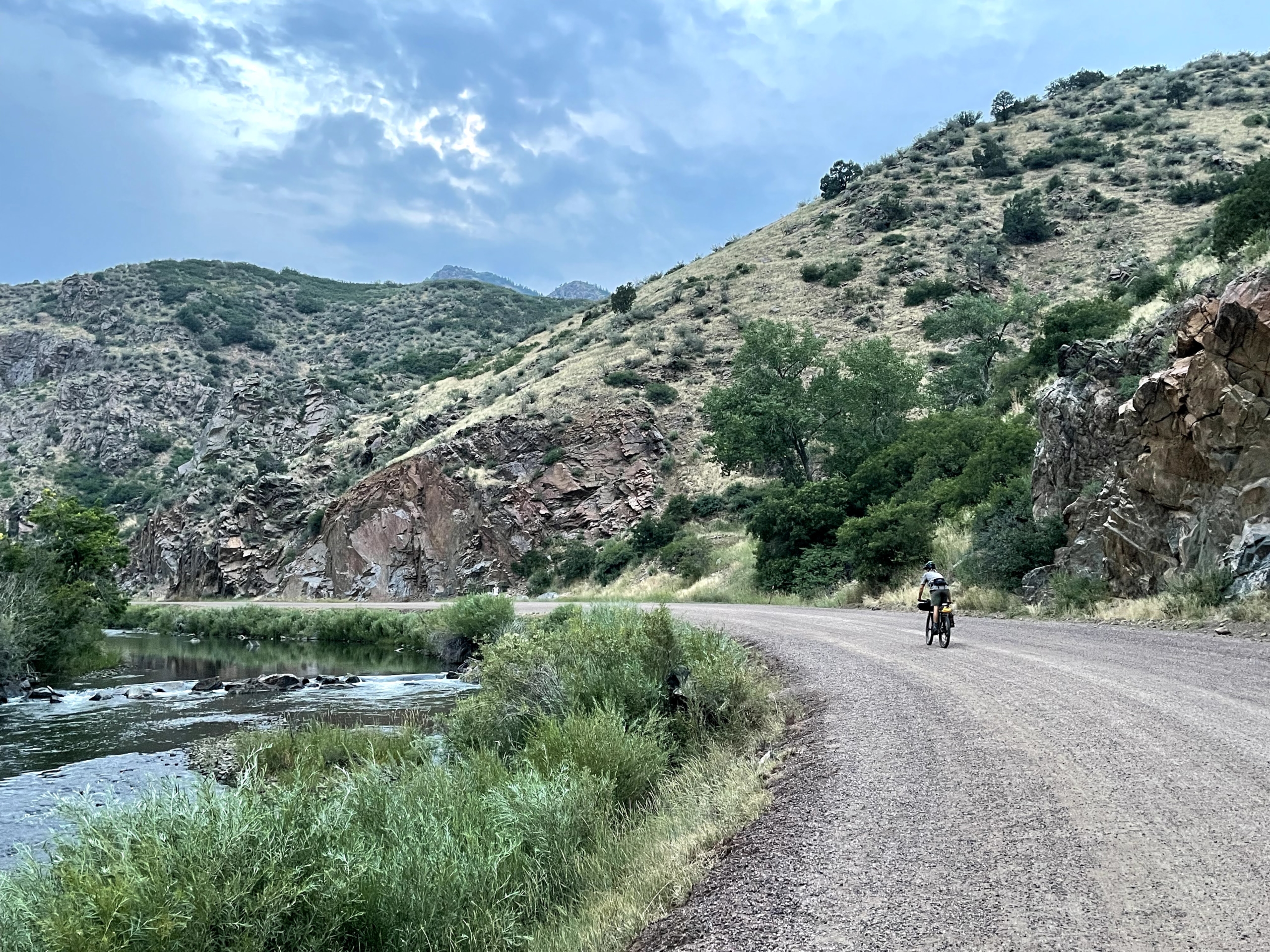
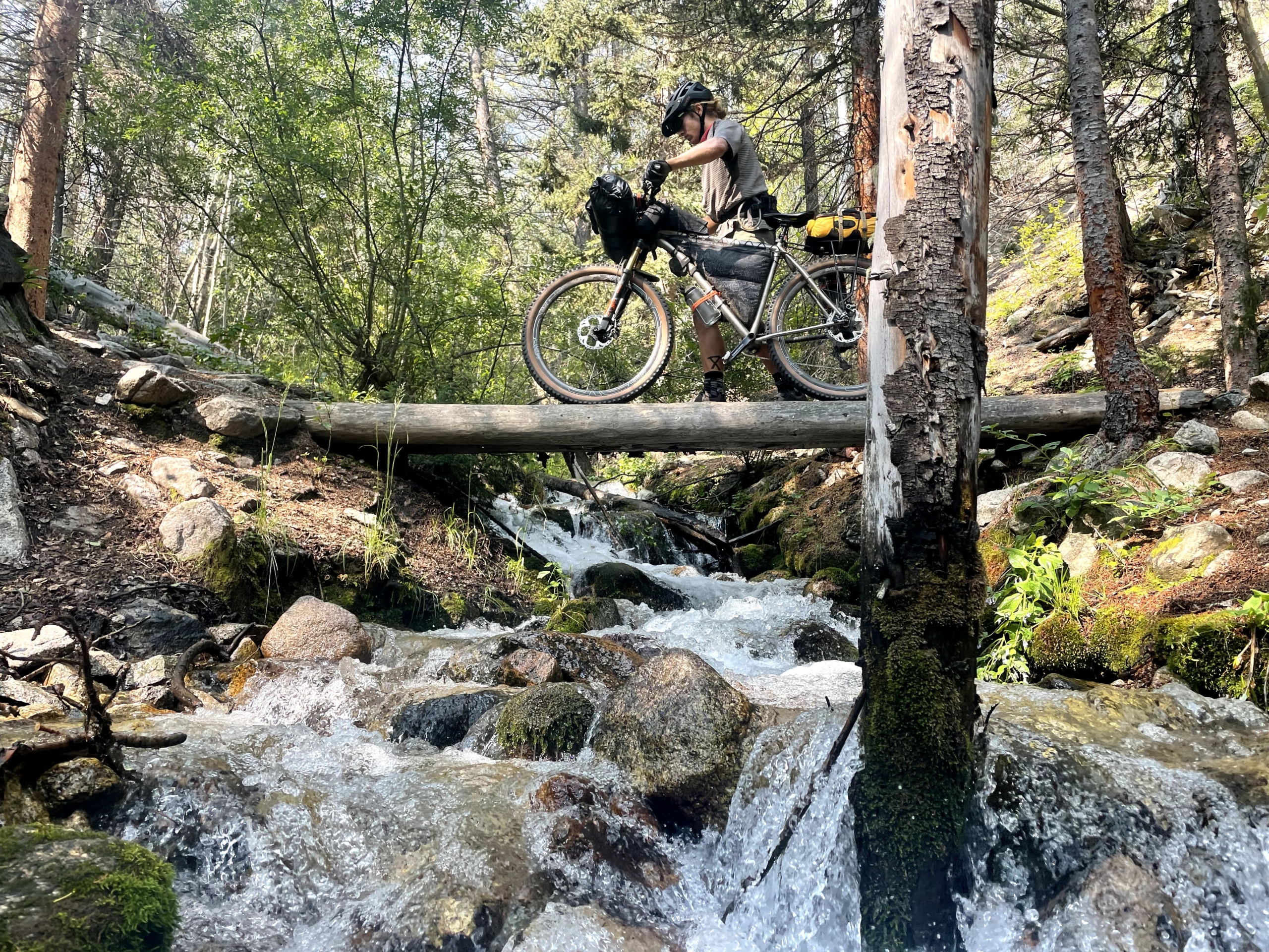
The Lost Creek detour proves to be an undulating, soft fire road. Rain spits from the gray sky, but the Bikepacking Gods keep the intensity dial below pouring.
To celebrate our first day on the Colorado Trail, Mason loses his phone at the end of a lonnnng descent. Dark:30 is incoming, plus we’re tired and low on water. I convince him to pedal back up and he miraculously finds the phone.
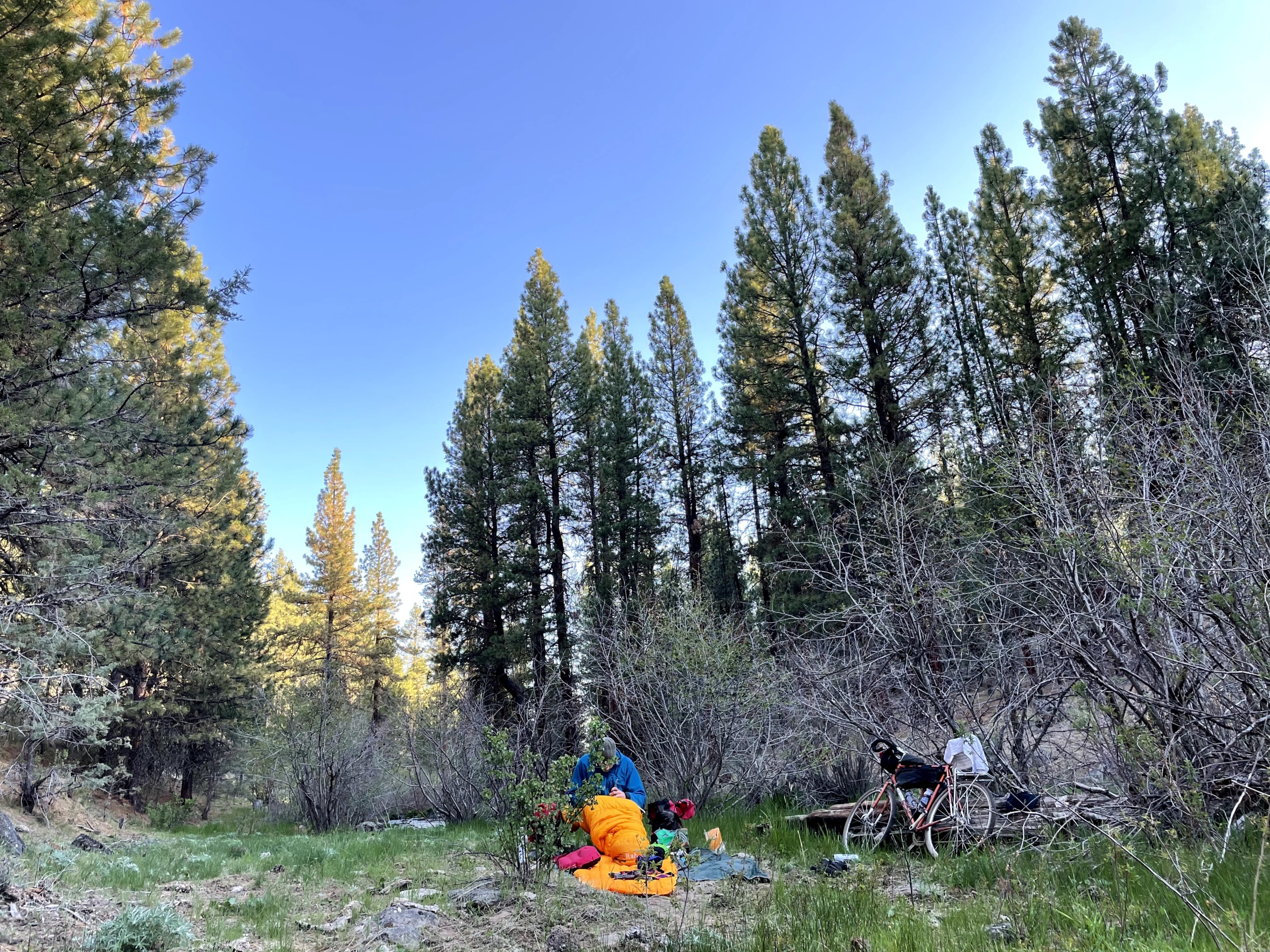
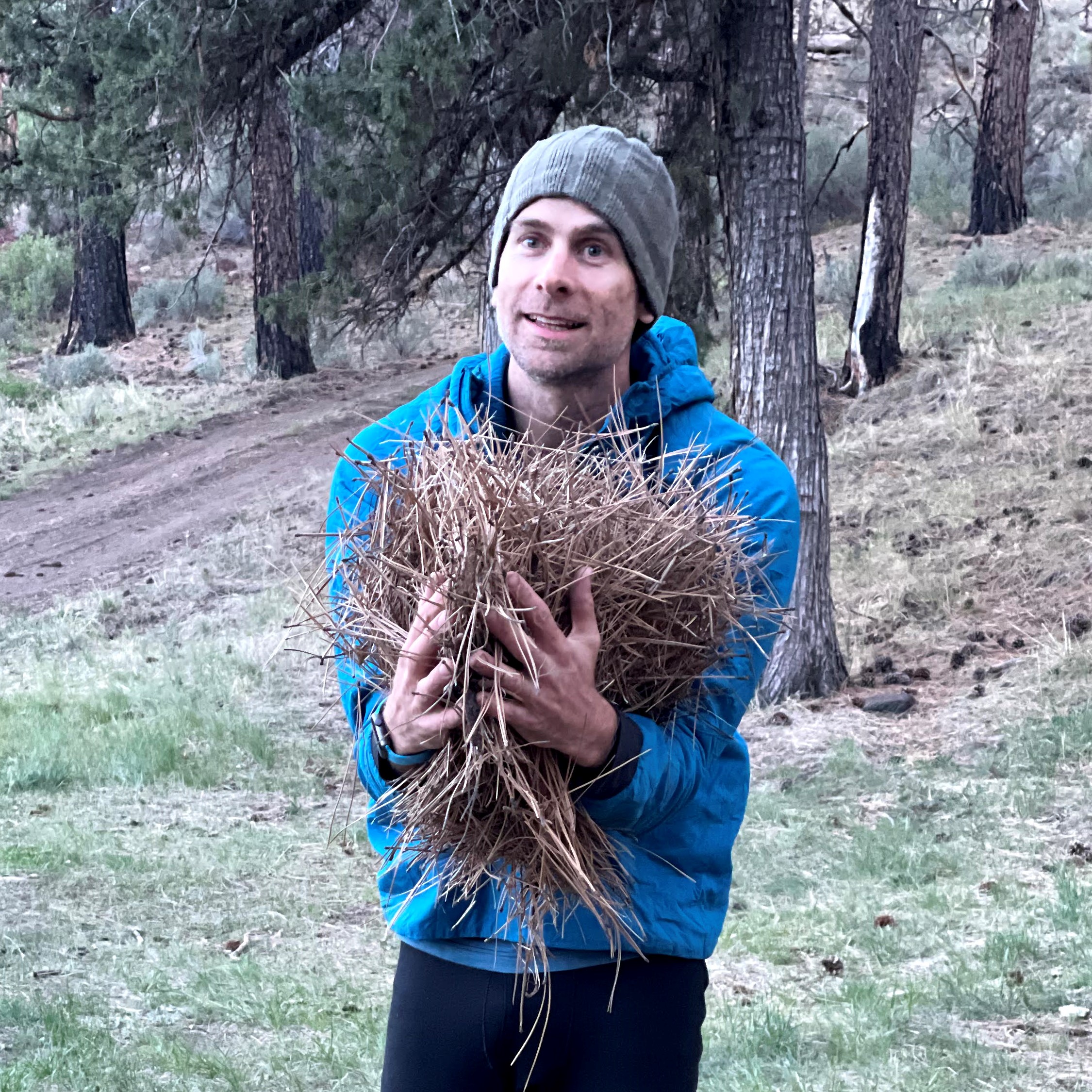
It’s almost dark and I’m shivering, body heat gone. We descend a mile and YES there’s a random stream with a perfect camping spot. I don all my clothing, pitch the tent, chug water, gobble down a freeze-dried meal, and get in my sleeping bag RIGHT before the skies open up. We drift off to raindrops smacking the tent.
Day 2, Tarryall detour to Kenosha Pass
We rise to soaked gear, but at least the rain has stopped. It’s a fresh day and more bicycling awaits!
Turns out the Tarryall traverse is steep climbs and descents, repeated forever. A couple miles in, we pass a father-son duo about to kick off day 3. They’ve under-estimated the trail and are bailing. “We’re playing golf in Breckenridge tomorrow. This trail is HARD.”
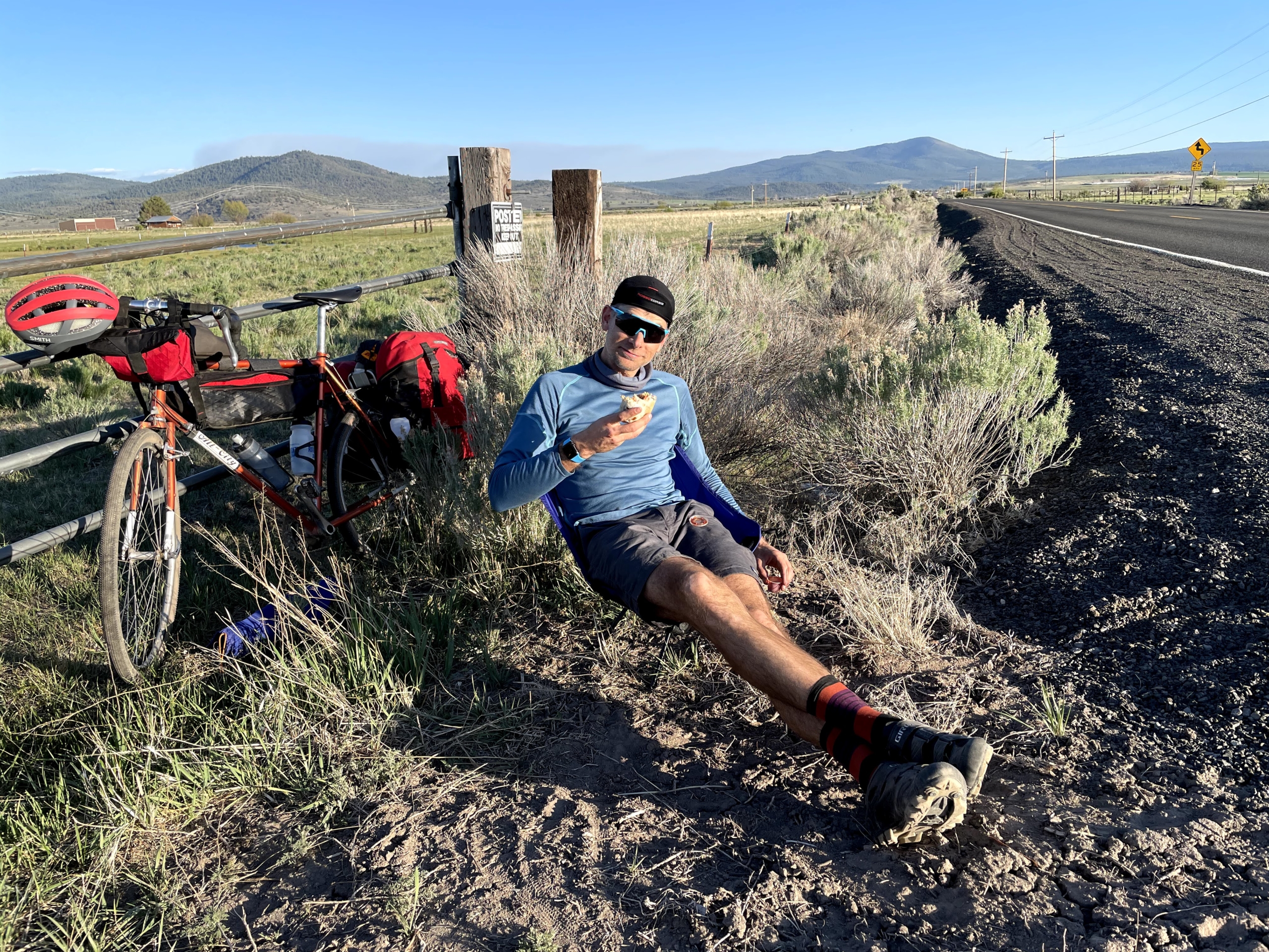
At Goose Creek campground, we chat with the friendly camp hosts as their giant tom cat plays in the brush. Our lunch wrap is vegan Violife cheese, Primal jerky, hot sauce and spinach. We’re living the good life out here!
And yet (small) wheels are threatening to come off: while drying my wet socks, I lose one on a descent. NOOOO. Rookie mistake. Second issue: my water filter is already slowing down to a trickle. WTF, it worked at home.
We hit pavement and push on into a headwind. Hours later, Mason’s enthusiasm jumps back to 10/10 when we reach the Stagecoach Saloon, which features a solid selection of snacks. We restock on super healthy options junk food. Stagecoach is our only food stop for the 150 miles between Denver and Frisco.
Another hour of fire road climbing and we’re back on the Colorado Trail. Always-Strong Mason pushes up the final climb as sunset sparks to the west. Over the top, mountain bike amnesia strikes as I descend through waving aspen.
We crash out at Kenosha Pass campground. Two Ibuprofen and ear plugs = blissful sleep.

Day 3, Kenosha Pass to Frisco
We kick things off with a smoky morning climb through sun-dappled aspens. We’d considered bailing on the trip, but an AQI of 175 is only a couple hundred cigarettes per day.
All’s going well, minus the giant hand squeezing my lungs on the long approach to Georgia Pass. Altitude is real and I can’t take deep breaths! We’ve climbed from 5k to 11.8k in 30 hours, so it makes sense.
The descent off the pass is initially fantastic, then devolves into rocky madness near the bottom. I’m a fan of rocky terrain, but this tests me and my loaded bike, especially with a broken dropper post..
Halfway down, we catch a hiker who plods along with headphones in. They must be noise-cancelling because we yell like psychos for two minutes until he hits a switchback and yelps in surprise. Hikers and bikers: one earbud while recreating, please.
Mason and I soak our shirts in a cold creek and chat with a backpacker from Florida. He torched his knees out of the gate with big days and may need to bail on his trip. The CT’s elevation gain is hard on a bike, but I can’t fathom hiking all that downhill. Brutal.
Up and over another steep pass with about 12 seconds of pedaling. Podcast and hike a bike, go! Especially at elevation as our lungs adjust, hiking feels far better than gasping.
MOUNTAIN BIKE AMNESIA. The descent is fast, smooth, all the funzies.
However, we hit Breckenridge and realize it’s NINE miles out of the way to Frisco. All paved bike path, but I quickly decide retracing our route the next day will damage my psyche.
In Frisco, we swing by the post office for a restock that Mason mailed ahead. I pull my favorite trick: not eating enough on days finishing in towns. My energy flat-lines and I barely can drag myself around Whole Foods.
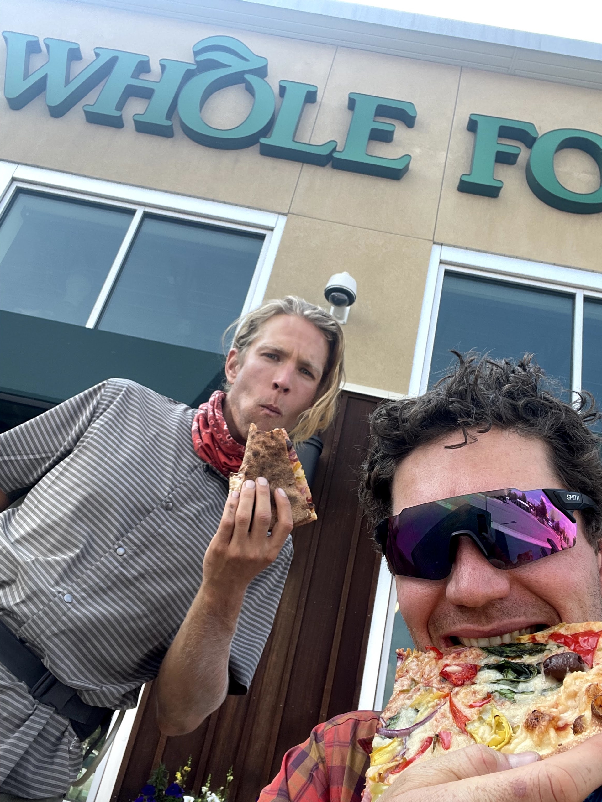
We pass the evening in repose in a hotel, cooking ravioli in the room, eating grapes and cherries, and laughing until we cry at the Coffin Floppers comedy sketch.
The only bad (?) news: Mason’s phone is torched from when he dropped it. He’ll spend the rest of the trip without one, probably the longest period of his life sans-phone.
Day 4, Frisco to past Leadville
We kick things off by fulfilling my goal to not be a purist. Gold Hill segment? Nah. We skip it and pedal the sweet bike path from Frisco to Copper Mountain. Between losing two days to my bike delay and the ominous weather forecast, it makes sense. I’d probably do it anyway.
I’m loaded down with a large bag of cherries, which I donate to the first backpackers I see. It totally makes the day of a fruitarian named Jay.

The usual pass protocol: pedal interspersed with hike-a-bike. I’m huffing my way uphill when another fun moment occurs: “Hey, are you Dakota? I follow your newsletter!” It’s a woman and her husband out for a hike. Small world!
The weather forecast remains true and threatening clouds amass to the west. They aren’t THAT bad though… We push on while keeping an eye on bail-out options in the trees down the slope. Then we’re over the false summit and above the treeline. Keep moving! We move fast and don’t eat enough, but manage to avoid getting zapped.
Halfway down the screamer descent, rain hits. We take advantage and pause to eat trail burritos and animal crackers.
It’s a solid push to Leadville, but we arrive in time to mow down giant burrito combo platters. Then we push on, another 10 miles of fire road before crashing for the night by a lovely stream.
Day 5, Twin Lakes to Buena Vista
We rise and immediately ride past a sign proclaiming “no camping within 100’ of water.” Whoops. We were good tenants, don’t worry.
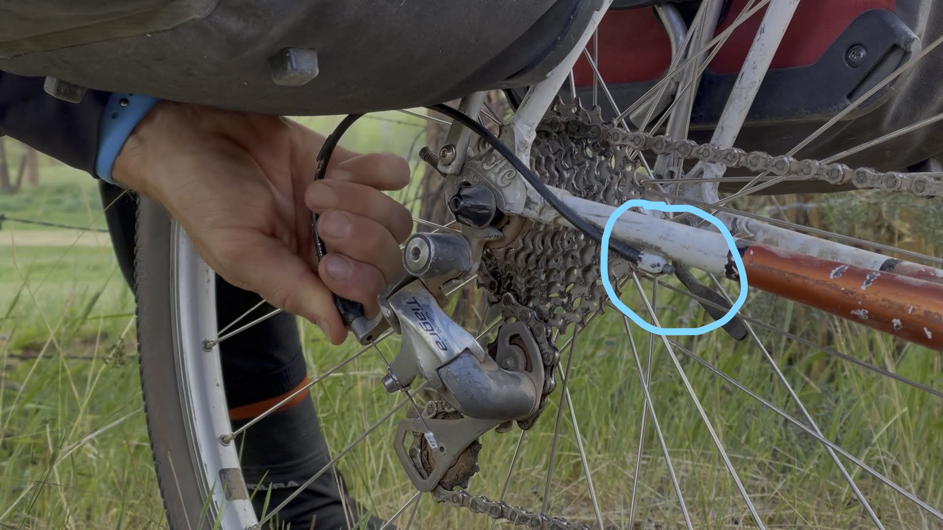
The smoke hangs heavy, toeing 200 AQI. Playing piano is less taxing on the system, methinks. Mason’s bike rebels against the terrible air by jettisoning its chainring. No big deal, it’s only required to pedal. Somehow, he MacGyvers a genius combination of tools to get it tight enough to get to Buena Vista.
Hours later, we trade beta with three stoked bikepackers from California northbound on the CT. The exuberant sharing of trail details and what’s to come is a fabulous aspect of any travel, but especially outdoor adventures. They also give us Oreos, so maybe I’m biased.
It’s one of our easiest days, helped by utterly fabulous tailwinds on the pavement into Buena Vista. On a slight downhill slope, we rip along for 20 glorious miles with barely a pedal stroke except to change leg position.
Buena (be-oona) Vista is a little town with a chill vibe. The post office is closed, but we planned ahead and scoop up a box we mailed ahead to someone on Warmshowers.
Once again, I make the cardinal error of not eating immediately when getting to a town. Instead, I buy a new, unclogged water filter and get my dropper post fixed at Boneshaker Cycles, a top-notch bike shop. Eventually, I Zombie-stagger my way across the street to get food.
We follow a pro tip on a camp spot and head out of town 10 miles. The smoke hangs heavy in the air and the headwind sucks. Thank god for sleep or bikepacking might feel impossible sometimes. How the ultra-endurance racers push on and on and on is beyond me.
We rinse off in an ice cold creek and crash. Halfway done with the Colorado Trail!
Day 6 – Buena Vista to Monarch
A hard day. My memories are mostly steep, unrideable uphills—like, why-is-my-bike-over-my-head steep. Our one big downhill is on pavement into Princeton Hot Springs. Sigh. Can’t win them all.
Mason hates it enough to cut off his shirt sleeves at a lunch stop. He’s officially a punk bikepacker. We channel the anguish and push on.
A couple of bikepackers in their late 60’s tell us how they figured out their lackadaisical trip pace. “I don’t have anywhere to be until ski season,” one quips. The retired life!
Sunset approaches and we’re pedaling up the Highway 50 bypass to Monarch Crest. Sunday night traffic suuucks. I’m d-o-n-e. We have no idea where we’re camping and 1.5 more hours of climbing with trucks whipping by sounds suboptimal. Anyone want to buy a cheap bike?
Suddenly, a beacon of hope appears. What is The Butterfly House?! Why, a donation-based respite for weary travelers! The proprietor is out of town—how cool is this place—so we make ourselves at home per the sign on the door. We score showers and do laundry, chat with the handful of backpackers staying there, and feel like humans again.
The quote of the day is from a backpacker named Alex, who asks us, “So, how many times a day do you wreck, 1-2?” HAAAA. If I wreck 1-2 times a year, I’m doing something very wrong. Thru hikers officially think we’re insane.

Day 7, Butterfly to Sargants Mesa
We barely peel ourselves away from Butterfly Hostel. A rest day doesn’t sound bad… My legs immediately agree once we resume pedaling up toward Monarch Crest. All good—it’s a beautiful morning, traffic is light, and we’re heading into a fabulous section of the CT.
The Monarch Crest general store revives my spirits with mind-blowing junk food options and cheery employees. Still, when Fritos improve one’s mood, the loony bin isn’t far away.
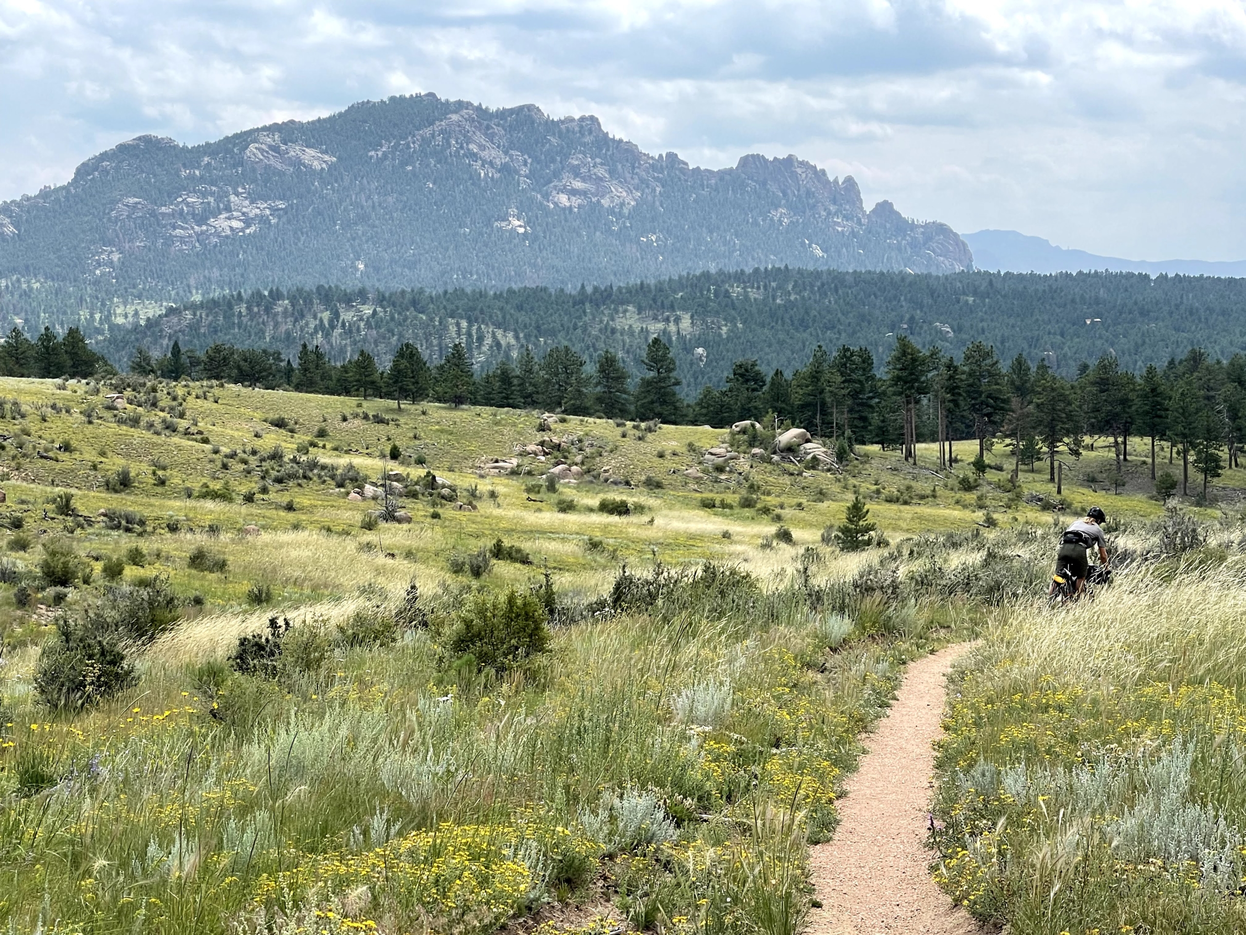
Monarch Crest trail delivers. Even the uphill pedaling is fun, with views unfolding until the smoky air diffuses them. Pro tip: skip the Ten Mile hike-a-bike and pedal the road. Thank me later.
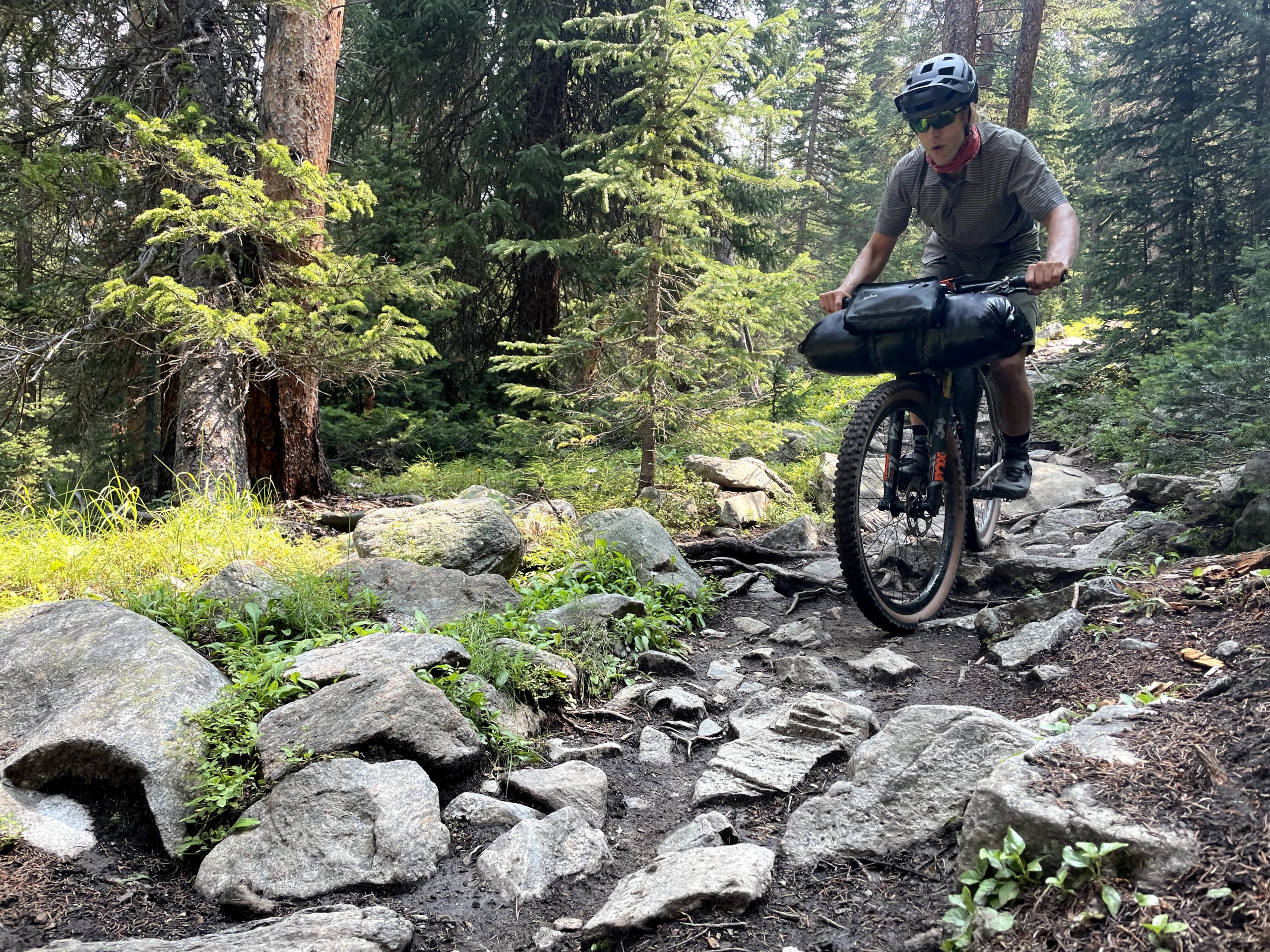
We descend, climb, the usual. It’s subtly difficult rocky terrain and the elevation is real.
However, we’ve arrived at the most-maligned section of the Colorado Trail, the dreaded Sargent’s Mesa. Descriptions of this zone are either very short or laced with expletives.
Yup, it’s rocky. Unrideable uphills and annoying bumpy flat sections aren’t fun, thought not as bad as expected. The downhills are rowdy as hell, but rideable and fun for us. (Glad I got my dropper post fixed.)
Still, somehow I screw up fueling and my energy feels like dog poo. Too much sugar after the bonanza at Monarch Crest, methinks. I flop on my back on the tent footprint and try to revive my appetite. Each day on the trail is so similar and yet so different, elation easily switching places with, shall we say, less positive emotions.
We push on into sunset, striving for Razor Creek. My energy levels and enthusiasm scrape the depths. Tomorrow, I shall eat less sugar. A descent in the dark, headlamps blazing, brings us to the trickle of water. We pitch the tent in an (almost) flat field and slip downhill into the foot of the tent 25 times an hour that night. It’s not restful.
Day 8, Sargents to Cathedral Cabins
A cold morning wrapped in all our gear, rain pants included. The air is clear and crisp, the nagging smoke moving north for a bit.
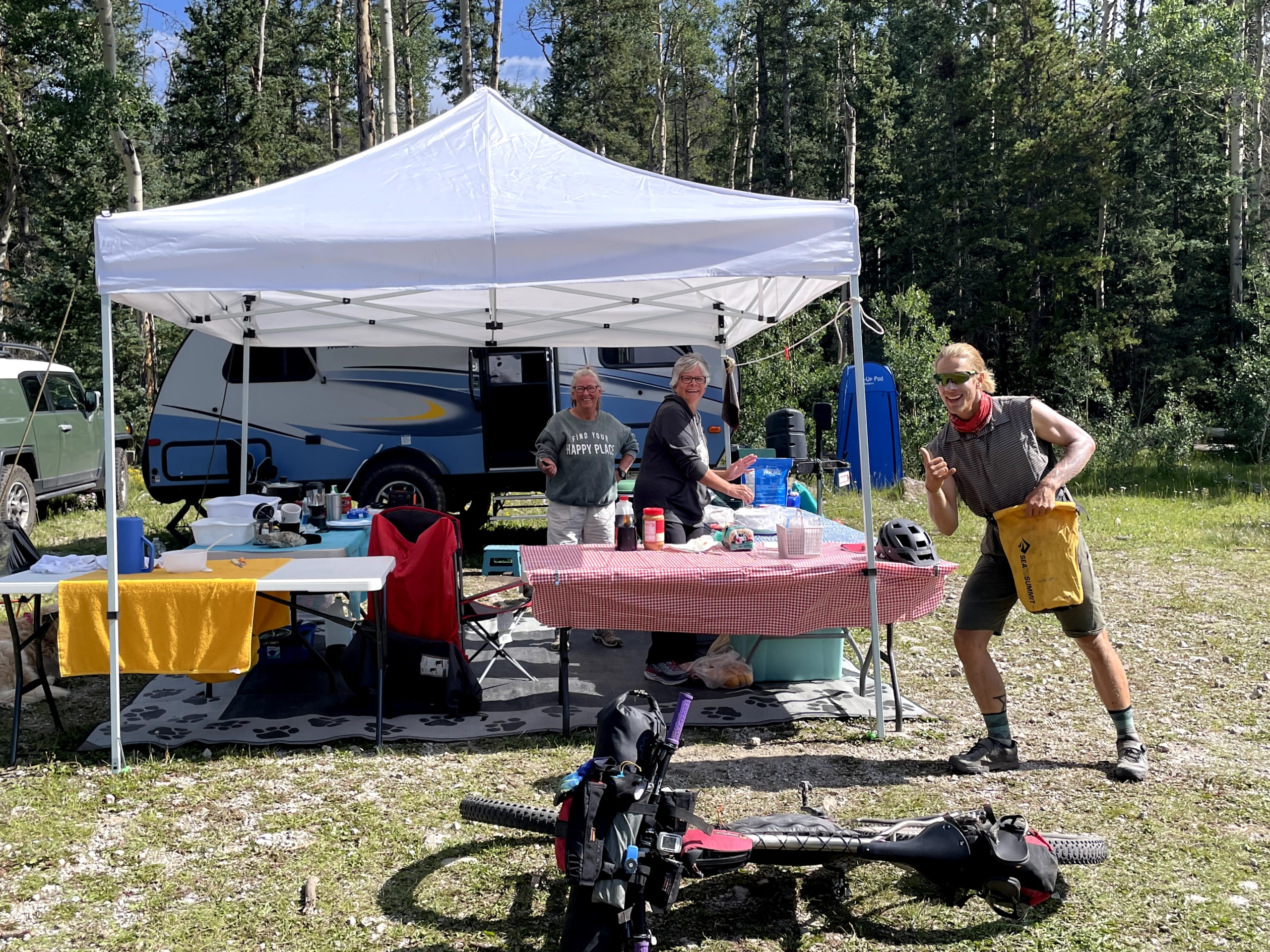
Traill magic! Two cheery ladies are cooking pancakes out of their Airstream. “We had 17 people camp in that field last night,” they proudly announce. We roll on with a heads-up that a guy named Eric needs grub—with a restock coming up for us, we give him two freeze-dried meals and pistachios. The backpackers have 10 days between restocks in this section, ouch.
A professional trail angel, Apple, is up next. He leaves broiling Cincinnati every summer to come stay in Gunnison, where he drives out to the CT and sets up a trail angel station from 8-5 every day, chatting away the hours with travelers.

The fire road bypass around wilderness at mile 361 is long and hot. Maybe I’m just mad because a freeze-dried meal with turmeric spilled in my frame bag and some of my possessions now feature yellow splotches?
We grind out the fire road, up a beautiful valley toward the pass. Sun. More sun. Audiobook territory.
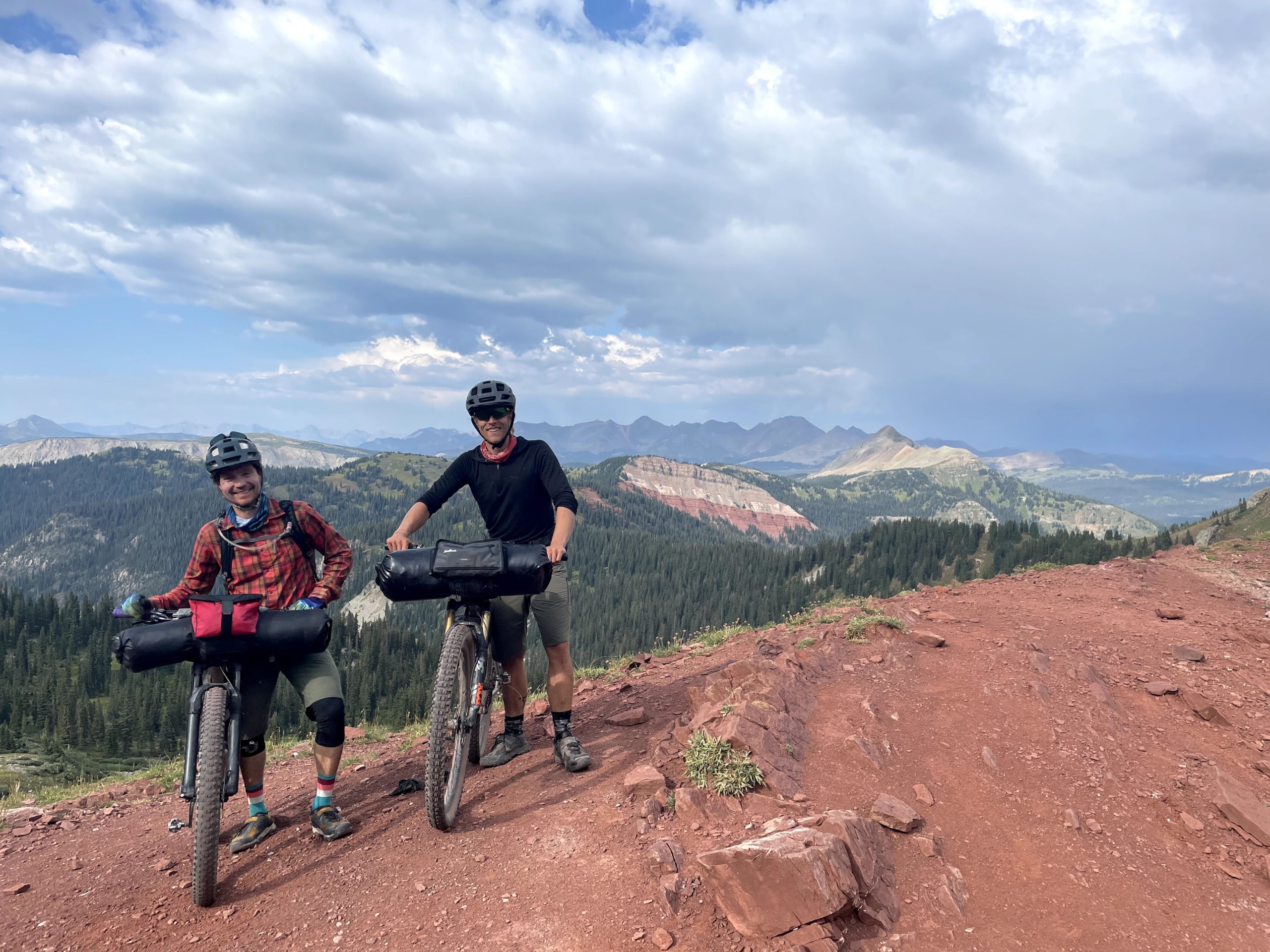
But whatever! A looong descent on the other side erases the hard work from our memory banks and drops us right at our destination for the evening: CATHEDRAL CABINS.
I capitalize CATHEDRAL CABINS because it’s a trip highlight. Cute cabins nestled back in a side valley, moose stomping by in the meadow, a box of food we mailed ahead, and tons of tasty snacks available for purchase. Bikepackers: if you don’t stop here, you’ve made a grave mistake!
We spend a fabulous evening joking around with three other bikepackers and the cheery, friendly owners.
Day 9, Cathedral past CT high point
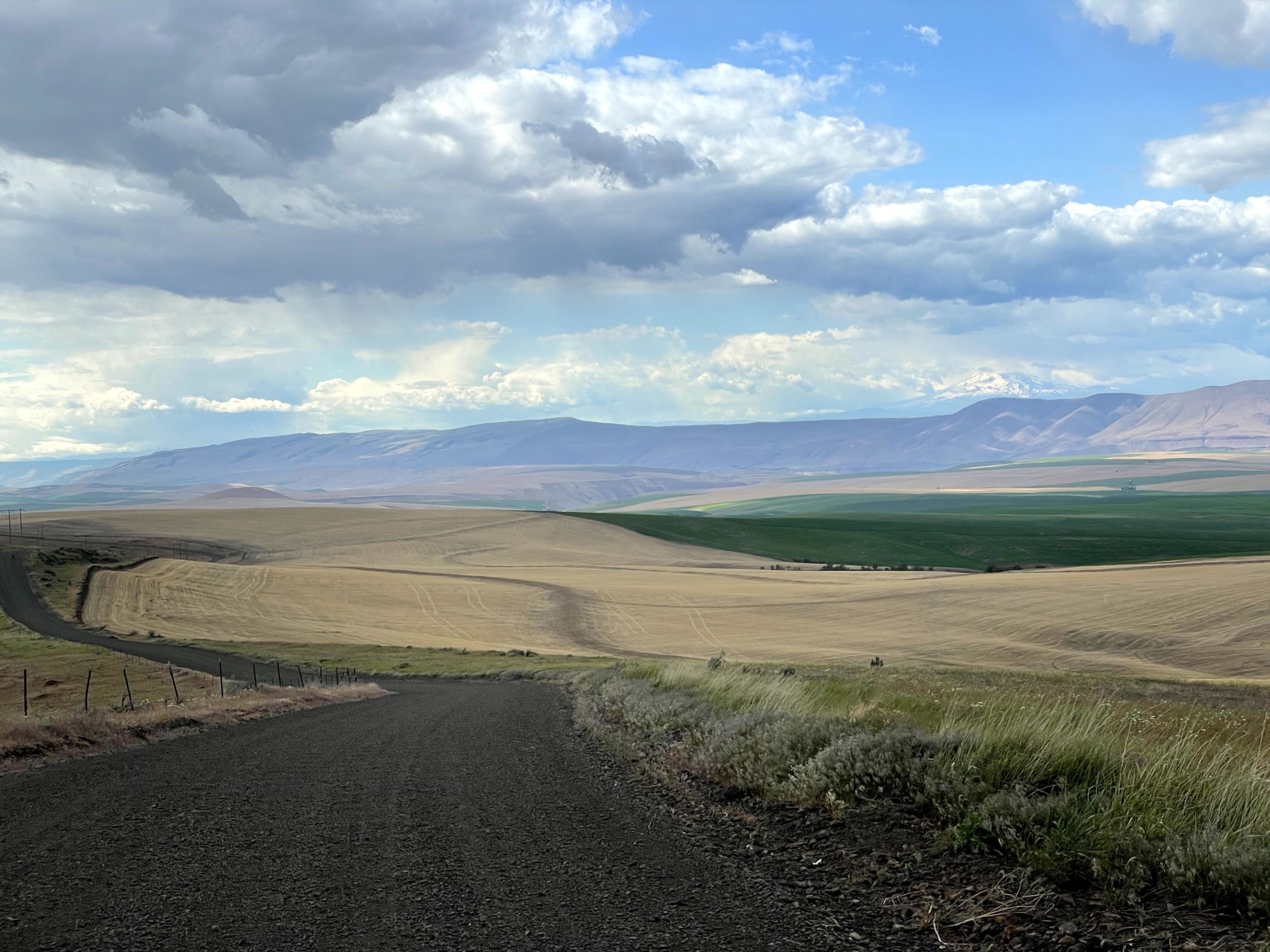
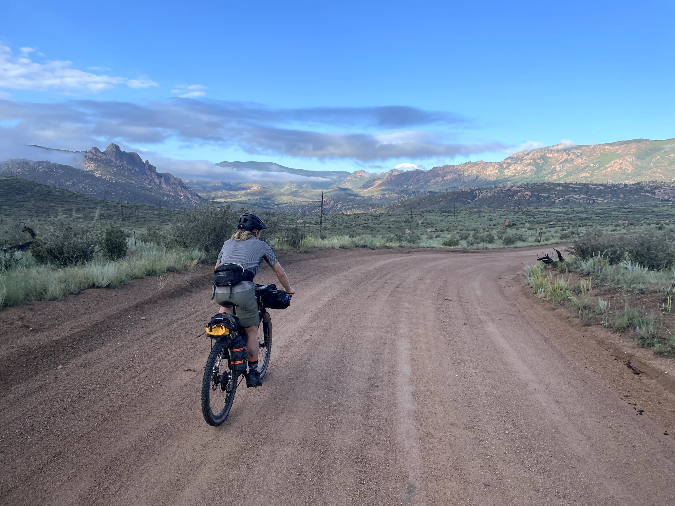
Since all nice things must end, we uproot from Cathedral and push on. Low-grade climbing allll morning on a gravel road, friendly ranchers cruising past in their trucks.
Pavement riding isn’t my thing, but Slumgullion Pass is a fantastic name. We aim for the sound barrier on the descent and almost crack 50 mph.
The kindness of strangers on the CT amazes me. We’re eating lunch by the side of the highway when a lady driving a truck slows down to ask if we need anything. She’s got four grungy backpackers in the back. Later we learn that she runs a volunteer shuttle from Lake City all the way up to the trail and back every day to help backpackers with resupplies.
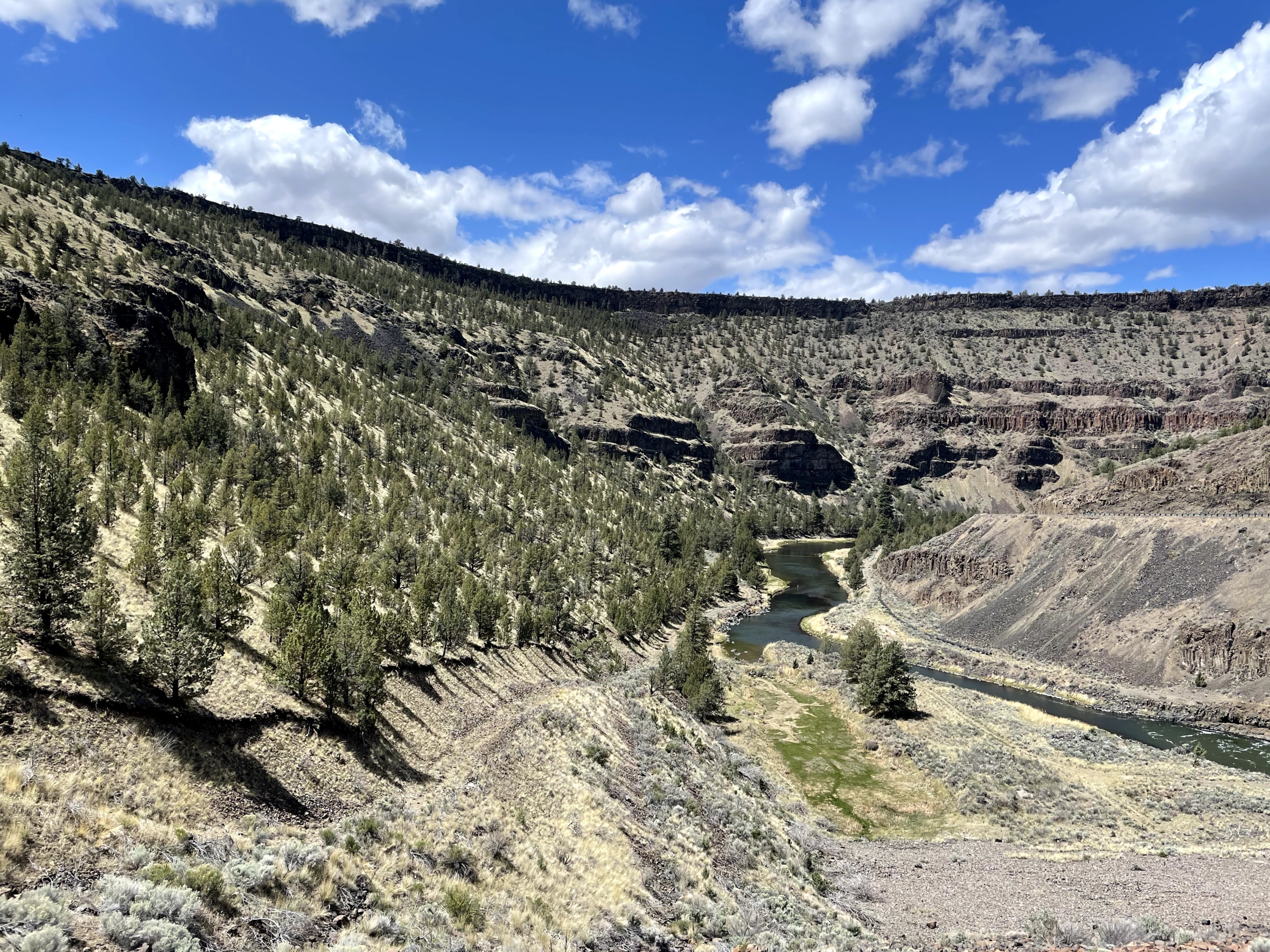
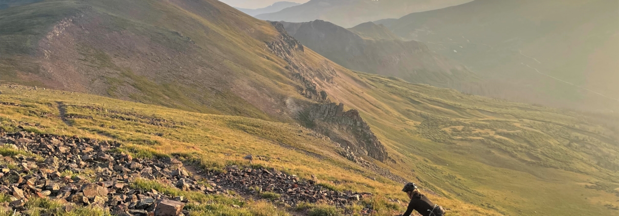
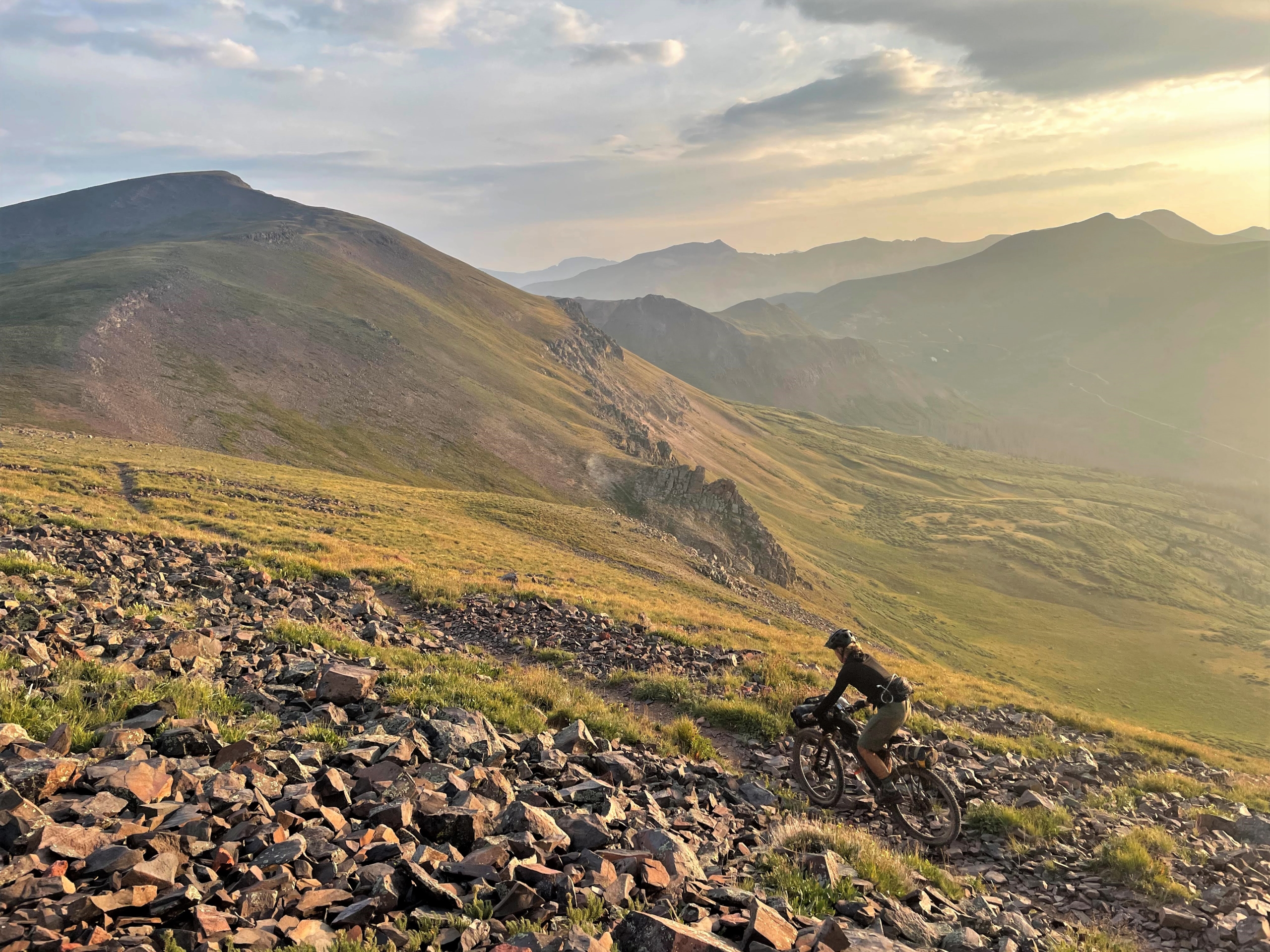
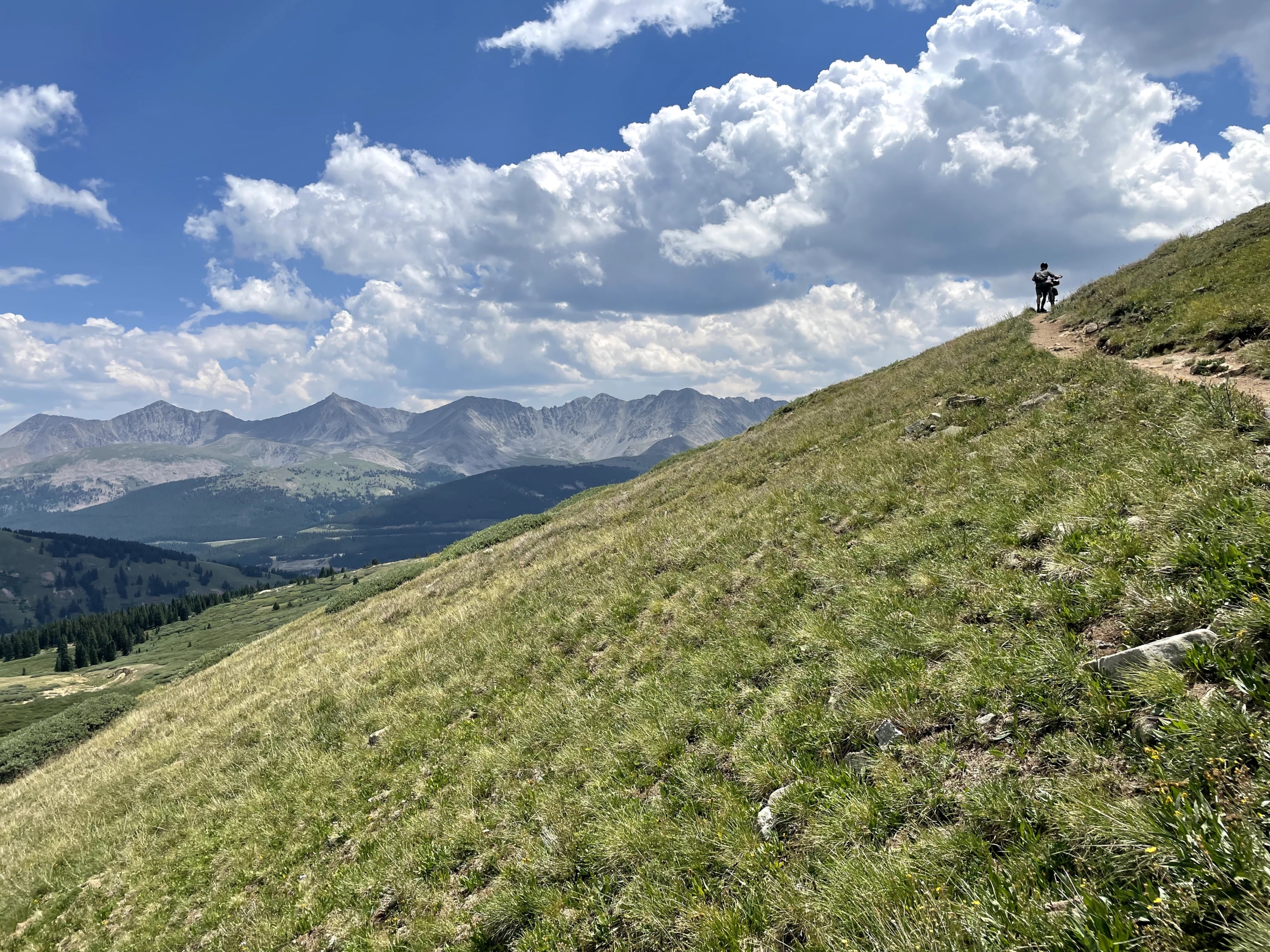
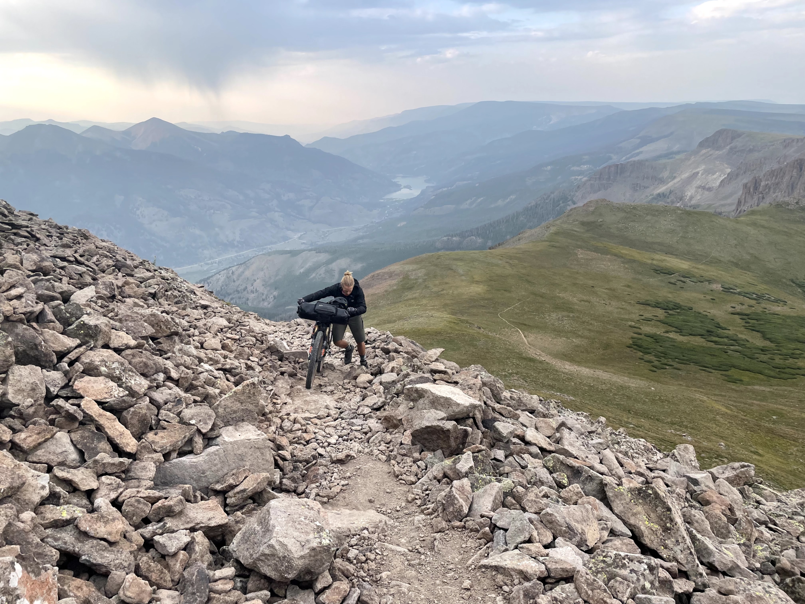
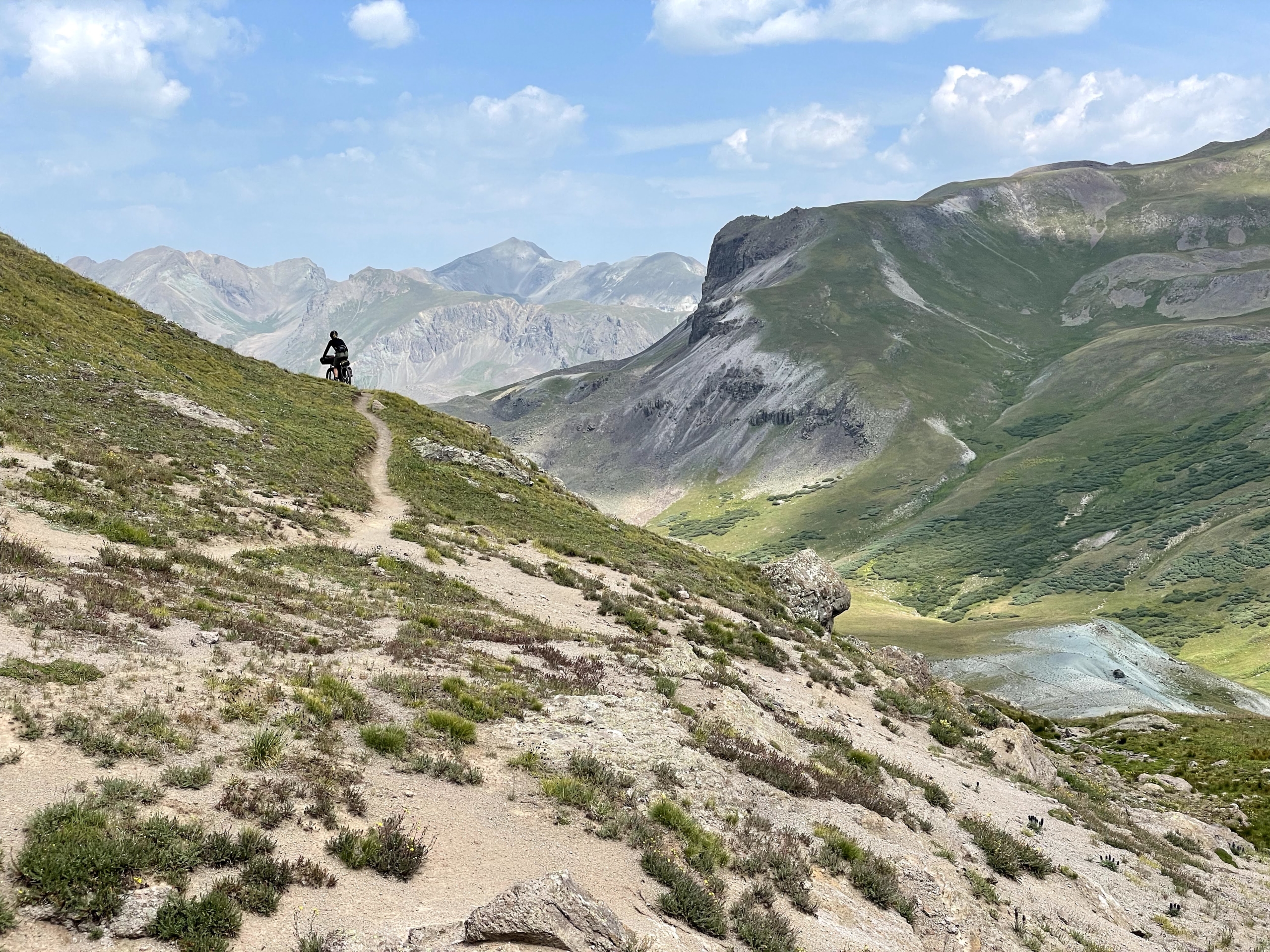
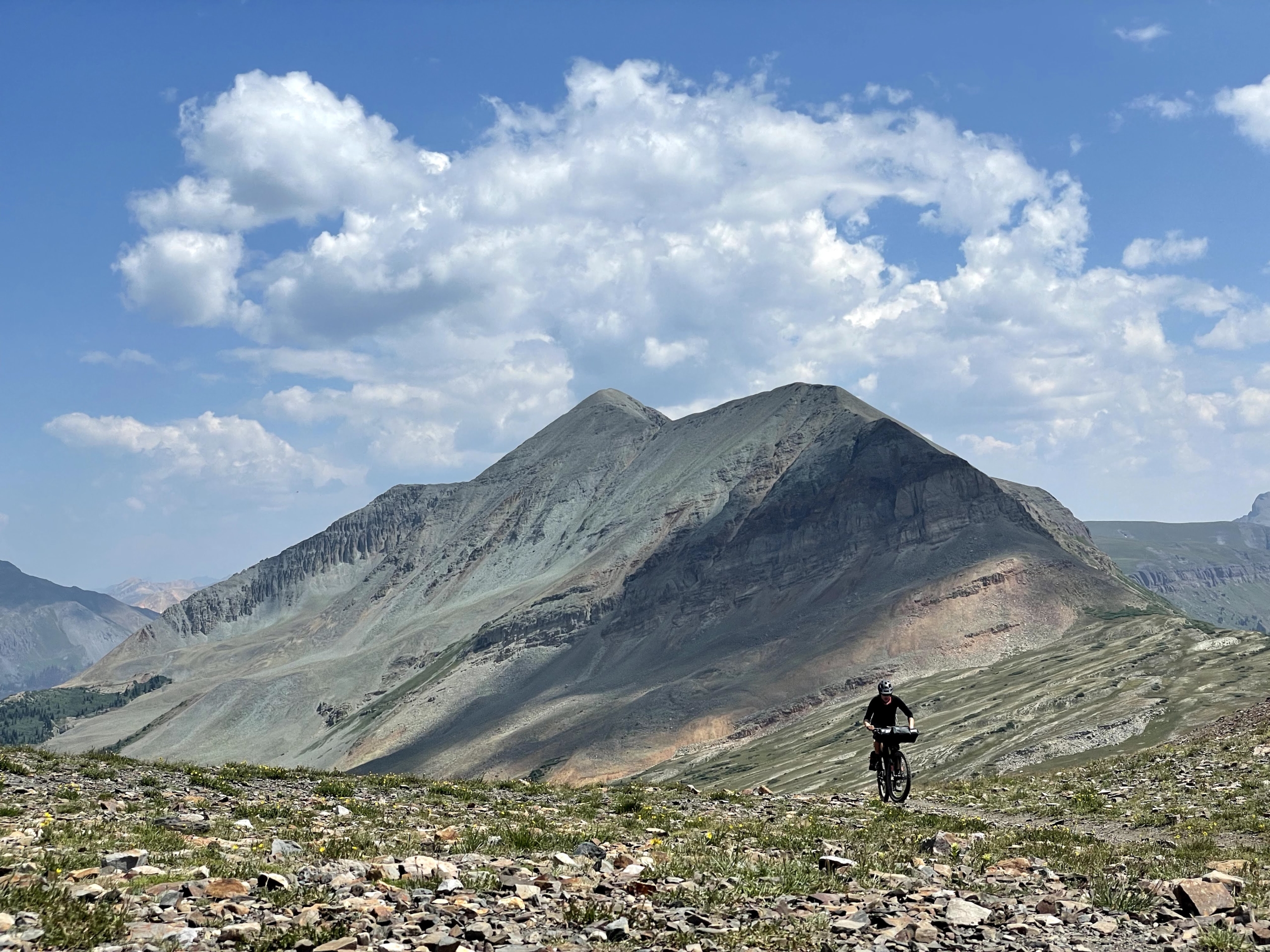
Sadly, there’s no shuttle for the next section, a steep, rocky climb off Spring Creek Pass. We play hopscotch with backpackers, pushing our bikes and even occasionally pedaling. At least the views are stunning—the Colorado Trail’s beauty amplifies as it unfolds from Denver.
At a water stop, we meet a family of four backpacking the CT for three months. The kids are just 8 and 10! What a summer.
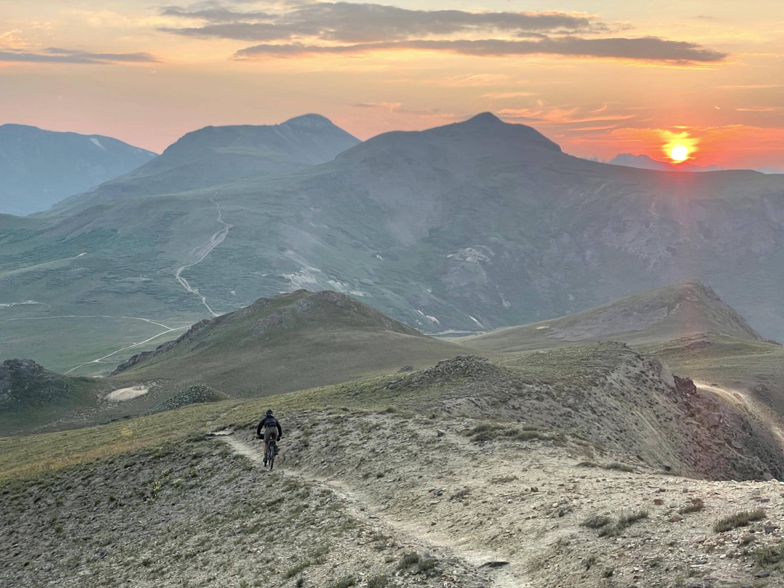
Rather than stopping at 5 p.m., we decide to push on (literally) over the CT’s high point. It’s another three hours of hike-a-bike as we ascend to 13,200’. At one point, I’m wrestling my bike up a ridiculous switchback as the sky drips warning rain…and then it clears.
Instead, we’re served a delicious evening dessert of sunset views. The smoke merely deepens the reddish hues. The descent ain’t bad either.
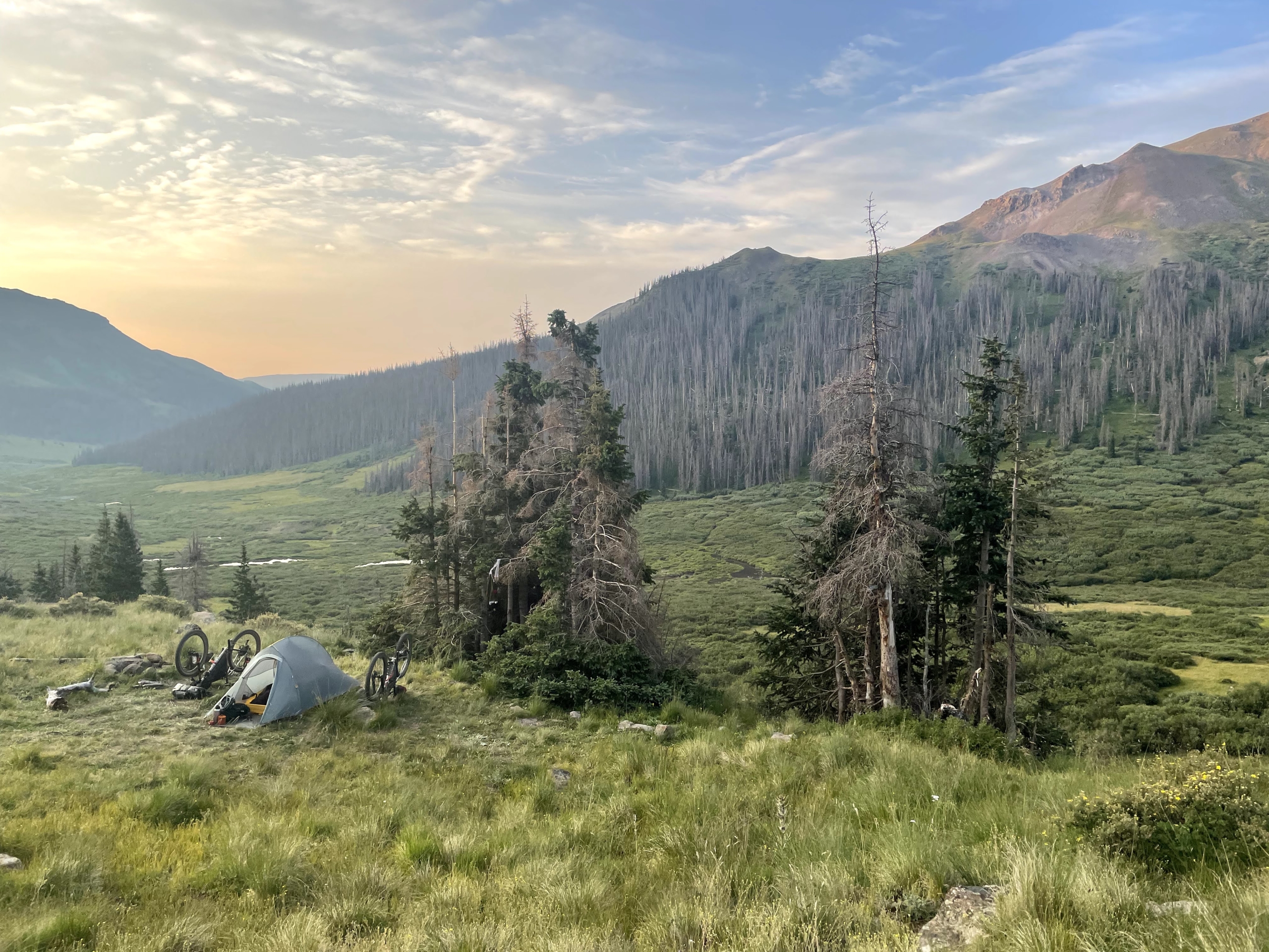
We dry camp at 12k’ overlooking a pretty valley. Another splendid day on the CT, even if we’re face-plant exhausted.
Day 10, to Silverton
Did I say exhausted? NOW we’re exhausted. We both feel slammed this morning; are we dragging chunks of steel behind our bikes?
Chalk it up to elevation. I haven’t spent much time at 10k+ and spending the night at 12k hurt us.
Thanks to that, we grind. All. Day. Long. Survival mode, a group of hikers with a tour company passing us again and again. Hooray for splendid views because otherwise…dark thoughts.
Luckily, there are marmots squeaking and skittering about. Their enthusiasm is contagious. Life is good.
We go over three 13k passes, up/down/up/up/up. Yegads the views are good, but clearly I am not cut out to be a high-altitude Sherpa.
The huge descent off Stony Pass is less than smooth, but gravity still works. Somehow, a half dozen masochists are driving up the insane road in beaten vehicles—were they new at the bottom?
SILVERTON. A hotel awaits us, but first we mow vegan pizza, tacos and tofu wraps. Food, life’s panacea. I grab a wrap for the road, Mason fixes a nagging flat tire at the excellent little bike shop.
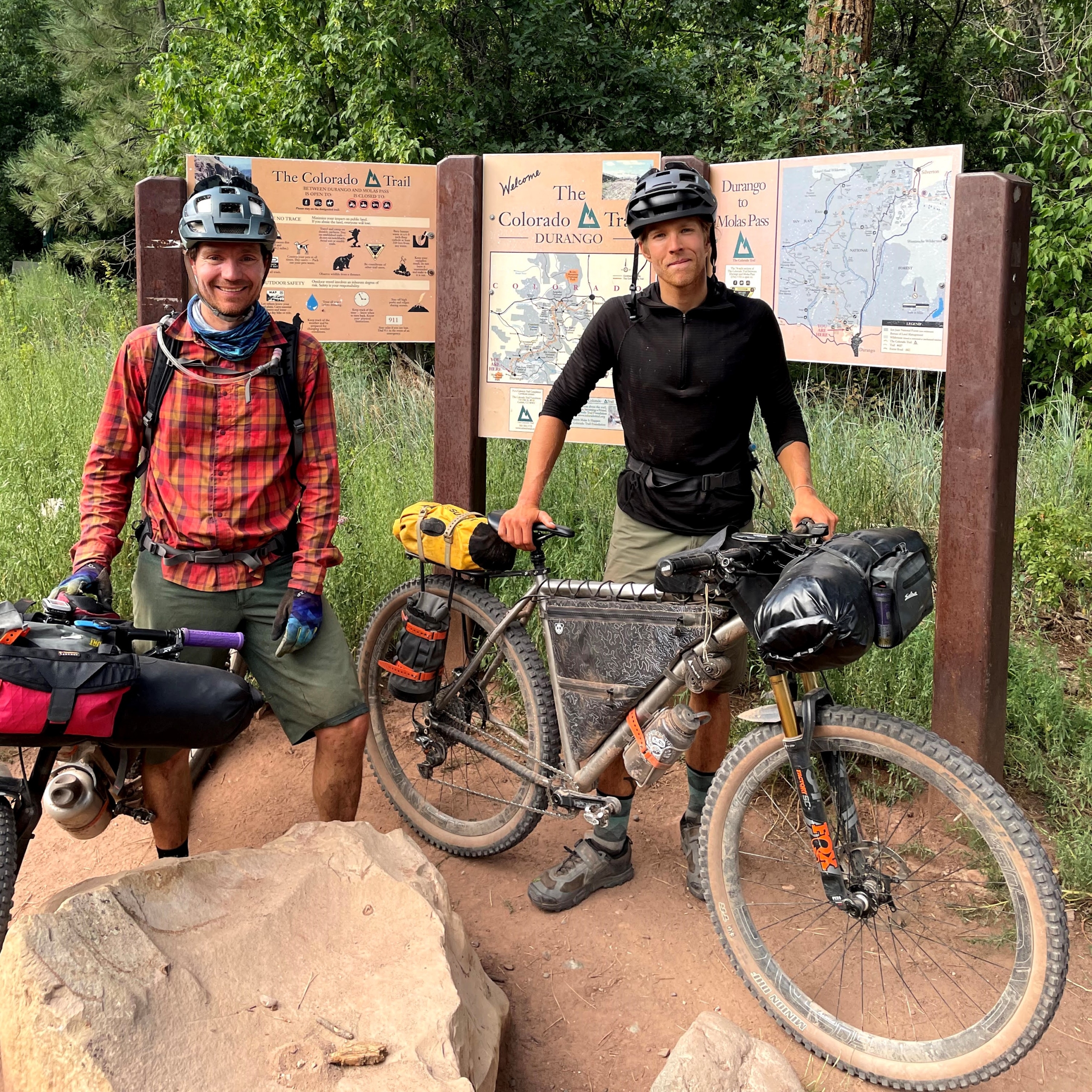
The final push to Durango is all that remains!
Day 11, Silverton to Hotel Draw Road
Two major wins to start the morning: our energy levels are revamped from sleeping at (only) 9k AND our bikes didn’t get stolen from the hotel’s backyard.
We notice immediately that today is different than yesterday…we’re actually pedaling our bikes instead of pushing them. There’s a lovely road climb to Molas Pass, then MORE pedaling on trail. Enthusiasm is high, even if we do spend a few hours pushing our bikes later in the day. (You don’t gain 6800’ in 34 miles just pedaling…)
Also, my tofu wrap from yesterday is the best. Always buy extra to-go food in cities!
It’s a fabulous day. Maybe the best one of the trip? We can’t remember more than a day prior at this point—bike, eat, hike, sleep blends together a bit—so who the hell knows.
Two people highlights from the day: at Blackhawk, we joke around with a Boston couple and Mason donates an extra Food for the Sole freeze-dried meal to their cause. Hey, they’re vegan too! There’s almost a spontaneous group hug before COVID awareness stomps the fun.
Another group of backpackers arrives while we’re at the top and compliments us on our passing etiquette. Apparently most bikepackers scare the hell out of hikers? (I’ve done it too.) A reminder to dial it back and be an ambassador out here.
We descend off the pass and stop riding at 6:30 (early for this trip) and lounge about. It’s cool to push to dark, and also rewarding to hang out in a nice campsite and enjoy a little free time.
Day 12, Hotel Draw Road to Durango
No rush today, so we sleep in and roll at 8. Just up the trail, some volunteers for a mtb race that day tell us “coming up you’ve got the best 11-12 miles of trail.”
LIARS. It’s mostly uphill and traversing. WTF. Expectation setting sucks! I prefer to be surprised—good or bad—with what’s ahead.
At a water source, we catch a young rider—he looks like a DH racer— from the Midwest who is 32 days in on the CT. He clearly hates bikepacking, but is sticking with it. If I felt as depressed as he looks, I’d sell my bike for scrap and bail immediately.
Wildflowers show off as we climb to Indian Ridge. No passes can faze us at this point, I think…and then hustle like mad to get off the ridge as weather threatens. We learn later that a bunch of the bike racers got stuck in a massive hail storm and bailed.
Our 6,000 descent into Durango is only briefly punctuated by an overgrown hike-a-bike. Otherwise, it’s downhill for days. My arms and wrists are exhausted from the huge quantities climbing and descending in the past 12 days, but hot food and a hotel await us in Durango.
Parting Thoughts
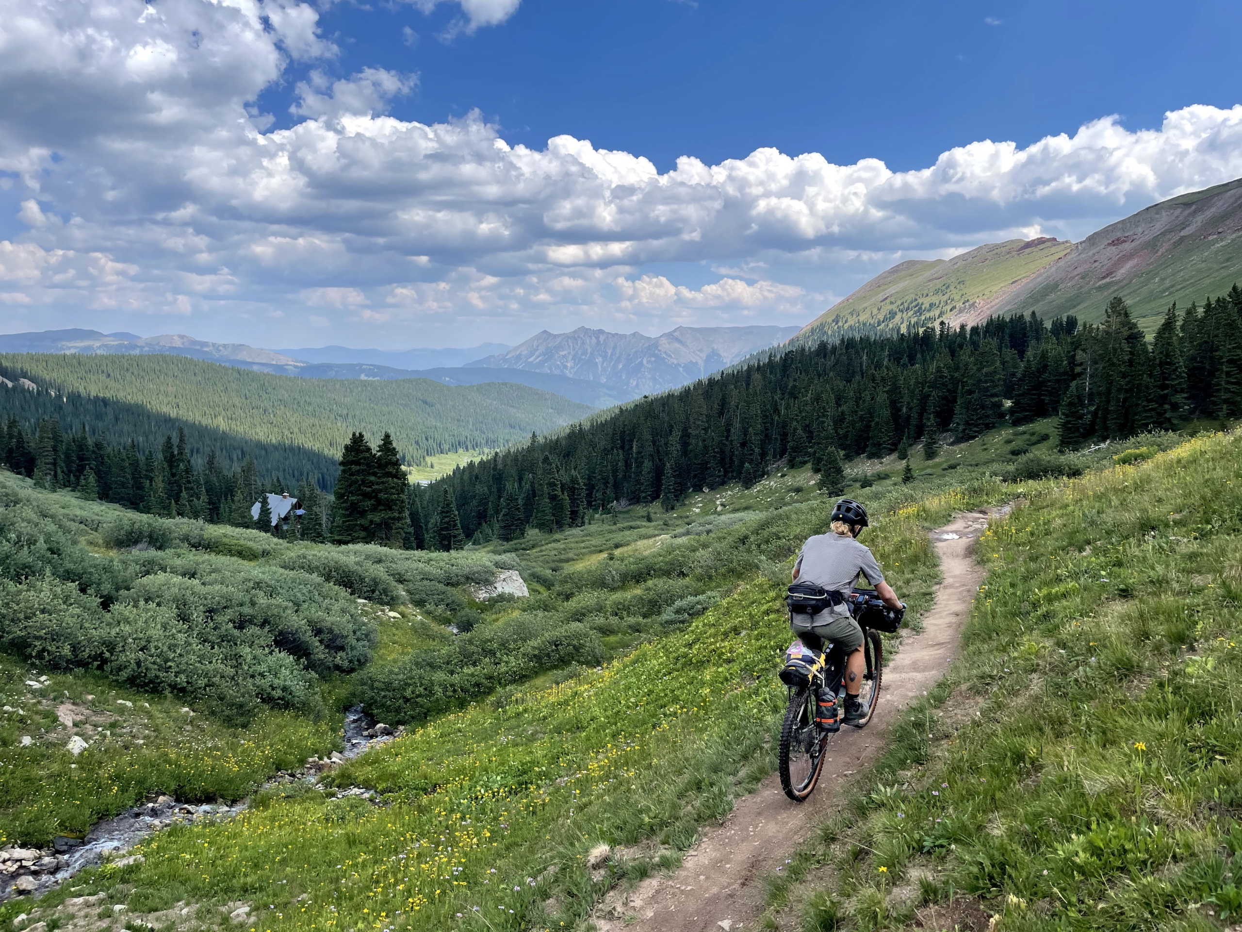
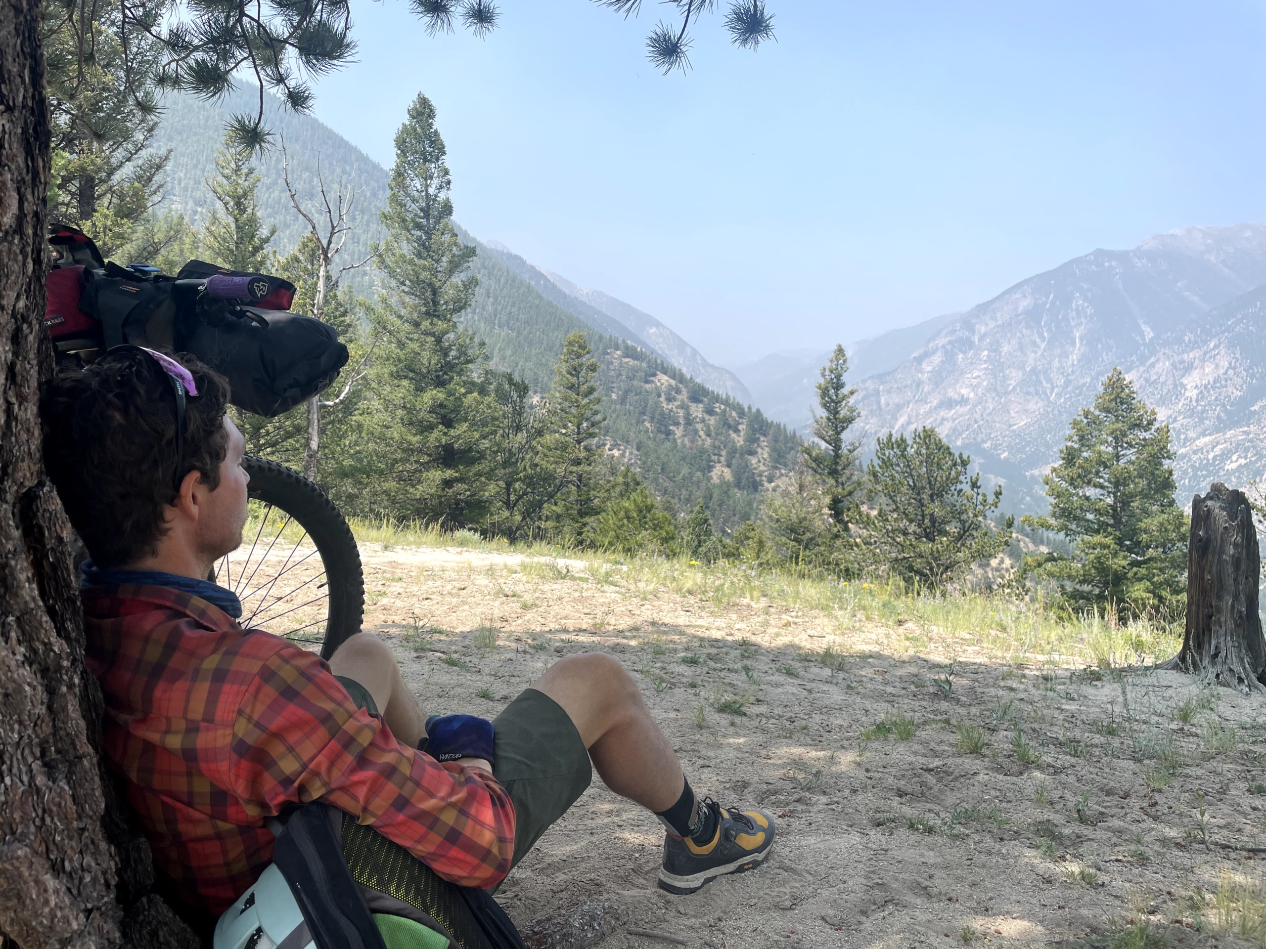
The Colorado Trail is magnificent. Many times during the trip, I’d take in the scenery and think, “Wow, I get to be here.” It’s truly a bikepacking trip of a lifetime.
That said, this is not a trip I’d recommend for a brand-new bikepacker or new mountain biker. The CT is a tough mofo! We met a number of groups who were bailing because they under-estimated the difficulty. A seasoned local we met guessed that only 30% of bikepackers who set out actually complete the entire trail. The altitude is real, the elevation gain is serious, and inclement weather means taking one’s time sometimes isn’t an option given the risks of Bikepacker Flambe on a pass.
I well-know bikepacking contains obstacles and suffering pushing through things are part of it. There were STILL times I questioned what the helllll I was doing with a bicycle on the CT, usually when my bike was above my head on an insane hike-a-bike.
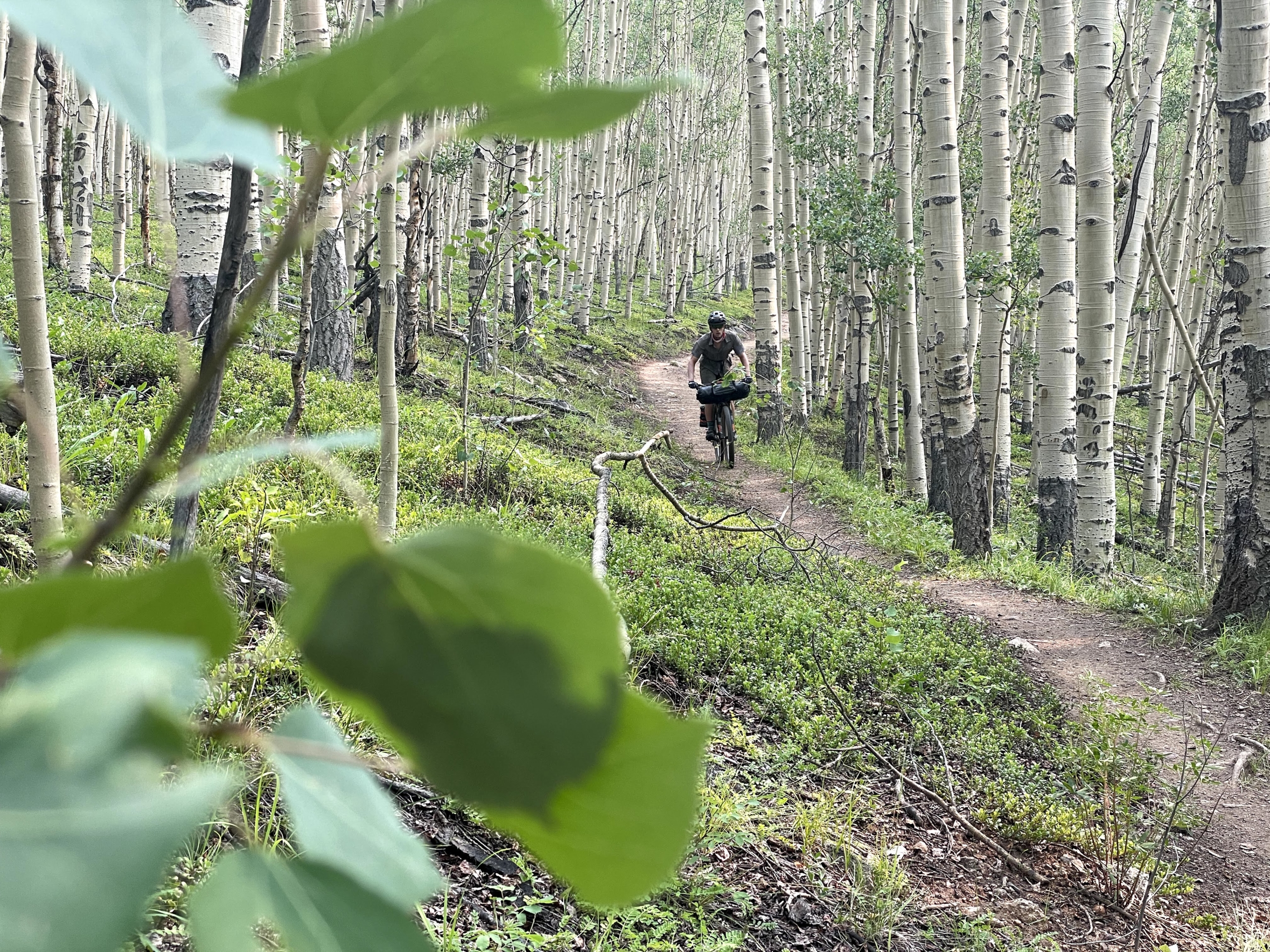
Bikepacking.com says 90% of the trail—time wise—is rideable. I’d peg that closer to 70-80%…and I like technical riding and my bike has a 26T front chainring. TO SUM UP: YOU WILL HIKE YOUR BIKE A LOT. Thank the Bicycle Gods for mtb amnesia, aka forgetting heinous climbs during a fun descent.

As any bikepacker knows, it’s not all fun and games. Day rides from my house or camper van aren’t even 100% fun; bikepacking is far from it. It’s all about the spirit of adventure, traversing beautiful landscapes, independence and ingenuity, camaraderie, eating Oreos on a mountain ridge, starry skies and sunrise vistas, and delirious laughter at the end of a hard day. And, sure, going downhill…
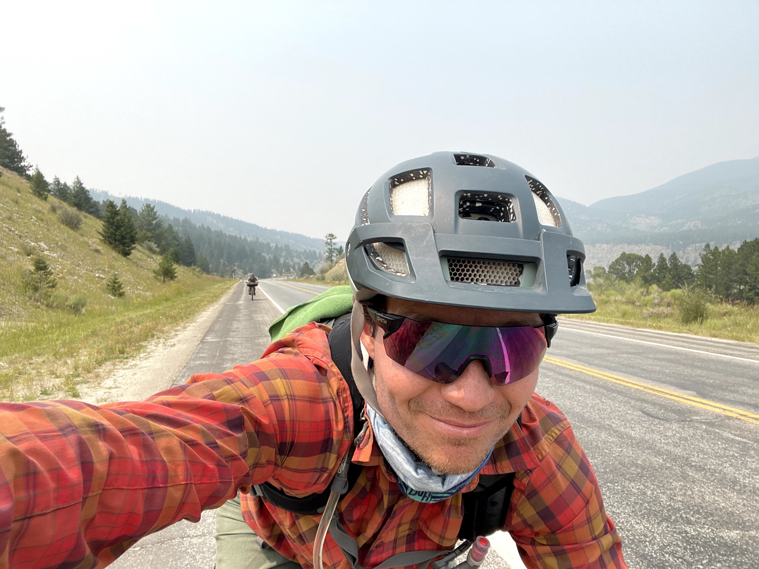
My deep thought from bikepacking the CT is this: weather creates half the adventure in outdoor pursuits. Heat, rain, smoke, snow, and wind can conspire to smote a trip upside the head and create insane conditions. Or they might step aside and make for a peaceful outing.
Such is the case with the Colorado Trail. An afternoon of lightning and rain on day one set my mind racing on the dread treadmill. “Will this happen every day?!” My soaked feet and gloves said oh hellll no.
Be prepared to get owned by thunderstorms. Everyone talks about them. We (mostly) got lucky and avoided the Devil’s Dance on alpine ridges, but many trip summaries and friends of mine mentioned fearing for their life at some point. One couple we met dealt with long thunderstorms every.single.day and started riding only at night. (He also got poison ivy so badly that his trip required THREE hospital visits. #cancelmytrip)
That said, the Colorado Trail deserves a slot on every bikepacker’s bucket list. It’s a spectacular chunk of Colorado and will inscribe itself in your memory. Start planning your trip now! Just bring rain gear and an adaptable mindset. Oh, and did I mention hike-a-bike? Pack light.
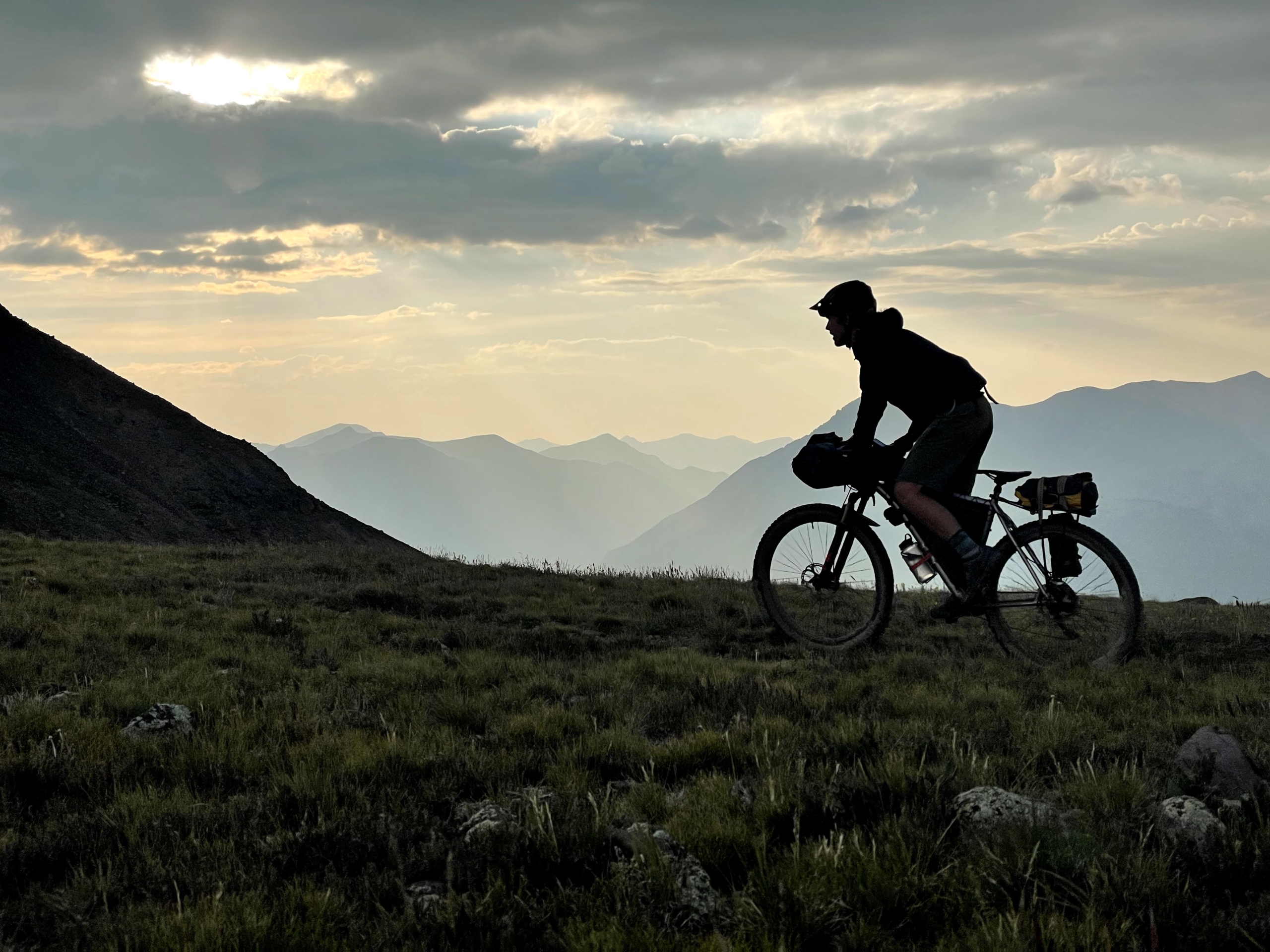
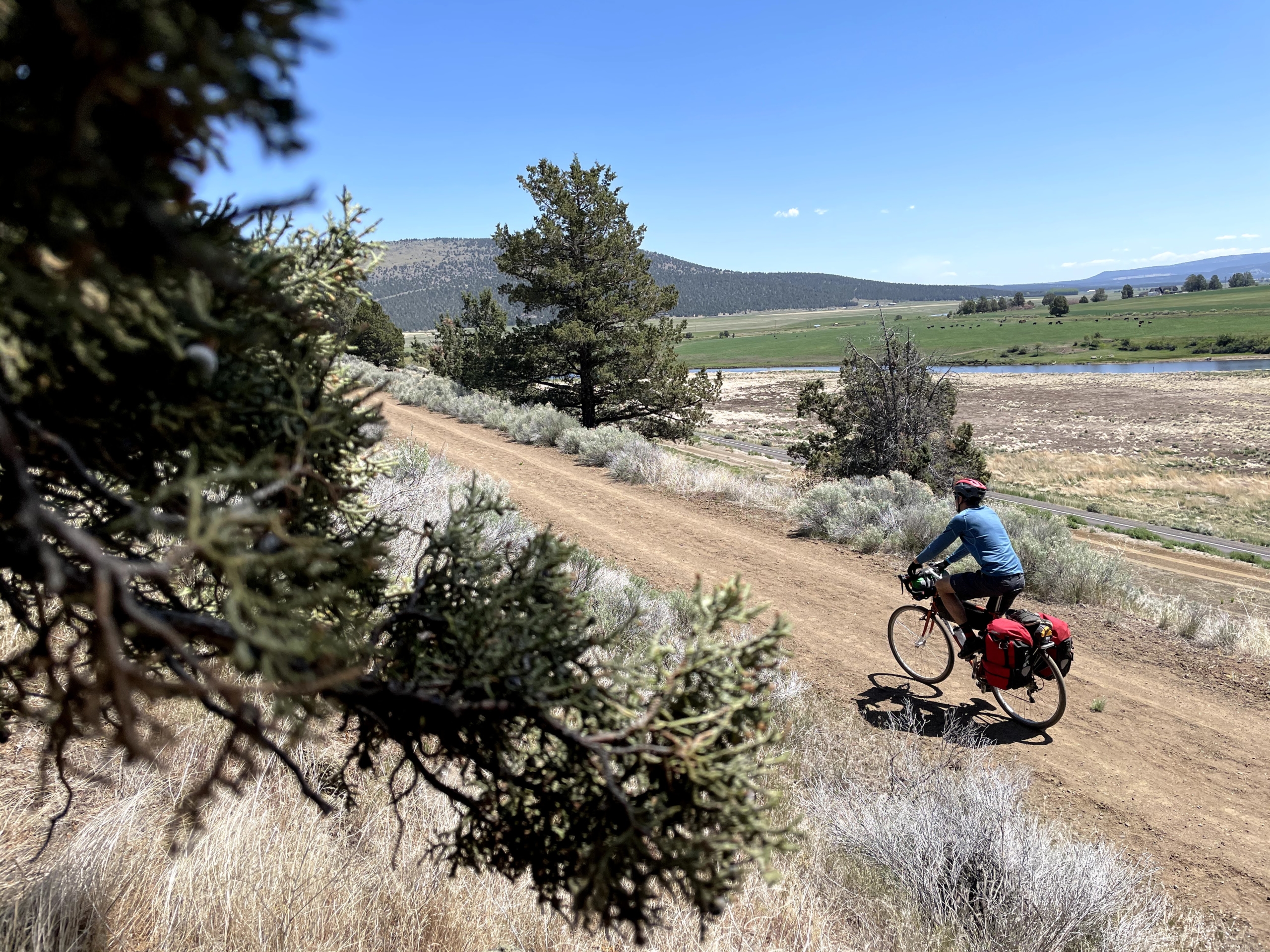
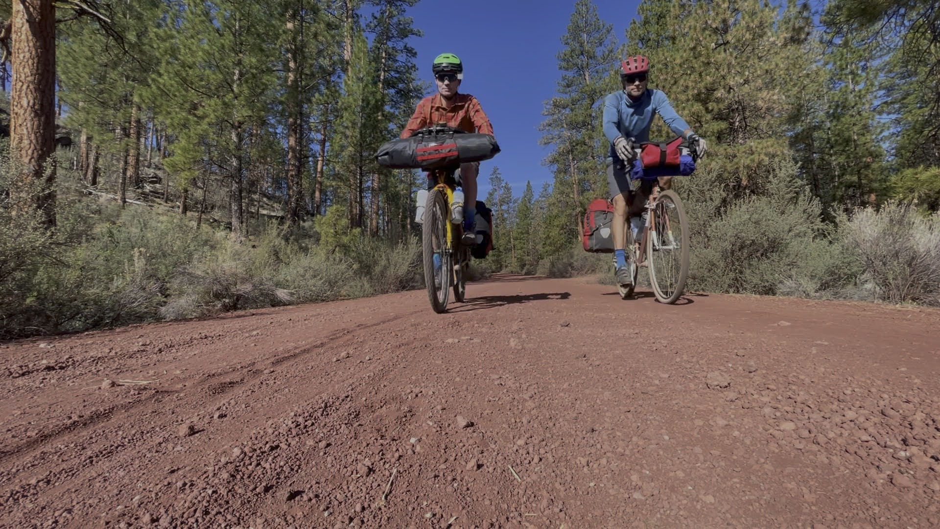
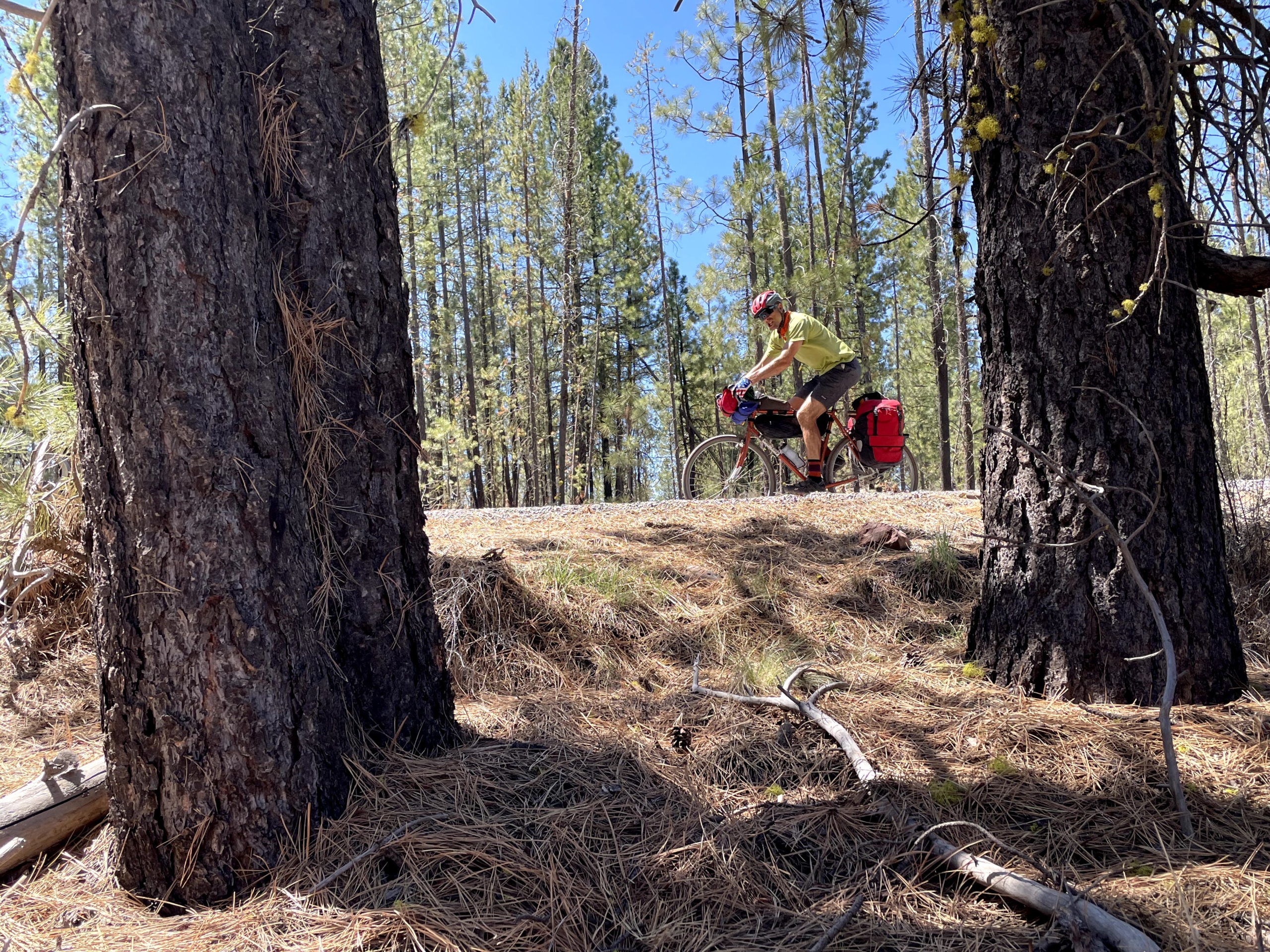
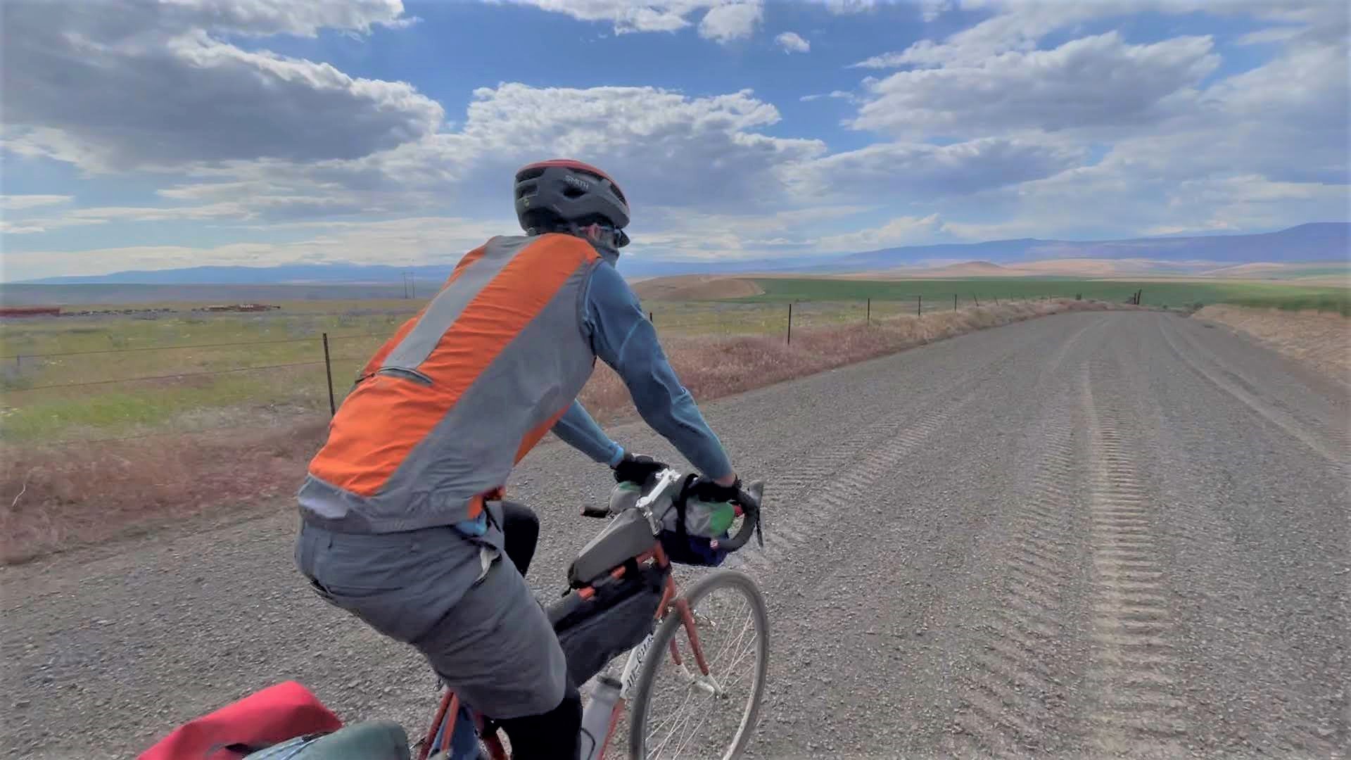
Photo Gallery
Click on any photo to enlarge and flip through them slideshow style. To get a sense of the trail’s progression, they’re in chronological order.


")


")


Logistics for bikepacking the Colorado Trail
Tips and suggestions for the route
Getting to/from start/finish
If you aren’t driving to the start, logistics to get to the trailhead are a little extra. From downtown Denver, catch mass transit to Littleton and then pedal the 10 miles to Waterton Canyon. It’s a nice warm up. Pro tip: your fare out of town is TWO zones, or $6 at the time of this writing.
Time of year
There’s no perfect time to ride the Colorado Trail, merely options. Go in June and risk snow on the passes. Go in July and risk daily monsoon-driven thunderstorms. Go in August and risk heat and/or thunderstorms. Go in September or later and you might get snowed on.
We opted for early August to ideally a) avoid snow b) get ahead of forest fires (sigh) and c) dodge the monsoon season.
We avoided snow and (mostly) dodged monsoon deluges. Forest fires served up shitty air quality for the first week (150+ aqi), but we pushed through it. What’s the equivalent of 200 packs of cigarettes going to do to my lungs anyway?
It was 99F in Denver at the start, but thanks to the high elevation, temps ranged from 45-75F from day 2 onward. Perfection.
May your trip avoid snow, smoke/fires and rain. Or at least two out of three.
Navigation
Navigation was straight-forward—the Colorado Trail is well-marked. I downloaded the route GPX from bikepacking.com and used Ride with GPS a bit, but wound up mostly using the Guthook app because it has more marked water sources. Highly recommend getting it.
My preferred method to save battery is to keep my phone on airplane mode with the volume turned up loud enough to hear the DING when a turn is approaching. There’s also another tone when you miss a turn, which quickly corrects any missteps.
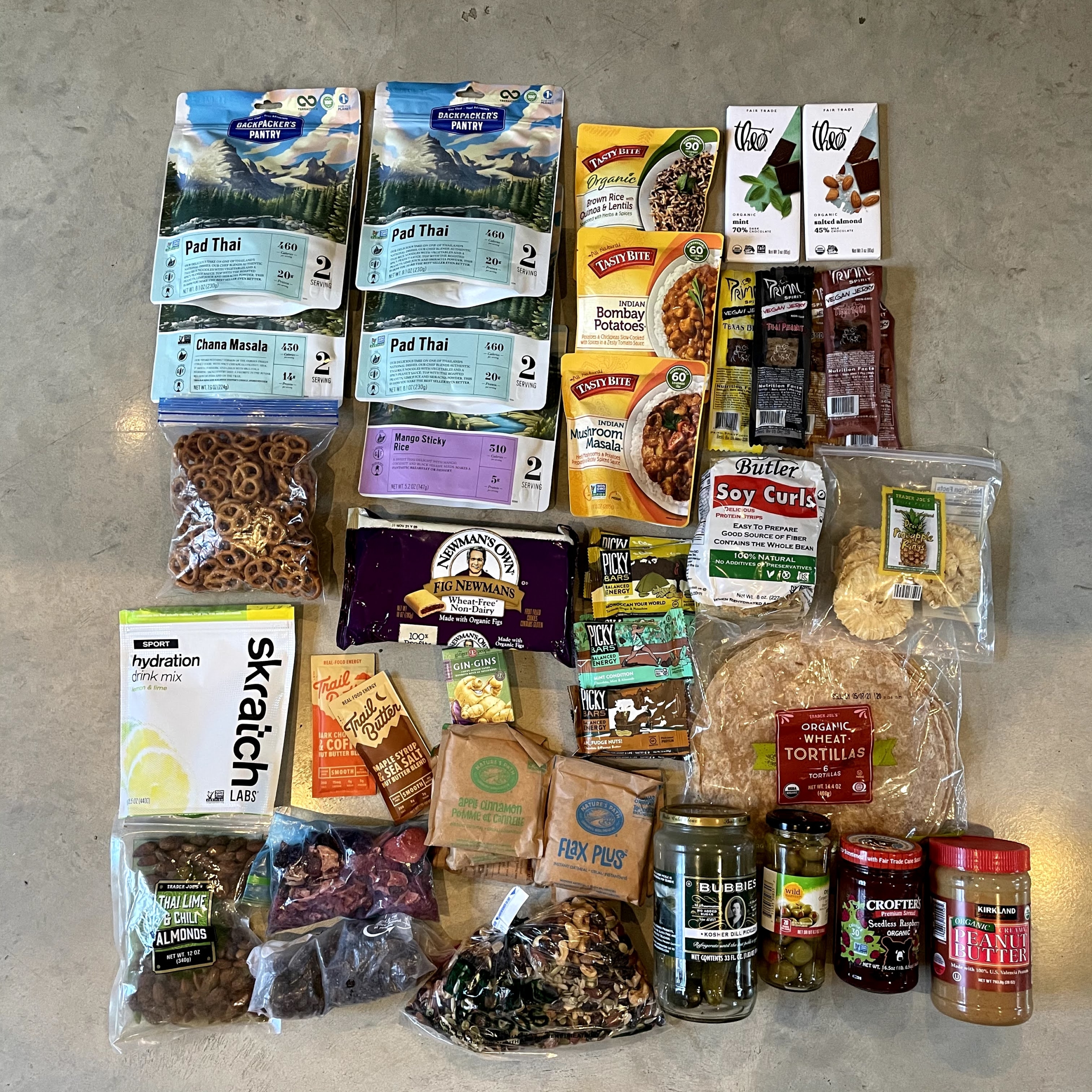
Food
As usual, I rolled on a plant-based diet for this trip. My companion Mason is also vegan, which made things easy.
With the exception of restaurant meals in Frisco, Leadville, Buena, and Silverton, I ate mega-delicious Food for the Sole freeze-dried meals. Lunches were a mix of freeze-dried options and various snacks from restocks along the way. Mason got sick of freeze-dried meals toward the end, but I enjoyed them the entire trip.
Overall, I aim for 400 calories an hour without counting calories. I prefer to have an extra meal and bonus snacks in case of a mechanical…or just raging hunger! It’s never perfect and sometimes I screw up and underfuel, but it usually works for me.
The section from Buena Vista to Silverton is LONG without a restock. Check out the Monarch Crest store and do not miss Cathedral Cabins before Lake City. You can mail a box to them, but they have tons of freeze-dried meal options and piles of delicious snacks for reasonable prices.
Riding on a vegan diet and curious what you can find in convenience stores? Traipsing About reader, badass cyclist and fitness coach Lauren Costantini put together a list of foods for all you plant-based folks.
Water
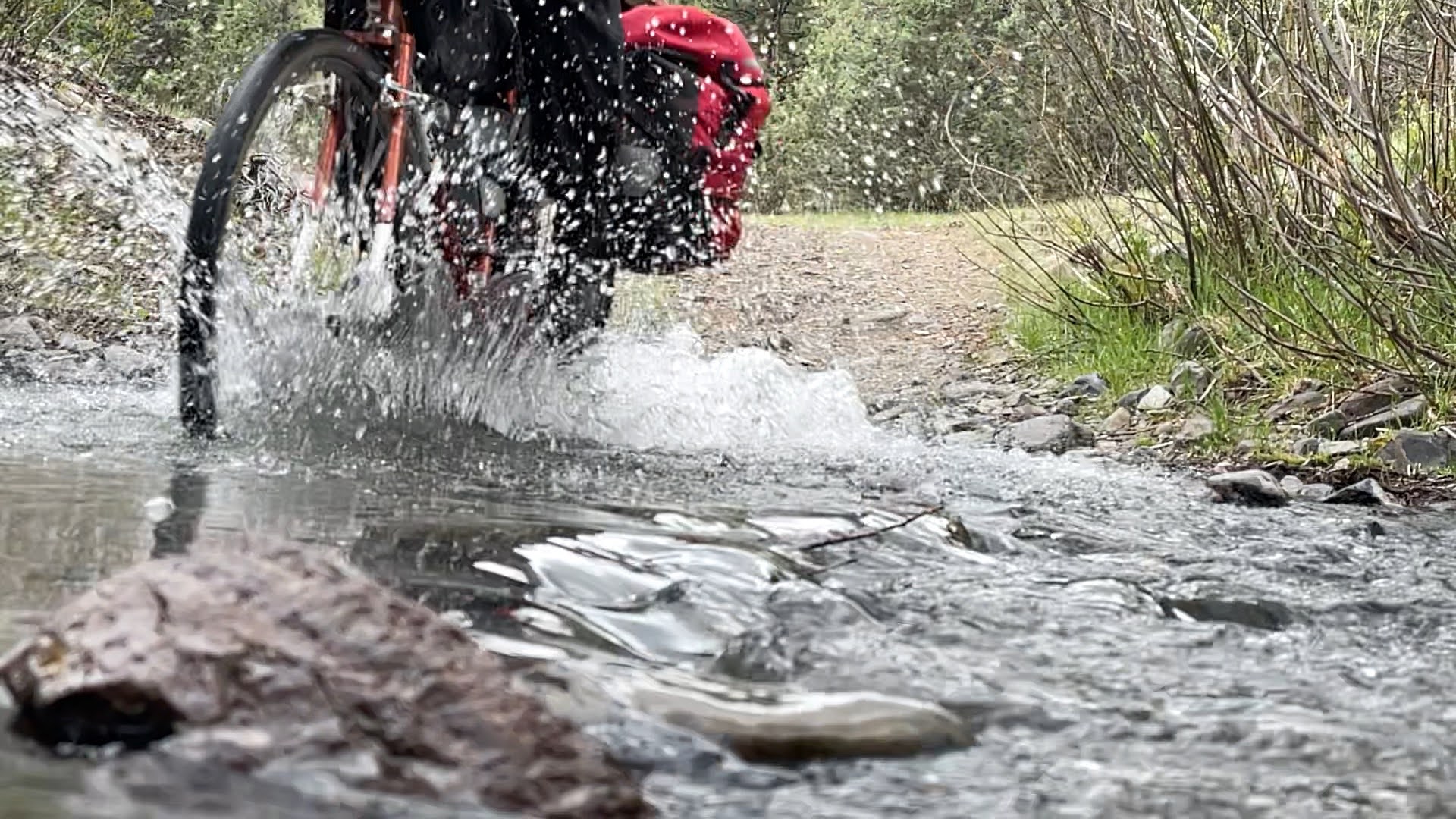
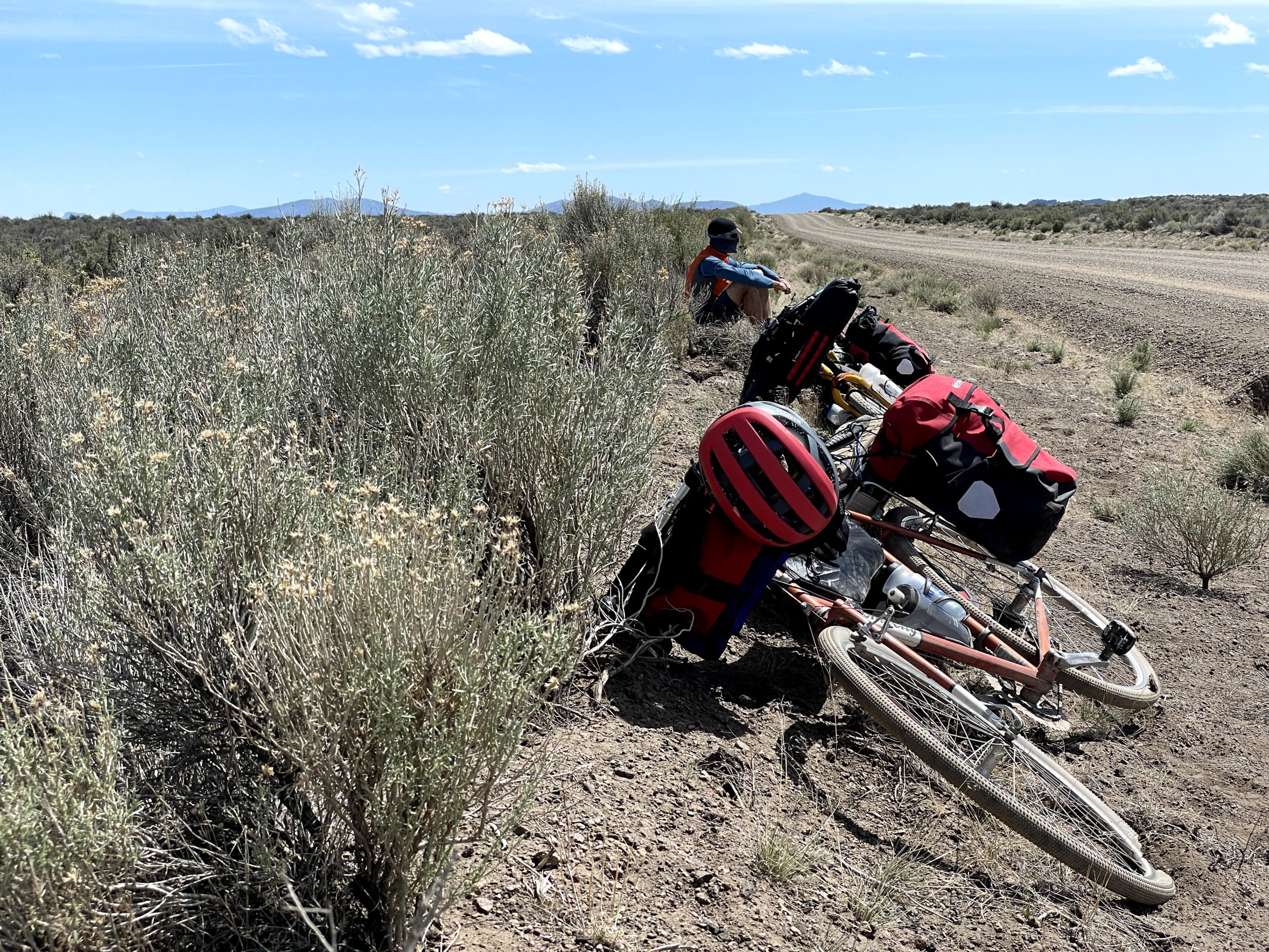
Tons of water on this route except for the Tarryall bypass and Sargent’s Mesa. You’ll (likely) never need to carry more than 2-3 liters at a time unless you for some reason are dry camping.
We both used Katadyn BeFree filters until mine got so clogged that I bought a Platypus flter in Buena Vista. The frustration of doing the boa constrictor squeeze on a filter every time you want water is not to be underestimated! Bring a new filter or clean yours thoroughly before the trip.
Sleeping
We stayed in hotels for four nights (Frisco, Monarch Crest Butterfly House, Cathedral Cabins, and Silverton). Otherwise, we slept outside.
We brought my Big Agnes Fly Creek UL2 bikepacking tent and split carrying duties between poles and fabric. Given temps, overnight moisture (dew and rain), I was glad to sleep in a tent every night. You’ll have no problem finding places to sleep along the route.
Cell signal
With Verizon, I had at least a weak signal up high most of the time. To save battery, I mostly kept my phone on airplane mode.
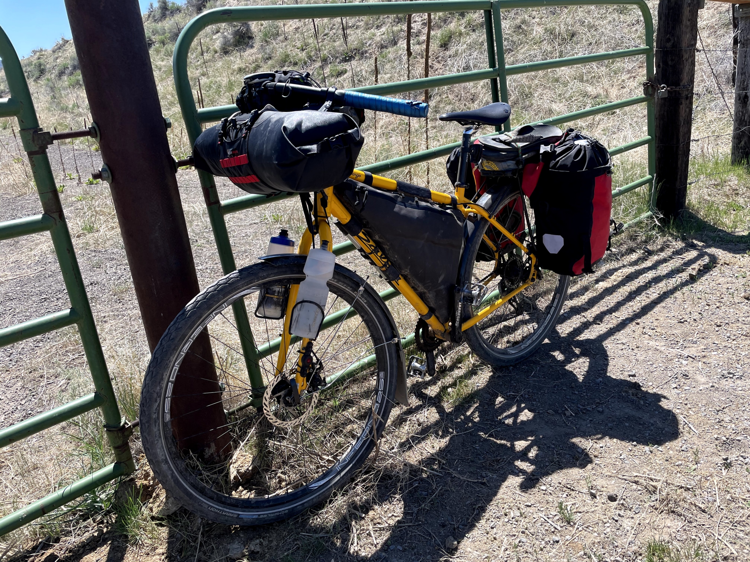
Gear
I rode my 2019 Why Cycles Wayward V.1 set up with a Terrene McFly 2.6” rear and 2.8” front tires. I run a 140mm front fork, which seems to handle most anything I’d want to ride a loaded bike down.
This year I added a 26T chainring on my Wayward to complement the 11-46 Shimano XT setup I’ve got. It was AWESOME. Spinning is the name of the game while bikepacking! You’ll never miss your taller gears as much as you’ll dream of more climbing range, trust me.
Rounding out my gear was a Revelate front roll bag for sleeping gear, a custom Rockgeist frame bag, and a Bedrock Black Dragon dropper bag.