I’d eyed bikepacking in the Oregon coast range quite awhile, so I wasn’t TOO sad to pivot from a fall bikepacking plan from Idaho after a forest fire messed up plans.
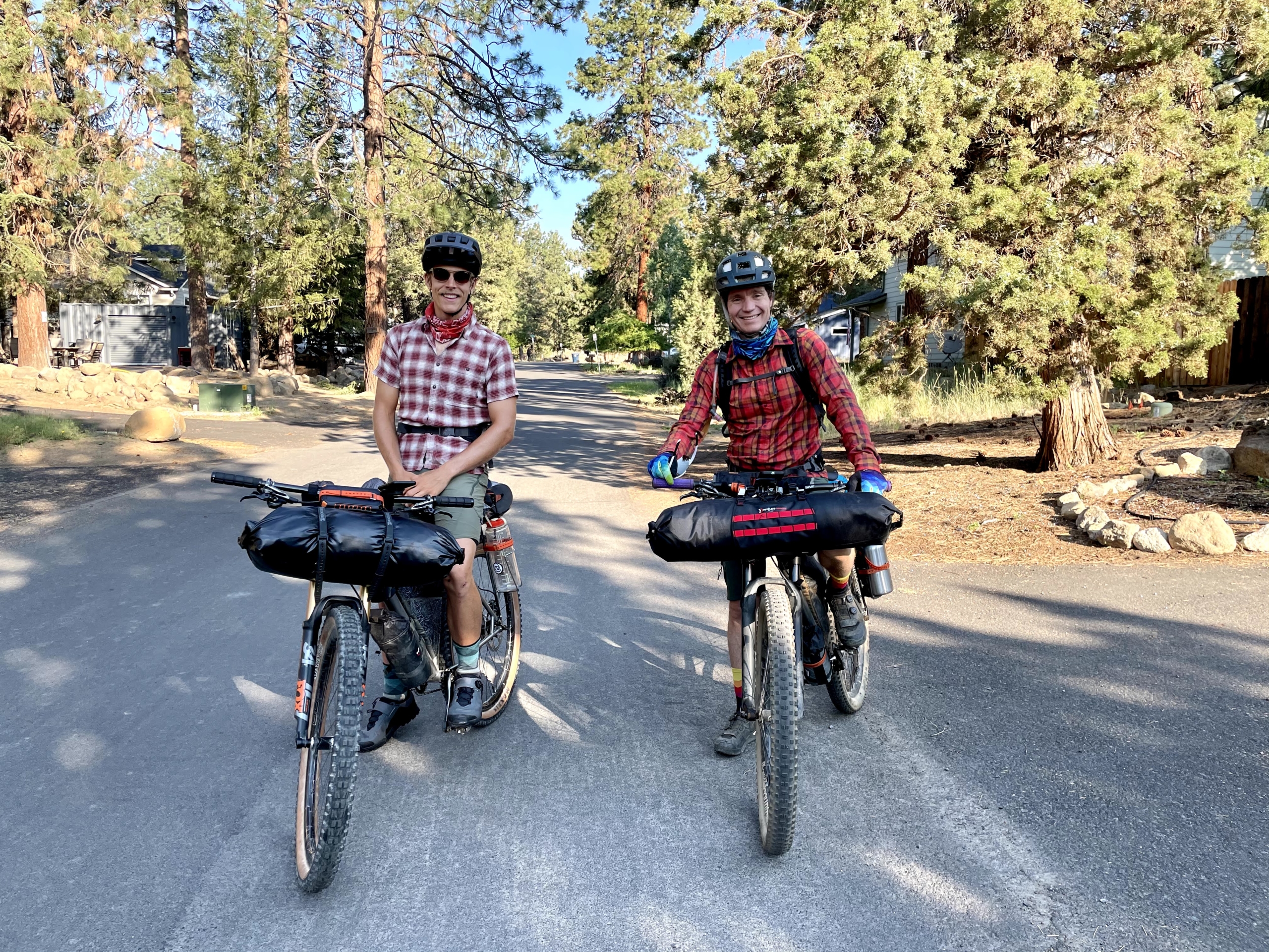
The VOG it was! My friends Brady, Tyler and I changed plans and met in Salem, Oregon to pedal out to the coast and back via some steep forest roads. With no research except downloading the GPS route, we were off.
Overall, it was an excellent voyage starting in the hot summer of the Willamette Valley, crossing over the coast range to cool, misty coast weather up the Oregon Coast, and then reversing it. Nicely planned, Ben! (Also, thanks for hosting us the night before.)
Below is my trip report for bikepacking the Odyssey of the VOG. I wrote this as a resource for folks looking to bikepack this route, so free to skip to the specific sections below.
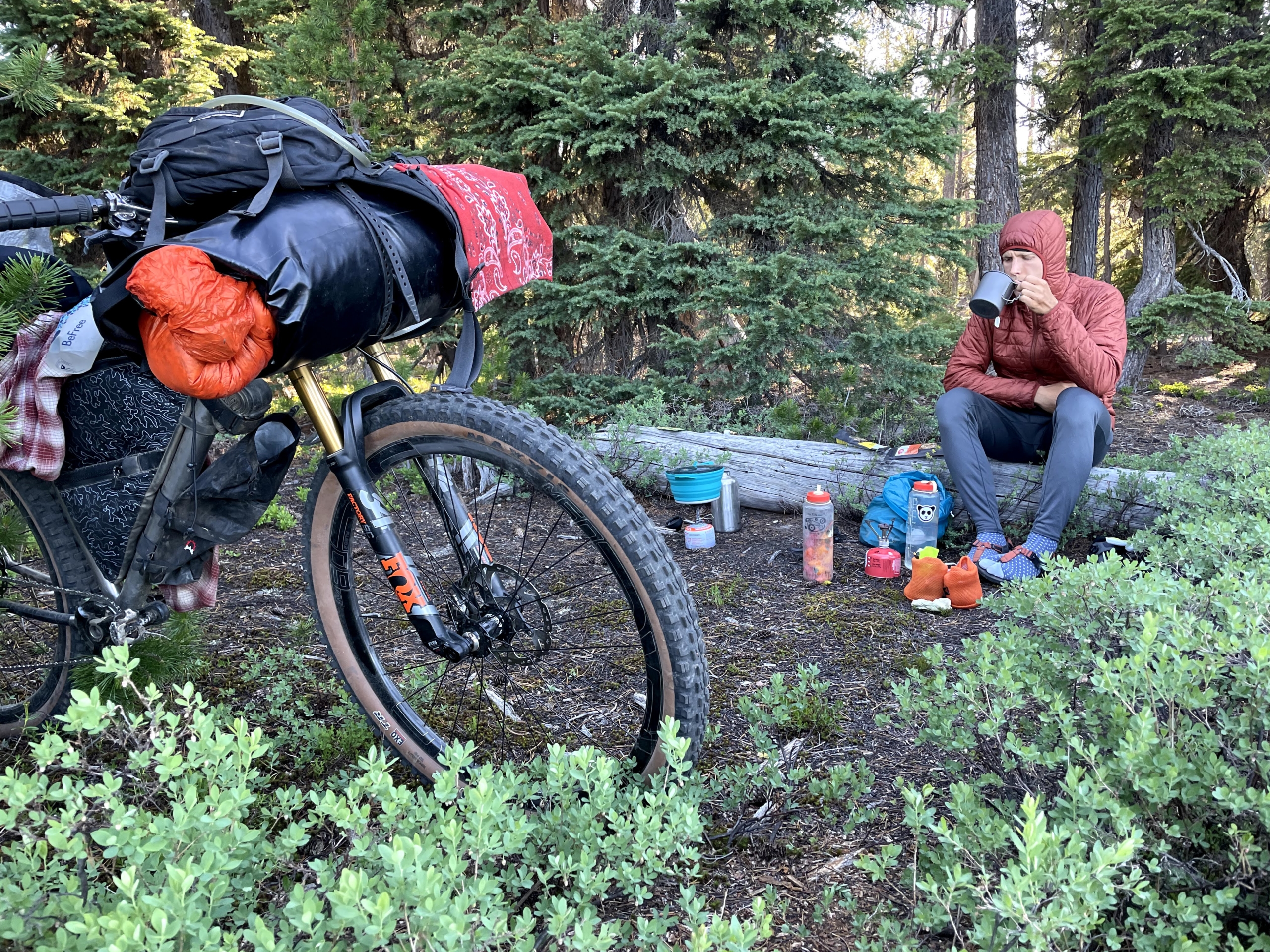
Nothing like break midday to soak in a cold creek. (Photo Brady Lawrence.)
Bikepacking Route Description
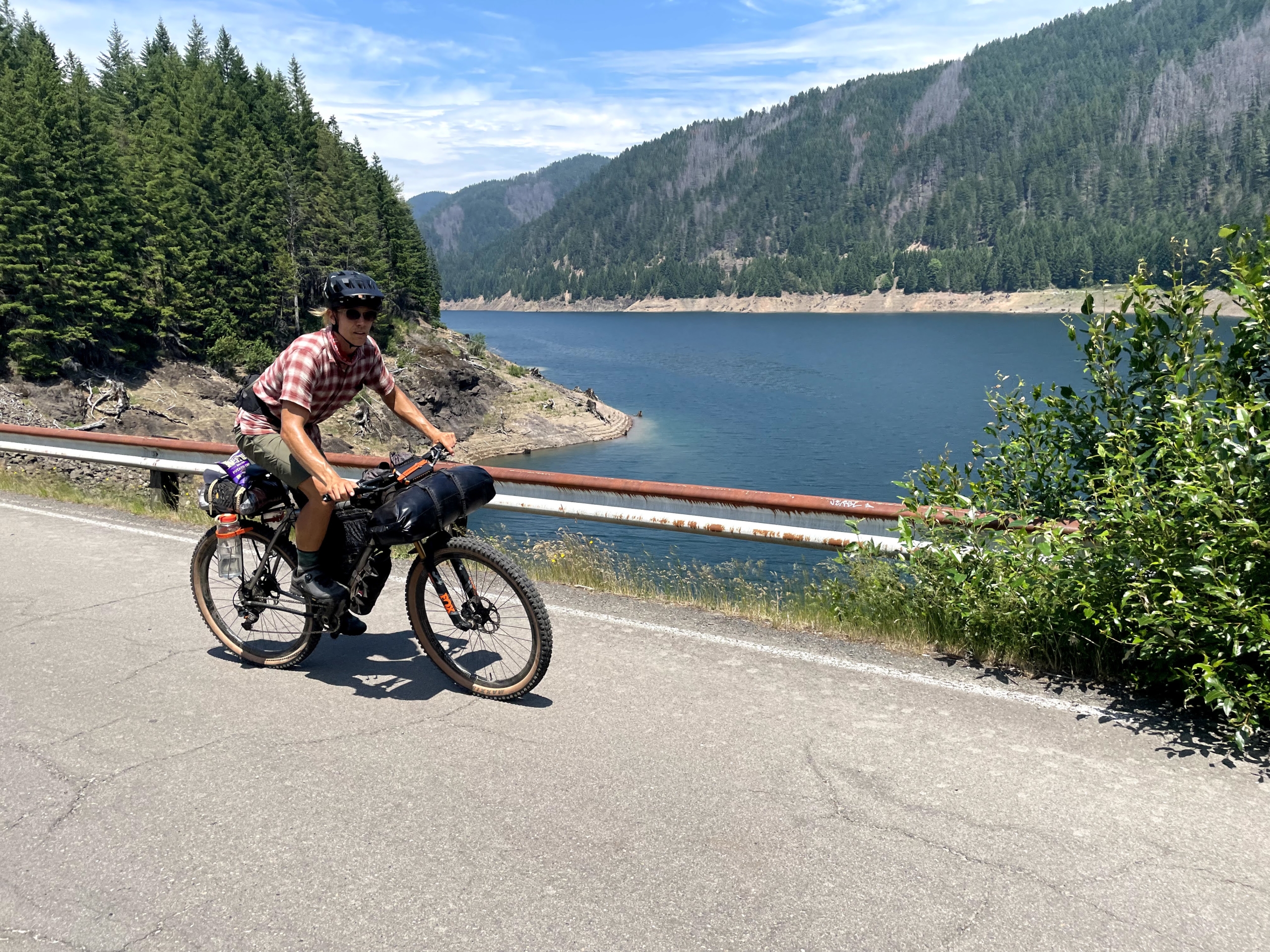
We spent six days wheeling in a clockwise loop from Salem to Pacific City on the coast and back. The route covers a mix of pavement and dirt logging roads.
Fair warning that the logging roads are STEEP. We frequently ground up 15%+ grades. Pack light (I didn’t) and gear down (I did). My quads were pissed that I didn’t warn them in advance, although Brady and Tyler are unstoppable on a bike and were unfazed.
Also, those logging roads are used to, well, log. Oregon has a long history of clearcutting and we rode through our fair share of them. They aren’t serene forests, but I’m fine with seeing the reality of where wood comes from, and it further reminded me that clearcutting is so.incredibly.destructive.
Clearcuts suck.
Caveat: We diverged from the route at mile 236 to head straight to Salem because a) Tyler’s derailleur blew up under the force from his blunderbuss legs, forcing him to cut the trip short and hitchhike to Portland, and b) while we were still having fun, we were ready to have other fun. We’ve all toured so much that perfectionism ain’t the name of the game!
Instead, Brady and I headed straight south from Yamhill 50 miles to Salem on cruisy back roads. This cut out Hagg Lake and the final section through the foothills of the coast range.
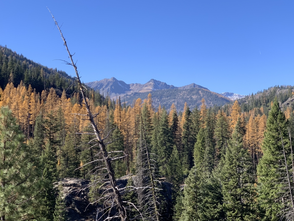
The shift in landscapes: farmland, coast range, ocean. From Willamette Valley farmland to the forested coast range with plenty of icy streams to the Pacific Ocean and back.
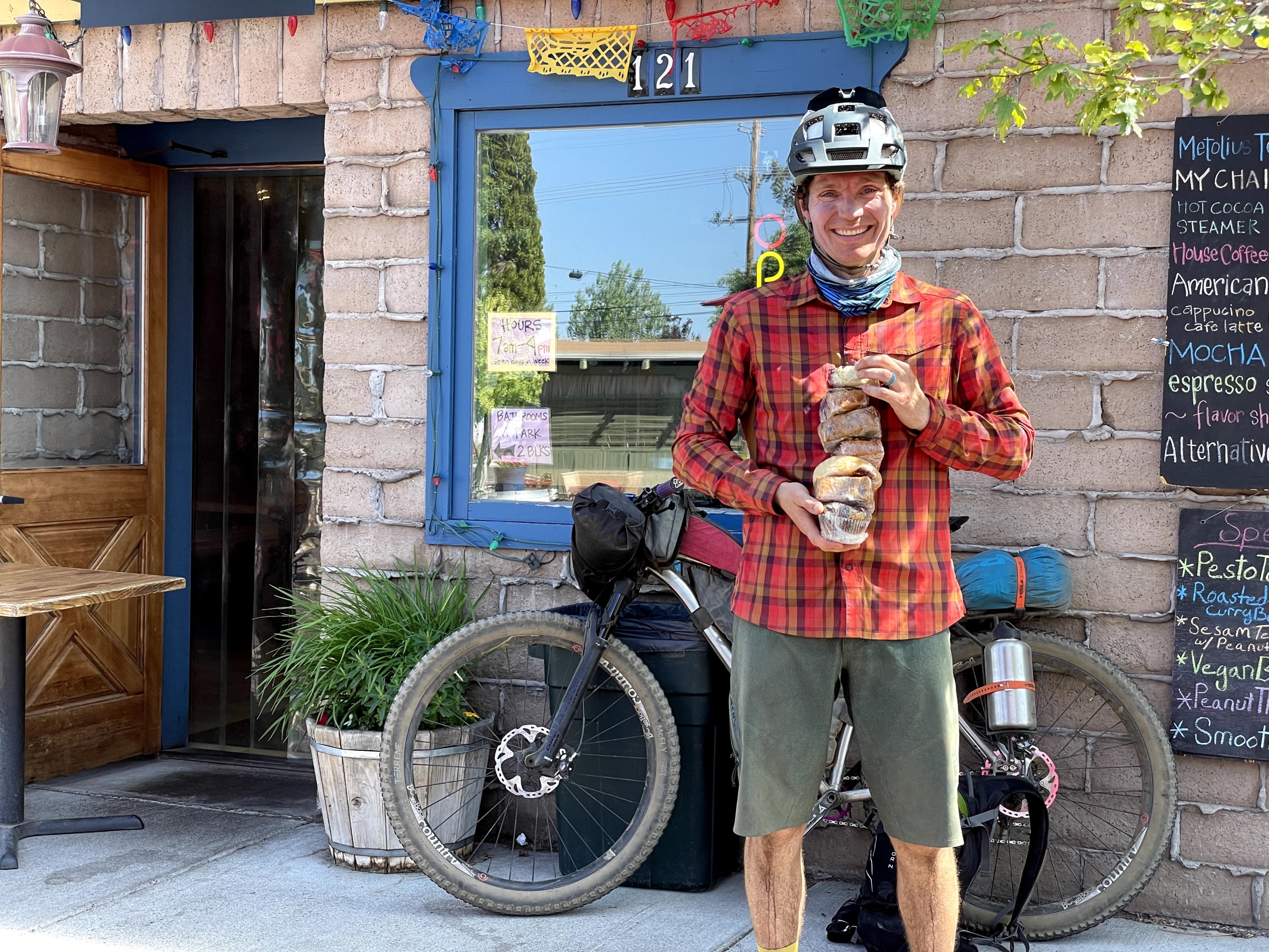
Eating at The Breadboard in Fall City! Amazing food, friendly, cheery owners and patrons. “Welcome to the gay Alps!” said the proprietor, something you nevereverever hear in a small rural logging town.
Somehow we each wound up doing a (totally sober) catwalk in front of a crowd of cheering people at The Breadboard.
Remoteness! Other than the coast and restocking in town, we saw basically no one.
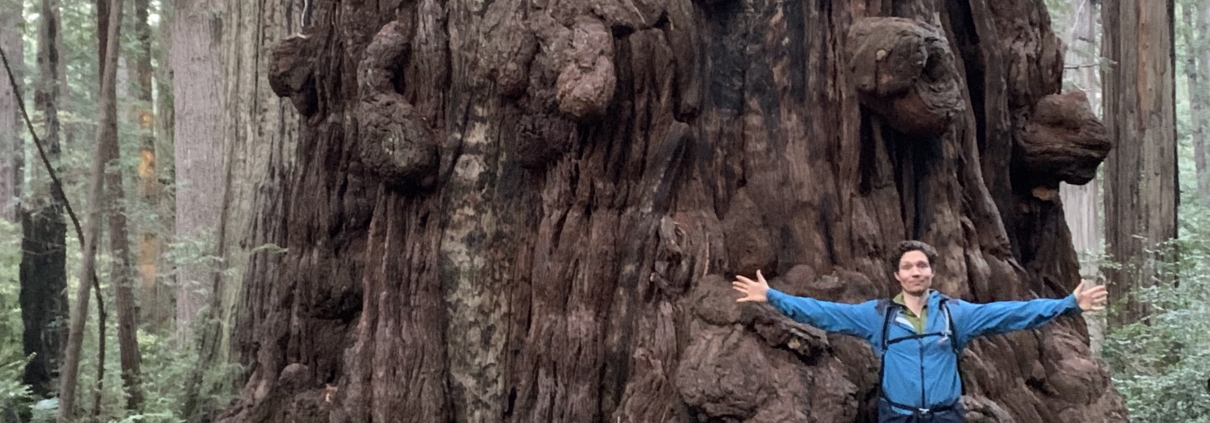
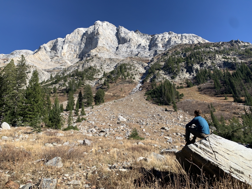
Hiking through the Valley of the Giants. (Tip: leave your bike at the top and hike down. Ask Brady how he knows.)
Restocking at American Market near Grande Ronde. Mmm, junk food.
The smooth, silky road north of Grande Ronde (offset by the grinder climb in the heat up to Lifesaver Lake, as I just renamed it).
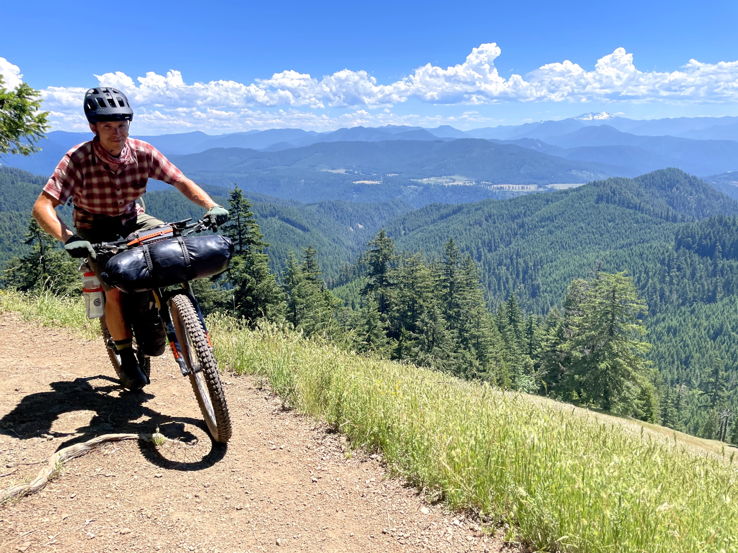
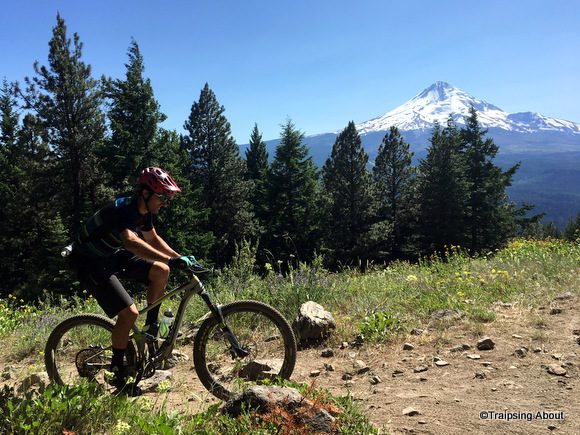
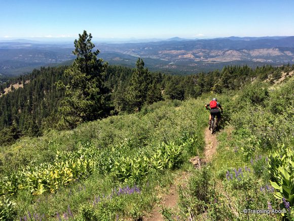
The OMG-biking-is-wonderful descent from Mt. Hebo over the top of the coast range. From 95 degrees to 60 in 20 minutes of swooping descending, grins plastered on our faces.
Finding a still-burning beach fire in Pacific City and enjoying a misty fireside chat.
Pedaling up the coast with ocean views the entire way…and not too much traffic!
The small things: Watermelon. Fried potato wedges at a gas station. Coconut water. Conversation about science, photography, and how to live well. Uproarious laughter.
Surviving a hike-a-bike in 97 degrees up the world’s steepest fire road with water running low. One of those “is this worth it?” moments for me.
Brady enjoying the death hike-a-bike.
Kind strangers, always. The guy who came over just to show us his intricately carved walking sticks. The party-goers at The Breadboard in Fall City recommending places to camp. A goateed dude with two knee replacements who loves his ebike. The hunter who saved us with a gallon of water.
Easygoing comradeship with Brady and Tyler, two excellent travel companions!
Another injury-free, successful trip.
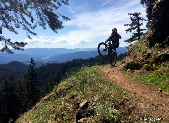
Lots of punchy uphill on this trip, but it sure made for smiles on the way down. (Photo Brady Lawrence.)
Dig this post and want more like it? Check out my free 2x/month newsletter for trip reports and much more.
Photo Gallery
Here are some of my favorite photos from the trip. Brady’s eye and skills are fabulous. Click on a thumbnail and scroll through to see them uncropped and larger.
The crew.
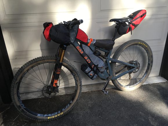
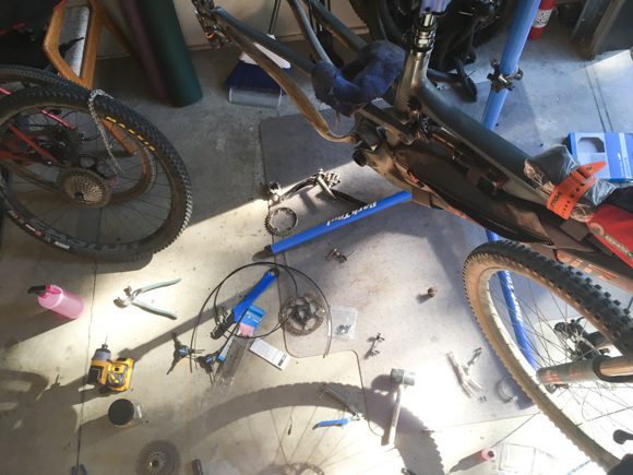
The packing chaos in Ben's garage before the storm.
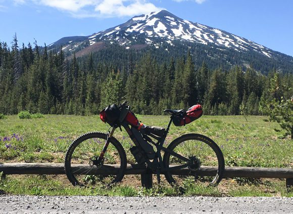
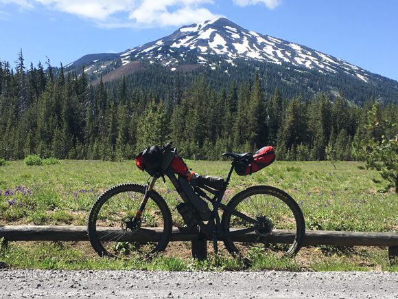
My bike setup for the VOG. Went a biiit heavy on the food to start!
Too. Much. Food. Chuck Waaaagon!
Nothing better after a long day of riding.
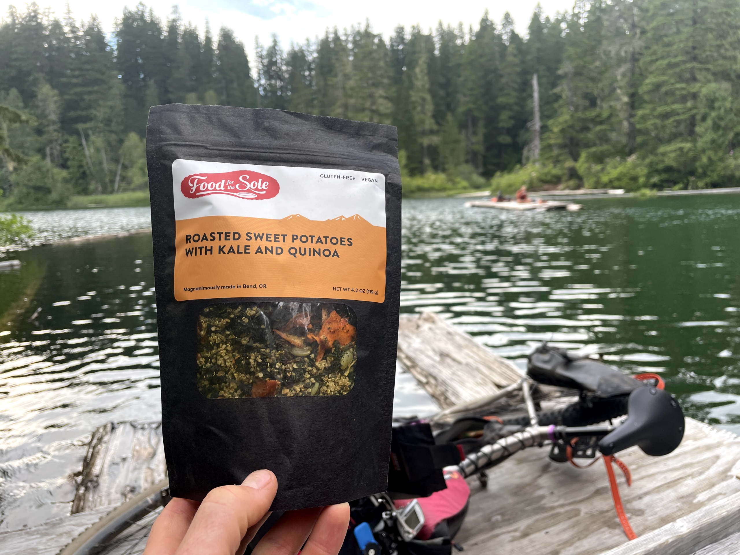
Very sad to see Food for the Sole go out of business recently 🙁
Grins.
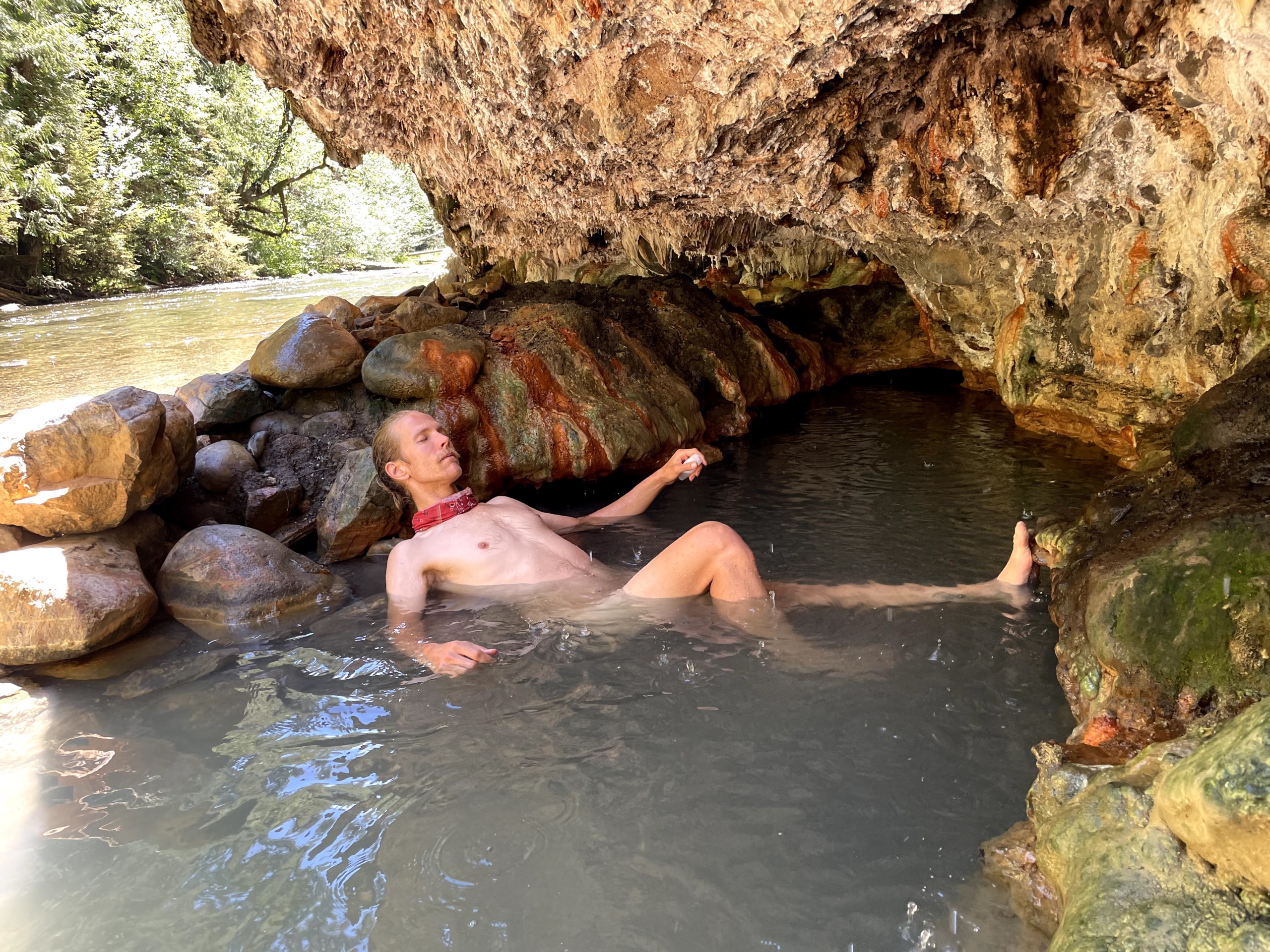
Bonus to the heat: it makes the cold water feel even better.
Me pretending to send it.
This guy came over to show us the walking sticks he carves.
Road's out. Surprisingly hard to push a bike up a steep, loose embankment!
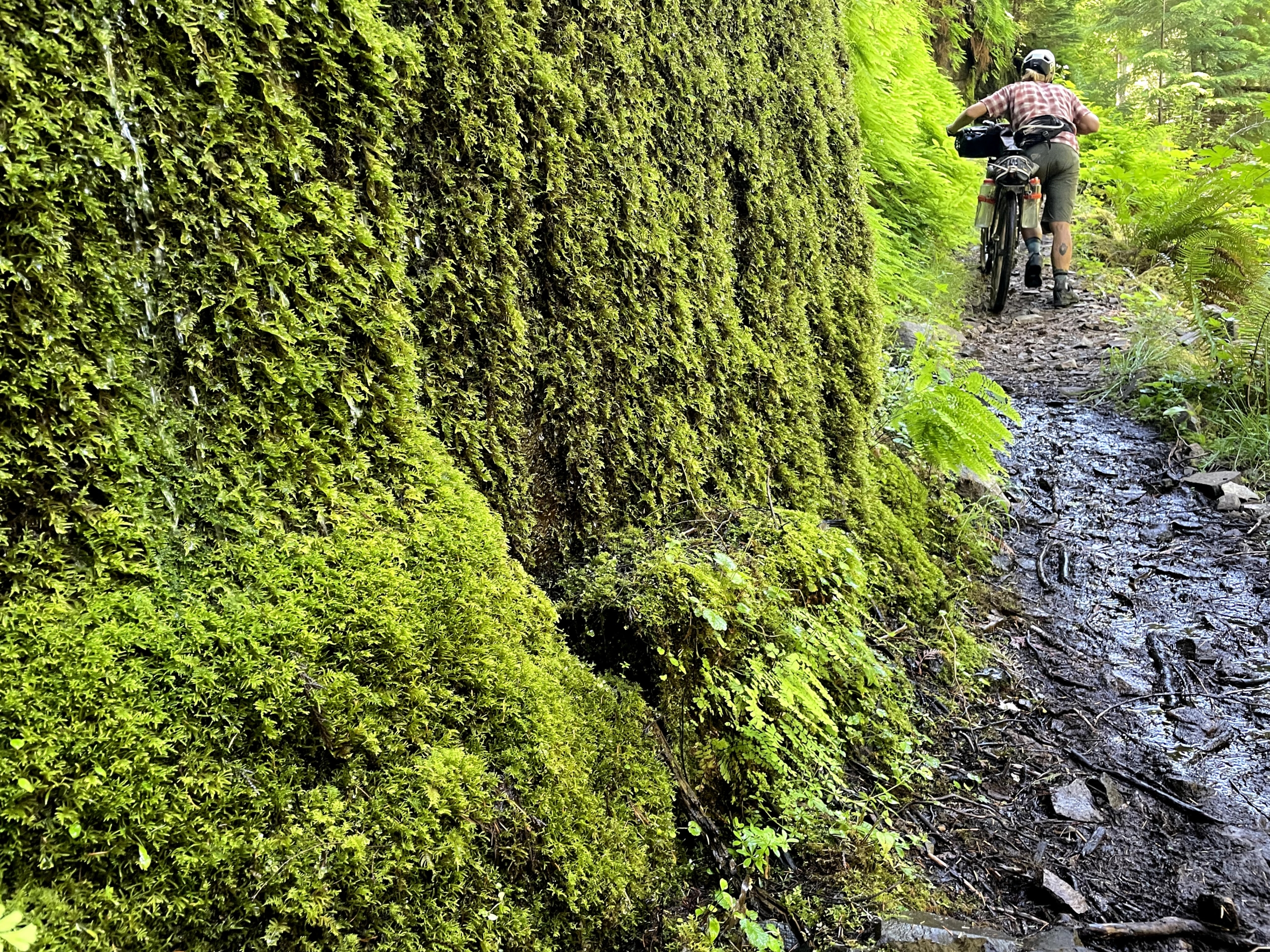
Nothing like break midday to soak in a cold creek.
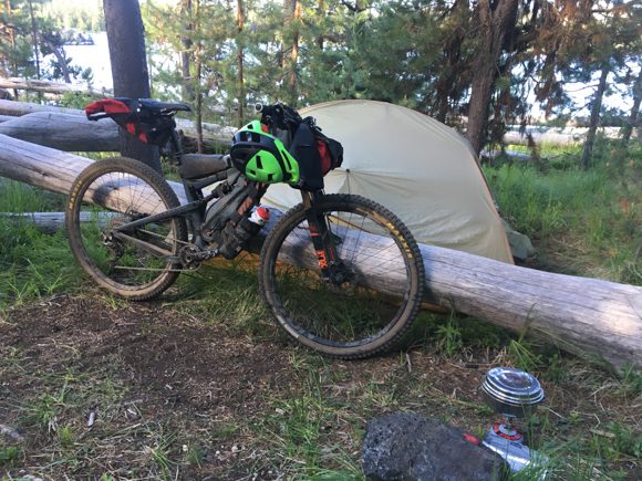
End of day 2 near VOG.
Hiking in the Valley of Giants. Worth stopping there...when will you ever be back??
Valley of the Giants. That is a BIG Doug fir.
Brady and Tyler getting dinner together, campsite day 2.
Up up up.
Grinding up a coast range climb.
Clearcut land.
Clearcuts suck.
We earned these turns.
Greenery at the coast.
Refueling at American Market. A real winner of a convenience store!
Target practice.
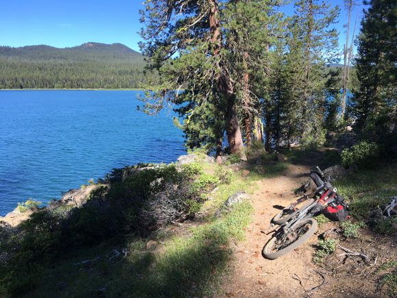
We jumped in juuuust about every body of water we encountered.
Top of Mt. Hebo.
Brady with the photographers eye!
Screaming down Mt. Hebo.
The old Hebo Hotel near the coast.
Fueling up at the Hebo Market. Super nice staff there!
Yours truly.
Tyler, ever-cheery and awesome.
Brady, the man behind the lens.
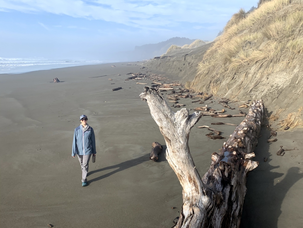
Checking out the beach in Pacific City.
Mark, a Pacific Coast hiker we shared a campsite with.
We found a still-burning beach fire and hung out for awhile.
Cute bunnies. I didn't actually feed them, but other people clearly do.
Pacific City bunny.
Dinner in Tillamook. We moved the picnic table out of the sun...
Cruising highway 1 on the coast.
Beach views on Highway 1.
Misty coastal magic.
Coast and forest overlay.
Coast views at the lighthouse.
Road out...
Pausing mid-climb to eat.
Tyler's massive quads ripping his derailleur right off the bike.
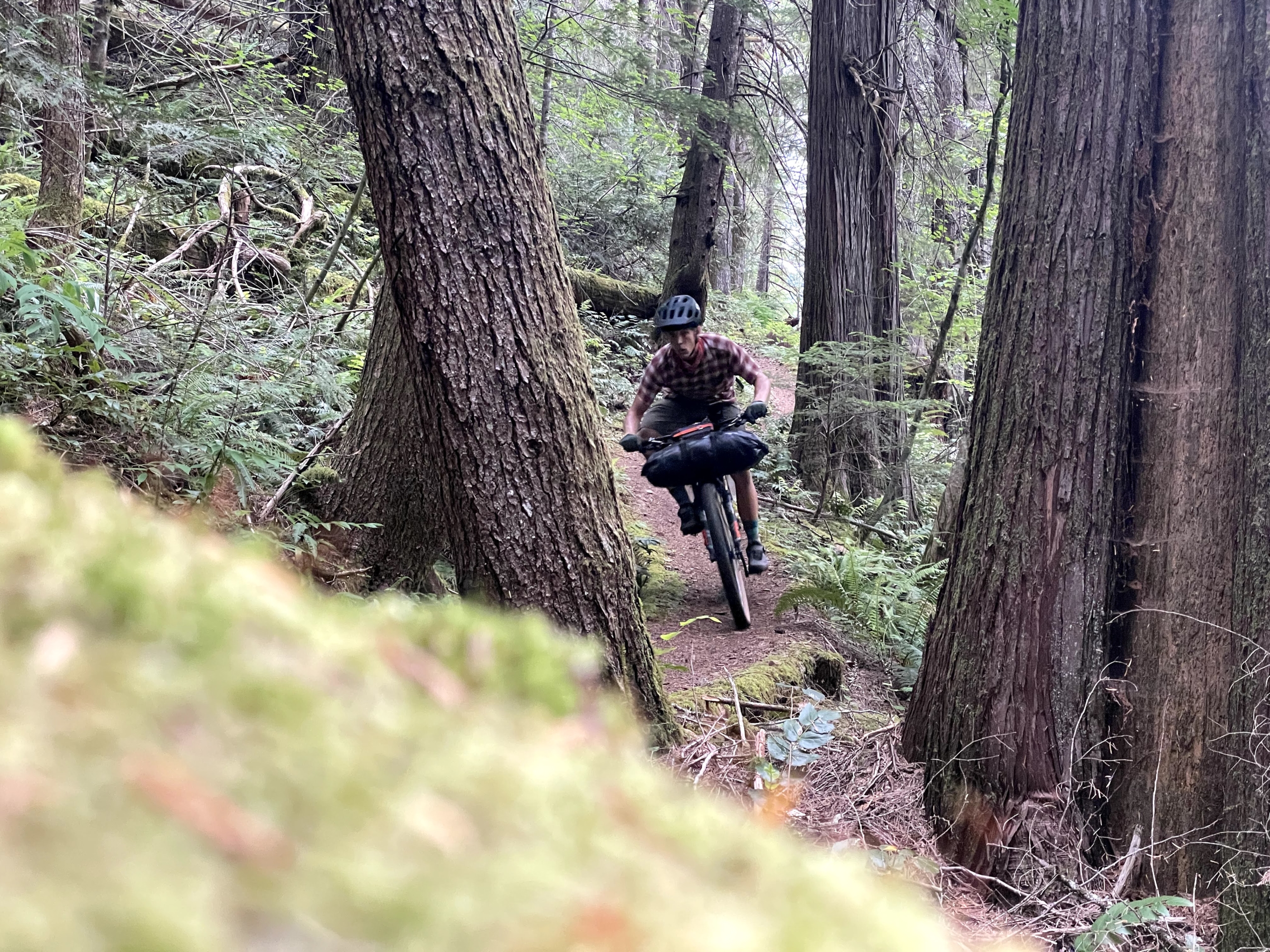
Sneaking some singletrack on the Wilson River Trail.
Wheeeeeee.
Gravity at work.
Sweet relief!
Brady enjoying the death hike-a-bike.
Tyler getting ready to hitchhike to Portland after his derailleur broke.
Classic Coast Range
Views.
End of day 6. I was...rather tired.
Campsite our last night.
How the (wood) sausage gets made.
This generous dude saved me and Brady from a dry night of camping with a gallon of water.
Day 1: Salem to Fall City (53 miles and 4,900’ of climbing).
Day 2: Fall City to a few miles past the Valley of Giants. A short (but punchy!) day with lots of swimming, plus a hike in the VOG. (35 miles, 4,555’ climbing)
Day 3: To the coast at Pacific City! (56 mi, 5,500′ climbing)
Day 4: Pacific City to east of Tillamook (51 mi, 3200’ climbing)
Day 5: Ass kicker of a day: broken derailleur for Tyler, steep af climbs (59 mi, 7,000′ climbing)
Day 6: West of Yamhill back to Salem (56 mi, 2,300’ climbing)
Tips and suggestions for the route
Swim in the rivers and streams whenever possible.
You can camp for free in the city park just outside of Fall City. It’s worth pedaling back up the hill after eating at The Breadboard, which is a must-do.
Bring a blinky tail light for the foggy coastal highway section.
Be friendly when you encounter vehicles/people on private forest land.
Stop at the Valley of the Giants! It’s worth it.
Hiking in the Valley of Giants.
Getting to/from start/finish
Either drive or catch a train to Salem.
Time of year
We rode this around Labor Day of 2022. It was smoking hot, which is obviously just part of the game sometimes. I’d vote late May into June or September to catch cooler weather and avoid rain.
Bonus to the heat: it makes the cold water feel even better. (Photo Brady Lawrence.)
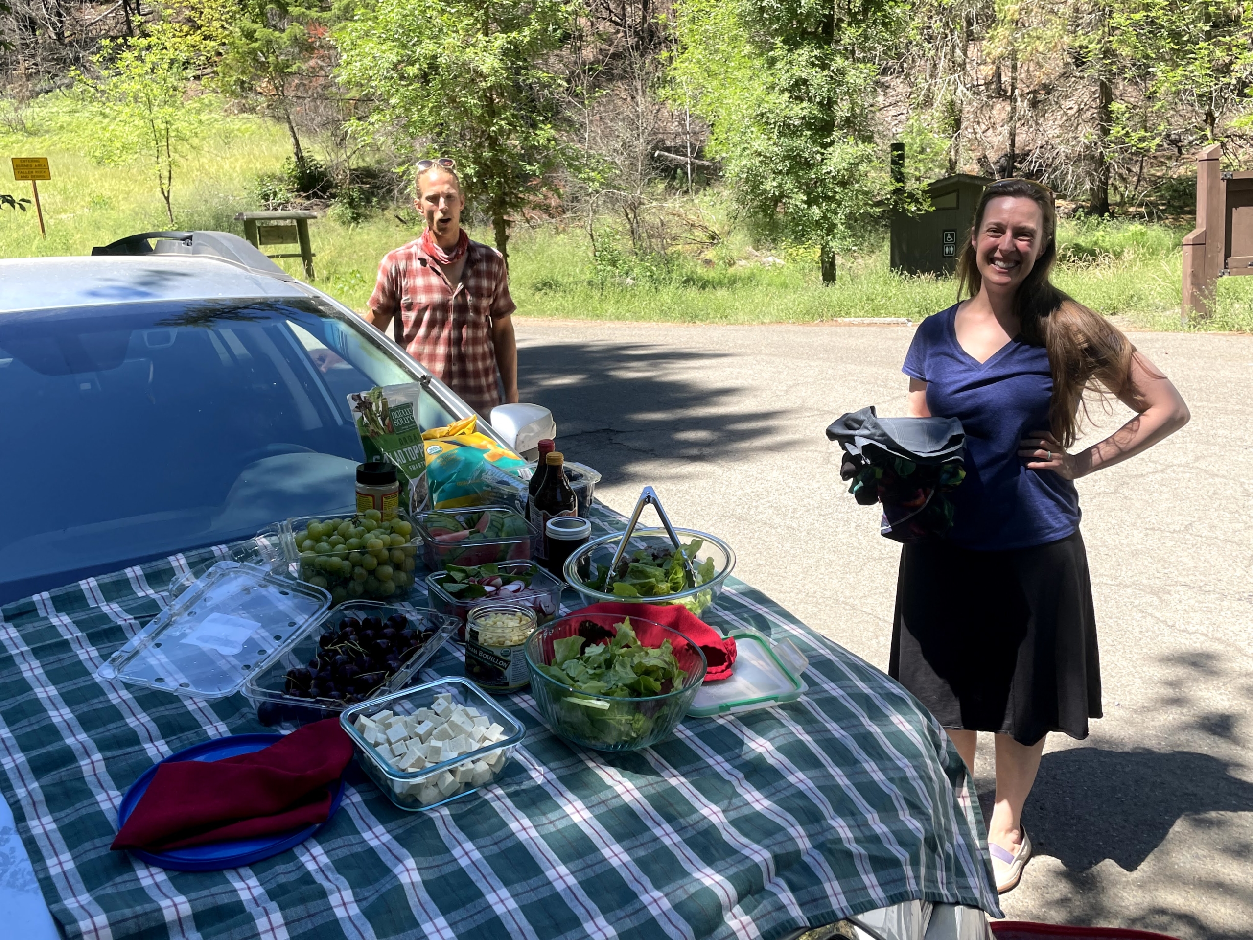
As usual, I rolled on a plant-based diet for this trip…and brought wayyy too much food. I’d planned for a 100% self-supported trip in Idaho and figured what the heck, I’ll bring a ton of grub for this trip.
Which was fine, except those roads are STEEP. And we were in towns every other day, so I did not need all the food. My self-imposed nickname was Chuuuuck Wagoooon (always yelled loudly).
Nothing better after a long day of riding.
Water
Water is quite plentiful with streams or faucets on the coast. I used the Katadyn BeFree filter.
You’ll have a signal up high, but the back roads of Oregon shut down any signal.
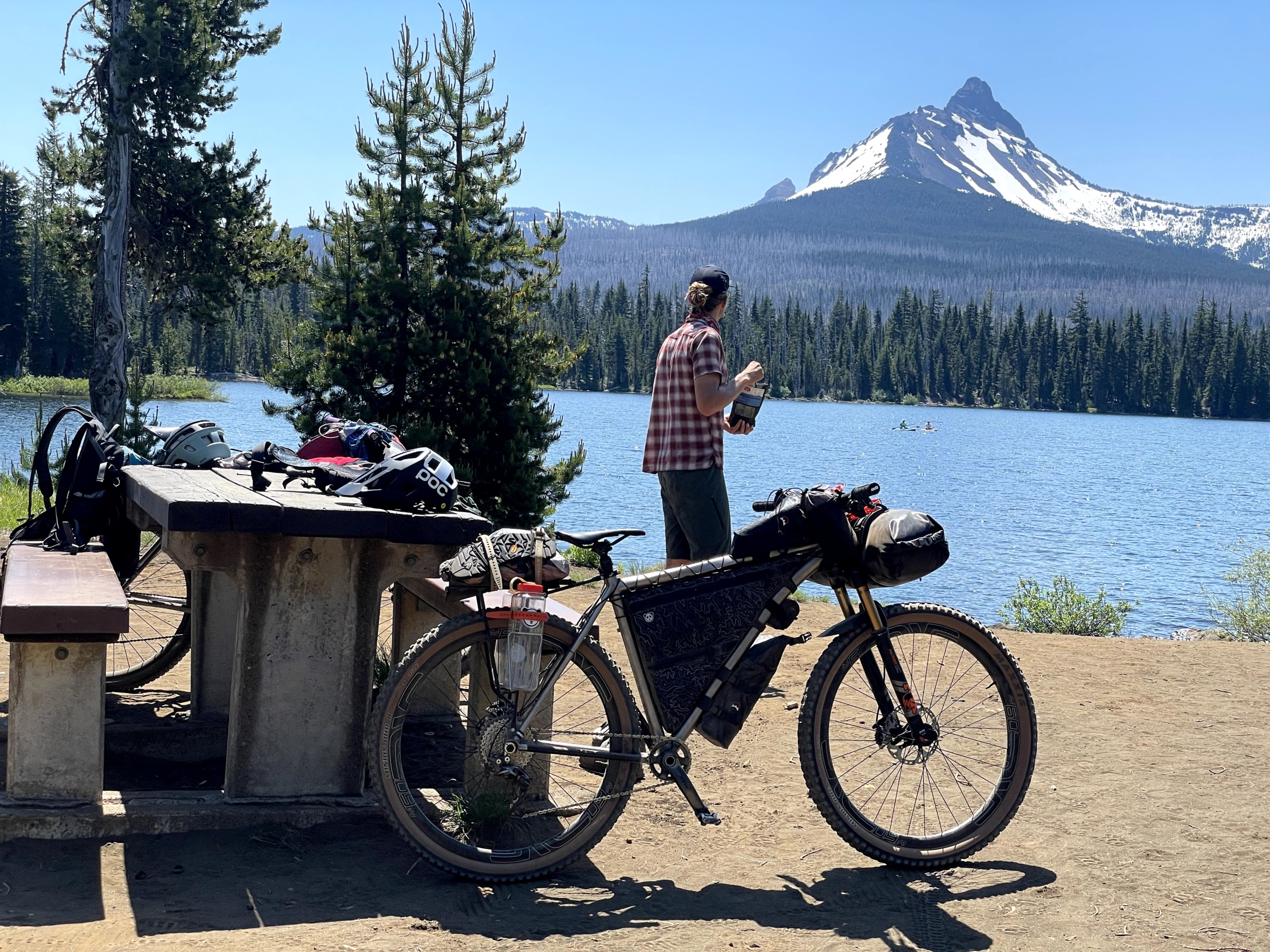
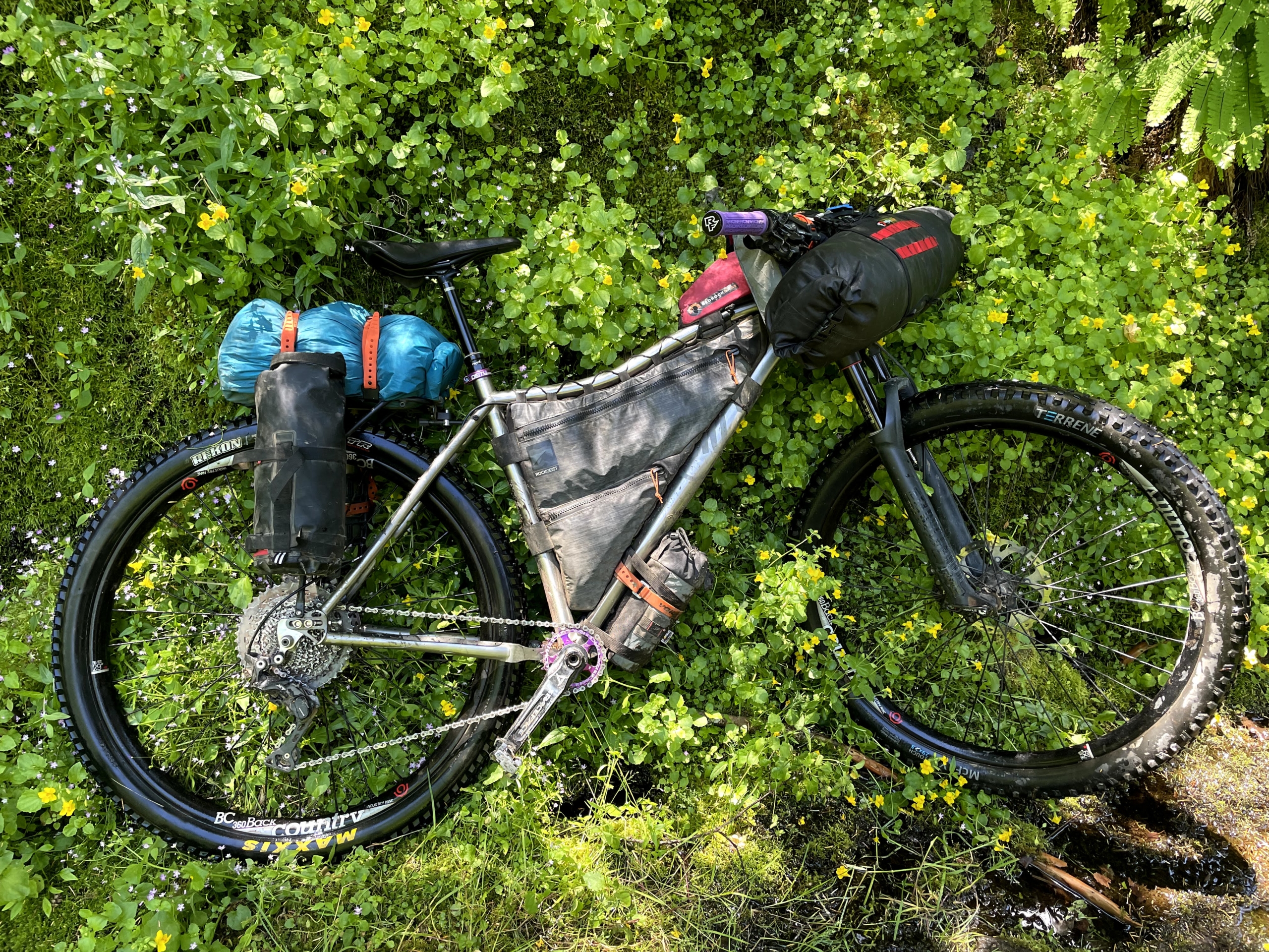
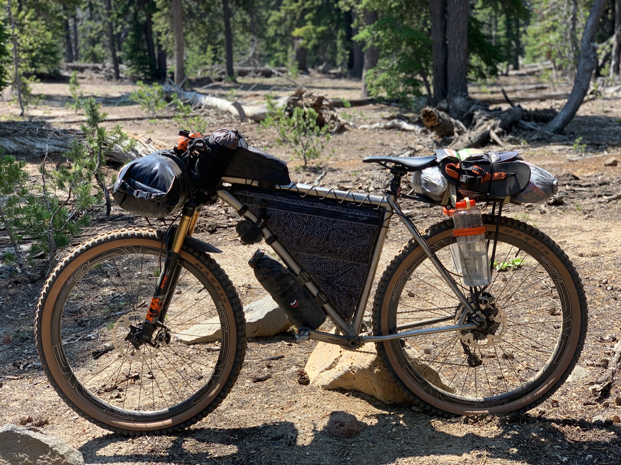
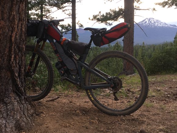
My bike setup for the VOG. Went a biiit heavy on the food to start!
Gear
I rode my 2019 Why Cycles Wayward V.1 set up with Terrene McFly 2.6” front and a 2.6” rear Maxxis. I run a 140mm front fork, which seems to handle most anything I’d want to ride a loaded bike down. It was overkill on this trip, but sections of logging roads were chunky enough that I don’t regret it!
Still loving my 26T chainring on my Wayward to complement the 11-46 Shimano XT setup I’ve got. It’s AWESOME. Spinning is the name of the game while bikepacking! You’ll never mix your taller gears as much as you’ll wish for more climbing range, trust me.
Rounding out my gear was a Revelate front roll bag for sleeping gear and a custom frame bag. I ran a lightweight T-rack from Tumbleweed Bicycles instead of a dropper bag, ski-strapping a dry bag to the rack. The weight is basically the same as a big dropper bag and functions much better. Sure, dropper bags LOOK cool, but are they truly uber-functional? I say racks still have a place.
Two Salsa Anything Cages rounded out the kit, one with my cook kit, another with water…and my REI lightweight chair, which I love having on fire road trips!
And that…is a wrap. Thanks again for setting up the route, Ben.
Grinding up a coast range climb. (Photo Brady Lawrence.)
https://www.traipsingabout.com/wp-content/uploads/2023/01/Lawrence-VOG-115-scaled.jpg6831024Dakotahttps://www.traipsingabout.com/wp-content/uploads/2018/03/Traipsing-About-logo-white-background-450x156.pngDakota2023-01-30 19:08:102023-05-06 14:44:57Bikepacking the Odyssey of the VOG
Way out yonder in SE Oregon lies the Oregon Big Country bikepacking route. If you’re looking for a remote desert getaway, you’ve found it.
Overall, I expected cruisy gravel roads, mild vertical gain, and hot springs to soothe bikepacking soreness.
I nailed 1 out of 3: the hot springs were amazing.
In reality, the Big Country route served up a variety plate of different terrain ranging from desert playa up to snowy mountains. I’ve bikepacked and road toured a lot and this trip surprised me with the physical difficulty, remoteness, commitment level, and sheer beauty.
Sean enjoys a morning soak (with coffee) in Bogg Hot Springs.
Shortcuts for Oregon Big Country:
Below I share snippets of my experience bikepacking the Oregon Big Country. I wrote this as a resource for folks looking to bikepack this route, so free to skip to any specific sections below.
The Big Country is a ~360 mile loop starting in French Glen, a tiny town on the west side of the Steens Mountain range in SE Oregon. Terrain varies from gravel to pavement to “where in TARNATION is that 1852 wagon trail?”
You’ll wander down into Nevada, roll across a full-on desert. You’ll find places to fill up on water about as often as you see people: rarely. The fickle weather might shut your trip down entirely if the Dread Mud is activated. The only shade comes from circling vultures (I’ve always wanted to say that).
In other words, it’s the best kind of adventure, chock full of places rarely visited, pronghorn antelope bouncing along, starry skies for days, and a fine tale for the folks back home.
Holy amazing camp sunset, Batman. (Willow Creek Hot Springs)
My experience bikepacking the Oregon Big Country
When I bikepacked the Oregon Timber Trail, I’d routinely complain when we hit fire roads vs. singletrack. What can I say, I like trail riding! (Cough, snob alert.)
Wellll, the Oregon Big Country features exactly zero singletrack, and I still dug it. The Big C served up a tasty cocktail of desert landscapes, remoteness, hot springs, and a chance to immerse myself in a part of Oregon I seldom visit, bermed trails be damned.
Roads? We don’t need no stinkin’ roads.
Most of our days on the bike unspooled lazily. We weren’t pushing too hard—and didn’t want to. Ample space for joking around during snack breaks and chatting with overlanders at Bogg Hot Springs or Gatorade-offering bird watchers in Malheur Refuge!
Our first night featured a full moon backed by a symphony of howling coyotes. That yielded to a silent morning campsite where I sipped tea and stared across the mesas thinking “this is what it’s all about.” Following sage and rough ranch doubletrack, we climbed over the Steens to the rowdy and rad Stonehouse Road descent. (May I never ride up it!)
Day 1 campsite, a few miles past Diamond Hotel. No sounds except birds chirping. Divine.
Water is always at a premium during the Big Country. We filtered from trickling streams in cow pastures or boggy reservoirs. A few kind hot springs car-campers saw us doing so and offered up a water donation. “You can’t filter out of that nasty beaver pond! Here, take this jug, we’re leaving tomorrow anyway.” Generally, we tried to camp at water sources, but pickings were slim between those, so we each carried 5-6 liters at a time.
During a late night soak at Alvord Hot Springs, a string of 30 UFOs transfixed us as they streamed across the sky. I was willing to be abducted for a couple gallons of cold spring water, but they were just Elon’s Skylink satellites and offered nothing but fast internet.
Tailwinds the Phoenicians would have prayed for pushed us across the Alvord Desert, a dry lake bed. Our luck ran out in Big Sand Gap as we hiked in the hot sun, but good humor, lupini beans, and knowing it would end someday got us through it.
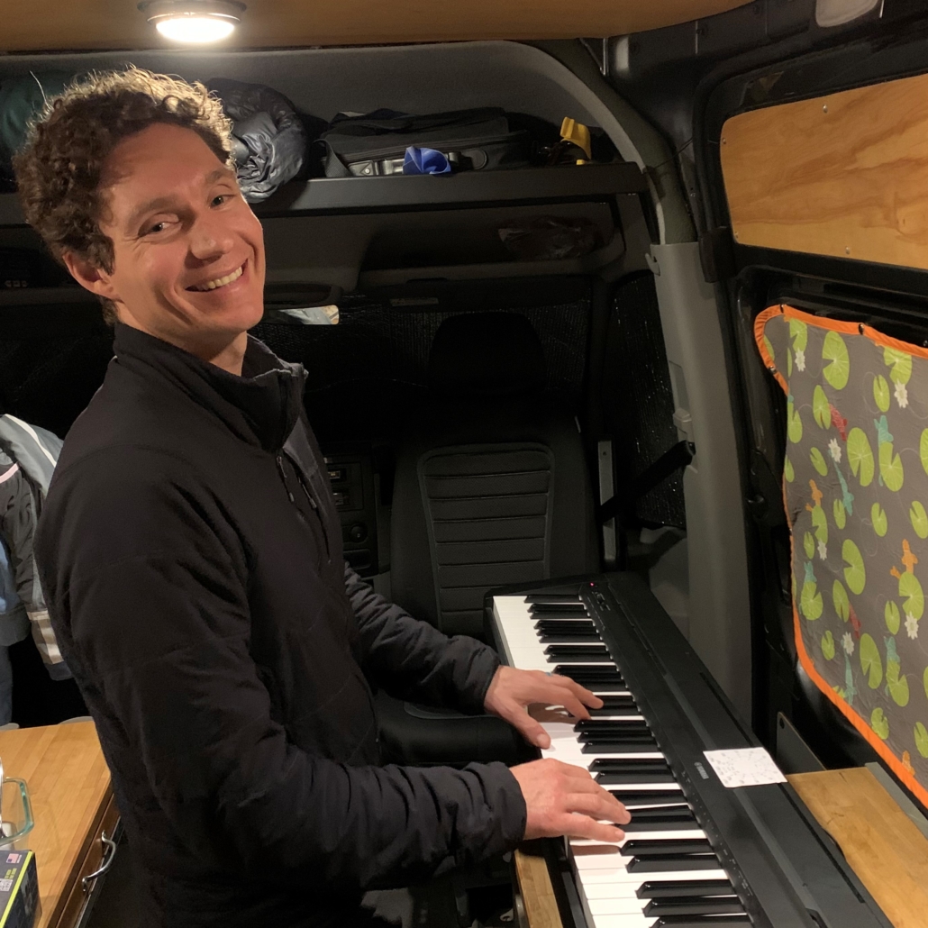
By the way, dig these kinds of posts? Sign up for the free 2x/month Traipsing About newsletter for more tales from the trail and creative challenges like drawing and piano when I’m off the bike.
Cruising east across the Alvord Desert. Not pictured: INCREDIBLE TAIL WIND.
I found a plastic workshop clamp at Alvord, which turned into a game of secretly depositing the clamp on each other for the next four days, trading it back and forth. “NOOO, not the clamp!” Subtle maneuvering and sleight of hand tactics escalated until some near-wrecks convinced us it was time to end the game.
Mason gets clamped.
The usual gear-testing (and MacGyver solutions) presented themselves. Chains broke. Bottom brackets loosened. Tires and sleeping pads punctured. My stove fuel failed in the cold. My new Platypus filter bag blew a hole in the side after 10 uses.
We swapped or shared gear, rallied. Mostly, things worked and mishaps were few. Good to have companions on a trip!
Trail repair. Bacon tubeless kits rock!
The Trout Creek Mountains delivered the promised hard work, plus temps dived toward freezing at 8k’. Cooold winds, but minimal snowy hike-a-bike. High on a ridge, wild horses cantered up to Mason.
Things grew more cruisy from the Trout Creek Mountains on day 5 as we hit smoother gravel and some pavement. We refueled our food supplies at Denio Junction Motel via a box I mailed ahead (do it!) and chatted with the gracious owner.
Gravel roads, folks.
After a brilliant afternoon lazing away at Bogg Hot Springs, we spent our last three days traversing endless rolling ranch country in Sheldon and Hart Refuges. Occasionally pronghorn antelope streaked across the open landscape, but mostly we encountered friendly cows. The heat dial stayed turned down (HURRAH), making the hot springs delightful.
A return to aspen marked the final approach to Hart Hot Springs and our last night of the trip. We finished our final climb well past dusk and descended in the dark to camp beside a burbling stream.
A late night and morning hot springs dunk clinched the deal: this is a sweet bikepacking loop. If you like sage, solitude, and soaking after long bike rides, you can’t go wrong on the Oregon Big Country.
Careening down the Trout Creek Mountains at the end of 12 hour day of bikepacking.
Oregon Big Country Photo Gallery
Photos! Click to see full-size images and scroll through. Arranged in sequential order (roughly) by day to get a sense of how the terrain changes.
Unloading gear for the trip
Malheur Reserve
Outside Malheur Refuge on smooth rolling pavement.
Sunset pavement, day 1
Day 1 campsite, a few miles past Diamond Hotel. No sounds except birds chirping. Divine.
Ah, the fresh smell of sage
Roads? We don't need no stinkin' roads.
Stagecoach Road: high to low
Can you spot Mason charging down Stagecoach Road?
Zipping down the splendid Stagecoach Road descent.
Wide, smooth gravel enroute to Alvord Hot Springs.
Cruising in the shadow of the Steens at sunset.
Late night at Alvord Hot Springs.
Rolling down toward the Alvord Desert
Mason knows how to stay cool in the desert.
The Alvord Desert lake bed.
Cruising east across the Alvord Desert. Not pictured: INCREDIBLE TAIL WIND.
Sean heading into the mega-fun Big Sand Gap with the Steens and Alvord Desert behind.
East of Big Sand Gap, route finding gets...tougher.
Trail angel! Thanks for saving us from filtering beaver pond water.
Holy amazing camp sunset, Batman. (Willow Creek Hot Springs)
Making friends at Willow Hot Springs.
Willow Hot Springs. #morningtentview
Mason gets clamped.
Sean kicking back, Mason plotting his next Clamp move.
Whoa, we started beyond those mountains?
Hiding from crushing wind during a lunch break. Mmm, salt and vinegar pistachios.
Trail repair. Bacon tubeless kits rock!
Bikes and stuff.
Careening down the Trout Creek Mountains!
Evening in the Trout Creek Mountains
Nevada!
Not too much traffic on the Big Country!
Sean enjoys a morning soak with coffee in Bogg Hot Springs.
Trail repair: leaky thermarest.
Superglue pens from your ER doc friend: don't leave home without them
No bikepacking trip is complete without a few hike-a-bikes. Good for stretching out the legs!
Coffee break looking back at Shelton Refuge.
Final stretch before the climb to Hart Hot Springs.
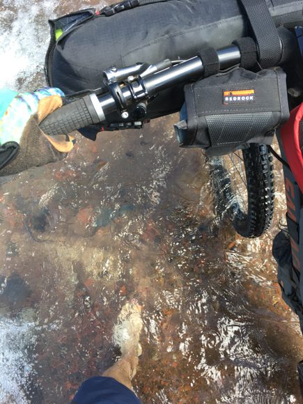
Not too many water crossings on the Big C, all easy.
A night descent into Hart Hot Springs.
The wide, rather boring road from Hart to Frenchglen.
Mason, Captain Dapper
Sean doesn't just ride bikes.
Yup, that's me.
Big Skies, steep roads.
Logistics for bikepacking the Oregon Big Country
Tips and suggestions for the route
-If you want to check snow levels in the Trout Creek Mountains, call the closest ranger station. Call 541-473-3144. They were happy to help. (The Gaia app with snow layers works well too.) We bumped our trip from May 2 to 16th after a late-season week of snow in April.
-Bring as much sun protection as possible. We all wore helmets with a buff pulled up most of the time. Others wear wide brimmed hats or a Da Brim helmet attachment.
Mason knows how to stay cool in the desert. Or just in general.
-Wind protection is quite nice. A buff kept my face from getting whipped raw.
-Mailing a package to the Denio Junction Motel was easy. Tiara and Alex (the new owners as of 2022) are fabulous, friendly people. Call ahead to double check, but they asked that we mail stuff to “Denio Junction Motel care of (your name)”. Restock options at the Motel are very limited, but they are ramping up.
-Big tires are your friend. Suspension is nice, especially the first 150 miles. Anything smaller than 2.4” could either slow you down, punish your body, or straight-up destroy your bike. My friend almost borrowed my old Salsa Fargo for the trip and we thought a half dozen times, “my god, this would be horrible on a Fargo!”
-Supposedly the water near Willow Creek is gross because of the beavers. Filter beforehand or head up really high to where less critters are? Or find some really nice people to give you some of theirs.
-Hart Mountain Trail is closed to vehicles until July 15th. There was no water from Sheldon Reservoir to past all the abandoned ranches. From there, we had plenty of water available to filter.
-The small pool at Hart Hot Springs is warmer vs. the Stone House.
-We took our shoes off for a half dozen water crossings. None of them felt unsafe though.
Not too many water crossings on the Big C, all easy.
Daily summary of trip
We pedaled the loop in 8 days, including a late afternoon departure on day 1 and a half day from Hart to Frenchglen. I’d say 7-8 days is spot on for pacing if you want to experience a hot spring every other night vs. a dehydrating midday soak and continuing to pedal.
Day 1: 33 miles, cruisy gravel roads and pavement from Frenchglen to a brilliant campsite just past Diamond Hotel. We hit the road at 4:30 pm and arrived at dark without pushing too hard.
Day 2: 55 miles up and over the Steens to Alvord Hot Springs. Terrain is lightly used ranch ATV trails with plenty o’ rocks, so going was slooow. Enjoy that descent down Stonehouse Road to the east side, it’s da bomb. (Filter water from the stream on the way down!)
Can you spot Mason charging down Stagecoach Road?
Day 3: About 30 flat miles from Alvord Hot Springs to Willow Creek Hot Springs. A surprise of a day…be prepared for it to take wayyy longer than the mileage and elevation suggest. Roll onto the Alvord and pedal across a straight-up desert. Survive Big Sand Gap. Wander around route finding in the swampy zones. Ford some creeks. Soak away your worries at Willow.
Day 4: Willow Creek to the other side of Trout Creek Mountains. A bruiser of a day. Windy as hell, COLD up high at 8k (below freezing), patches of snowy hike-a-bike…and beautiful. So beautiful. Be prepared for a physically challenging, exposed day of riding. (We did ~40 miles and climbed 6500′.)
Day 5: Trout Creek Mountains to Bogg Hot Springs, 35 miles. Ahhh, almost a day off! Cruisy gravel and paved roads, a stop at the Denio Junction Motel to pick up a box we mailed, and an early arrival at the fantastic hot springs to nap and kick back for the afternoon.
Day 6: Bogg Hot Springs to Sheldon Reserve, 52 miles. Gravel cruising into ATV trails to pavement to gravel for days. Since Virgin Valley Hot Springs was closed, we skipped it and rode the highway over the nearby climb.
Day 7: Sheldon to Hart Hot Springs, 55 miles. A long day out on rarely-used rancher double track. We didn’t see another person the entire day until arriving at the (marvelous) Hart Hot springs.
Day 8: Hart Hot Springs back to Frenchglen, 55 miles. We lazed around all morning at the hot springs, then gunned it for the car on wide, fast, boring gravel roads. (My least favorite kind…)
This is more like it! (Evening in the Trout Creek Mountains.)
Getting to/from start/finish
Frenchglen rhymes with nowhere and is close to nothing, so getting there is up to you and your vehicle. At least the route is a loop! Get in the car and drive, then pedal your way clockwise back to your rig.
The friendly owner of the Frenchglen Hotel is totally cool with people leaving rigs. We donated some cash for parking afterward.
Time of year
There’s no perfect time to ride the Big Country, merely options. We initially planned on May 2nd, but late-season snow forced us to bump our trip to May 16th.
I’m glad we did because we still needed to do some hike-a-bike through snow in the Trout Creek Mountains. To check snow levels beforehand, call the local ranger station at 541-473-3144 or use the Gaia snow layers.
Full jacket mode for a cold descent into Hart Hot Springs.
In mid-May, nights dipped into sub-freezing temperatures. Overall, I’d still vote for that time of year because:
a) days are cooler and there is SO little shade. Pedaling in 90 degrees in low-water terrain = yikes.
b) hot springs feel way better when it’s cold vs. hot.
c) seasonal springs dry up later in the season and water is not plentiful on this route.
Navigation
Navigation was straight-forward thanks to the route GPX from bikepacking.com. As usual, I used Ride with GPS to navigate. There were a few swampy or sandy sections that were tougher to navigate, but generally the track was apparent. Even if it had last been traversed in the 1850s… Thanks to Gabe at Limberlost for putting this together!
East of Big Sand Gap, route finding gets…tougher.
Food
As usual, I rolled on a plant-based diet for this trip, eating freeze-dried meals the entire way.
I ate a variety of freeze-dried meals, including delicious Food for the Sole, Backpacker’s Pantry Pad Thai, and the (too spicy!) Good To-Go Bibimbap. Lunches were a mix of freeze-dried options and various snacks.
Overall, I aim for 400 calories an hour without counting calories. I prefer to have an extra meal and bonus snacks in case of a mechanical…or just raging hunger! It’s never perfect and sometimes I screw up and under fuel, but it usually works for me.
Water
Finding reliable, clean water is definitely a thing on the Oregon Big Country. I brought 6 liters of capacity and was glad I did since we dry-camped a few times.
Compared to my previous trips, this outing felt like I was marooned on the planet Dune sans stillsuit. Again, riding this in hot temps would create less-fun situations.
Good plan: If the water looks good, filter it! You aren’t carrying your bike over downed trees or pushing over giant passes, so a couple extra pounds isn’t a big deal. You usually won’t find anything better anyyytime soon in my experience, and we rode right after late-season snow. In June? Yikes.
Trail angel! Thanks for saving us from filtering beaver pond water.
Two of us used Katadyn BeFree filters and I brought a Platypus flter. Even with a pre-filter using a bandana, the water sources weren’t sparkling snow melt and the filters clogged up.
The frustration of doing the boa constrictor squeeze on a filter every time you want water is real! Bring a new filter or clean yours thoroughly before the trip. I’m planning to roll with a gravity filter from now on plus backup water treatment drops.
There is no water faucet at Alvord Hot Springs, so filter water before you arrive. You’ll need to buy water if you don’t filter before arriving, but the store closes fairly early. Ask me how I know…
Other than swamp water, we didn’t see any water from Alvord to Willow Creek. From Willow Creek, we didn’t have water until the other side of the Trout Creek Mountains at the big stream crossing. Fill up there, pickings are slim past it!
Sleeping
We slept under the stars every night on this trip. Camping was easy to find and free except for a few bucks to say at the Alvord Hot Springs.
With Verizon, I had a signal until Willow Creek and around Denio. Otherwise, plan on zero signal.
Gear
Bikes and stuff.
I rode my 2019 Why Cycles Wayward V.1 set up with a Terrene McFly 2.8” front and Maxxis Rekon 2.6” rear. I run a 140mm front fork, which seems to handle most anything I’d want to ride a loaded bike down. You could do this trip on smaller tires and/or with no suspension, but I loved this setup.
Still digging my 26T chainring on my Wayward paired with my 11-46 Shimano XT rear cassette. Spinning is the name of the game while bikepacking! You’ll never miss your taller gears as much as you’ll wish for more climbing range, trust me.
Rounding out my gear was a Revelate front roll bag for sleeping gear, and a Rockgeist frame bag. To increase water and food carrying capacity, I also ran a Tumbleweed lightweight rear rack with two Salsa Anything Bags and a 20L Sea-to-Summit dry bag, which worked great.
https://www.traipsingabout.com/wp-content/uploads/2022/07/Trout-Creek-Mountains-descent-bikepacking-Oregon-Big-Country.jpg10801920Dakotahttps://www.traipsingabout.com/wp-content/uploads/2018/03/Traipsing-About-logo-white-background-450x156.pngDakota2022-07-13 18:50:292023-05-06 15:08:11Bikepacking the Oregon Big Country route
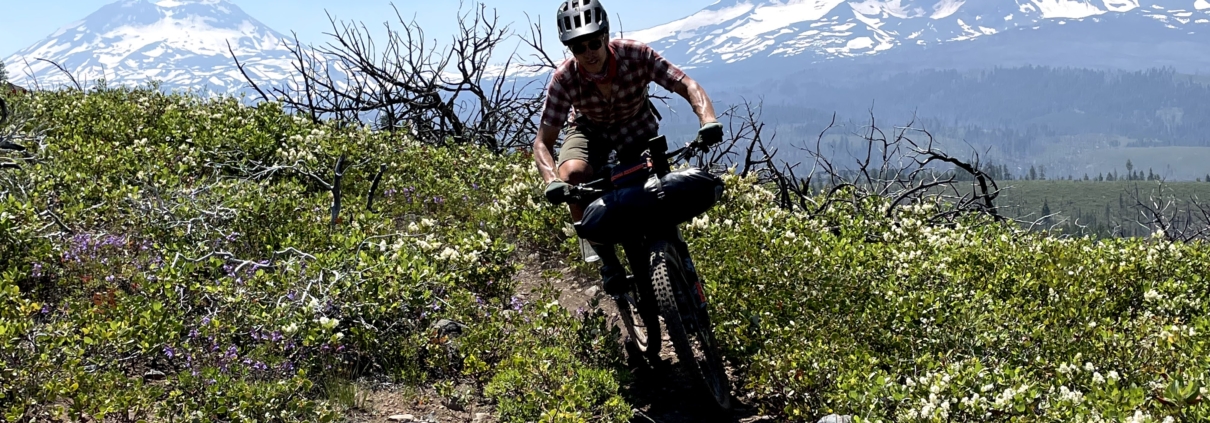
If your idea of a fine bicycle trip features tons of swimming, singletrack on two sides of a mountain range, and views aplenty, bikepacking the Three Sisters, Three Rivers might be for you. Sure, you’ll encounter mosquitoes and plenty of hard work, but call them the price of entry for the magic of outdoor experiences.
And magic there was. Rocky ridge riding with magnificent views of the Three Sisters; the primal deliciousness of pastries from Angeline’s Bakery after a hard day of riding; ferny, mossy beauty on the McKenzie River trail; spine-tingling dunks in cold rivers.
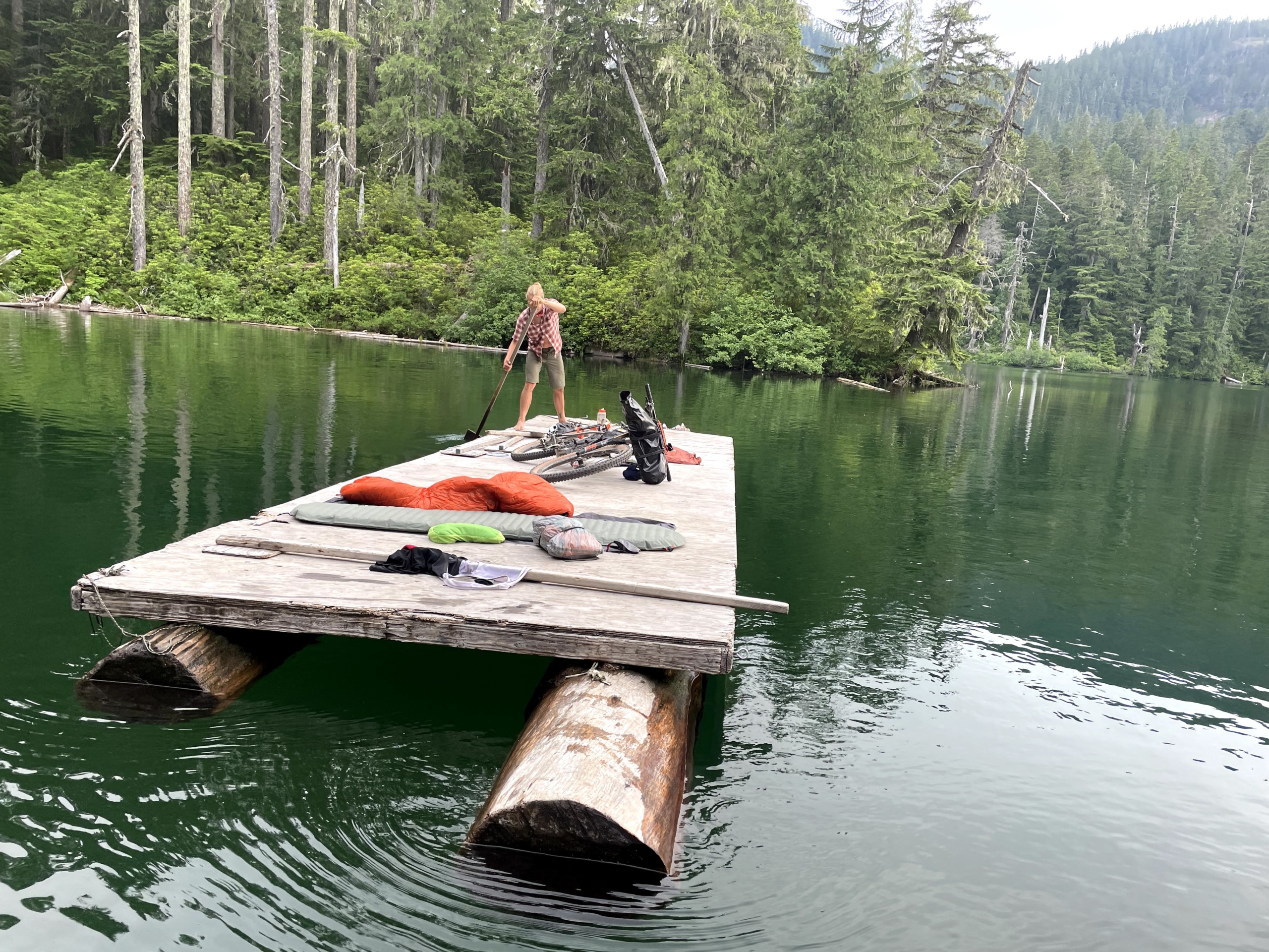
Throw in trail angel generosity and hilarious chats with random people, paddling out on log rafts into the middle of Hidden Lake to sleep, and brake-smoking madness down Alpine trail and the recipe for a spectacular trip is complete. The calm quiet of mountains in the evening tops it off.
Here’s my experience doing an unsupported bikepack on the Three Sisters, Three Rivers route. I created this as a resource for folks looking to bikepack it, so feel free to skip to the specific sections listed below as needed.
A favorite moment: loading our bikes onto log rafts at Hidden Lake and paddling out to sleep on them.
Three Sisters, Three Rivers Bikepacking Route Description:
The Three Sisters, Three Rivers route travels 325 miles from dry Central Oregon over the hills to the west side of the Cascade Mountains. From Bend, it’s singletrack most of the way to Sisters, followed by a pedal around the shoulder of Black Butte to Suttle Lake and over the Old Santiam Wagon Road, a historic route for plucky early Oregonians.
The famous McKenzie River trail leads you to the Aufderheide, a snaking road through the hills outside of Oakridge. You’ll peel off the Auferheide and head up steep fire roads to the crest of the mountains, then grin your way downhill on Alpine trail into Oakridge. Regain the vert out of town on the Middle Fork of the Willamette River and back to the crest of the Cascades (and mosquito breeding ground, fair warning).
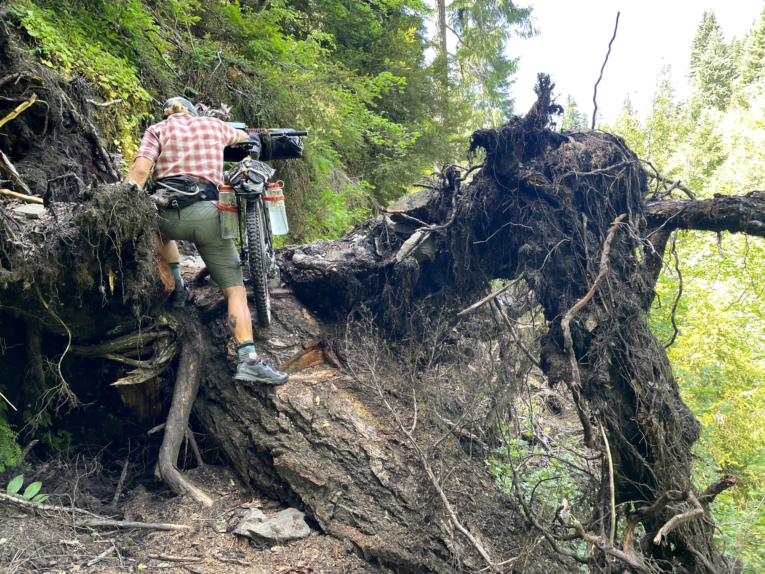
Then it’s west and down down down (except when you’re pushing your bike up) on the North Umpqua Trail toward Roseburg. This section will test any bikepacker and help you brush up on swearing, but at least there’s respite in the cold river and the Umpqua River hot springs helps revive spirits before the push to the finish.
I’ll also suggest an alternate route to make this route a loop, which simplifies logistics by skipping the N. Umpqua Trail and picking up the Oregon Timber Trail out of Oakridge or from Crescent Lake.
Fun and games on the North Umpqua Trail.
Our Trip Plan
My trip companion this time around is Mason, a stoked guy on his first serious bikepacking trip. For once, there’s some real planning via a shared Google Doc.
Our rough goal for the ride is 8-9 days of pedaling, though we end up doing it in 6.5 days due to closed trail at the end of N. Umpqua Trail and by increasing mileage to avoid a looming heat wave.
Prior to the trip, my angst grows as Mason stacks up huge riding days – “43 miles and 7,000’ of climbing again today!” – while I play piano and pretend to ride. (Good thing I recently rode the Oregon Outback or I’d be researching ebikes.) Many years of endurance riding gives me confidence in my ability to rally survive without extensive training, but training still matters. If I can get 5-8 hours of pedaling per week for the month leading up to a trip, I’m good.
Since I live in Bend, we leave from my front door. I’ve ridden sections of this route before, but linking it all up is satisfying. When I bikepacked the Oregon Timber Trail, connecting the entirety of Oregon purely under my own power unveiled new facets of the state.
By the way, dig these kinds of posts? Sign up for the free 2x/month Traipsing About newsletter for more tales from the mountains and creative challenges like drawing and piano when I’m off the bike.
Mason (left) and me rolling out on the Three Sisters route.
Day-to-Day Experiences on the Three Sisters, Three Rivers
Day 1: Bend to Sisters
We pack up the night before and hit the road by 7:30 am. My legs feel like mush to kick things off. Ah, a good omen. Sadly, there’s smoke in the air from a fire. It’s June 20th – is this the new reality, summer’s mired in a haze?
On the way up the first climb, Mrazek, I chat with a woman with plans to ride part of the Three Sisters with her employees. Bikepacking is increasingly popular and it’s awesome to see people trying it out. There’s plenty of room outside and biking spreads people out. Plus, it’s not my private playground.
Mrazek is a smooth, leisurely pedal out of Bend and a great start to the trip. We refill water at the creek up top, where I realize I accidentally carried an extra half gallon uphill for two hours. Didn’t even notice. Another reminder for me to not to be a weight weenie.
On the fire road connection to Trail 99, we stop and eat lunch. Thanks to Mason, we’ve got different freeze-dried food, a local plant-based Bend company called Food for the Sole. The first cold-soak lunch meal, curried cauliflower, BLOWS MY MIND. It’s exponentially better than PBJ on a tortilla.
My latest realization: I’m over sweet meals on bikepacking trips. Bring on the savory snacks mid-ride.
On the infrequently-ridden Trail 99, we pass through a large burn from 2017. Skeletal trees with panoramic views of the Three Sisters, fun descending and the trail all to ourselves, yeehaw.
It’s a 95 degree day, but we pedal into Sisters feeling fresh(ish). Last trip to Sisters, we stayed in the campground by the highway and I learned accelerating semi trucks aren’t my favorite white noise. I opt for a hotel room for the night. Credit card points are the bomb.
We eat massive burritos at a Mexican place and are in bed by 9:00. Temps are heading to 99 degrees the next day and we don’t want to bake our brains out on Old Santiam Pass.
We make it to Angeline’s Bakery in Sisters right before closing (3 p.m. Mark your calendars, riders!). When I bikepacked the Oregon Timber Trail, I only bought two pastries; this time I buy four. I STILL regret not getting more by the next afternoon.
Day 2: Sisters to Clear Lake
We gobble down cold-soaked instant oatmeal for breakfast. Still learning things: why did I ever bother cooking oatmeal in the morning? I always add a healthy portion of freeze-dried fruit, nuts, and peanut butter to up the ante.
We slip outside into the sunrise, cool air nipping at our grins. Those smiles subside on the steep, sandy traverse around Black Butte, but my audiobook, A Game of Thrones, distracts me from the horse-impacted trail and dusty quagmire.
We cross the frosty Metolius River and head up to Suttle Lake. Finally, the trip is underway: our first skinny dip, . A woman hikes by and we turn away, but she merely yells, “that was me an hour ago!”
Then we’re climbing up Old Santiam Pass. I pause to catch a work call while Mason pushes on toward Big Lake. Like any good relationship, it’s beneficial to have time apart while bikepacking.
Nothing like soaking your head/shirt/entire body when it’s 99 degrees.
People lament the sand on Santiam, but with a 2.6” rear tire and 2.8” front (Mason has 2.4/2.5”), we do zero hike-a-bike. How early Oregonians got over this pass in Model T’s is beyond me. I suspect they swore a LOT and planned for unexpected overnights. They did other things too: dug in the sand, pushed cars, and straight up walked away when their vehicles failed them.
I catch Mason at Big Lake and we enjoy the cool water. He also receives his comeuppance for teasing me about installing my bike rack backwards: his chain install is routed incorrectly and his derailleur guide now has custom grooves. I handle it diplomatically by laughing uproariously and teasing him for an hour.
Thermometers are popping their bulbs when we arrive at Clear Lake. Our energy levels are high, but who the heck wants to pedal further in an oven? The lake is gasp-inducing cold, the best. We jump in repeatedly, hang by a kayak put-in and chat with people, help folks haul their gear out of the water, and generally enjoy ourselves.
A lady whose son is hiking the PCT is excited to be a trail angel and shares some cold bubbly waters with us. Always say yes to offers of hospitality to encourage it in humans! (We do, however, turn down non-vegan mac and cheese with sausages later on. Gotta stick to core values as well.)
We end up camping with a cool crew of folks from Corvallis. One is an ice scientist moving to Tasmania to help them develop their nascent research program. The other guy wears a chess nonprofit shirt, but sadly doesn’t have a board with him. I didn’t need to lose anyway.
The guys ran a juggling club together in college and entertain us with stories of their exploits, plus tales from a multi-month bike tour cut short thanks to a testicular torsion. Google it: you don’t want one.
Luxurious overnight digs at Clear Lake.
Day 3: Clear Lake to Hidden Lake via McKenzie River Trail
I wake up at 5:30 a.m. as morning lights seeps through the trees. My eyes are heavy thanks to staying up late around the (safe!) campfire.
The McKenzie River is as beautiful as always, a crisp blue rushing flow. With a 6 am weekday departure, we have it alllll to ourselves the entire 26 miles except for two guys who we fly past on a descent. Loaded bikes still haul ass downhill, folks.
The 26 miles is a tuck and weave ride through mossy trees and fern-covered undergrowth. The contrast with the east side of the mountains is a cool aspect about this route. And being able to jump in the river, of course.
Mason ripping down McKenzie River Trail.
To streamline things, Mason mails food ahead to the post office in Blue River and Oakridge. Thru-hikers often do this, but I never have. The simplicity of knowing what to expect food-wise, especially following a plant-based diet, proves quite nice. We do the same thing on the Colorado Trail.
I restock snacks at the gas station in McKenzie, eating two cold cans of Amy’s soup right out of the can like a (happy) wild animal. Meanwhile, Mason hammers along the highway to get a resupply package he shipped to Blue River. He’s disheartened it’s 3 miles out of the way, but he’s strong and determined. No biggie, it’s all part of the adventure. I rendezvous with him on the climb out of the valley. Oakridge or bust, tally ho!
This is my first time on the winding Aufderheide, a paved road through the mountains. At the dam, the road is blocked to car traffic and there’s a “No pedestrians” sign. We scarcely glance at each other and keep pedaling. We’re on bikes, after all. (Yes, we’re hardened criminals, but we also encounter zero landslides or reasons to not pedal the road.)
Rolling on the Aufderheide.
The day’s hard work is the long fire road climb up to Hidden Lake, our evening destination. I pop in an earbud and disappear into Game of Thrones again. At 2.25x speed, I can actually finish a 35 hour audiobook on a trip like this.
Hidden Lake is divine, a gem perched in the mountains. The kicker: some creative genius nailed a bunch of plywood to logs and created rafts for paddling around the lake. It’s still early in the afternoon and we both have energy to continue, but why the hell travel by bike if you can’t stop and enjoy a spot like this?
We each paddle a raft over into the shade and spend the afternoon swimming, napping, chatting, and reading. These moments, free of a cell signal or anything pressing to accomplish, often kick off the best conversations. I learn more about Mason in two hours than I’ve learned in the last two years. (And yet still make plans to ride the Colorado Trail with him.)
Nightfall brings out cricket with megaphones. I pop an earplug in and pass out on my gently rocking raft. Later, I wake to the full moon and watch the trees wave in the wind. It’s splendid. The cricket’s serenade drops me back into sleepville.
Hidden Lake. When was the last time your bikepacking trip included log rafting?
Day 4: Hidden Lake to Oakridge
We spend the cool morning hours pedaling straight uphill while waving at gravel trucks working on the road. Why are fire roads in the middle of nowhere maintained to this degree? Deep philosophical questions abound on bike trips.
It’s a long day of pedaling, some 50 miles and 6,000’ of climbing. However, the fire roads feel blissfully easy. After the McKenzie River trail the day before, I appreciate the laid-back enjoyment of a nice road in the middle of nowhere. The views still sparkle and the effort is far less. Variety!
As usual, the view from the top of Alpine trail stretches out for miles. And then I descend into tunnel vision and only see trail for the next seven miles as we roast our brakes downhill. Don’t let anyone tell you loaded bikes aren’t fun: singletrack, especially smooth and fast stuff, is still copious fun on a bikepacking rig.
The classic view at the top of Alpine. It’s still beautiful.
A snide guy at the bottom of the trail levies advice at us and talks up the rides he’s done. It’s strange how some people have a compulsion to one-up when they see people doing something difficult. (I’ve only done it a dozen times to other people!) We hastily bid him adieu so we can get to baking our brains out on the hot pavement for the final five rolling miles to Oakridge.
Sadly, the 3 Legged Crane Pub is closed, so we settle for sitting outside a Thai place in the scorching heat. I chat with a Timber Trail rider from Durango who is WAY stoked on all the swimming in Oregon versus the Colorado Trail and he fires me up for my upcoming trip.
We finish out the day with the A/C cranked at the Best Western. Between delicious cold air and the massive haul of fruit I bought at the store -including a watermelon I carried under my arm – it’s a perfect end to a stellar day of bikepacking.
Day 5: Oakridge to Oldenburg Lake via Middle Fork of the Willamette River
Loaded with grapes and cherries, we head out into the cool morning for a day of uphill. A mile out of town, my cranks wobble and try to fall off my bike. Hmm, odd… My multitool doesn’t have an 8mm, but Mason comes to my rescue. Many benefits to traveling with a companion.
We huff our way up to the dam. At the top, there’s a guy sitting in his car smoking a cigarette. “You guys pedaled up that hill?!” Yup… (And a few hundred others.)
Early in my bike travel days, I’d scoff at how people didn’t understand what we were doing, how “cool” it was, the commitment, etc. Then I realized something: it doesn’t matter. Nobody except psyched cyclists care what I’m doing beyond a “cool you’re out here.”
Post-trip, I’ll sit down for a belated birthday dinner with some friends. Since our last hang, I’d done the Oregon Outback and Three Sisters bikepacking trips. How long do we spend talking about them? About 3.6 minutes. It’s merely another bike trip for Dakota. Let’s move on.
And you know what? It’s freeing, a fine reminder I better be doing these trips because I WANT to, not because it’ll impress people. I’m not sharing the rides on Strava or Instagram, so no one can see the daily distance and elevation. If I’m going to sweat my way up a climb or hike my bike through downed trees, there better be some deep intrinsic motivation or I might as well stay the fuck home!
But that dinner is a week away. Here and now, we both head into audiobook land and grind out the Middle Fork climb, 5,000 of climbing and climbing and climbing. The trail is off to my right, but I see no reason to pedal punchy uphills with a paved, low-traffic road available.
Memories of Alpine help me remember why the uphill is worth it.
At Summit Lake, I’m reminded of 2018 and the Oregon Timber Trail when we came through here. Why? Because the mosquitoes in this cursed place are like the screaming hordes of Genghis Khan, except he took a few prisoners and these rapacious killer bugs do not.
We’ve already ridden 50 miles and kicking back to swim and camp sounds nice. Except it’s only 3 p.m. and sitting here while the bugs attack in rolling waves of fighter jet formations is simply not an option. We push on, straight into the teeth of the assault. Mason abandons all reason and splashes through a deep creek; I pick my way across as the bugs frolic in my eyes, ears, and soul. It’s not too bad, really, assuming you are already a crazy person.
We crest the top of the Cascades (again) and drop down to Oldenburg Lake as the sun dips low. The bugs have disappeared, at least for now. It’s a beautiful summer evening and our post-ride swim feels divine. Pedaling up to remote spots like this for an evening of solitude is why the hard work of bikepacking is worth it.
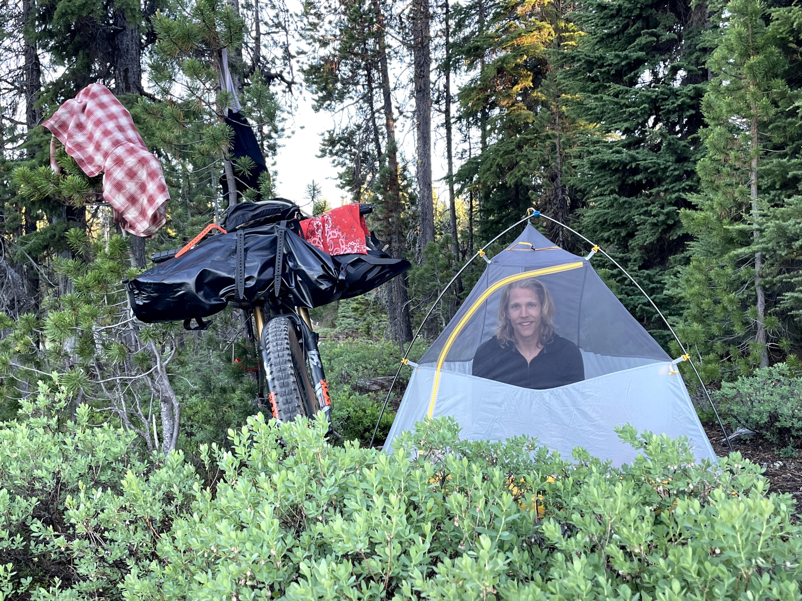
The mosquitoes return and I try to tough it out. (Mason immediately hops in the tent and watches me deal, gloating smile pasted wide on his face.) Surely they’ll go away when the sun sets… They don’t. *sigh* Into the tent, where we crash out for a solid night’s sleep.
Mason showing the mosquitoes what’s up.
Day 6: Oldenburg to reservoir along North Umpqua Trail
We wake to beady stares from hungry mosquitoes. Breakfast and camp teardown is a brief affair, shall we say.
The climb out of Oldenburg gets our blood moving with water bars and downed trees. Any stops are met with swarms of mosquitoes manning their turret guns. We make good time.
A screamer descent on a fire road brings us to the NUT: the North Umpqua Trail. Relative to the McKenzie River, the NUT is rougher, punchier, and far less traveled. As we discover, it’s not ideal for bikepacking.
We restock with a few salty snacks at the KOA campground before the Dread and Terror section of the NUT. The owner, Jim from Kansas, retired to the Oregon woods and now works his butt off running the establishment. He warns us about the terrifying trail ahead, the narrow cuts between downed trees, and so on.
None of Dread and Terror is too bad. If you can ride a solid blue trail, you’ll be fine. A reminder people who aren’t participating in the same activity rarely have useful insight. “Oh, climbing over the pass isn’t too bad,” they say, comfortably kicked back in their car. Take any advice on the road with a major grain of salt.
Perhaps Dread and Terror isn’t scary, but it kinda sucks for bikepacking after about the first few miles of fun descending. Sure, the Umpque River is a crisp blue and the terrain is beautiful. However, steep, punchy climbs, lots of downed trees, not much flow… It’s a truckload of work for not much reward.
And then the trail gets overgrown and competes with ferns and scratchy brush. Note: if you’re planning to do the Three Sisters route, consider the rerouteI suggest in the logistics/tips section below.
Steep and mucky on the NUT. Beautiful though!
Mason soldiers on without complaint, but his eyes laser cut through the underbrush. I follow, my bike’s crank still getting loose. Mason is out of earshot, so I tighten it with a stick enough to keep riding, repeat. One of those days.
The Umpqua Hot Springs are right along the trail, a naturally occurring series of pools. Air temp is about 98 degrees, not quiiiite ideal soaking temps. Still, we cool off in the freezing Umpqua, which makes the hot springs feel good.
Mason pulls off a tasteful nude in Umpqua Hot Springs. Is this site rated PG-13?
We’ve made great time and plan to finish a couple days earlier than planned thanks to mosquitoes, but also thanks to a historic heat wave: it’ll be brain scorching hot in two days. I’m no climatologist, but 115 seems hot enough to warrant not biking.
A thought strikes me. What if the fire from 2020 messed up the trail? (Yeah yeahhh, I should have checked earlier. At least we have food!.) It doesn’t show as closed on Trailforks, but a call to a local business gets me a quick answer. The last 25 miles of the NUT are closed.
Whoa. We only have 25 miles to go?! We immediately call it a night and wild camp by Tokatee Lake. A dinner of Food for the Sole wrapped in tortillas warms my belly. Life is good, even when the mosquitoes drive us into the tent for our final night.
Day 7: Reservoir to the end
Not much to say about the final day except: wow, it’s hot. Temps head toward 107 degrees as we pedal, push, cajole and threaten our bikes through the final sections. There are picturesque views of the N. Umpqua, but the heat and the overgrown trail tempers my enthusiasm. I’m glad to explore this part of my backyard, and also only plan on returning to the North Umpqua Trail sans bicycle.
We hit Panther Creek by 10:30, but are overheated enough to sit in the icy Umpqua for a solid 15 minutes. Chelsea, continuing her streak as the best wife ever, rolls up with a huge salad fresh-picked from our home garden, plus piles of fruit and good cheer. Another trip in the books!
A sight for sore eyes. Check out Mason’s face as he sees the food.
Parting Thoughts
All in all, I think this is a solid bikepacking route to experience what Oregon has to offer. Plenty of resupply points, lots of singletrack, and reasonable elevation gain make it quite approachable.
My biggest suggestion: unless you reeeeally want to ride the North Umpqua Trail, I’d consider rerouting from either Oakridge or Summit Lake.
Options:
Pick up the Oregon Timber Trail (OTT) from Oakridge and climb up to Waldo Lake and ride back to Bend. A perfect way to streamline logistics and turn this route into a loop.
Follow the Three Sisters route all the way to Summit Lake, then singletrack to Crescent Lake (reverse OTT), and then back west for a short stint on highway 58 to get to Waldo Lake. There are probably ways to do it on fire roads or even over the top of Maiden Peak for an amazing descent to Gold Lake. A bit of a detour, but you get to see more eastside Oregon riding.
Throwing out ideas! The entire Three Sisters route is beautiful and well-worth doing. Know what to expect on the North Umpqua Trail though.
Photo Gallery
Click on the first image and scroll to see full size shots or scope them out in smaller format!
Logistics for bikepacking the Three Sisters, Three Rivers Route
Day 1: Bend to Sisters via Mrazek and Trail 99 (48 mi, 4,400′ climbing)
Easy climbing out of town up Mrazek. Until early July most years, there’s a creek at the top before turning north toward Sisters.
If it’s a hot day, taking a short detour up to Three Creeks Lake for lunch and a dip is well worth it. Good chance it’s the last water until Sisters as well.
Angeline’s Bakery in Sisters closes at 3 p.m. You’ve been warned.
Day 2: Sisters to Clear Lake via Old Santiam Wagon Road (46 mi, 3,800′ climbing)
Easy pedaling to the base of Black Butte. The trail climb around the NE side suuucks. Do yourself a favor and take the fire road. I wish we had.
No need to filter water from Suttle Lake. At the SW corner is a campground with water spigots. Soak your shirt, climbing is coming…
Bigger tires (2.4″+) will make Old Santiam Wagon Road actually fun. The views are great and Big Lake is a must-stop for an afternoon dip.
Not much camping on the north side of Clear Lake, though there’s a spot right by the highway where we stayed when I did the Oregon Timber Trail. Fair warning: the truck noise is BAD there. This time around, I camped in the Clear Lake campground and slept much better.
Lunch at Big Lake on the Old Santiam Wagon road
Day 3: Clear Lake to Hidden Lake via McKenzie River Trail and Aufderheide Road (45 mi, 3,300′ climbing)
Plenty of water down McKenzie River Trail (obviously) and a solid restock option at the general store on the highway in McKenzie Bridge.
Easy road pedaling (with some climbing, sure) all the way to Hidden Lake. The detour is worth it – how often do you get to sleep on a raft?!
Day 4: Hidden Lake to Oakridge via fire roads and Alpine trail (50 mi, 6,200′ climbing)
Plenty of vert on fire roads and not much water past June, so stock up at Hidden Lake. The climbs aren’t too bad past the initial push to the top.
Grab water at the bottom of Alpine to get you to Oakridge. The last five miles was HOT with plenty of climbing.
Make sure to swing by the Oakridge Mercantile bike shop. Great folks!
Day 5: Oakridge to Oldenburg Lake via Middle Fork Willamette and Windy Lakes (59 mi, 6,000′ climbing)
Lots of water all day, so no worries there.
The road next to Middle Fork is quiiiite nice for uphill pedaling. You hard asses out there can ride the trail uphill.
Expect mosquitoes from Timpanogas Lake until you get to the North Umpqua Trail. They will get you. Be ready.
Dinner at Oldenburg Lake.
Day 6: Oldenburg Lake to Tokatee Lake via North Umpqua River Trail (36 mi, 2,400′ of punchy, overgrown climbs)
Restock at the KOA before the NUT. Say howdy to Jim.
Don’t stress about Dread and Terror. It’s a straight-forward blue trail.
Past a few miles, be ready for hike a bike and downed trees and overgrown trail. It’s errrr less fun.
Don’t miss the natural hot springs.
Day 7: Tokatee Lake to Panther Creek trailhead (21.5 mi, 2,900′ climbing)
The upper NUT wasn’t terrible. The section below Tokatee mostly was. Tons of downed trees, zero flow, and close to zero fun. Leave your bikes behind and hike or trail run this section!
Past Panther Creek trailhead, the final 25 miles of trail is closed due to fire damage. I wasn’t sad to call it!
Getting to/from start/finish
Since I live in Bend, I pedaled straight out the door to start the trip. However, there are buses from Portland if you’re flying in.
Getting back from the end of the trail is a bit tougher. My wife picked us up, but if you pedal up the highway to Rogue River, there are bus options to Eugene/Portland and then back to Bend if needed. Cog Wild Shuttles is another resource.
Time of year
This route is clear of snow fairly early since you don’t get much higher than 6k elevation. By mid-June, chances are you’re good to go. One downside to earlier departures is a higher chance trails won’t be cleared of trees, but these are (mostly) popular riding areas and you’ll likely be fine.
Navigation
This route is mostly on long trails like Mrazek, Trail 99, McKenzie River, etc, so navigation was straight-forward. I simply downloaded the route GPX from bikepacking.com and used Ride with GPS to navigate. The app is easy to use and only costs $6 per month.
My preferred method to save battery is to keep my phone on airplane mode with the volume turned up loud enough to hear the DING when a turn is approaching. There’s also another tone when you miss a turn, which quickly corrects any missteps.
Food
As usual, I rolled on a plant-based diet for this trip. My companion Mason is also vegan, which made things easy.
With the exception of a dinner in Sisters and two dinners in Oakridge, I ate mega-delicious Food for the Sole freeze-dried meals. Lunches were a mix of freeze-dried options and various snacks from restocks along the way.
Riding on a vegan diet and curious what you can find in convenience stores? Traipsing About reader, badass cyclist and fitness coach Lauren Costantini put together a list of foods for all you plant-based folks.
Dinner ala raft: Food for the Sole on Hidden Lake.
Water
Tons of water on this route! You’ll (likely) never need to carry more than 2-3 liters at a time unless you for some reason are dry camping. Even the creeks south of Sisters were running in late June. The driest sections are Sisters to Suttle Lake and Hidden Lake to the bottom of Alpine, though we found a running stream at the top of Alpine. Past June, it’s likely gone.
We both used the fantastic Katadyn BeFree filters. Skratch Labs electrolyte powder helped power us when energy levels were low.
Sleeping
We brought my Big Agnes Fly Creek UL2 bikepacking tent and split carrying duties between poles and fabric. Mosquitoes drove us inside the tent on two nights, but otherwise we cowboy camped for free. You’ll have no problem finding places to sleep along the route. Pro tip: DON’T SKIP HIDDEN LAKE!
Cell signal
You’ll have a signal up high most of the time, but the river trails and section south of Oakridge proved sparse with Verizon.
Views from the North Umpqua Trail. And a Verizon signal.
Gear
I rode my 2019 Why Cycles Wayward (version 1) set up with a Terrene McFly 2.6” rear and 2.8” front tires. I run a 140mm front fork, which seems to handle most anything I’d want to ride a loaded bike down.
With the Colorado Trail coming up, I took some sage advice and threw a 26T chainring on my Wayward to complement the 11-46 Shimano XT setup I’ve got. It was AWESOME. Spinning is the name of the game while bikepacking! You’ll never mix your taller gears as much as you’ll wish for more climbing range, trust me.
Rounding out my gear was a Revelate front roll bag for sleeping gear and a custom frame bag. New this trip was a lightweight T-rack from Tumbleweed Bicycles. Rather than a huge dropper bag swinging around behind me and dragging on my tire on descents, I ski-strapped a dry bag to the rack. Two Salsa Anything Cages rounded out the kit, one with my sleeping pad and cook kit, another with a 64oz water bottle.
My Why Cycles Wayward taking a nap on the Umpqua River Trail.Mason’s setup
The weight is basically the same as a big dropper bag and functions much better. Sure, dropper bags LOOK cool, but are they truly uber-functional? I say racks still have a place.
The setup worked great and I plan on using it for future bikepacking trips one exception: hike a bike is a bit ungainly with the Anything Cages. For Colorado, I’m running a light kit with a Bedrock Dragon dropper bag to keep my hips close to the bike. I’ll simply carry a bit more weight on my back.
And that…is the end.
https://www.traipsingabout.com/wp-content/uploads/2021/07/Bikepacking-Three-Sisters-Three-Rivers-Traill-99-view-of-Three-Sisters-scaled.jpg19202560Dakotahttps://www.traipsingabout.com/wp-content/uploads/2018/03/Traipsing-About-logo-white-background-450x156.pngDakota2021-07-28 21:14:062023-05-06 15:09:36Swimming and Singletrack - Bikepacking the Three Sisters, Three Rivers Route
Between the pandemic and smoke, we spent a biiit more time at home this year. (Anyone else?) Luckily, early December presented a (rare) clear weather window in the Pacific Northwest, so we packed the van and headed west to the ocean.
This wasn’t an adventure trip with Type 2 fun. Nope, this was a vacation, a chance to revisit areas we fondly remembered from kicking off our van trip in 2013.
We had simple goals as we drove over the Cascades: 1) turn our faces to the salty ocean spray during beach walks and 2) wander with necks craned back in the towering redwoods of Northern California.
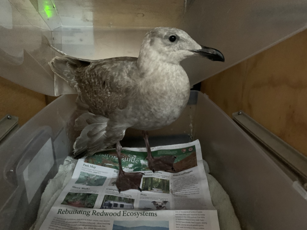
Since covid disclaimers are all the rage, here’s ours: other than gas fillups, we were completely self-contained and alone for the entire week. Well, we rescued an injured seagull, but I don’t think they can catch the virus…
For those Googling for specific hikes and campgrounds, skip ahead to the section.
Beach walking near Tillicum Campground.
The Beach
Travel in mountains stokes me with possibilities, but the beach acts as the ultimate grounding agent. Standing next to a massive body of water strips away day-to-day worries for both of us.
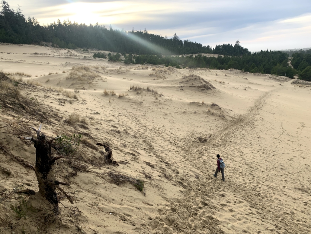
The southern Oregon coast is special because it’s a mix of treed areas and dunes, with steep cliffs interspersed with perfect sand beaches. We’d hike through an emerald green tunnel and then burst into the sun onto rolling dunes as far as we could see. The contrast is fantastic.
We leisurely skipped our way south in the van, stopping to camp, hike, or eat meals at vistas. Our only headache was toasted batteries – they’re five years past replacement age. New ones incoming soon.
Enough about the beach. Off to the redwoods!
The magical Alder Dunes area north of Florence.
The Redwoods
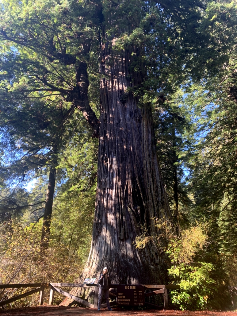
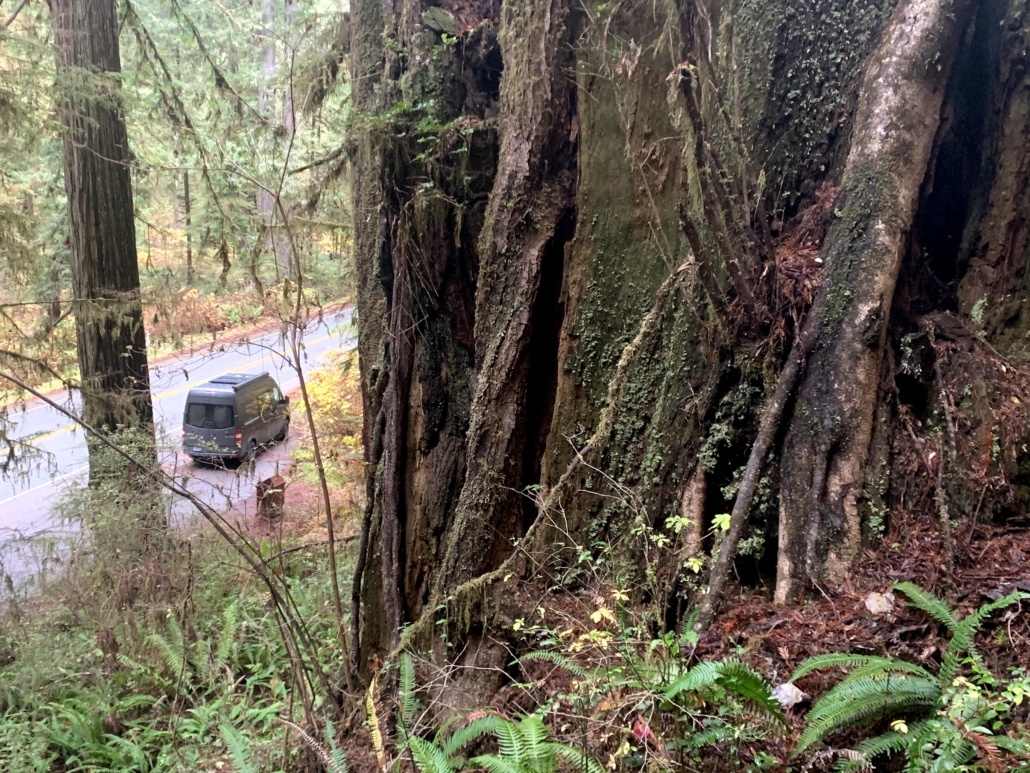
Time scales for redwood trees are too long for my brain to really grasp. Take the 1,500-year-old Big Tree in Prairie Creek Redwoods State Park as an example: when colonialist settler loggers first arrived in the 1850s, the tree had lived 90% of its current life. Somehow it survived the axes and is part of the 5% of remaining old-growth redwoods.
At 286 feet tall and 25 feet in diameter, the footprint is a fair portion of most houses and is as tall as a 30-story building. According to The Hidden Life of Trees, if humans were able to digest wood, one that large could feed us 3,000 calories a day for our entire lives.
The Big Tree. 1,500 years old, 75 feet around and 286 feet tall.Each gnarled branch looked like it was 500 years old!
Next to such majestic, old beings, humans seem small and short-lived, skittering about our frenetic little lives in the time a redwood grows a few more inches in diameter. Hiking beneath them feels like traversing nature’s cathedral, a quiet, reverent place where anything over a whisper feels rude.
One fascinating aspect of redwoods is the ability of their seeds to sprout on the stumps of their fallen forefathers. The little seed taps into the root system of the elder tree, gaining access to the vast subterranean network of nutrients. Tree lottery winner! The symbiosis of the trees is clearly apparent, with the gigantic snags often circled by their offspring.
Since there is no possible way to fully capture the coast and redwoods in words, I’ll end this here. Instead, below are some of my favorite photos from the trip, which of course don’t capture it either.
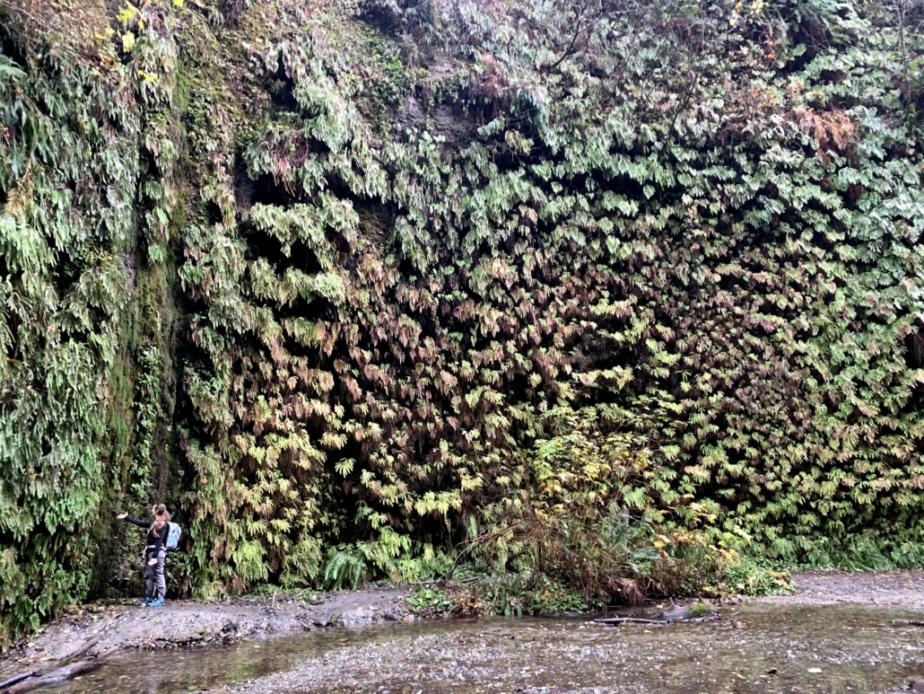
In the heart of the marvelous Fern Canyon in Prairie Creek Redwoods SP
Resource List: Campgrounds and Hikes
First, a quick list of our favorite campgrounds and hikes on the Oregon Coast and California redwoods during our trip.
A note to van lifers: While we usually boondock camp, most coastal property (other than the entirely-public beach) is private. I was happy to pay for the pleasure of empty campgrounds with beach access.
I noticed that iOverlander moderators have closed many camping spots due to overuse and complaints from locals. For an impacted area like the coast, I think paying for a site is the way to go. We can boondock camp in the desert and wide-open national forests!
For summer, book six months ahead of time for the coast and the redwoods. I prefer the off-season. Sure, the weather is iffy and it gets dark early, but there are ZERO crowds.
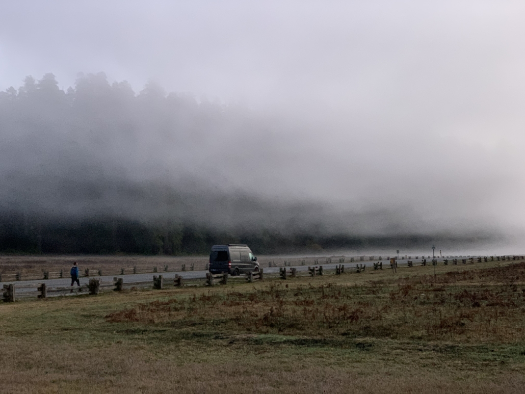
Fog rolling in at Prairie Creek. In the summer, this road is lined with cars.
Oregon Coast (from Waldport to CA border):
Tillicum Campground: campsites overlooking the massive beach south of Waldport. For $25 a night, you get a million-dollar view. The beach offers endless walking opportunities.
Alder Dunes Campground & hike: a secluded spot north of Florence with a 6ish-mile hike from camp through tree tunnels and over dunes to an empty beach.
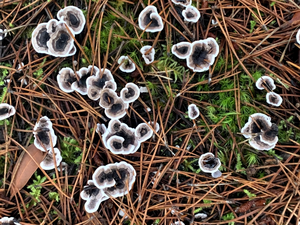
Tahkenitch Dunes hike: this hike spends a mile deep in the coastal rainforest before bursting out onto the dunes. Mushrooms were everywhere! For reference, there’s a campground at the trailhead, though it was closed.
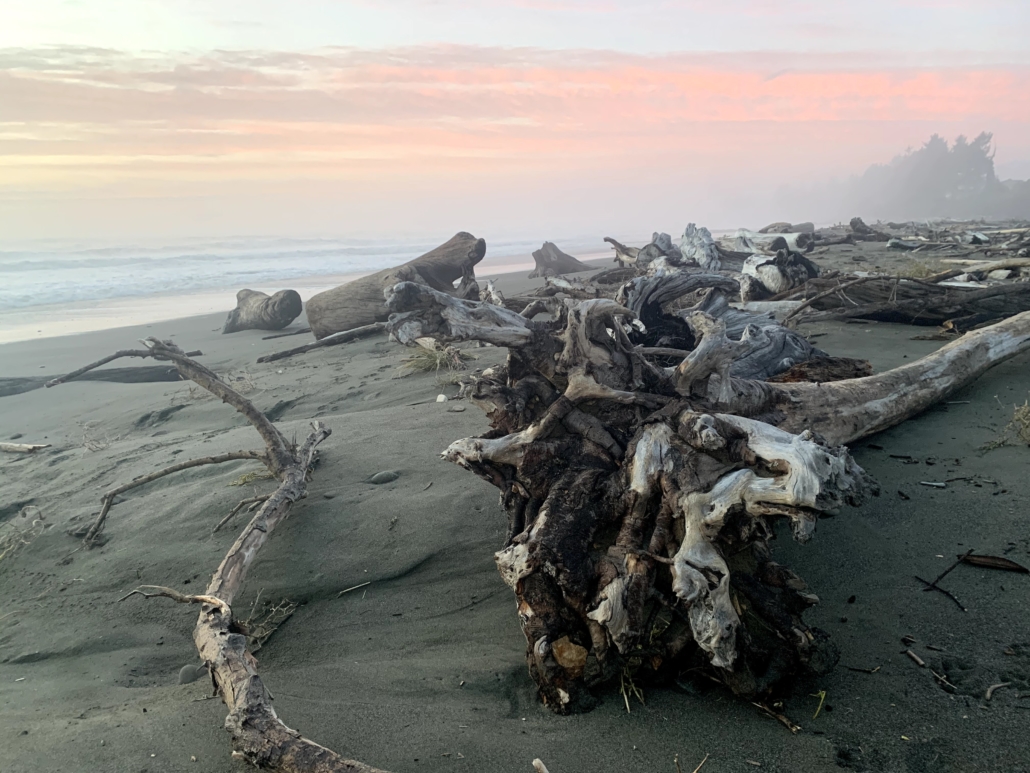
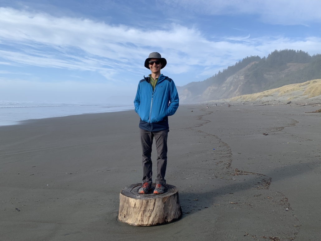
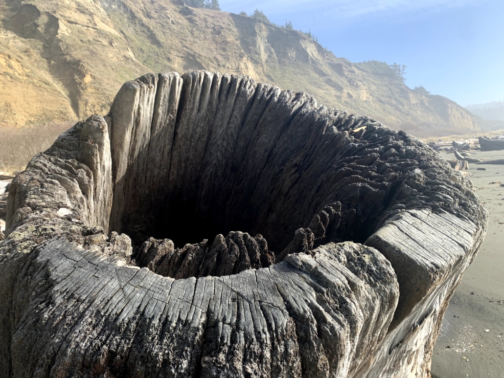
Cape Blanco hike: Oregon’s westernmost point! The lighthouse is cool, but my favorite part was getting down on the beach and wandering through all the giant driftwood logs. We didn’t camp here, but there’s a state park as well.
Driftwood (and Chelsea) on Cape Blanco beach.
Northern California Redwoods:
Florence Keller County Park: most county parks resemble parking lots, but we pulled into this gem north of Crescent City to avoid dark, foggy conditions and WHAMMO were in tall trees with secluded spots. Many reviews say it’s the place to go during peak tourist months when everything books up.
Prairie Creek Campground: a stunning setting in the redwoods that must be absolute mayhem when it’s busy. In the off-season, it was quiet and provides access to many loops in the park.
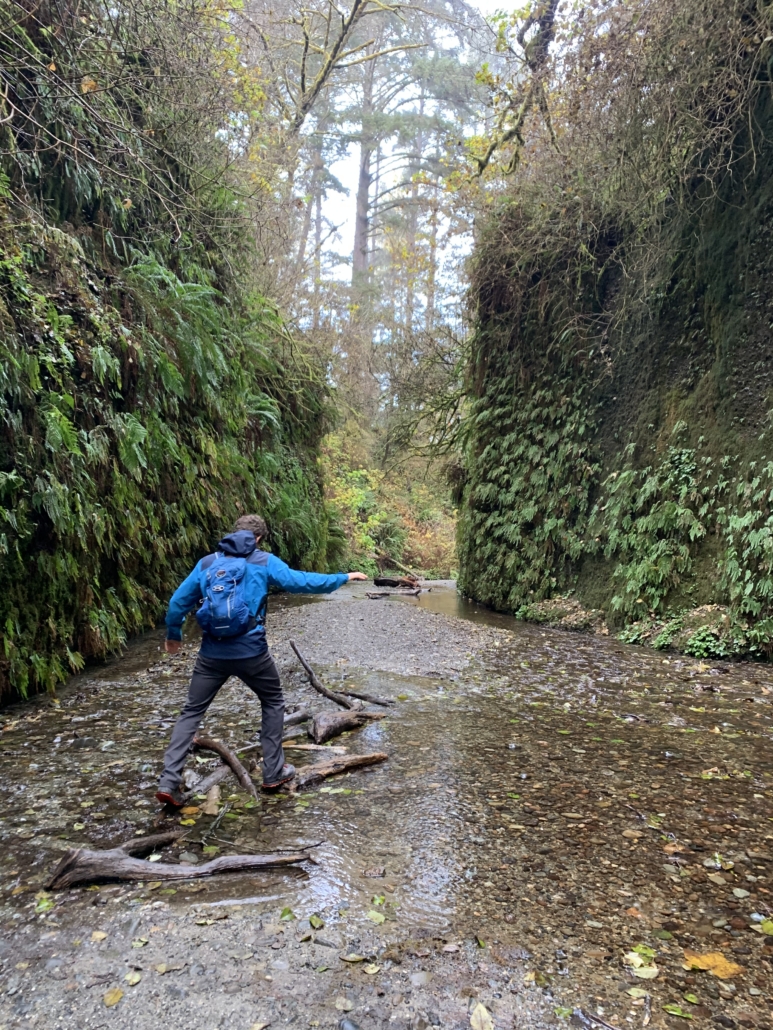
John Irvine to Fern Canyon to Miner’s Ridge hike: try this ridiculously awesome 12-mile hike for variety. Miles and miles beneath 250-foot redwoods, then down into a canyon with walls covered in ferns, and then along a beach, where we saw Roosevelt Elk (they sport 4’ antlers, whaat). From there, you loop back through redwoods. A top-10 hike for me.
Mushrooms!
Prairie Creek/Foothill/Circle/Cathedral Trail hike: all manner of options available here, but this 5-mile option goes by the Big Tree mentioned above plus other giant redwoods, overlooks spawning salmon habitat, and gives you a chance to see elk in the prairie.
Note: stop and wander down any of the short signed trails off the Newton B. Drury Parkway. Anywhere in the redwoods is worth seeing!
Enough chit chat. Photos, go.
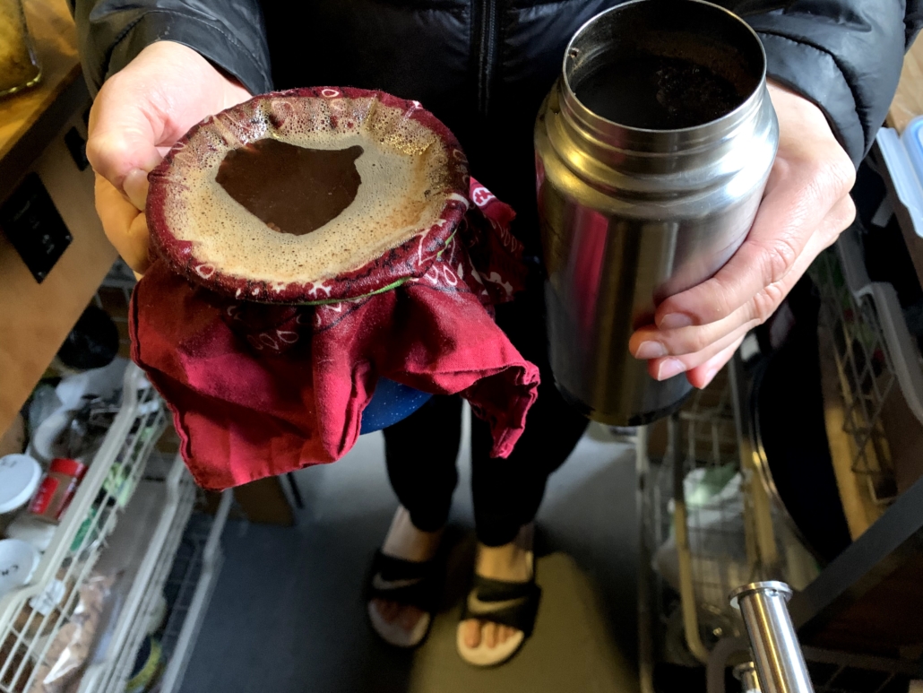
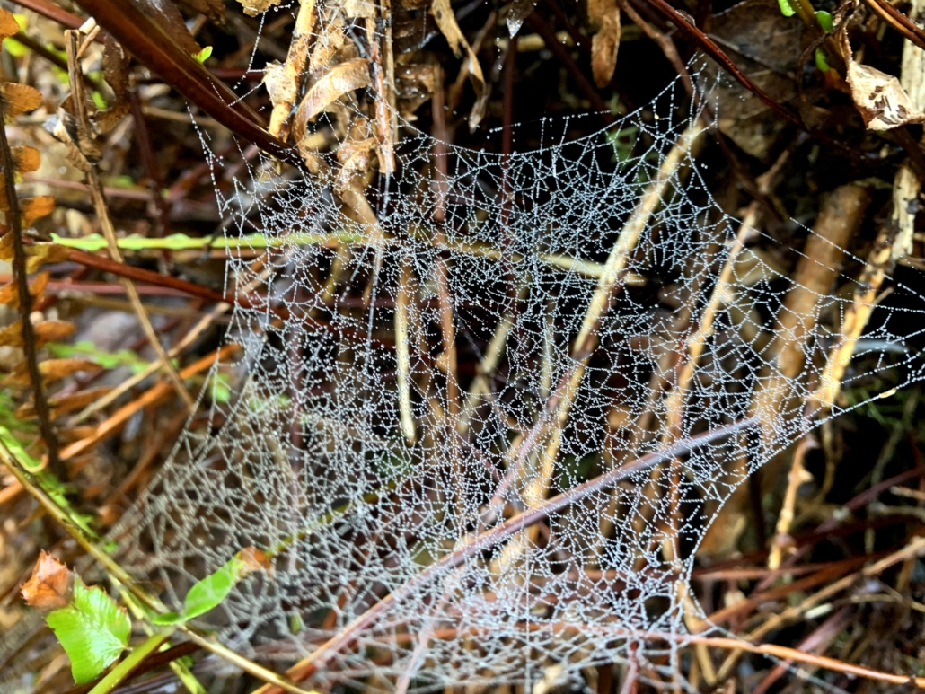
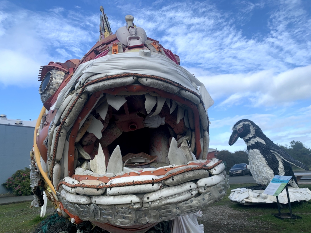
What a trip to the beach does to us! (No, we didn’t get soaked by that wave.)It wasn’t all easy though: Chelsea forgot the French press. This cowboy coffee kiiinda worked.Thick seaweed (or something!) coating the rocks at Pebble Beach by Crescent City.Our rescued seagull (Lefty), who Humboldt Wildlife Care took in. Not before he spent a night in the van though… Newsflash: seagull poop is stinky!Sunset on the beach near Brookings.Ocean-spray dew on a spider web near Yachats.Out of the tree tunnels and onto the sand during the Tahkenitch Dunes hike.A stop in the redwoods for a quick hike at one of the many pullouts.Clearly this chunk of log on Cape Blanco was put here to stand on!Two sculptures made of plastic at the Washed Ashore project in Bandon. They’re 8′ tall!Henry the Fish’s eyeball from the Washed Ashore project. Check the detailing out.Henry’s scales.An old hollow stump on the beach at Cape Blanco. I could climb inside it!Hopping logs over the creek in Fern Canyon.Don’t eat these!I forgot my headphone adapter, but Chelsea was nice enough to tolerate me playing my keyboard. (Stop pretending you don’t travel with a piano. Everybody is doing it.)Let’s end with a puzzle: Dunes from 10,000′ or the beach from 3′?
https://www.traipsingabout.com/wp-content/uploads/2020/12/Giant-redwood-in-prairie-creek-redwoods-state-park-scaled.jpg19202560Dakotahttps://www.traipsingabout.com/wp-content/uploads/2018/03/Traipsing-About-logo-white-background-450x156.pngDakota2020-12-16 22:42:202020-12-16 23:09:10Circling Back to the Oregon Coast and California Redwoods
Coming off two weeks working on my parents‘ property right before the 2020 election drama, I craved time alone in nature. En route to home, I swung through the Wallowa and Elkhorn Mountain ranges for some true solitude. Below is a photo essay from my time there.
The summary:
No phone signal for days.
Two total other people encountered on the trail. My favorite was the ebullient Pastor Dave, who “moved to the area 17 years and 75 pounds ago, found hiking, and have been to all 76 lakes in the Wallowas!”
Lots of time on foot and pedaling in the mountains.
A big shout out to Chelsea for graciously supporting my extra time away. It made me appreciate her even more and brought to mind this Rainer Maria Rilke quote:
I hold this to be the highest task of a bond between two people: that each should stand guard over the solitude of the other. For, if it lies in the nature of indifference and of the crowd to recognize no solitude, then love and friendship are there for the purpose of continually providing the opportunity for solitude. And only those are the true sharings which rhythmically interrupt periods of deep isolation.
Photos from the Elkhorn and Wallowa Mountains!
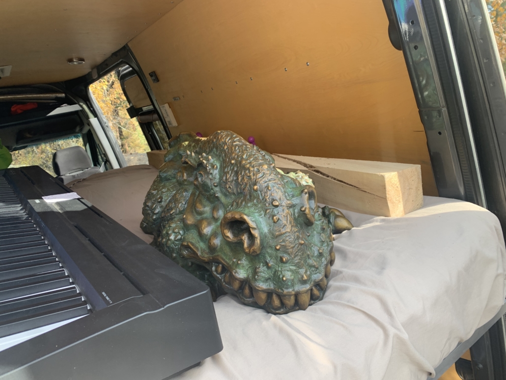
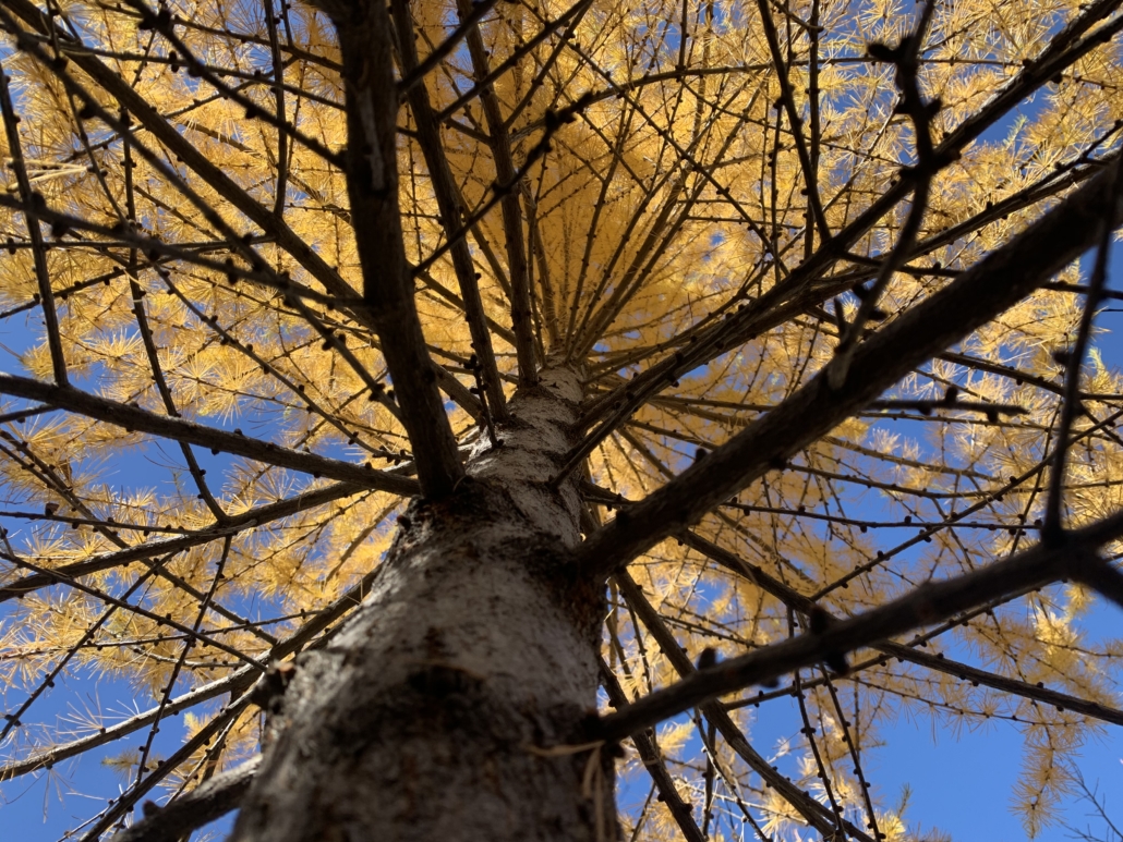
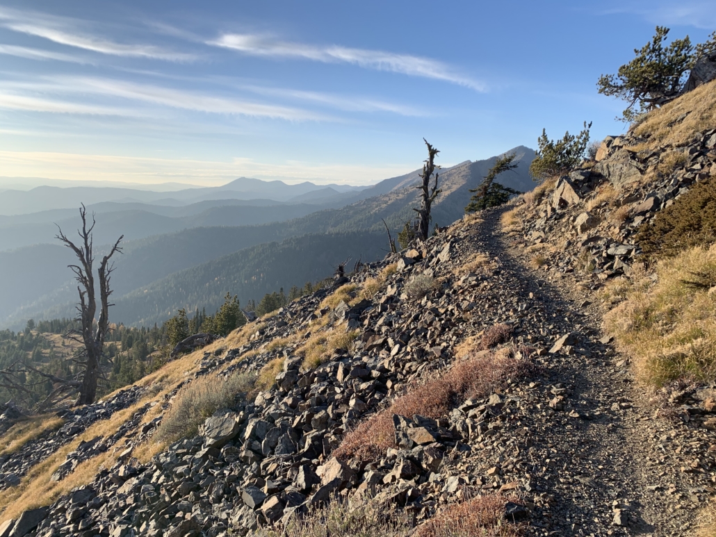
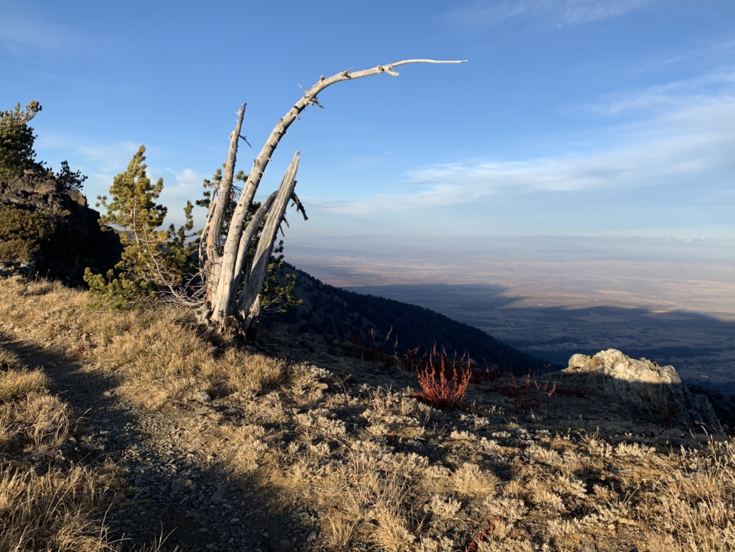
A clearing storm on the Palouse en route to the Wallowas. It made me think of the potential in the election…Taking in the Matterhorn view on Hurricane Creek Trail in the Wallowas. No wonder they call them The Little Alps! (Also, props to apps with 30 second camera timers…see how relaxed I look? Didn’t even have to sprint.)The sign read “Bridge Out,” but clearly it was fine.Firing larches and a perfect fall day on the S. Fork of the Imnaha.Rather than destroying the van on a rough fire road, I opted to bike in. The snow/ice had other ideas. I’ll be back, Bonny Lake!Strange bedfellows on this trip: my keyboard, a bronze sculpture by my dad that I picked up at a foundry, and a maple 4×4 that we’re going to grow mushrooms on! All less cuddly than Chelsea, but they don’t toss and turn at night… ‘Tis the season for magic larch colors! The air was adrift with floating golden needles.Sunset on the stunning Elkhorn Crest Trail on Oregon’s highest singletrack trail! Looking west, you see this…And looking east, you see the desert near Baker City.The U.S. ain’t perfect by any stretch, but I sure love the huge swaths of public land for recreating and van camping with a view!Fallen larch needles.Tired but alive at the top of Dutch Flat trail in the Elkhorns. This trail is incredible, a combo of views, gold larches, and grin-inducing rocks, speed and… anyway. #mountainbikedorkalertSing us a sooooong, in the piano van! (Thanks to my friend Eric for getting THAT ditty stuck in my head for a week.)Sunset on the sublime Elkhorn Crest trail.Deep in the zone in my happy place.
And that’s a wrap! Sing us a song la da deee da da… Ciao for now, folks.
https://www.traipsingabout.com/wp-content/uploads/2020/11/Hurricane-Creek-Wallowas-with-Matterhorn-scaled.jpg19202560Dakotahttps://www.traipsingabout.com/wp-content/uploads/2018/03/Traipsing-About-logo-white-background-450x156.pngDakota2020-11-04 18:53:572020-11-04 18:57:09Solitude in the Elkhorn and Wallowa Mountains
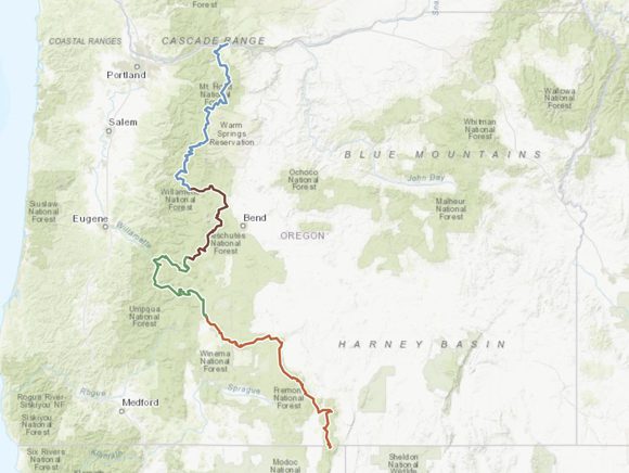
Border to border, the Oregon Timber Trail traverses the state from California to Washington. On Saturday, three friends and I start pedaling all 670 miles of it. (Update: here’s the full trip story!)
Starting down south, Brady, JT, Zach and I will crank north over 16 15 days through terrain ranging from high desert plateaus to dense old growth forest to volcanic lava. For maximum fun/quad punishment, the route wanders back and forth across the Cascade Mountain range.
The terrain ranges wildly: smooth trail, chunky rocks, sandy fire road, trails so steep pushing is the order of the day. At some point, we’ll probably hoist our bikes over downed trees for a few hours.
I fully expect this trip to secure Hardest Physical Accomplishment status for me. Our plan aims at 45 miles and 8 hours per day for two weeks straight on trails. On loaded bikes and riding so much singletrack, that’s far more difficult than my past road tours. With 67,000’ of climbing in total, we’ll be riding uphill over 4,000’ each day on average. (That’s 2.3 sea-to-summit ascents of Everest, for comparison.)
Intense. And so, so rad.
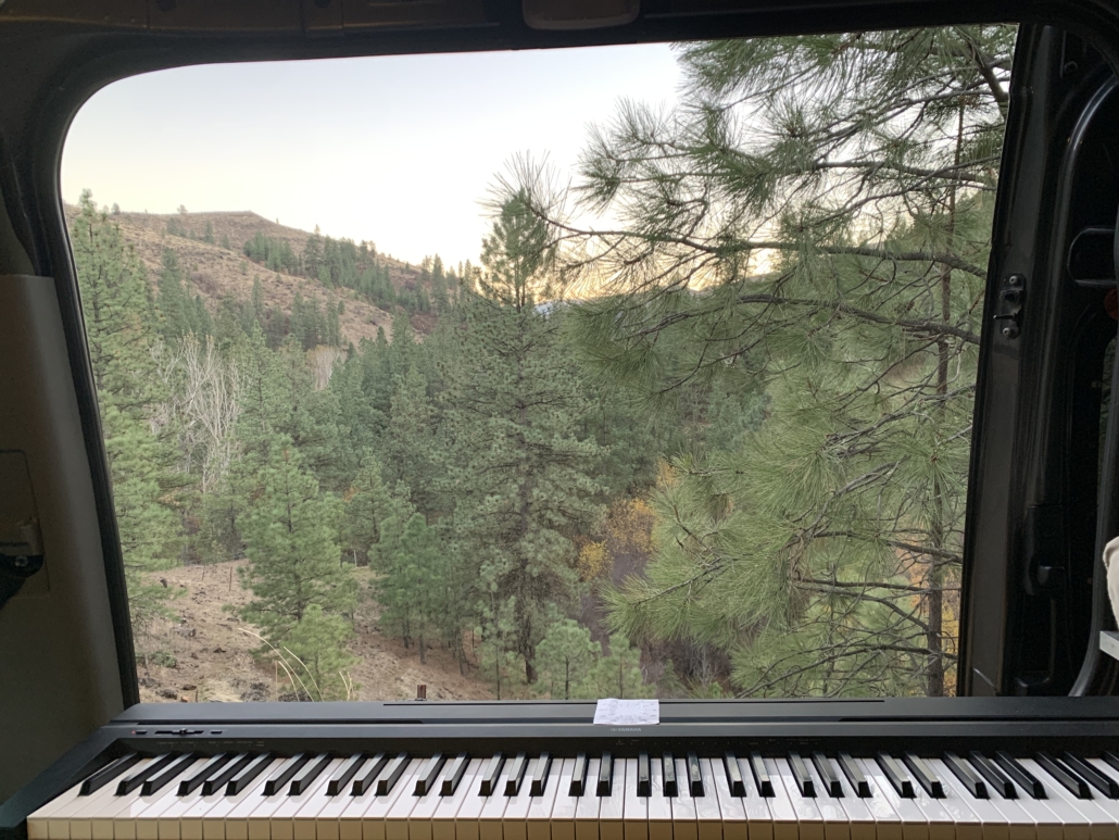
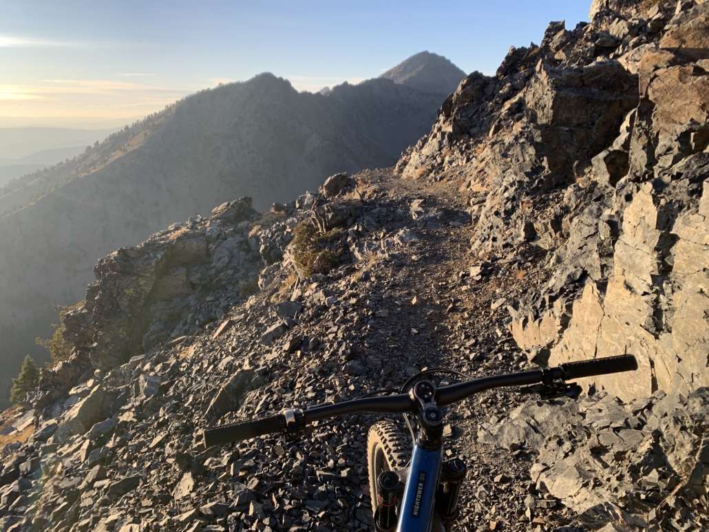
View from the cockpit
What is the Oregon Timber Trail?
The OTT is a scenic combination of singletrack and fire road. Apparently it sports the highest percentage of singletrack (60%+) for a long-distance bikepacking route in the United States. The full linkup blossomed into fruition in 2017 with trail work, initial riders testing the route, and plenty of publicity.
670 miles of fun on the Oregon Timber Trail
The full trail splits into four distinct sections: Fremont, Willamette, Deschutes, and Hood. It traverses the rock-strewn Fremont National Forest, slips through old-growth to Oakridge on the Middle Fork Trail, sneaks around Mount Bachelor near Bend, and finishes on the east side of Mount Hood on scenic Surveyor’s Ridge before rolling downhill into Hood River.
In short, some of my favorite Oregon riding, linked together with a variety of dirt roads, historic thoroughfares like the Old Santiam Wagon road, and remote forest and lake regions I’ve never visited.
Lakes, lakes and more lakes
The OTT’s excellent website says this: “The Oregon Timber Trail is an iconic backcountry mountain bike route spanning Oregon’s diverse landscapes from California to the Columbia River Gorge. It is a world-class bikepacking destination and North America’s premiere long-distance mountain bike route. It runs south to north and travels through a variety of landscapes, communities, ecosystems, terrain, and, most importantly—mountain bike trails.”
The trail linkup is laid out for people who want to ride it on two wheels. This isn’t a hiking trail like the Pacific Crest Trail or one used by hikers and bikers like the Colorado Trail. Only a handful pedaled the full trail last year. It’s a raw, adventurous linkup with route finding, few restock points, and lots of potential hard work. And fun! Did I mention fun?
Still snow in the mountains!
Why Bother? That Sounds Haaaard
There’s magic in a traverse of an entire state. Immersed in nature, this is a chance to disconnect, disappear, and live in the moment.
Wading a frosty-cold stream on the shakeout ride.
I recognize the privilege inherent in the freedom to hop on bikes and go explore for two weeks. I’m grateful for that opportunity.
This adventure trades easy living to strip life to the basics and go adventure. Some Type 2 fun may rear its fanged head, but that makes life at home all the sweeter in contrast when the trip lives on in memory lane.
The simplicity of the experience appeals to me, combining two of my favorite activities (mountain biking and traveling) with a preferred method of exploring the world (bike touring). In the two big road tours Chelsea and I enjoyed across the U.S. and Europe, we sunk into a rhythm: wake, eat, bike, eat, bike, sleep, repeat.
This time I’m checking out of work for the entire two weeks for the first time in 10 years. YES. No calendar appointments, no conference calls…
No cell signal, just mountain views.
The Logistics: Gear, Sleeping, Eating, WILL YOU EVEN SHOWER?!
I’ve mountain biked a ton. Bike toured plenty. Traveled often. Camped enough to know how a sleeping pad works. Linking it all together with a light kit (who needs multiple pairs of riding shorts anyway?) is another story.
I’m planning an entire gear post to share what I’m carrying for my trip. I’ll also talk about doing the trip as a vegan. I’m excited that Brady is game to join me for 100% plant-powered fueling the entire way. Props, man!
Cozy camp on Lava Lake.
Quick logistics summary: we booked zero lodging and our plan is to sleep in the dirt the entire trip. (Unless we can convince Mountain Man JT otherwise.) Lakes shall be our showers; restocking in random small towns along the way our sustenance, though hopefully we can cross paths with Chelsea and a van full of treats at a highway crossing or two.
10:30 pm dinner prep. Pad thai!
Quick gear summary: I’m taking a full-suspension mountain bike (a Santa Cruz Tallboy) with shiny new Bedrock bikepacking bags as the base kit. Here’s a shot of the general setup.
The sexy bikepacking setup. It amazes me that this carries everything I need for the trip!
I dig launching into adventures, and this bikepacking trip is no exception. Our itinerary is loose, though that’s easy when each night’s sleeping arrangements revolve around, “Hey, this lake/creek/mountain looks sweet.”
I haven’t done specific training other than my usual pedaling. For my lone gear test, I pedaled out 30-odd miles, descended a gnarly lava trail (in the dark), and solo camped (in the rain, yeahhh). The return trip of 40 miles around Mt. Bachelor left me grinning with excitement for this upcoming trip. As I love to say to Chelsea (as she shakes her head), it’ll be fiiiiine.
Maybe I didn’t specifically train, but my bike is ready. I basically rebuilt the entire thing preparing for this trip. Great practice for my bike maintenance!
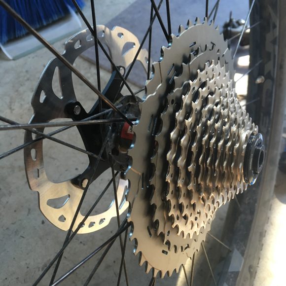
New rear cassette (11-46, if you’re curious) and bigger brake rotors (180mm).
Want to Follow Along?
When we have a signal, I’ll be posting to Instagram here and Brady is @bradylawrencephoto. This marks my return to IG after three blissful months off. Gotta spread the word about Oregon’s awesome new trail!
Post-trip, I’ll blog about the experience and do a breakdown of how gear and plans (the few we have) work out. We’re aiming to make a short film of our time on the trail with Brady’s skills and JT/Zach’s dashing good looks. I’ll provide comic relief.
Without further adieu, onward we go! Catch you on the other side.
Mountains, here I come!
https://www.traipsingabout.com/wp-content/uploads/2018/07/Mt-Bachelor-and-bikepacking-setup.jpg435580Dakotahttps://www.traipsingabout.com/wp-content/uploads/2018/03/Traipsing-About-logo-white-background-450x156.pngDakota2018-07-05 06:05:492018-09-05 08:13:08Launching a Bikepacking Trip on the Oregon Timber Trail
At 5:30 tomorrow morning, I’ll pedal off on my mountain bike (along with 350 other lunatics) to race 100 miles. The event, High Cascades 100, traverses some of the best trails around Bend and climbs about 10,000 feet in the process.
It’s the culmination of months of hard training. I’ve put in the time and am confident, but feel excited, a bit nervous, and ready to ride!
I’ve never raced mountain bikes before, so starting small with a mere 10 hours of pedaling is just the ticket. HA. At least I’m consistent, since that’s the same way I jumped into bike touring – “hey, let’s ride across the US!” or started a business – “I’ll leave engineering for finance and fake it ‘til I make it!”
Registering for High Cascades was partially a reaction to landing last fall after three years on the road. Both Chelsea and I were tired of constantly saying goodbye to friends and wanted to park it in a cool outdoorsy town, but that glitzy sparkle of long-term travel was hard to shelve. A goal months down the road was just the ticket, so I woke up Thanksgiving Day and signed up for the race, ran a 10k event, then ate myself silly.
Nearing the end of a long, hard ride with my MTB crusher friend Paul.
If I’m honest with myself, I’ve coasted a bit the last three years. With my business running nearly on auto-pilot and the open road in front of us, it was easy to live in the moment and enjoy myself. Sure, we did some big bike tours, volunteered at Farm Sanctuary, saw stunning places, and I blogged frequently – but that’s for fun. I wasn’t elbow-deep in any projects with a long view.
For five years prior to 2013, I’d focused on chasing greenbacks. I worked like a tornado, spinning in one place until I realized I needed to think about something – anything – other than work/business/making money. Thanks to my supportive and adventurous wife, that led to travel and a focus on creative projects. Blogging, photography, video: all were intentional projects with no revenue model in mind. I’m no expert in any of them, but can now produce work that I’m proud of.
Still, I’m not the type to sit around and relax. After the dust from High Cascades settles (and my legs stop hurting), I’ll need a project to set my sights on. This time around, it won’t be a purely physical one. I’m feeling the desire to make something, be it a business, a creative work, or a service for others. (Don’t get me wrong – my bucket list continues to grow. The 670 mile Oregon Timber Trail, yessss!)
Camped out after a great day in the mountains.
I’m currently intrigued by the intersection of the athletic/plant-based movement, which is gaining more steam every day. The desire to create a documentary still lights up my ambition circuits. All it takes is commitment and daily effort. Waiiiit a second…just like getting up with tired legs and heading out for a training ride when I’d rather sit at home and read a book.
If I can train for a race by riding a bike like it’s a part-time job, why can’t I apply the same long-term, sustained effort to a project? The possibility of failure is no excuse, since racing and creative/business efforts are fraught with peril. Time to buckle down.
These ambitions will swim in my thoughts tonight, though I’ll dream mostly of singletrack and logistics for the race. Speaking of that, where is that spare water bottle? I should probably snap this laptop shut and go tune up my bike. Tomorrow’s 4 a.m. alarm is chiming soon, so au revoir and wish me luck!
A beautiful day in the Ochoco Mountains NE of Bend.
https://www.traipsingabout.com/wp-content/uploads/2017/07/Mountain-biking-Alpine-Trail-Oakridge.jpg435580Dakotahttps://www.traipsingabout.com/wp-content/uploads/2018/03/Traipsing-About-logo-white-background-450x156.pngDakota2017-07-13 21:47:182017-08-09 22:11:23A 100 Mile Challenge in the High Cascades
Whoa, how did two months pass since I last posted? Whoops… For all you new subscribers, howdy! Don’t worry, there’s not usually this much radio silence.
Not that I’ve laid around in traction or anything! Far from it.
Climbing in the Marsupials above Smith Rock.
It’s merely that Bend is the ultimate distraction. Turns out that 1) the city and surrounding area are an outdoor playground with too many potential sports and 2) everyone visits if you move here. Since January, athletic fun and constant guests conspired to leave minimal time for blogging.
Hosting vegan cookbook club in Bend.
My friend Eric skins up Tumalo Mountain on a backcountry ski outing in the Cascades.
Rather than writing, my creative outlet shifted to shooting and editing videos for Instagram on my phone with the Cameo app. My rule: a limit of 15 minutes for editing, which helped me avoid perfectionist tendencies that find me editing for untold hours. During March, I cranked out 10 of them.
It was easy to find material for quick, fun cuts thanks to 30 days of skiing this year (for my first season, I almost don’t suck!), plus rock climbing and mountain biking. Throw in a Portland road trip and a few days in Palm Springs for a wedding and where DOES the time go?
South Sister through the looking glass on a bluebird day.
Check out our recent shenanigans! Here are my favorite Instagram videos (all less than 60 seconds) from the last couple months, all edited on my iPhone using Cameo. Pick a few that sound interesting and crank the sound up!
–Antics in the Palm Springs sun for a friend’s wedding – pool and diving board exploits, trail running, biking around town on a clunker Airbnb loaner bike, and other festivities!
-A pivot to other sports after weather shut down a backcountry ski up/down Mt. St. Helens
On top of Tumalo Mtn – hard work done, time for the fun!
https://www.traipsingabout.com/wp-content/uploads/2017/04/Stoked-to-ski.jpg6831024Dakotahttps://www.traipsingabout.com/wp-content/uploads/2018/03/Traipsing-About-logo-white-background-450x156.pngDakota2017-04-05 22:59:132018-02-27 14:20:50Spring Shenanigans in Bend
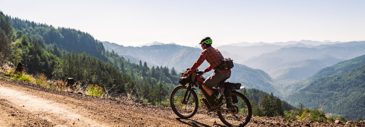
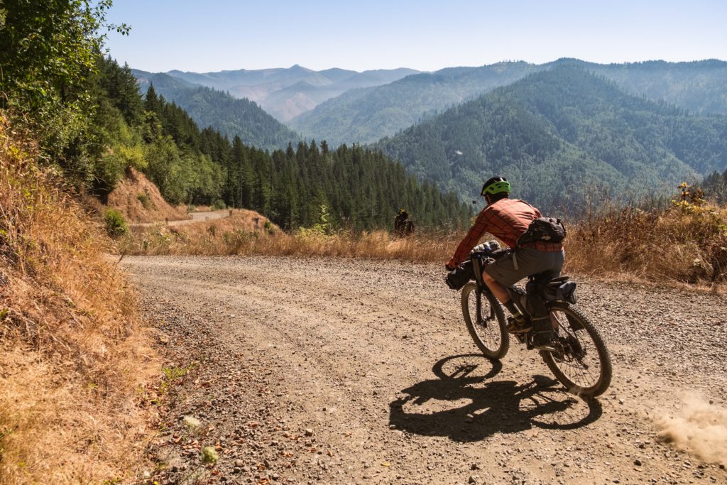
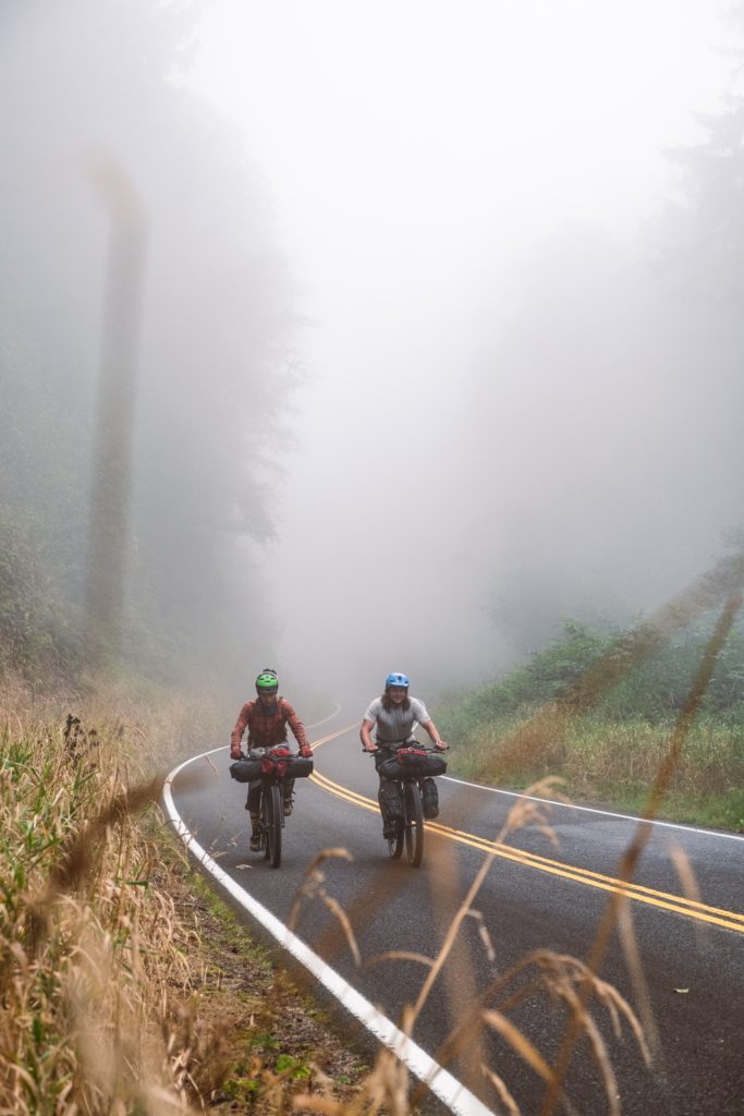
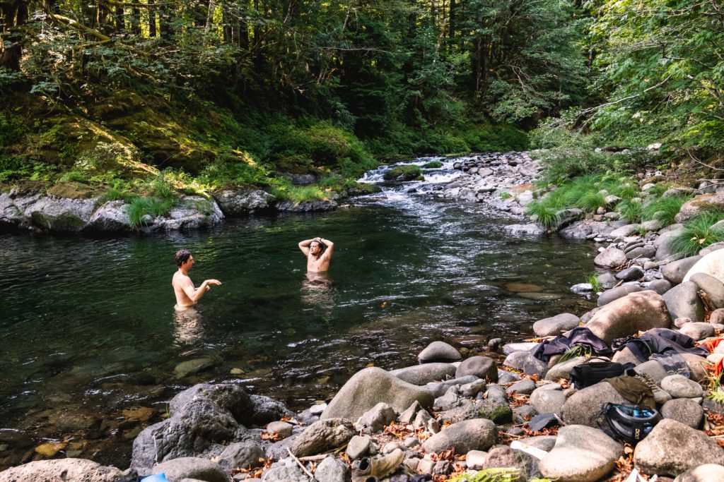
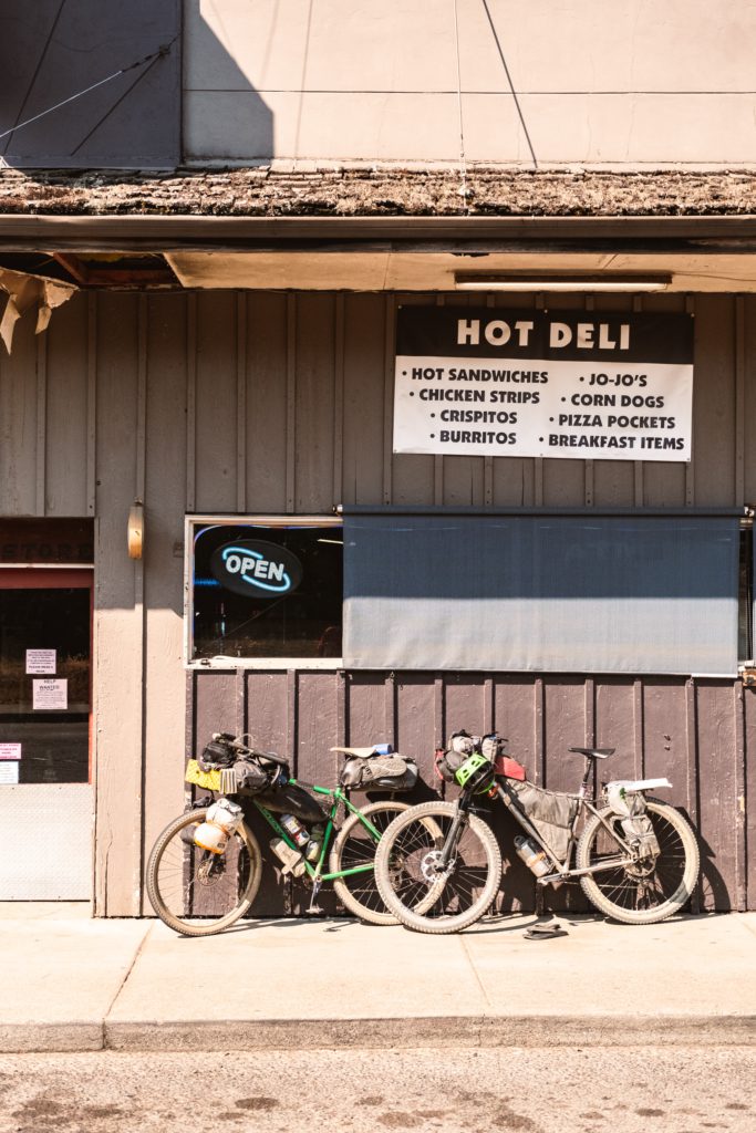


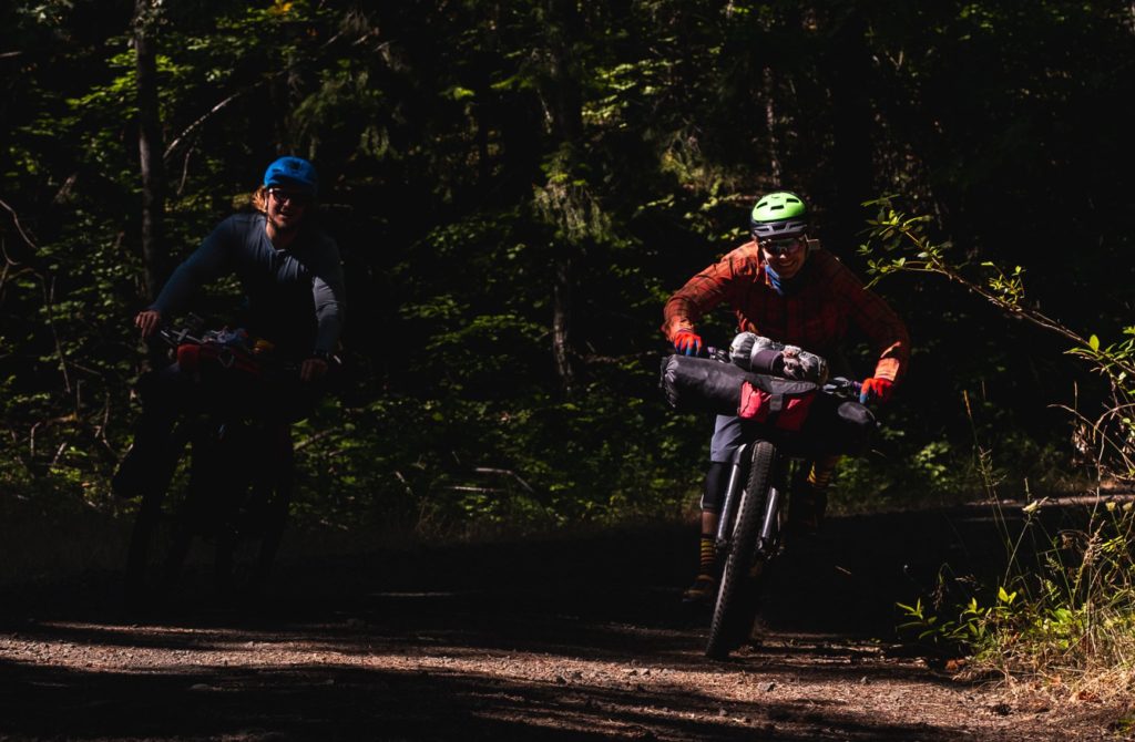


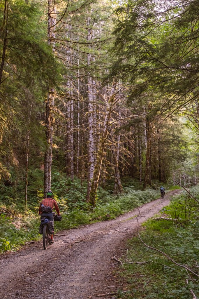

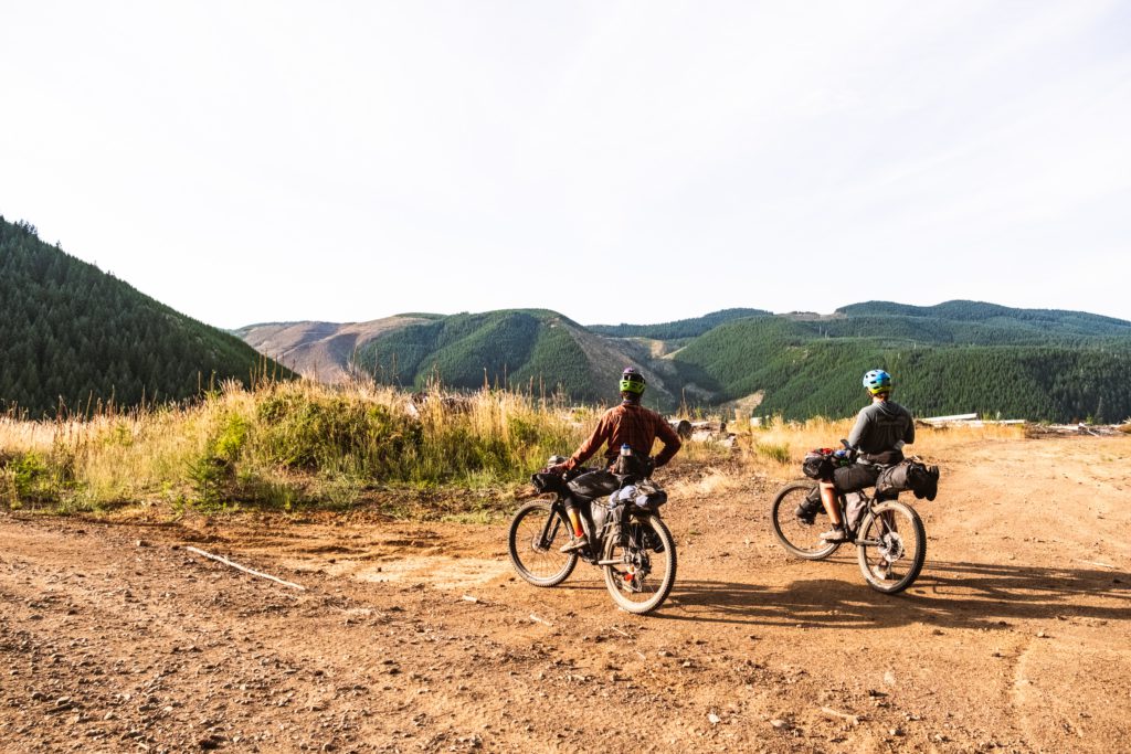


 sausage gets made.")


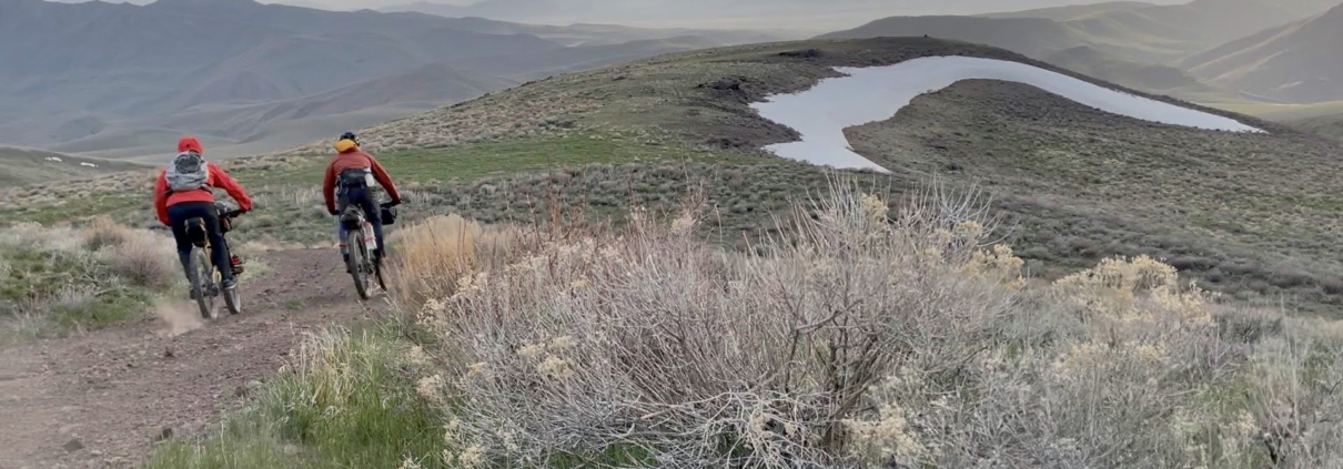
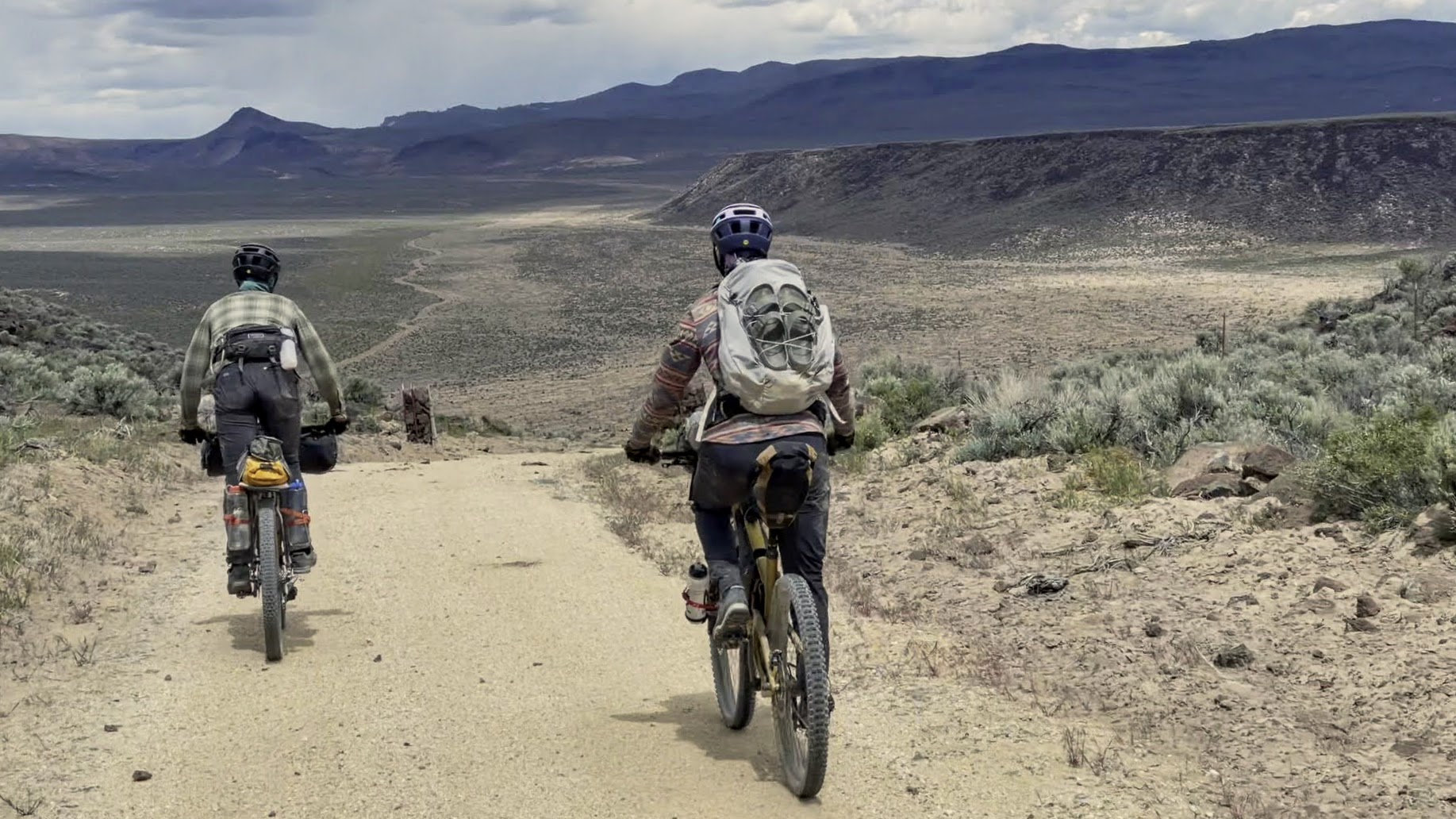

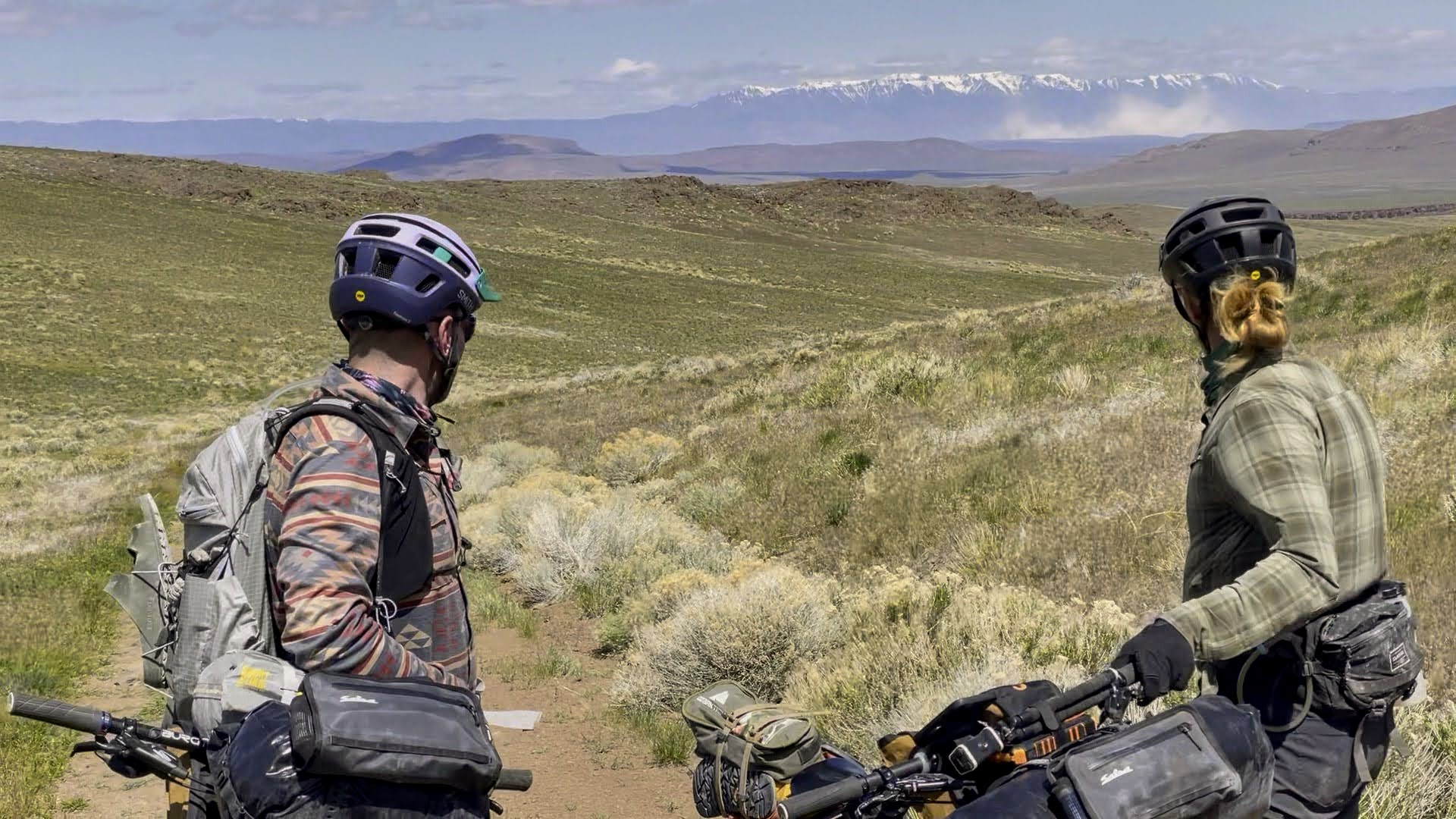
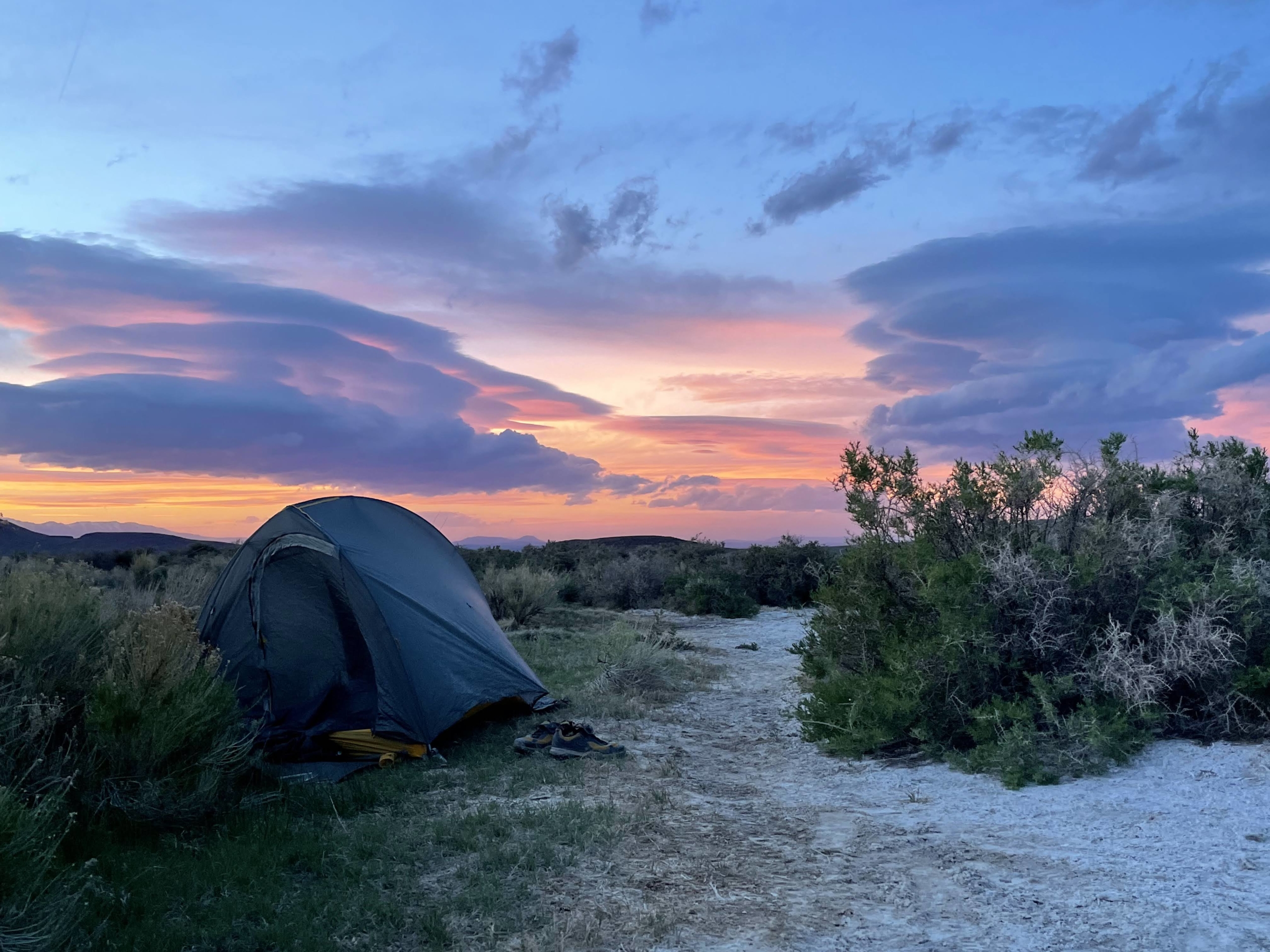
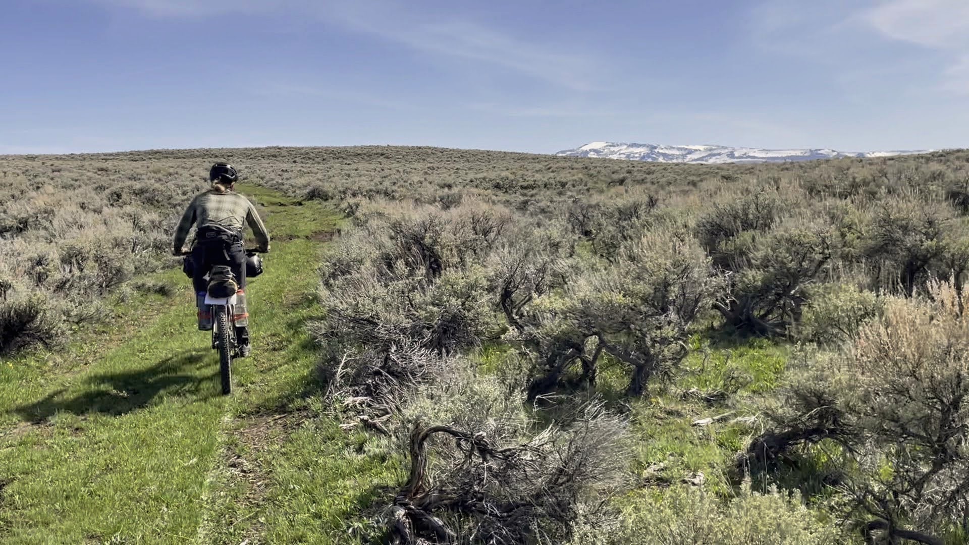
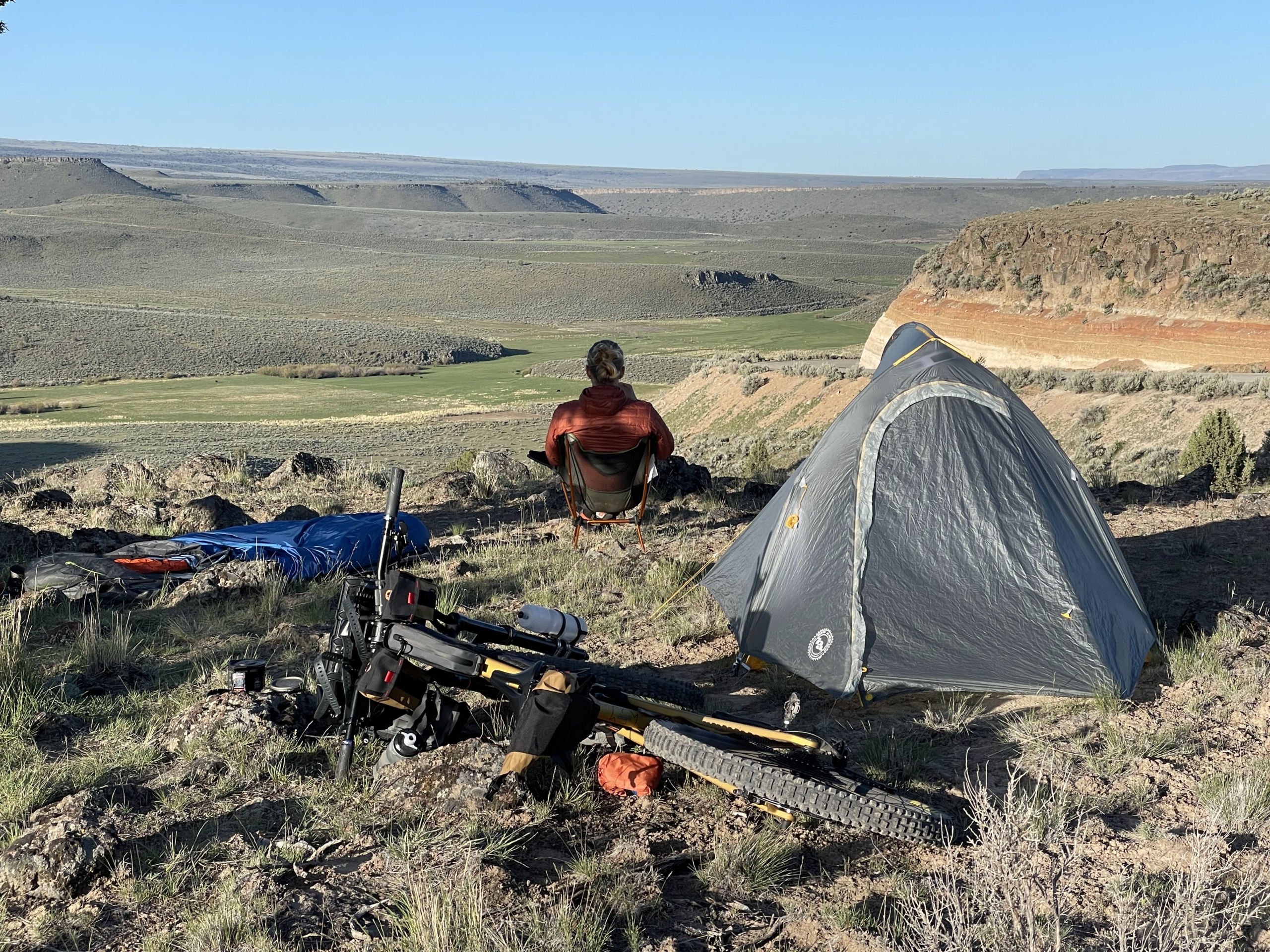
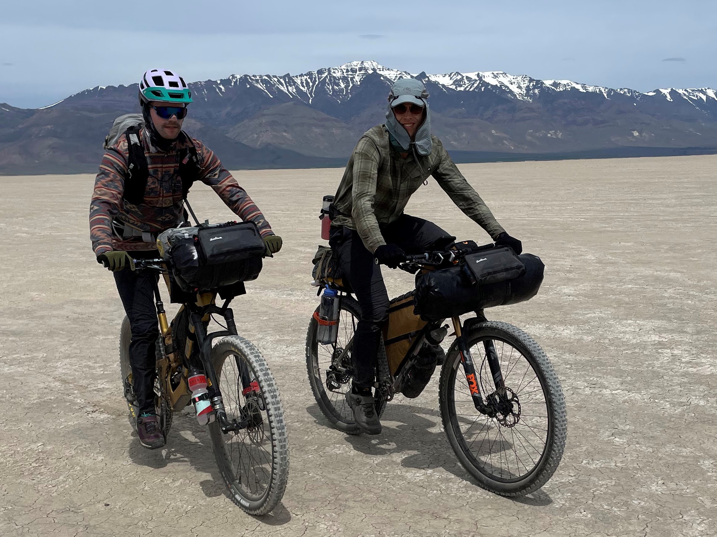
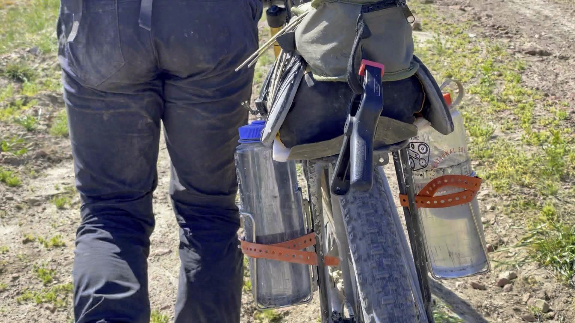

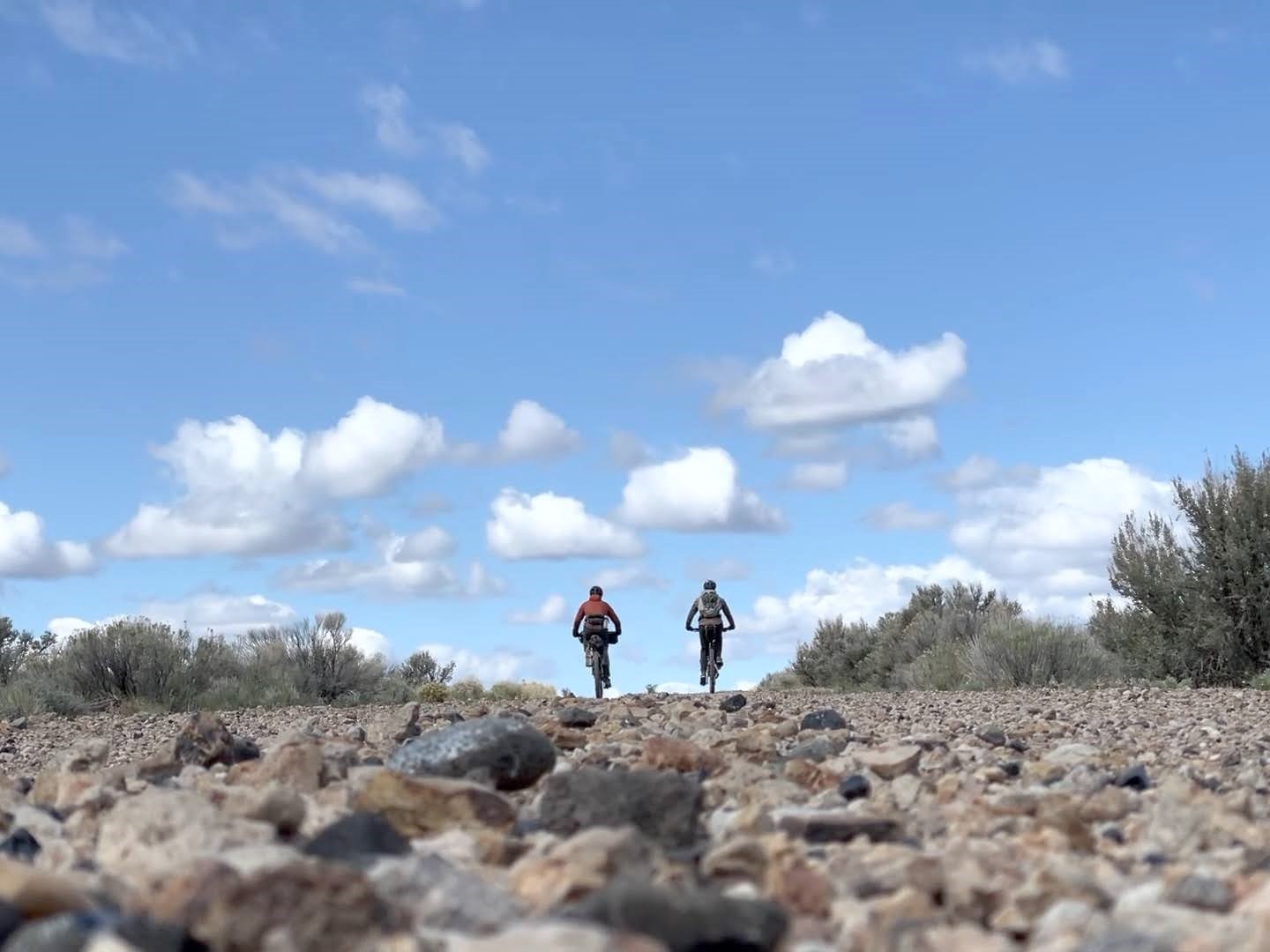
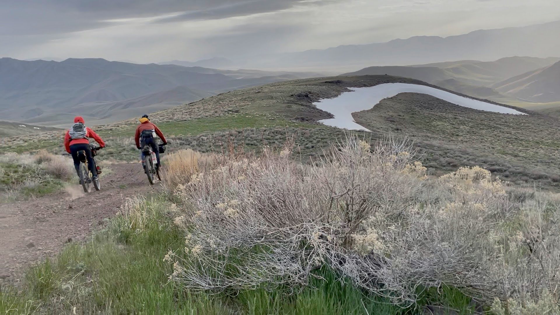


")